|
Notes from the Trail
|
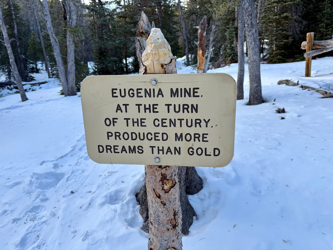
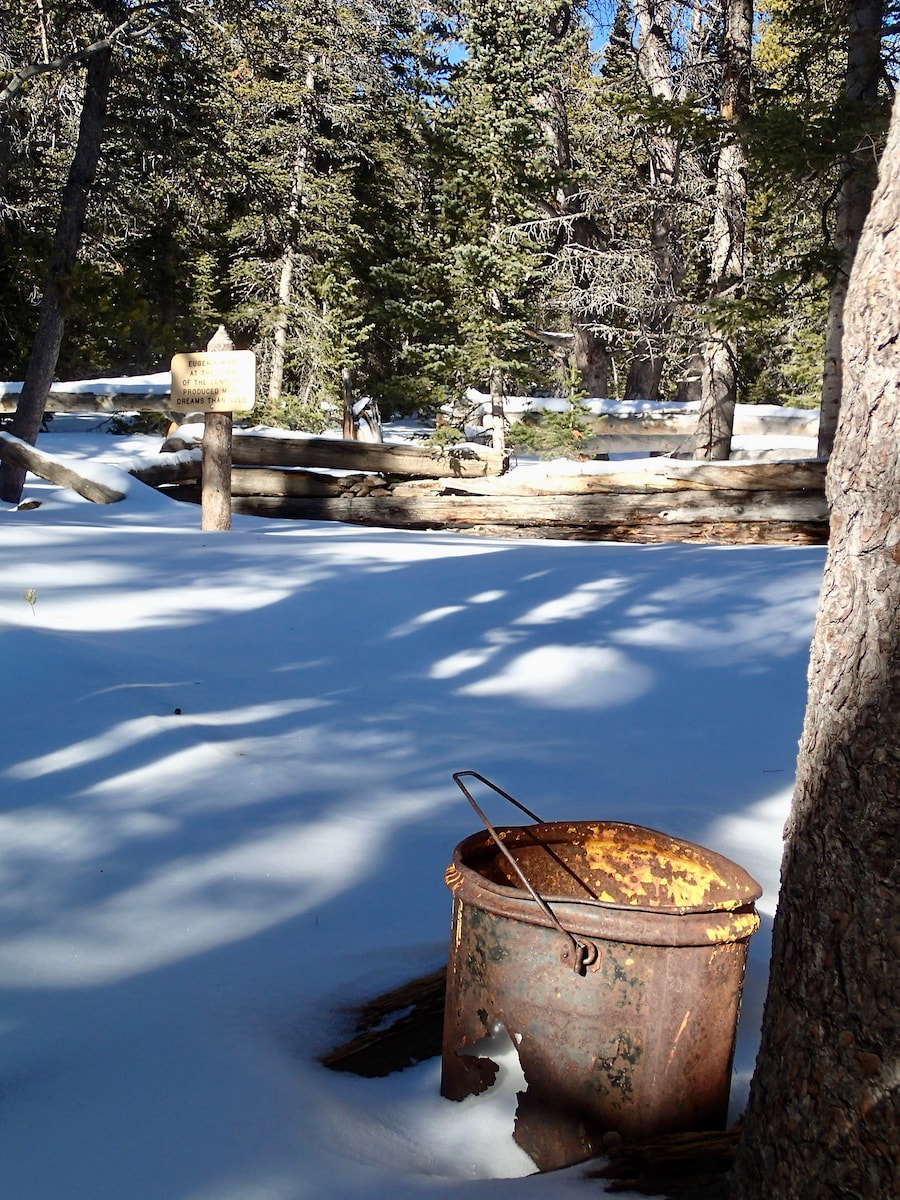
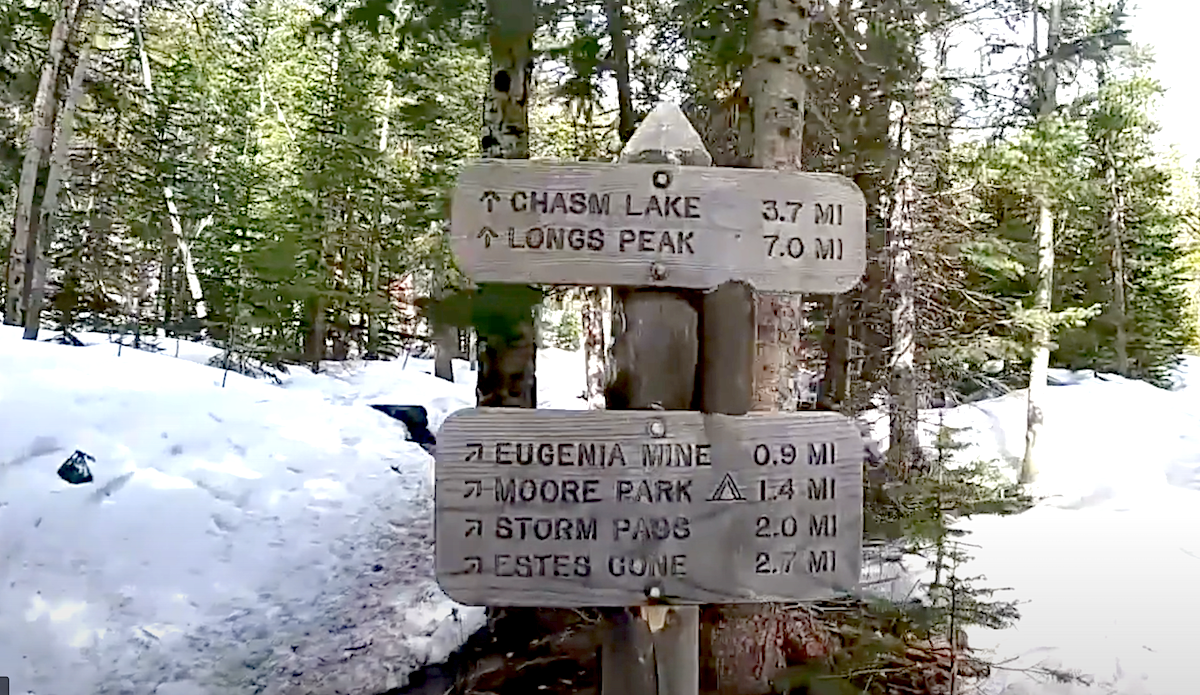
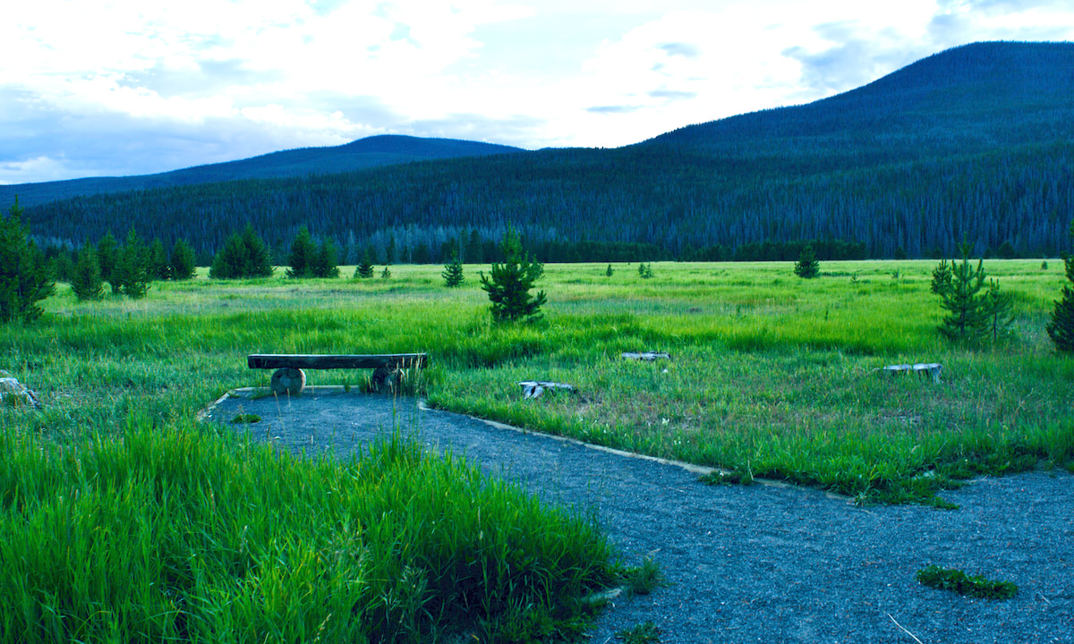
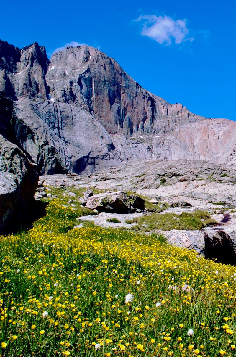
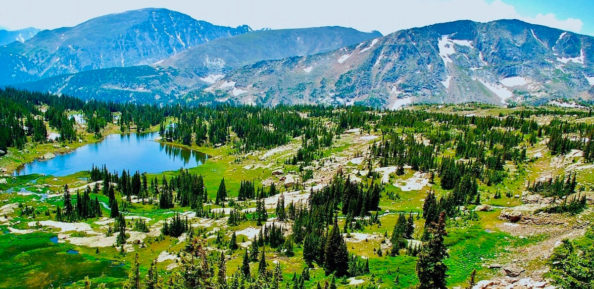
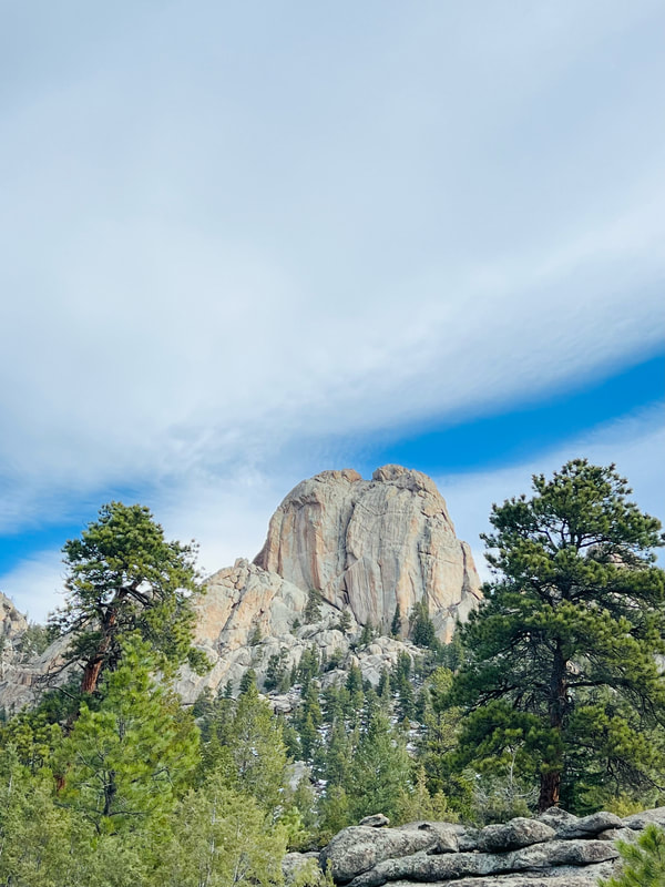
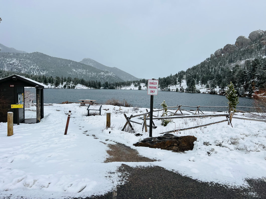
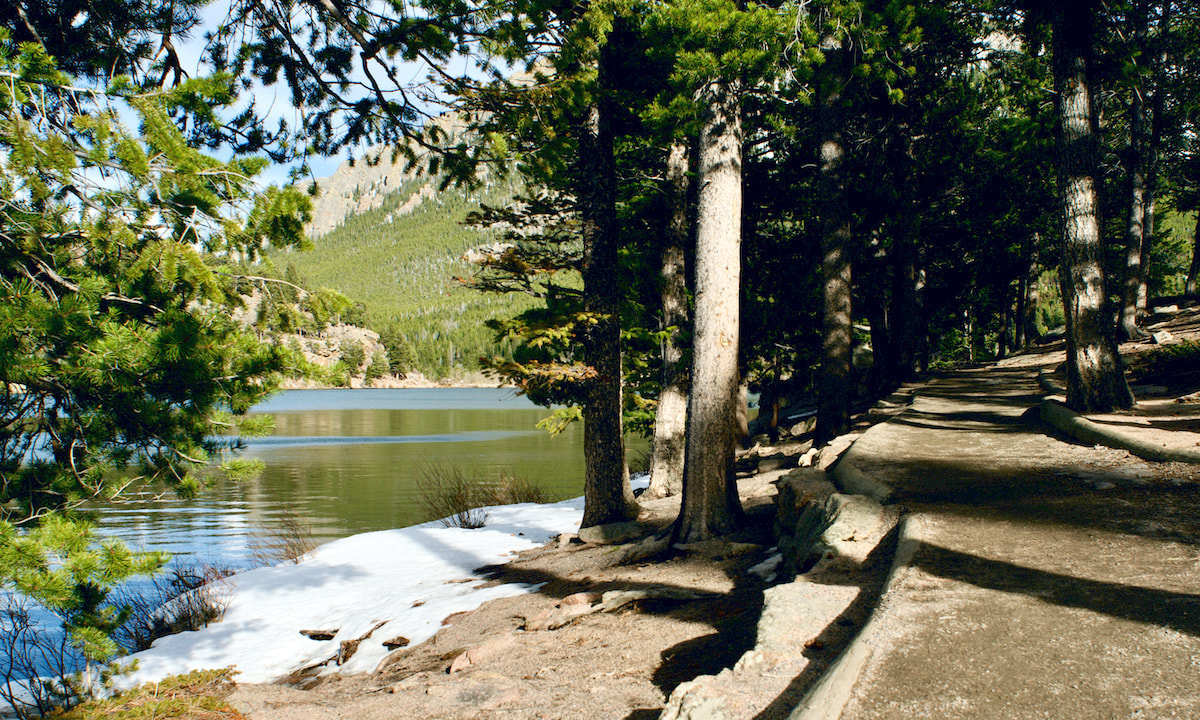
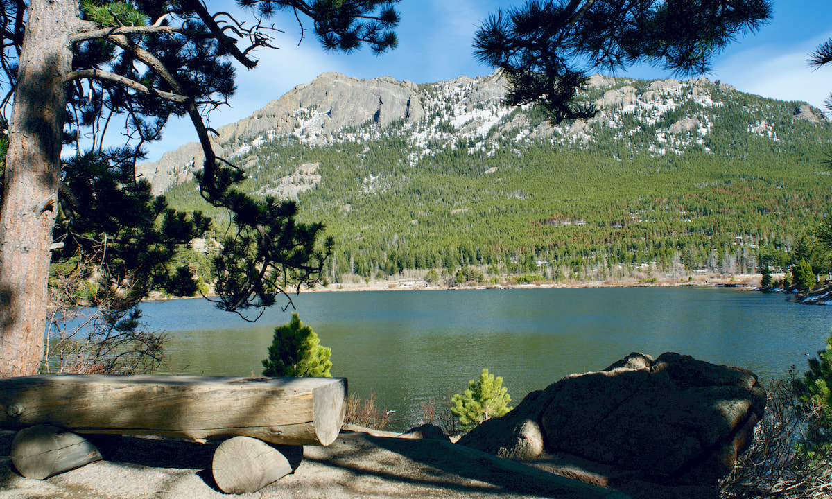
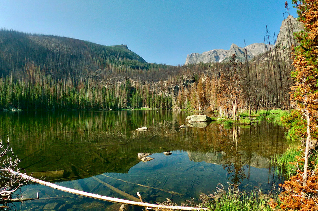
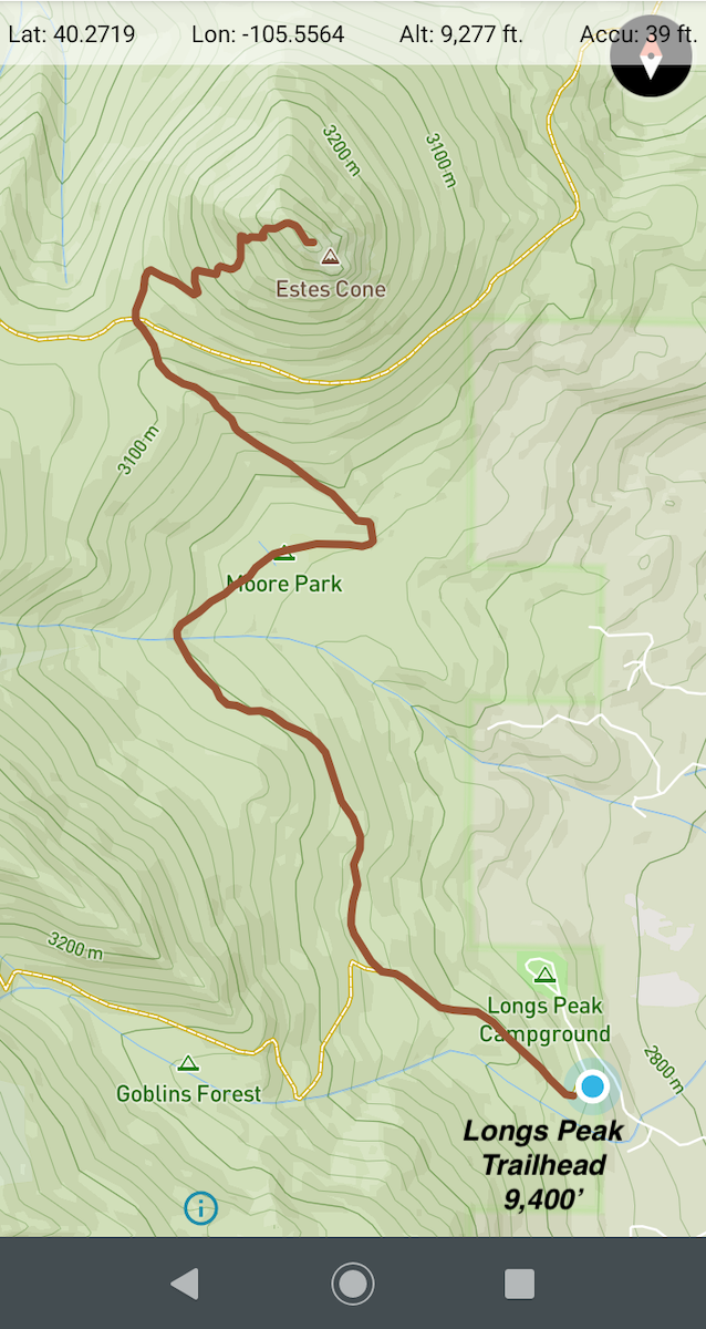
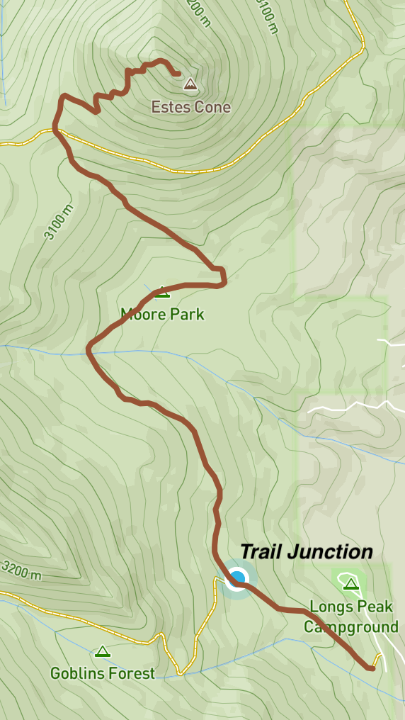
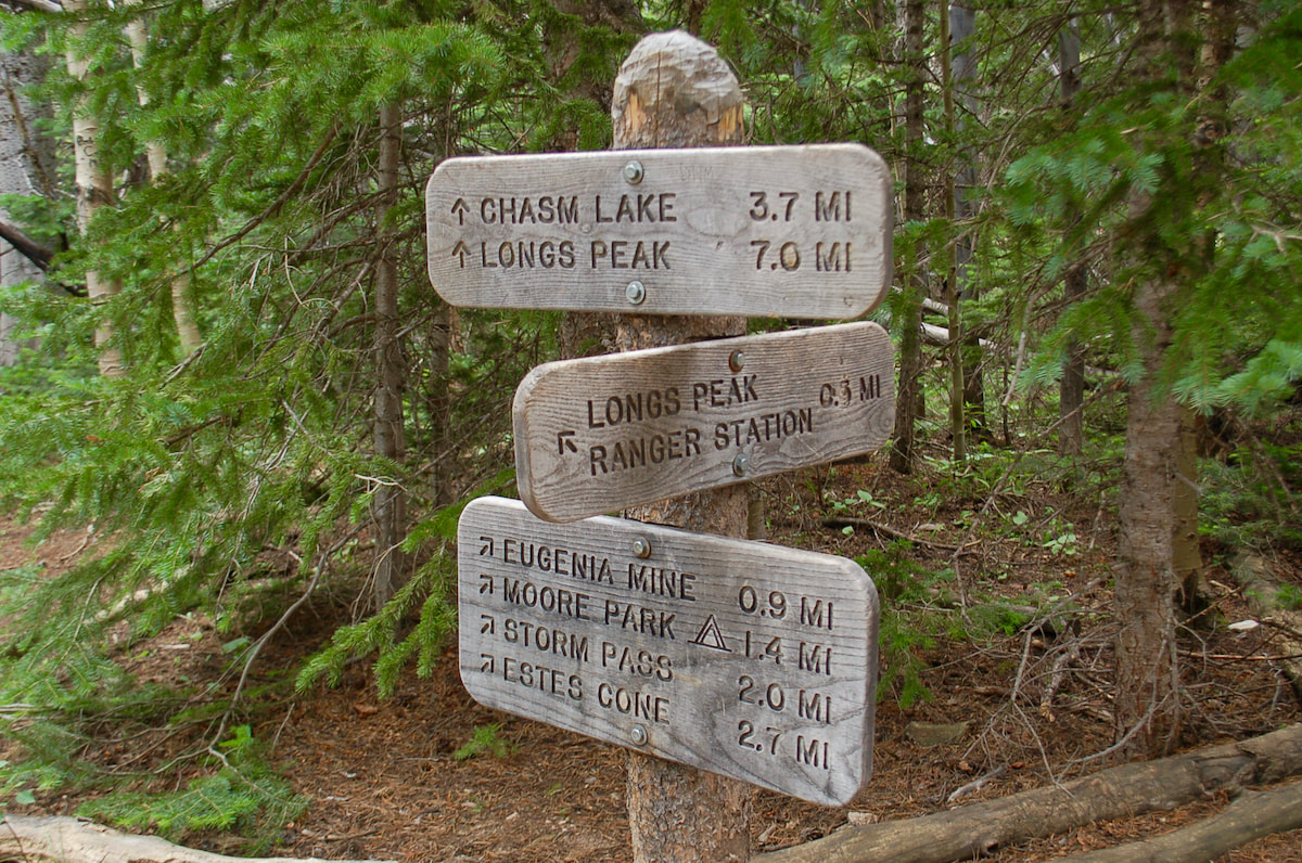
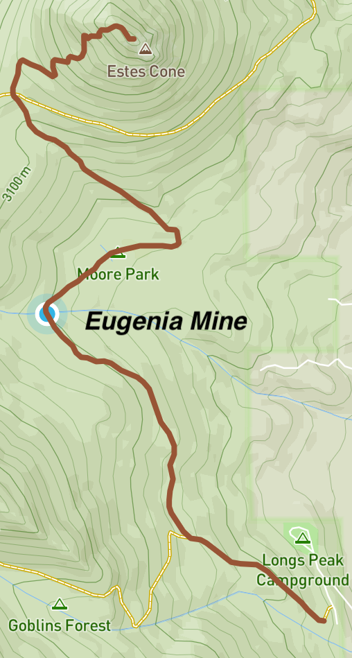
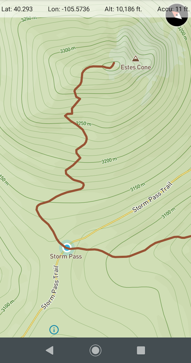
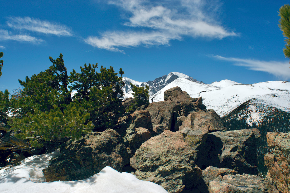
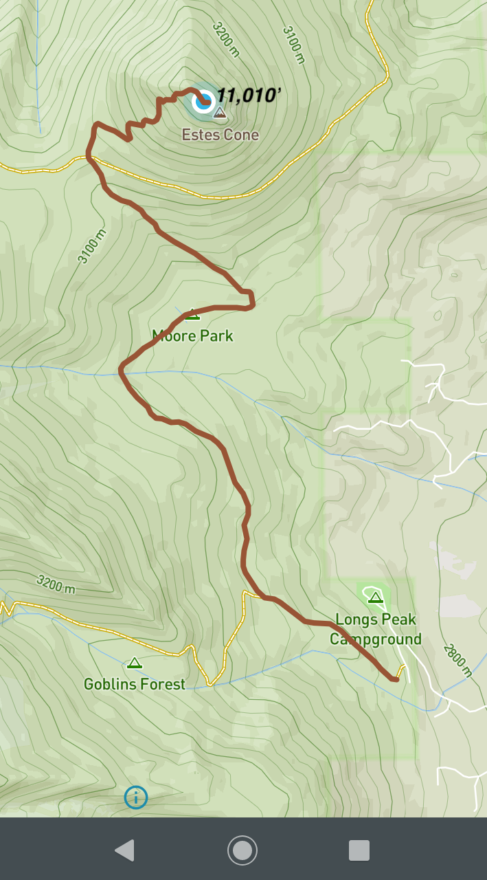
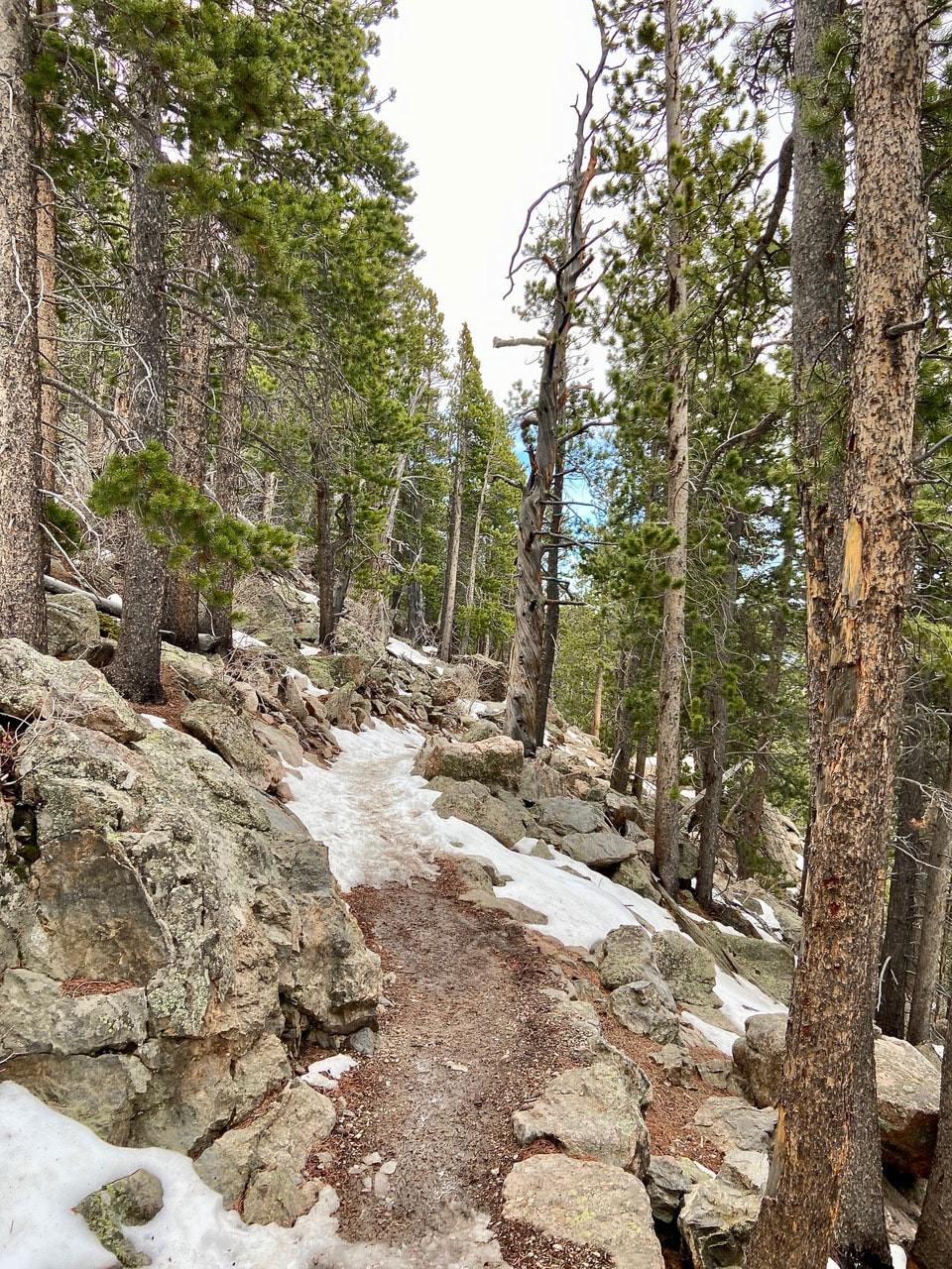
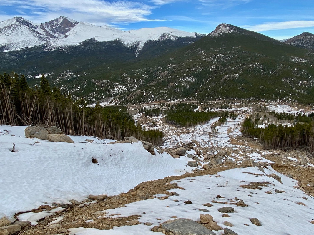
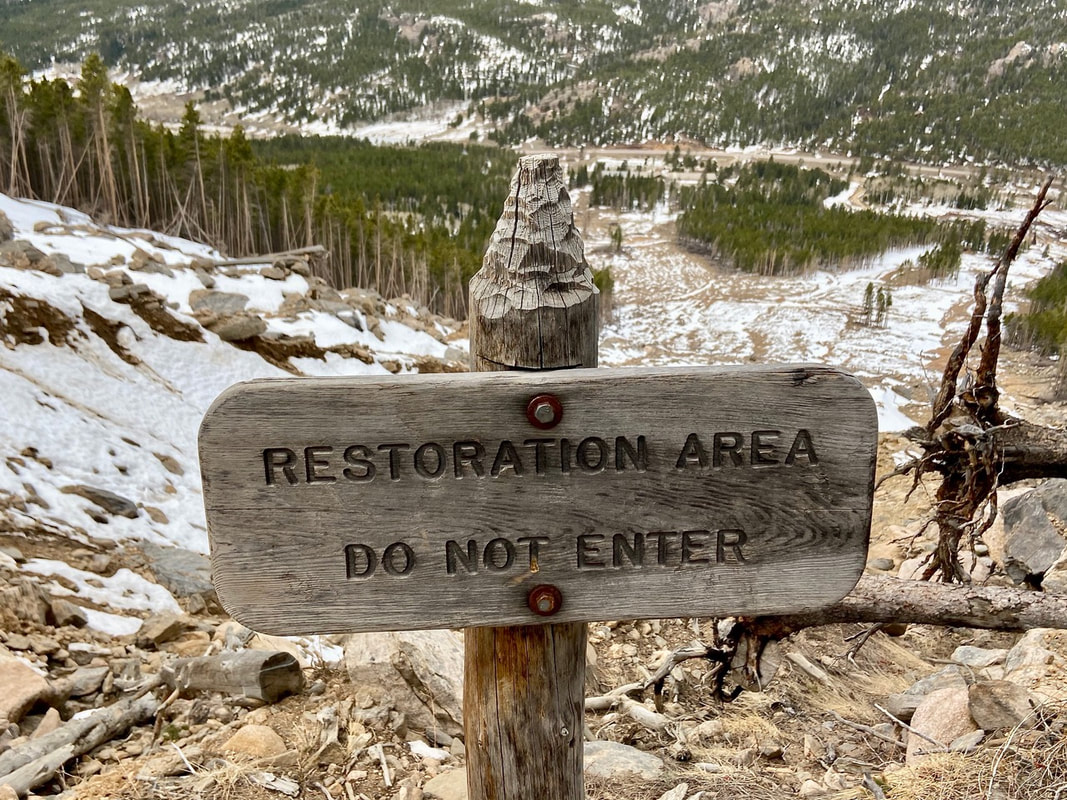
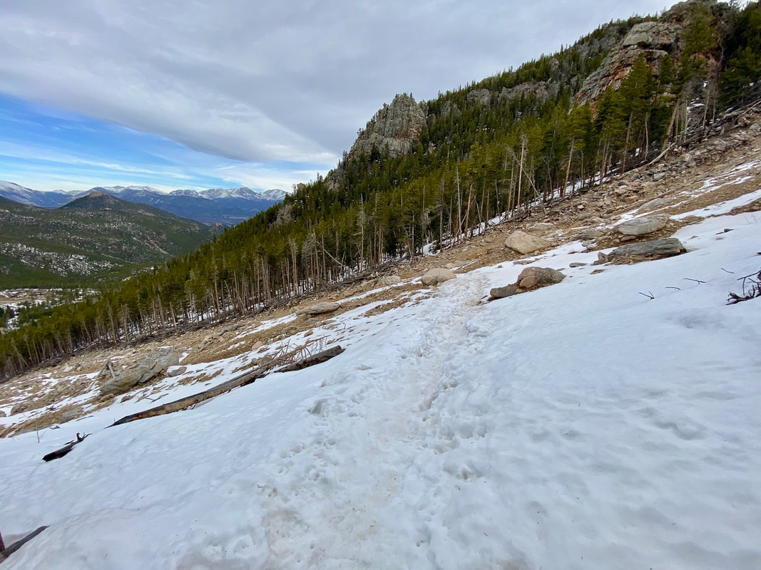
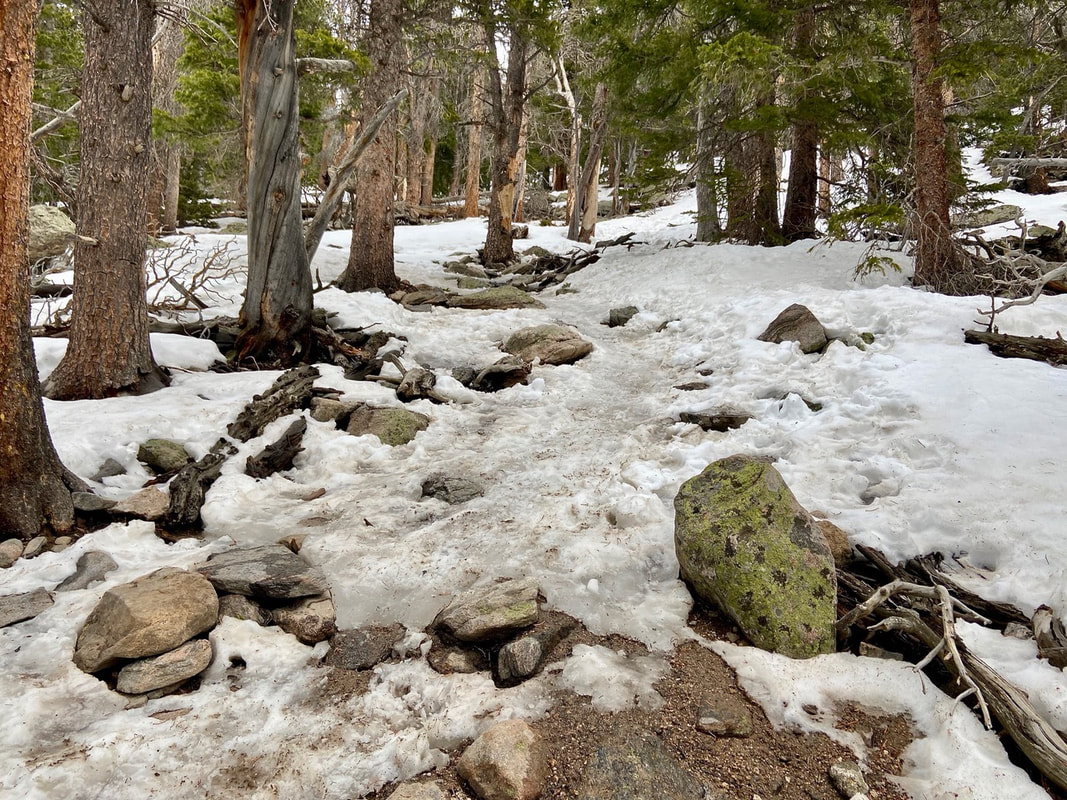
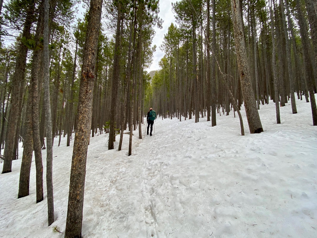
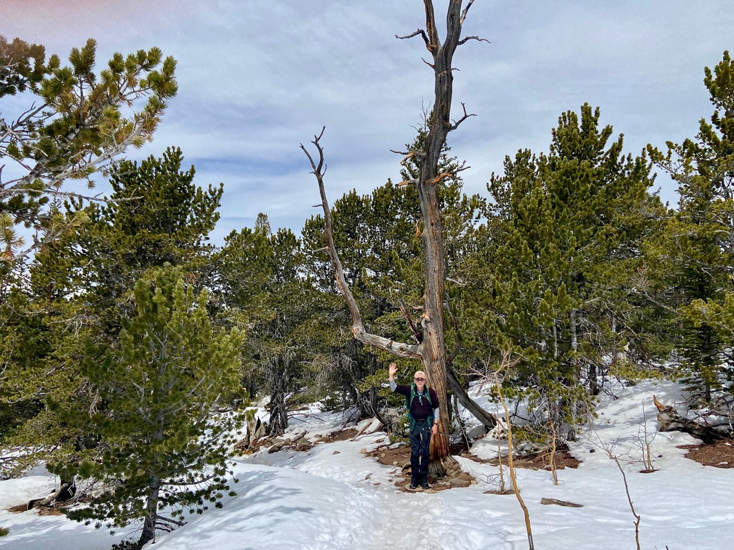
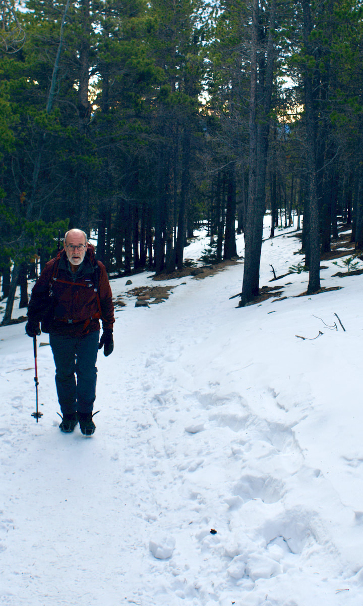
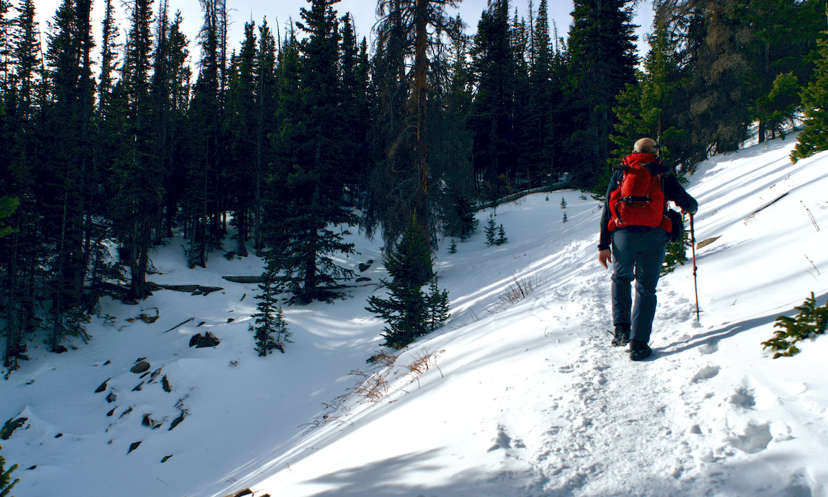
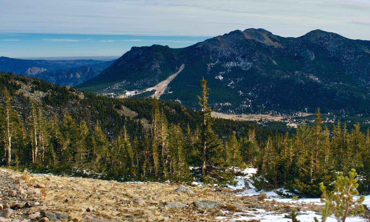
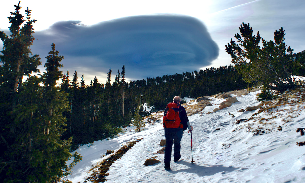
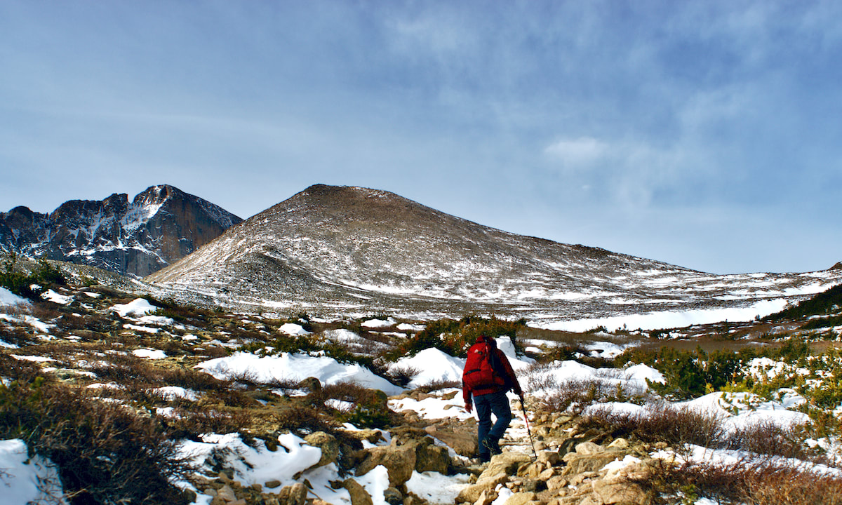
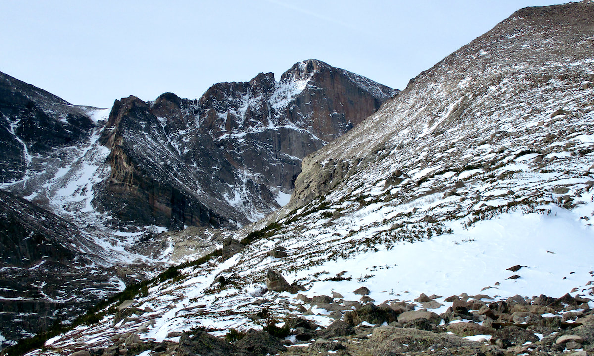
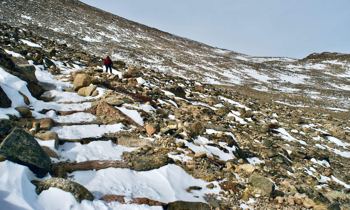
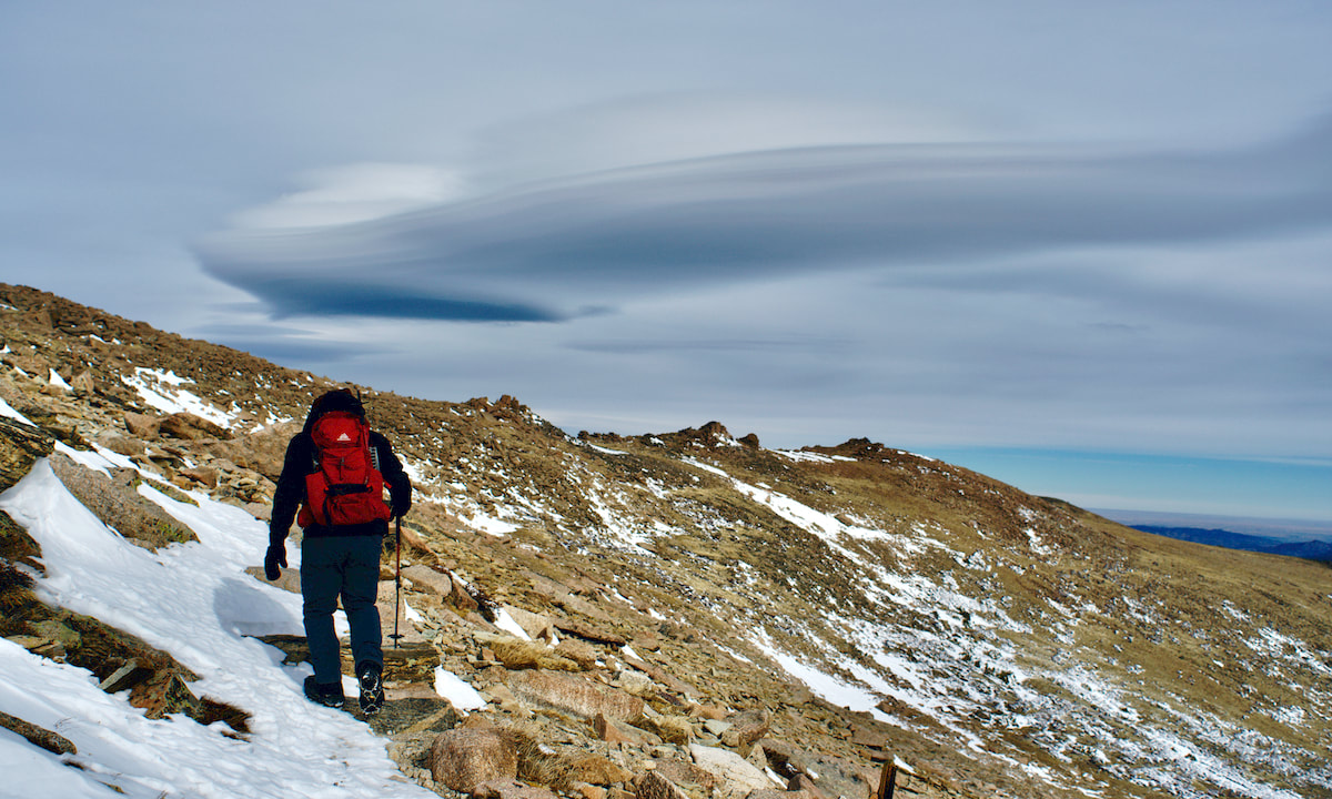
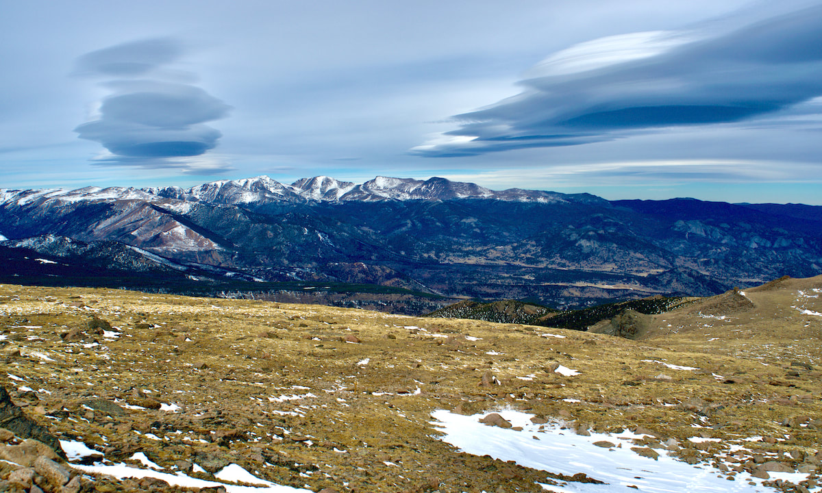
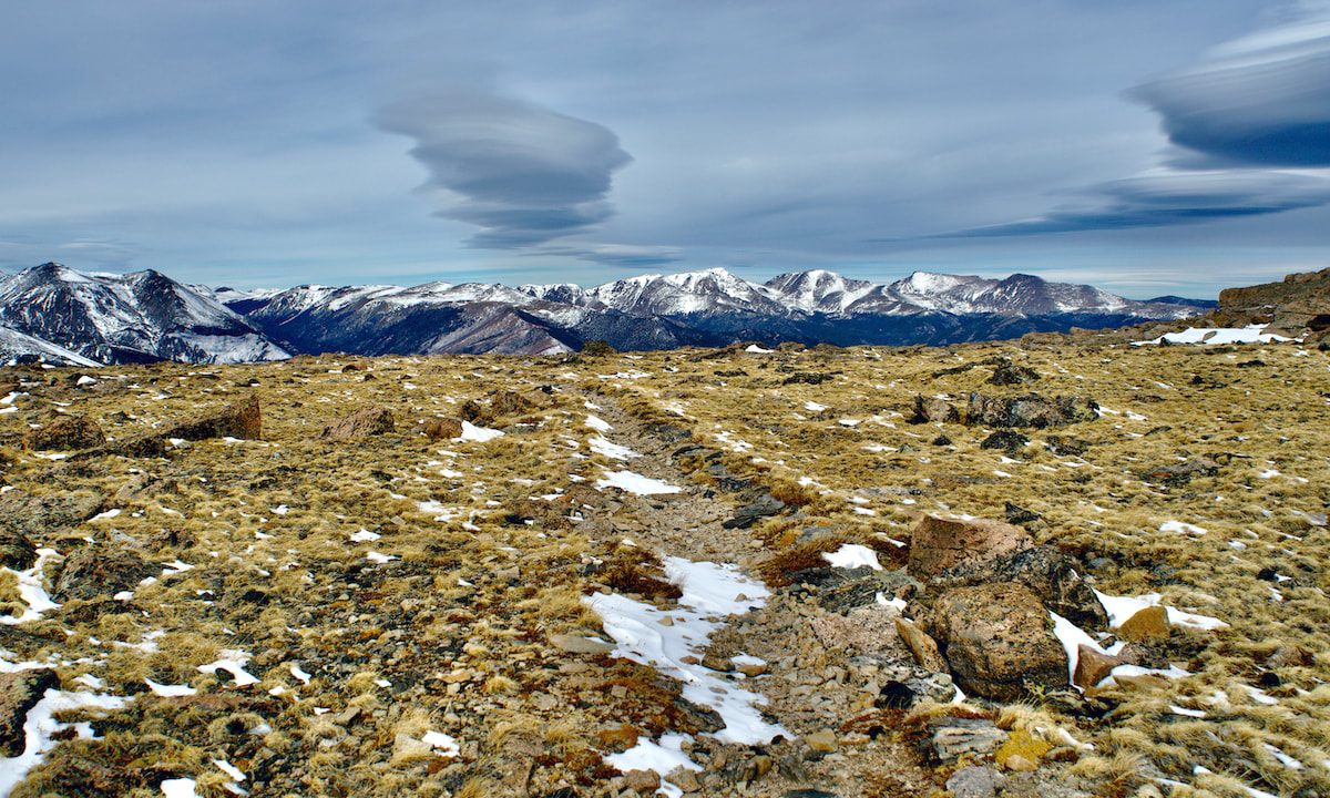
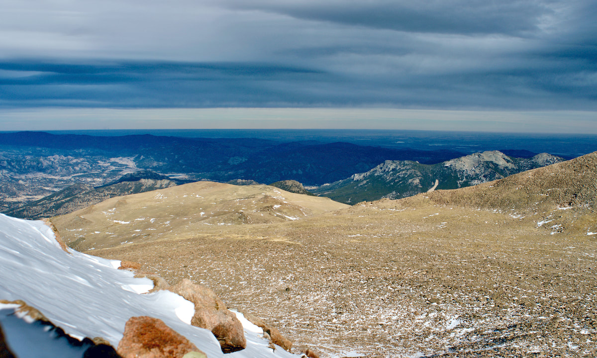
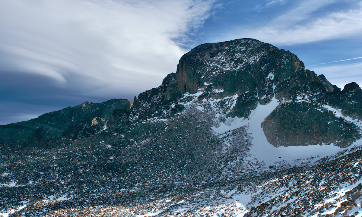
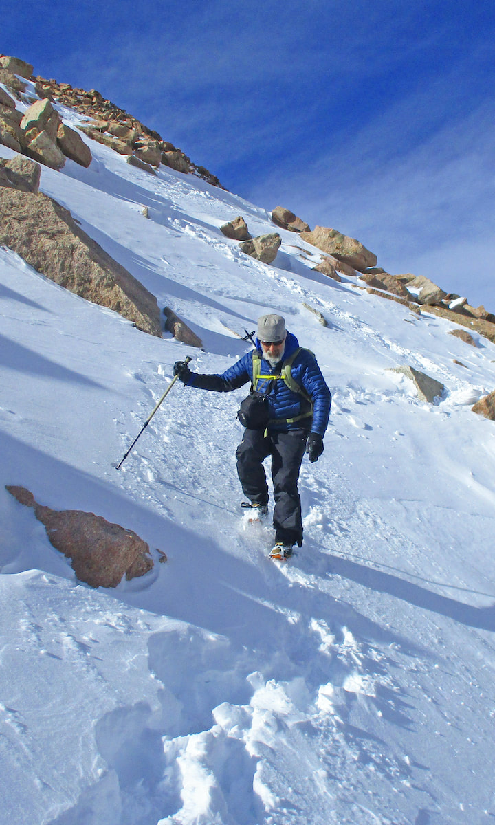
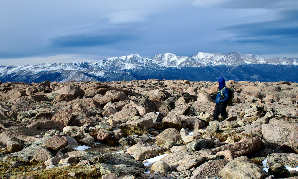
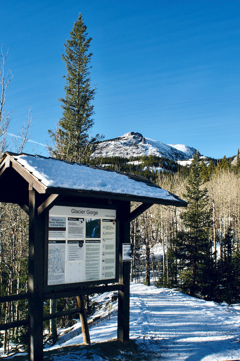
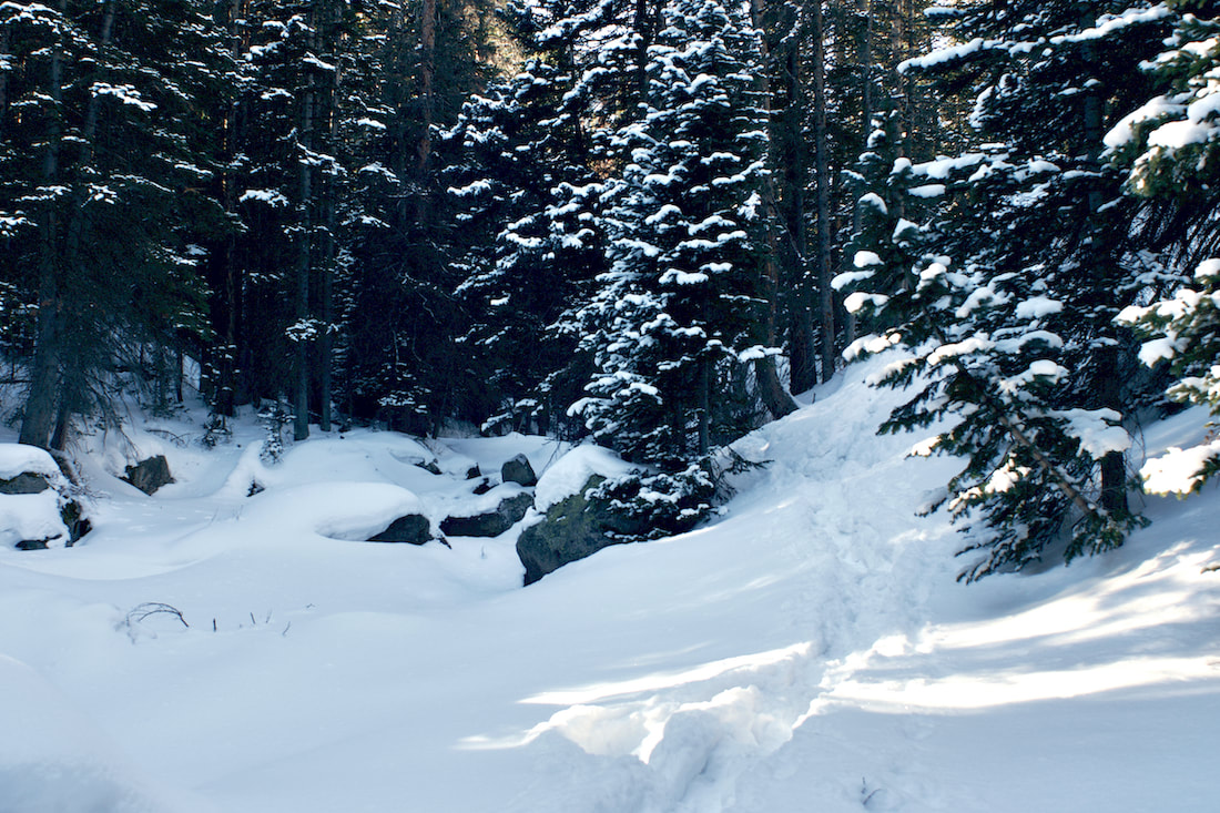
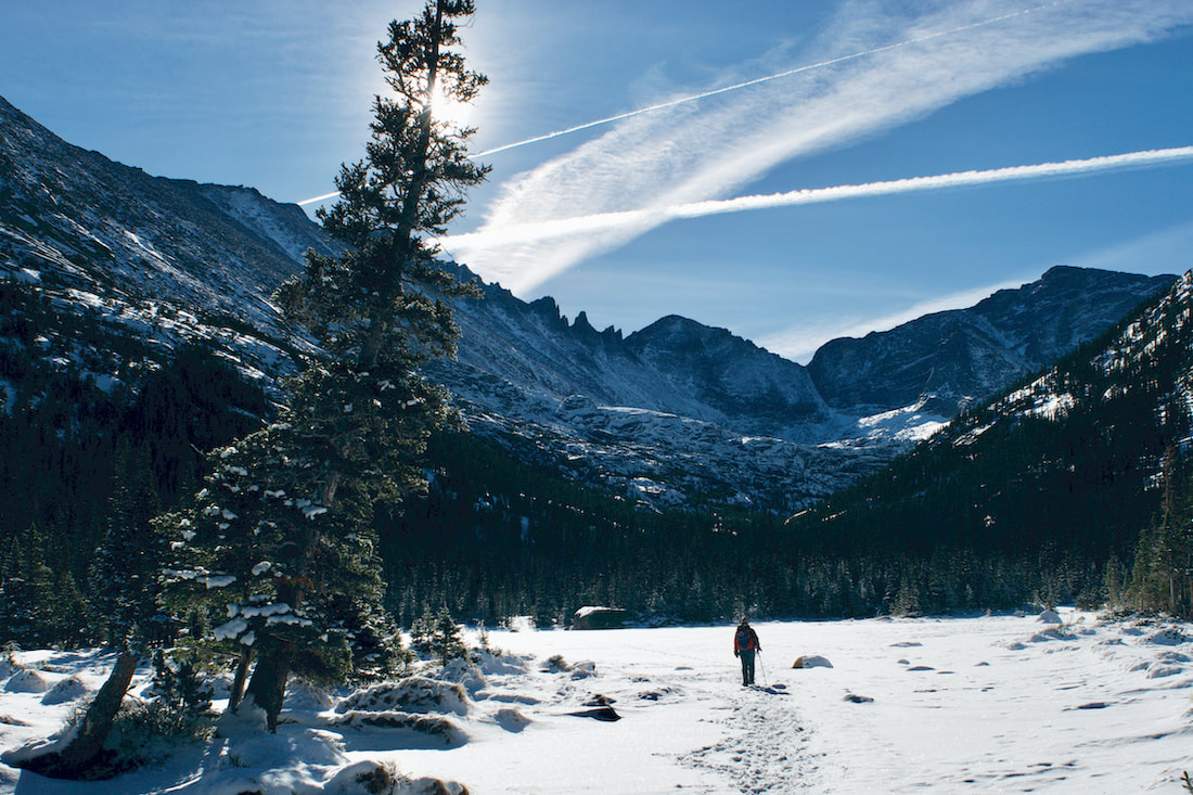
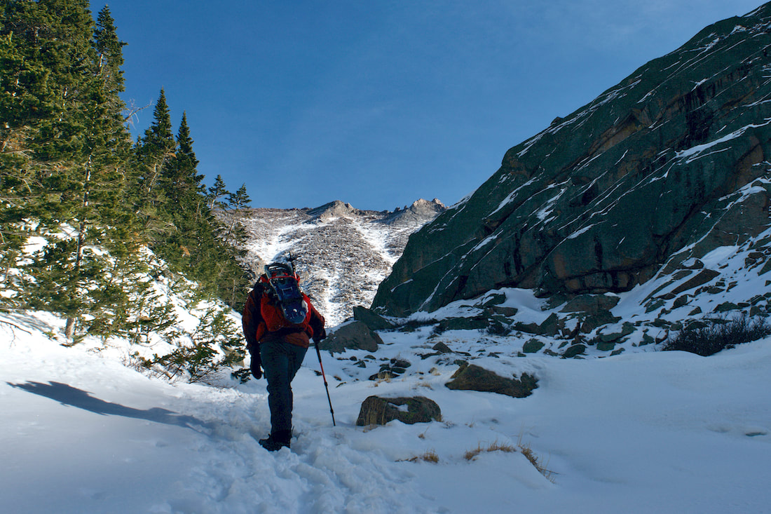
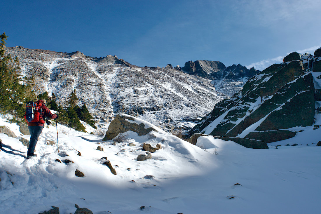
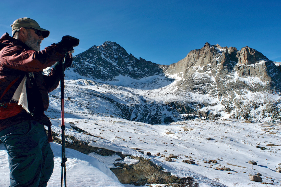
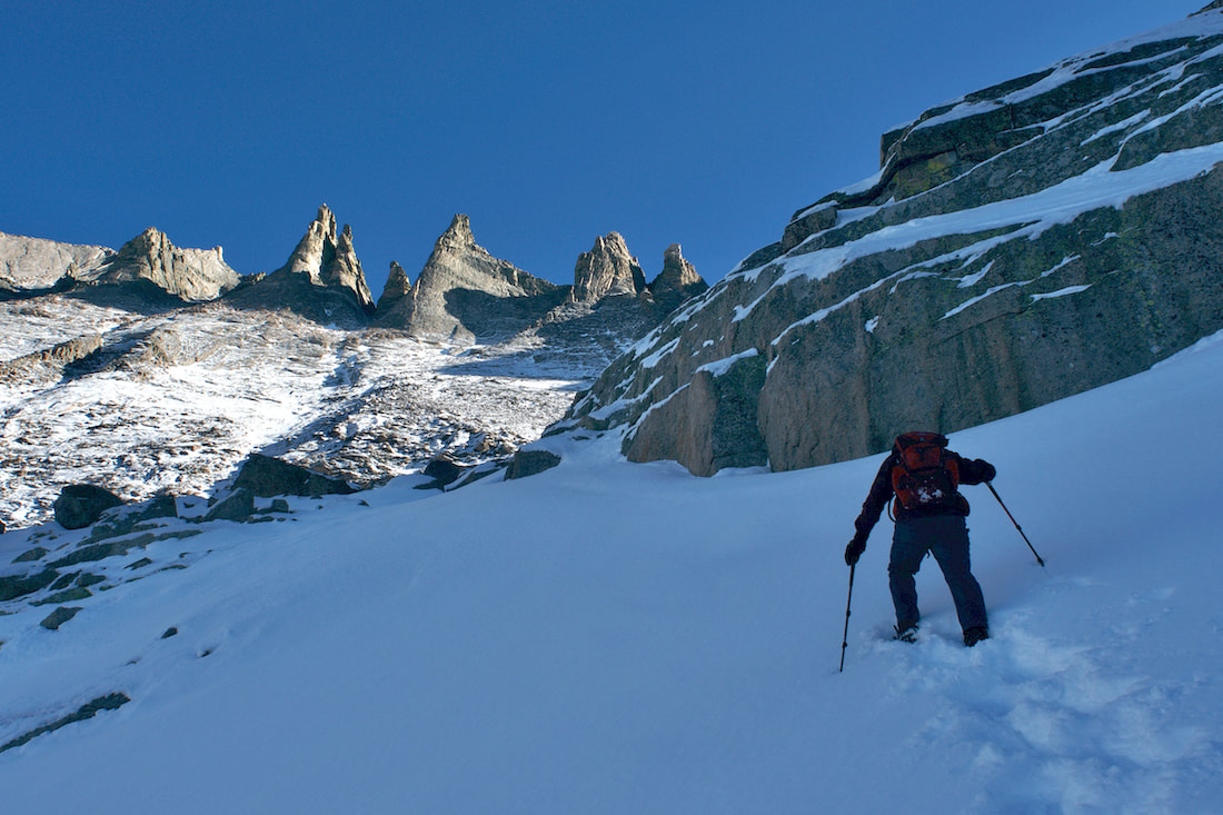
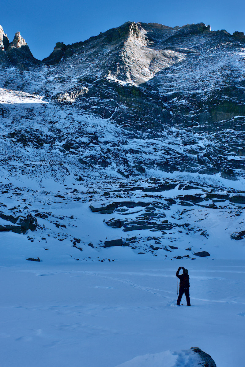
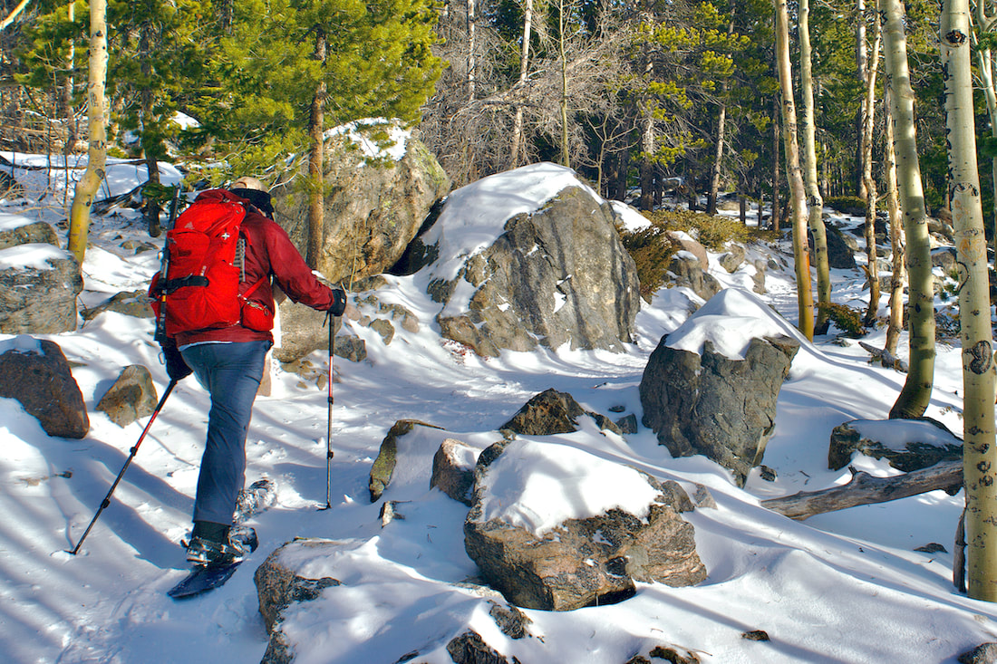
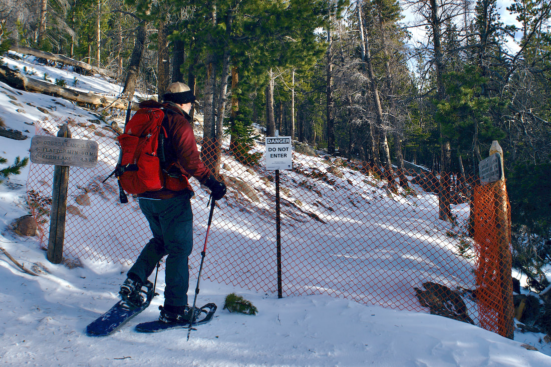
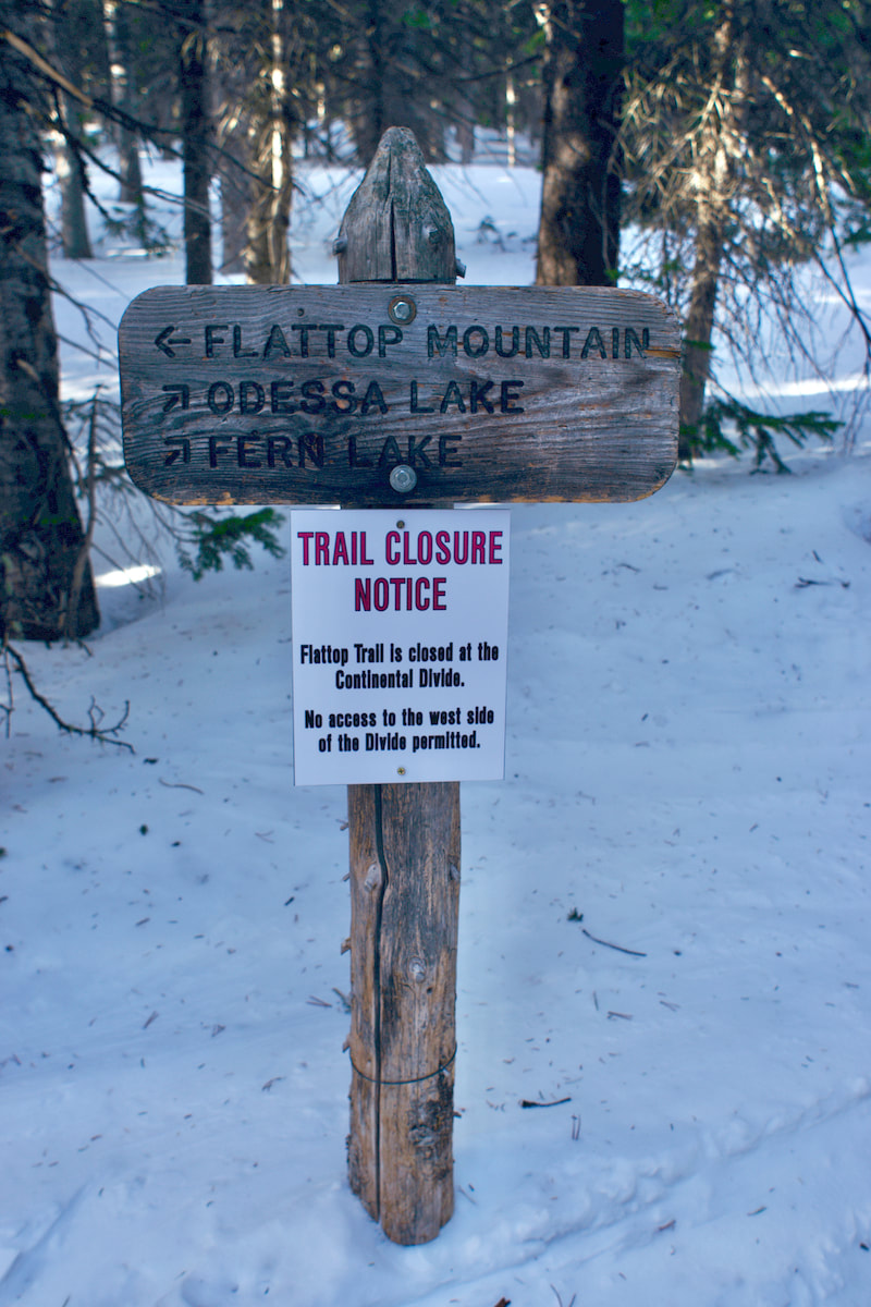
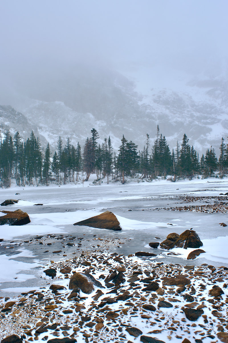
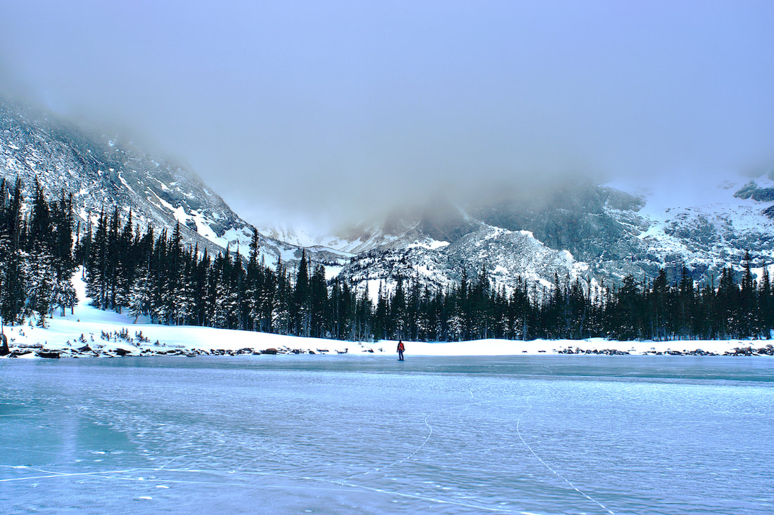
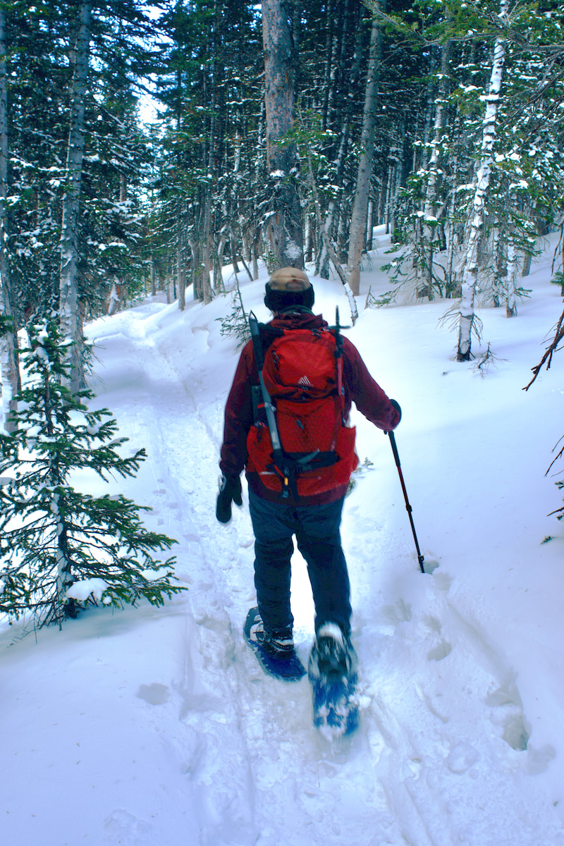
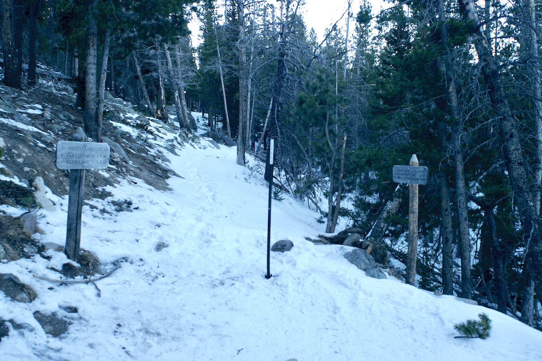
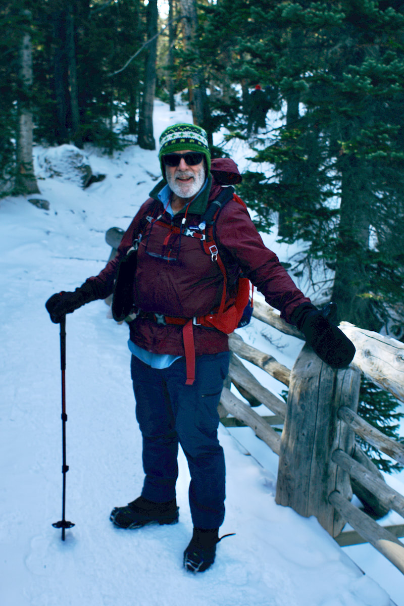
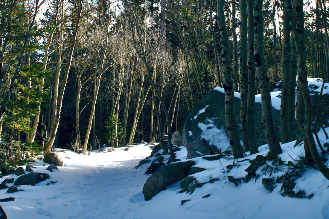
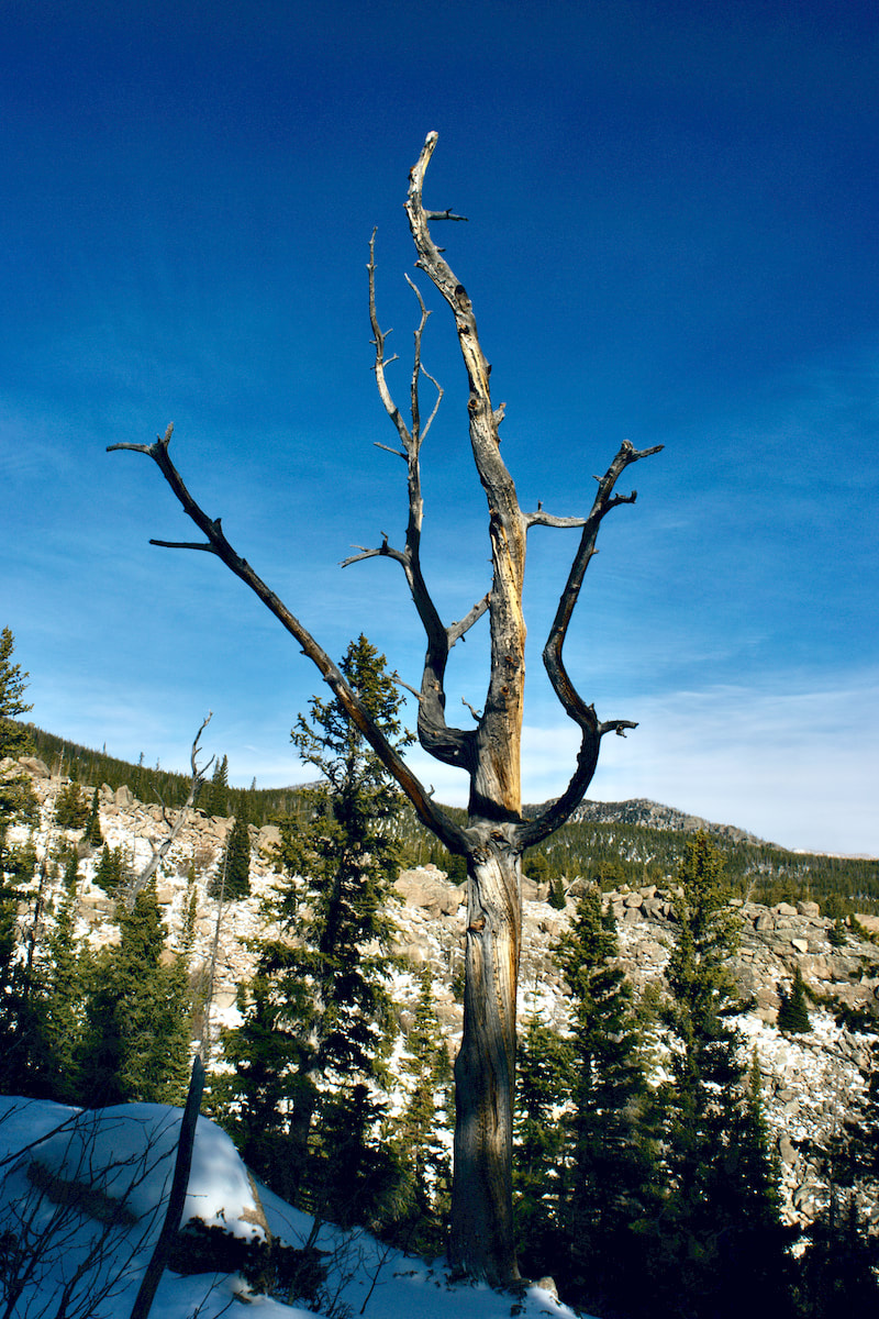
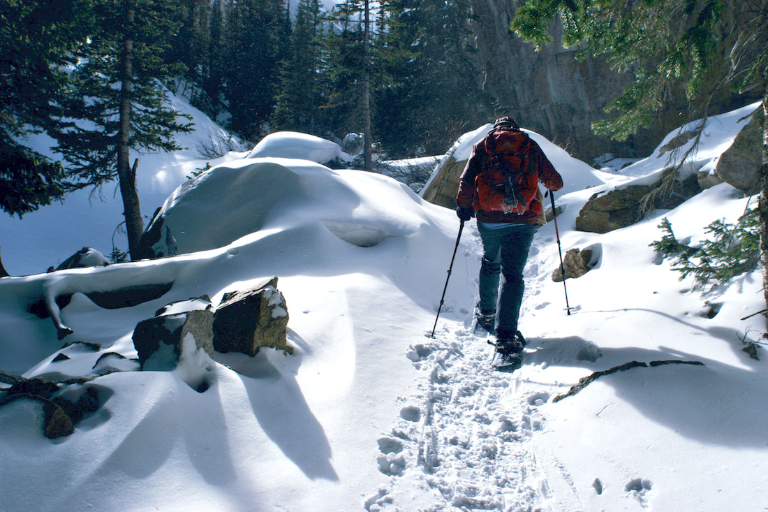
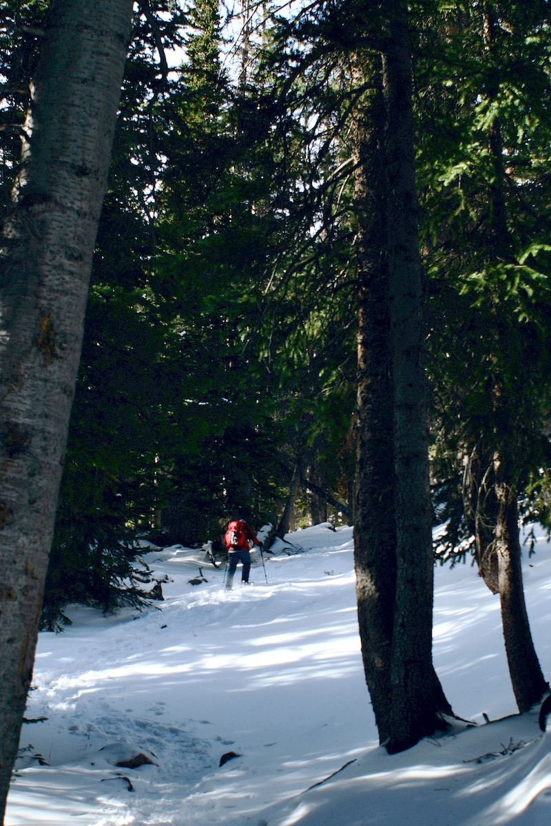
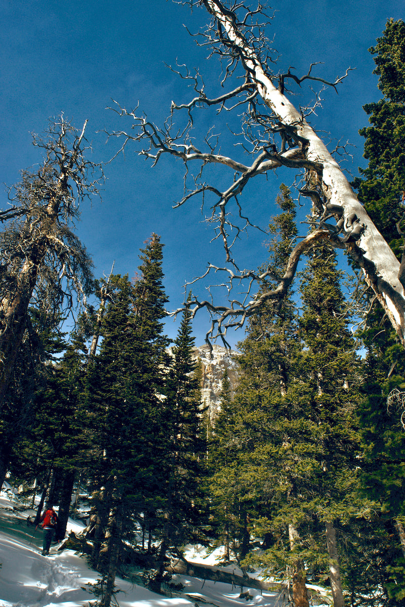
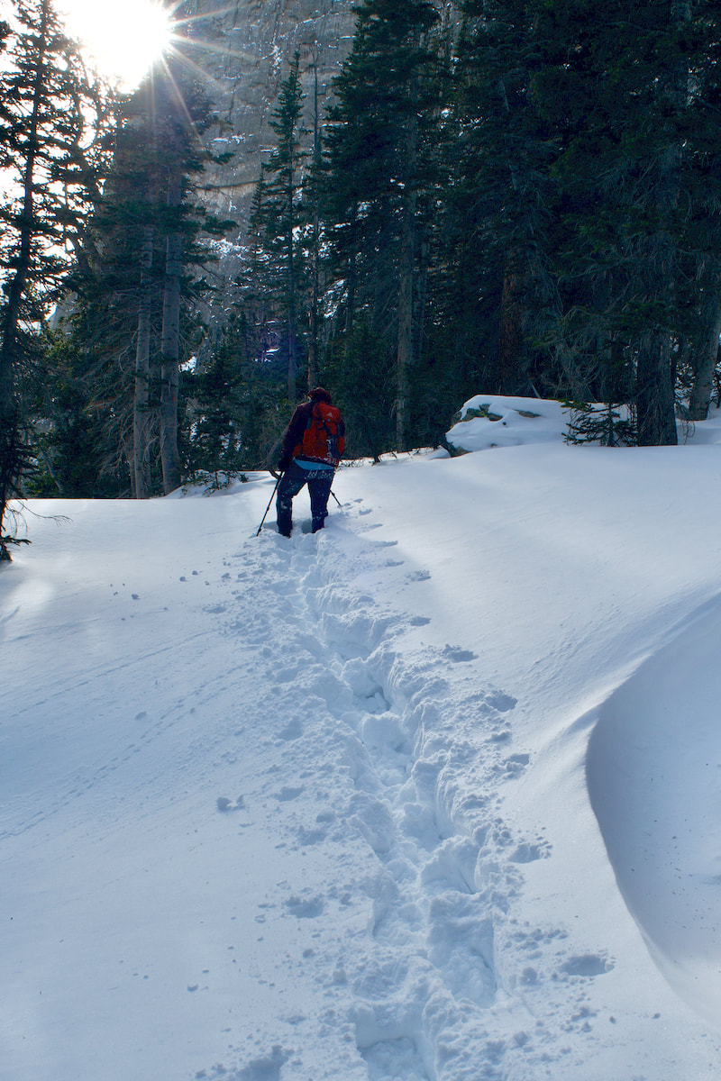
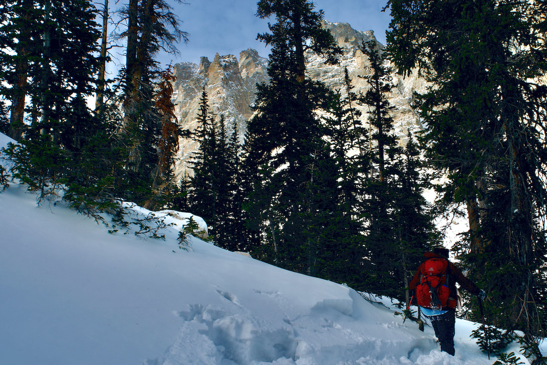
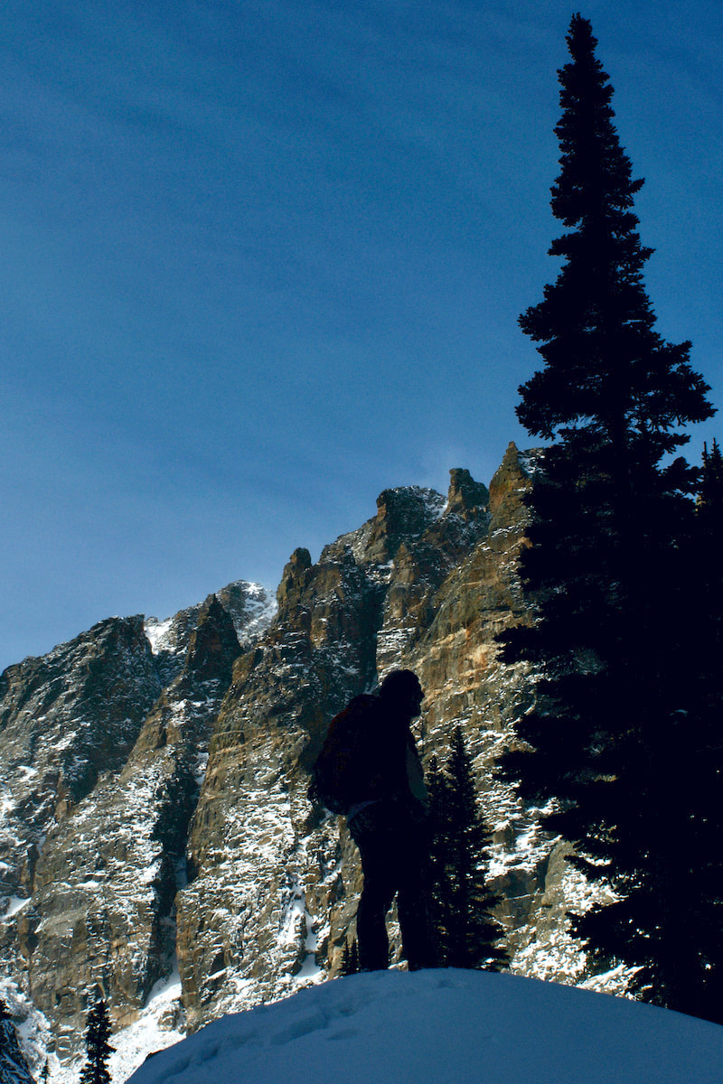
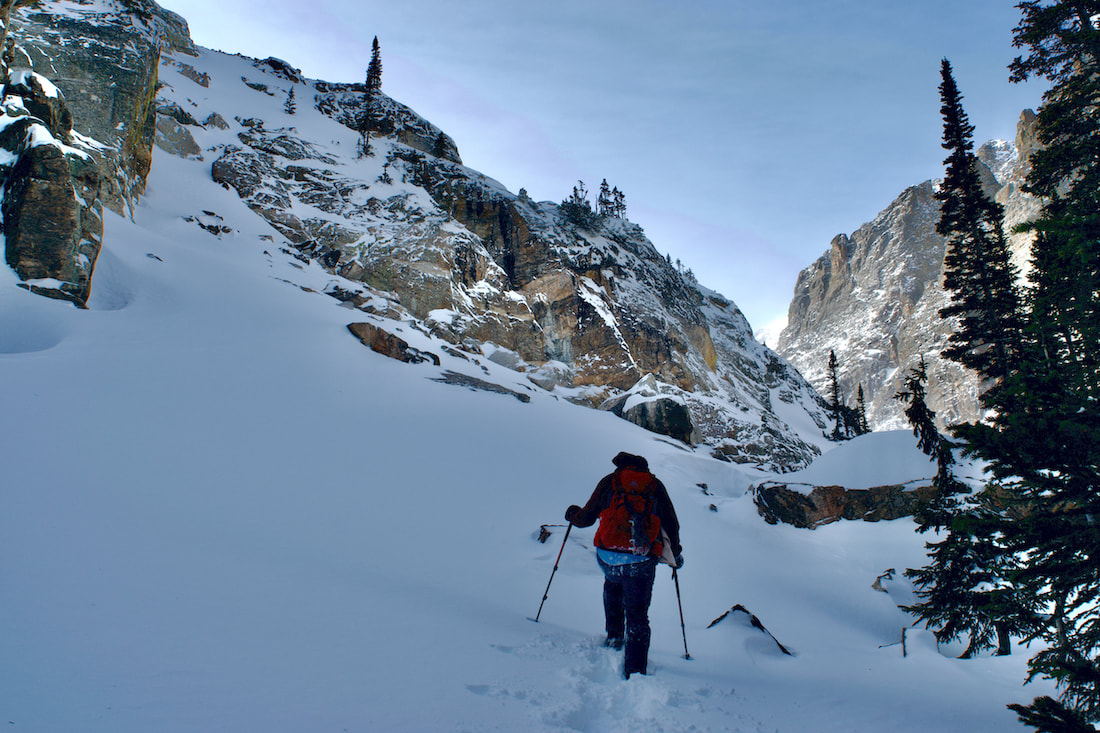
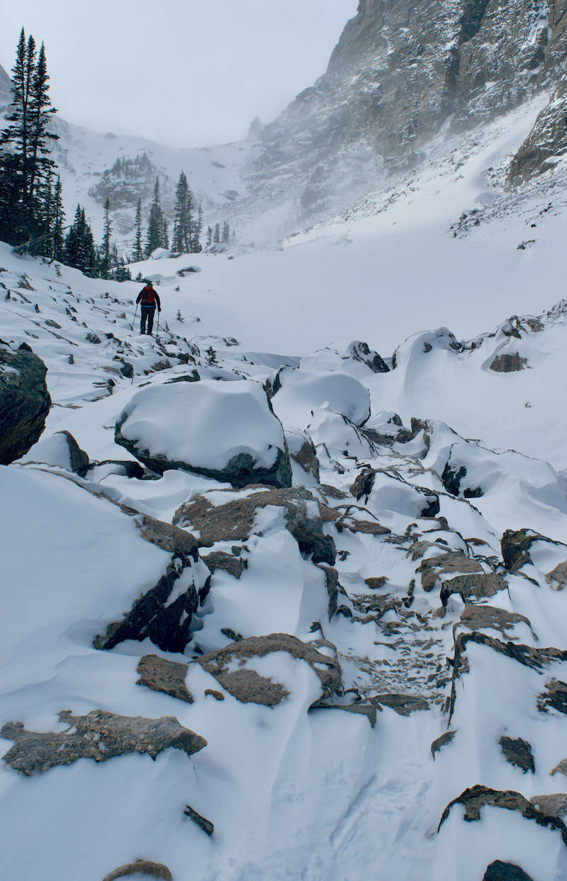
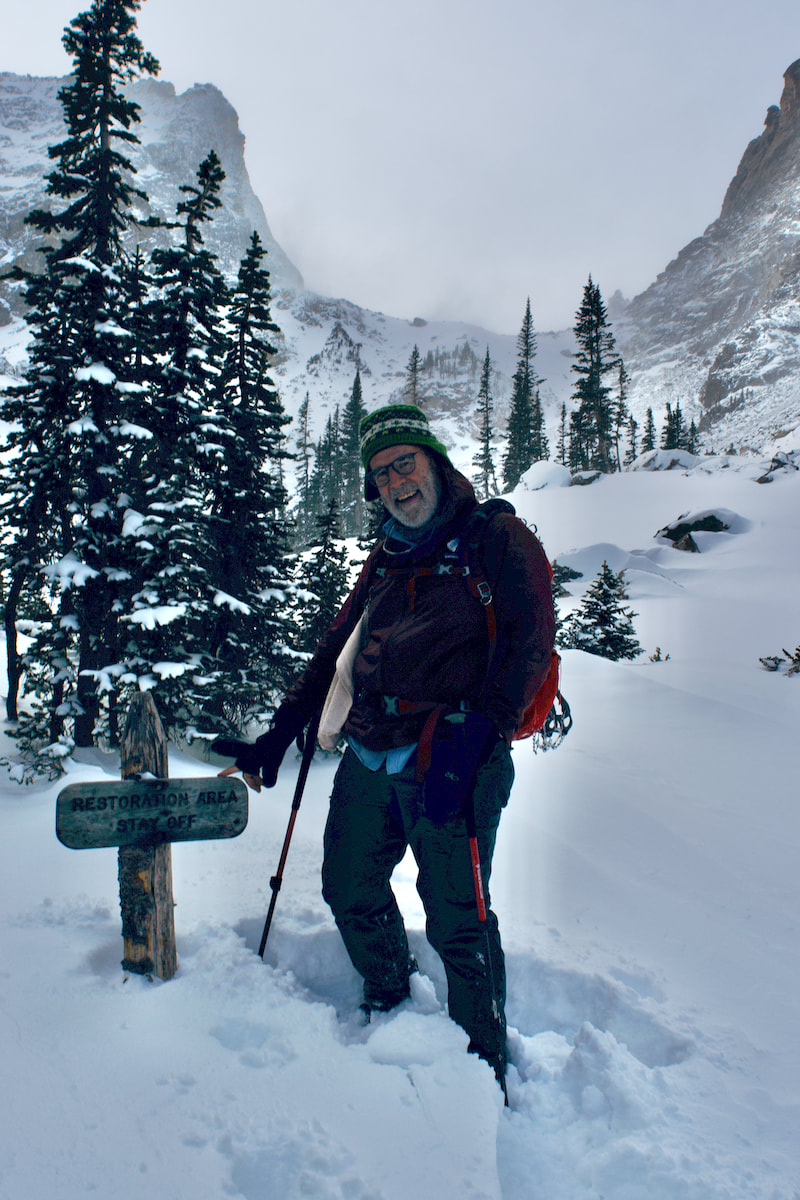
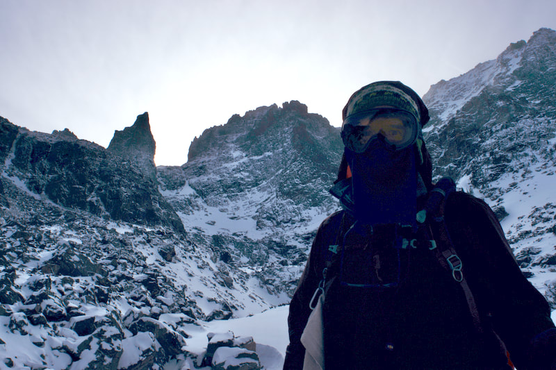
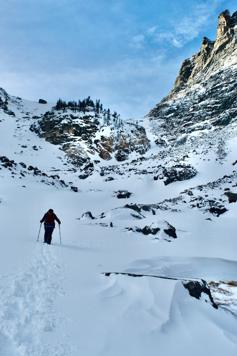
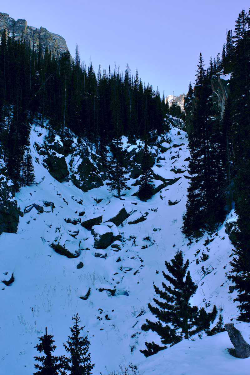
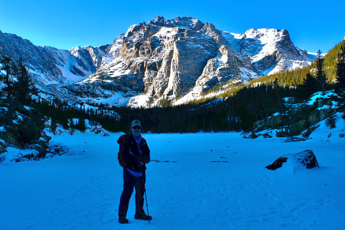
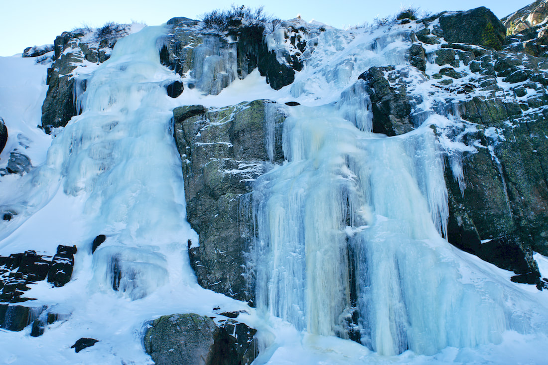
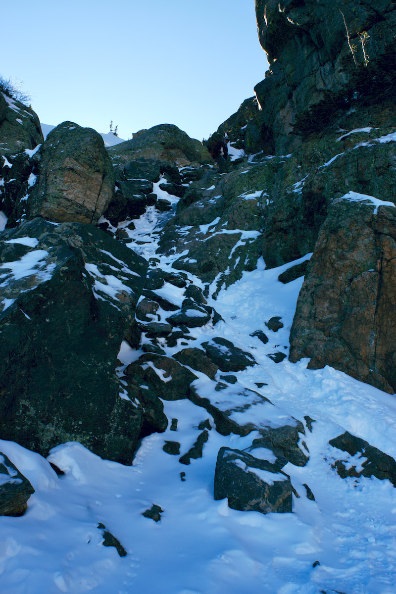
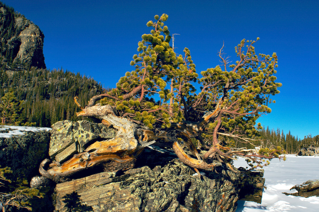
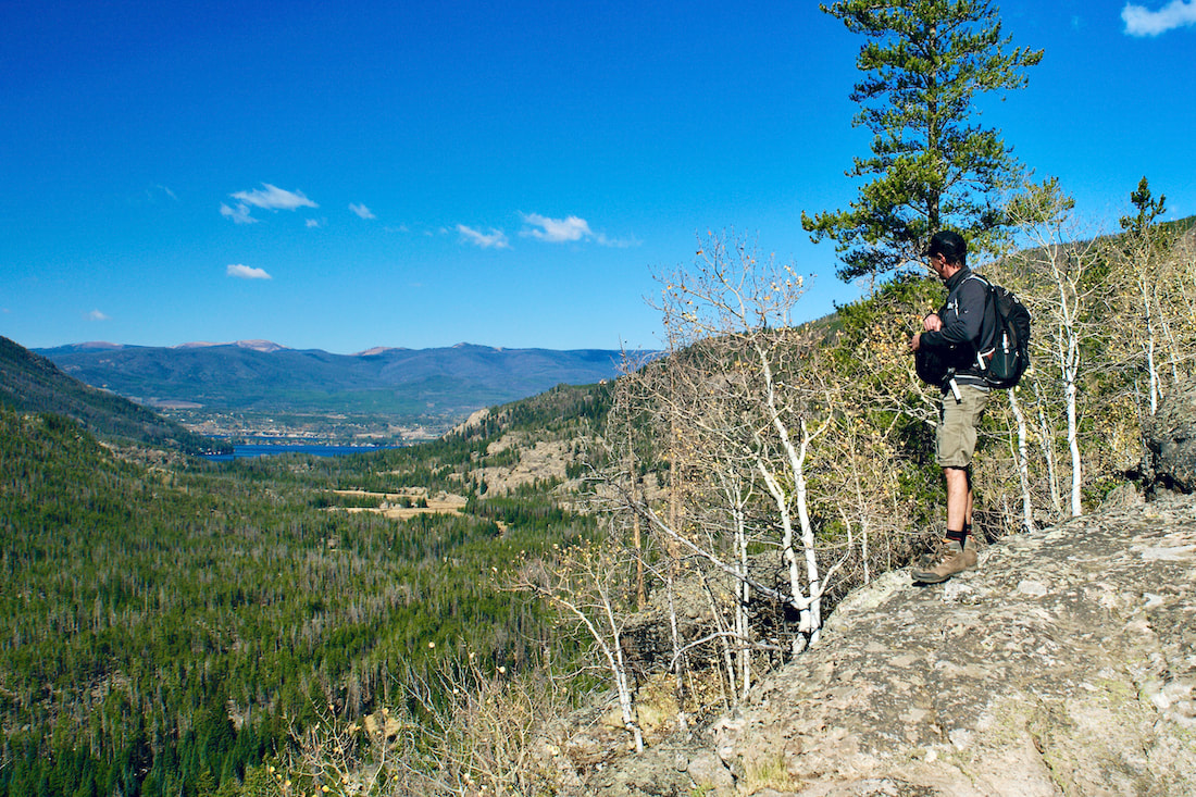
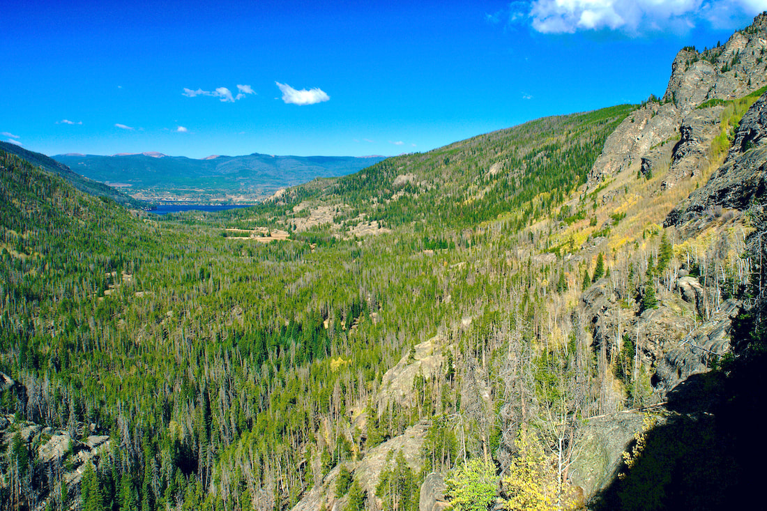
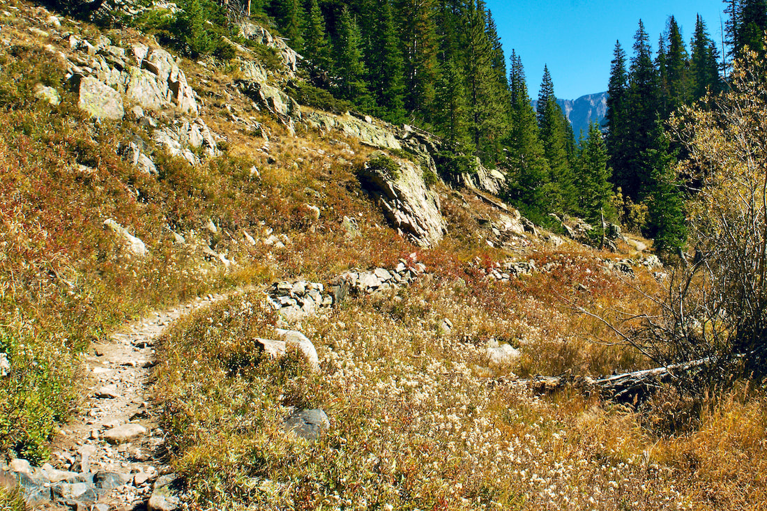
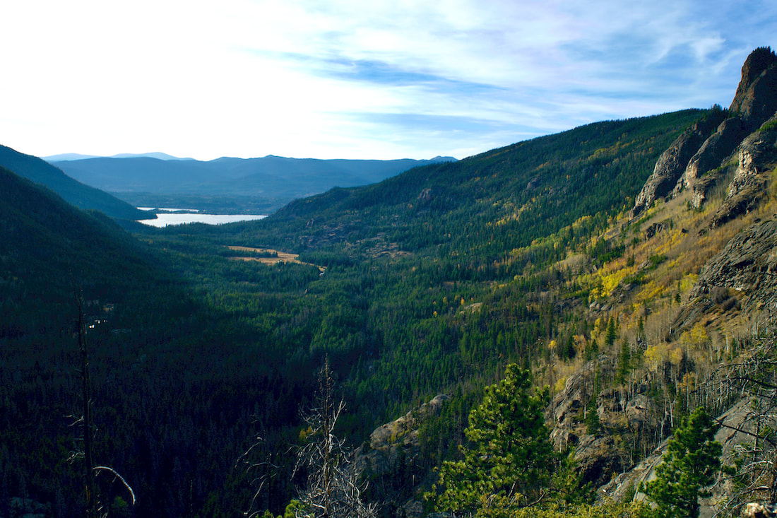
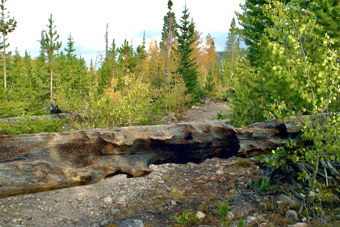
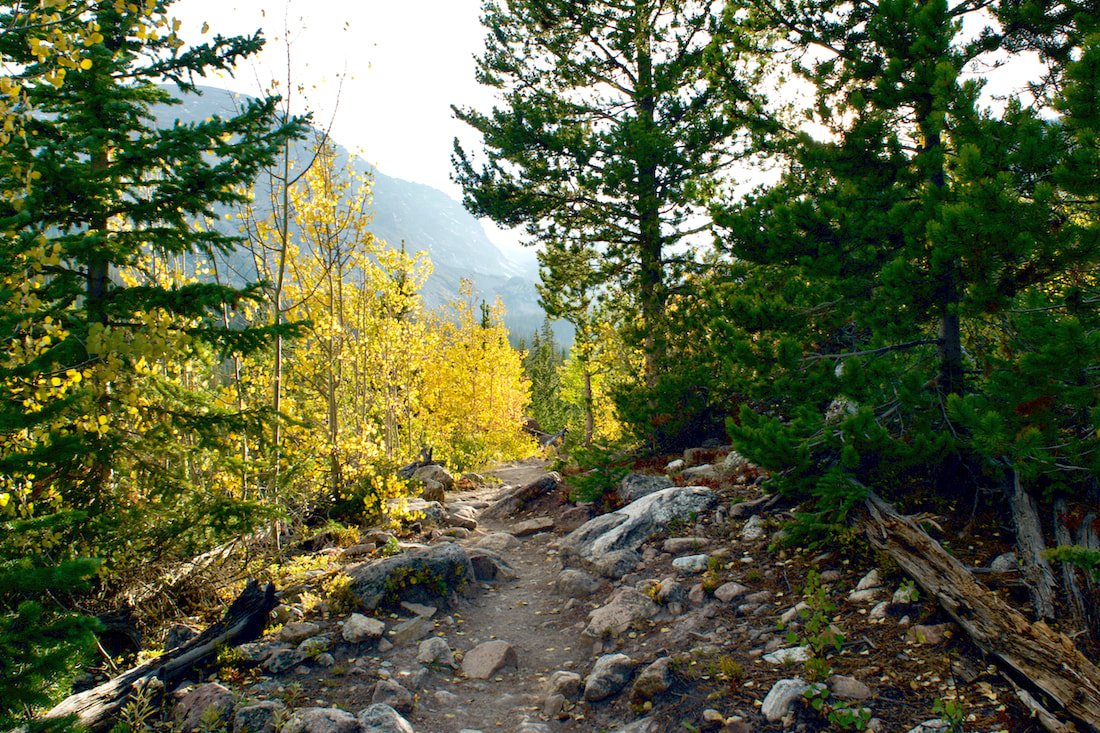
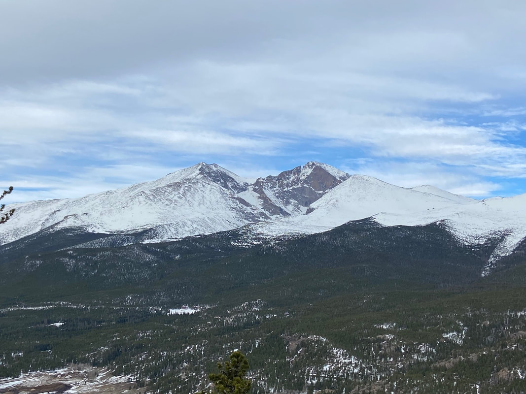
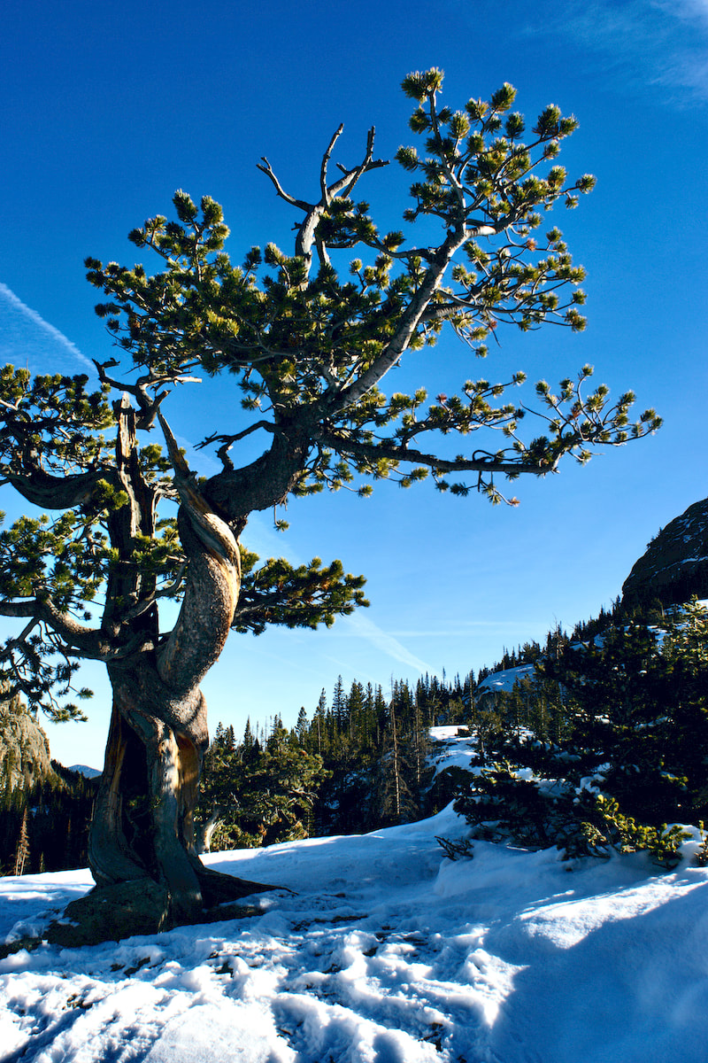
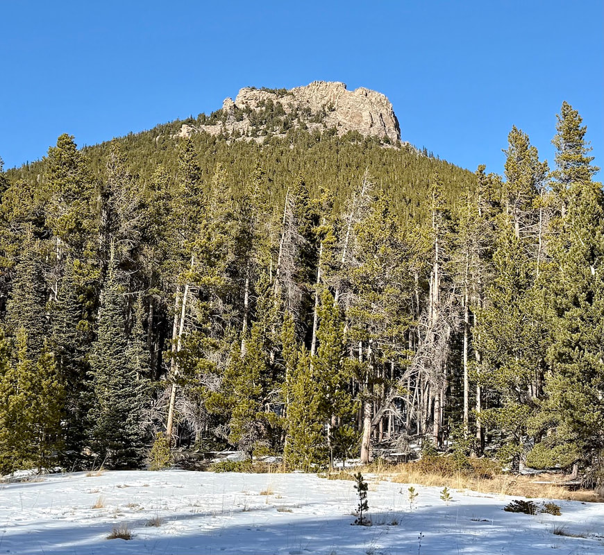 The Estes Cone as seen from Moore Park. Marlene Borneman by Marlene Borneman Go to the winter woods: listen there, look, watch, and “the dead months” will give you a subtler secret than any you have yet found in the forest." Fiona Macleod, Where the Forest Murmurs Hike Rating: Moderate Distance: 6.6 Miles Round Trip Elevation Gain: 1,606 feet Sitting at 11,006 feet, Estes Cone can be a challenging peak in cold, snowy months. The trail most often used in winter is located at the Longs Peak Ranger Station at 9,400 feet. The Ranger Station is not staffed in the winter. Trail and weather conditions can change in a heartbeat especially in winter so check ahead with the Wilderness Office. There are days carrying snowshoes is a must as the start may only require spikes or no devices, but later the trail can become deep snow and could stop one in their tracks! The start climbs steadily for a half mile to the junction with the Eugenia Mine, Storm Pass and Estes Cone trail. Leave the Longs Peak Trail and turn right heading towards Eugenia Mine and Storm Pass. This section of trail is surrounded by aspen and conifer forest and loses a bit of elevation before reaching Eugenia Mine. You may spot moose and often snowshoe hares. Approach a small footbridge crossing Inn Brook and arrive at the Eugenia Mine ruins. In the early 1900’s a miner from Chicago settled at what is named Eugenia Mine with his family to mine for gold. After a few years of laboring with no results he abandoned the site. Remnants of a log cabin, rusty pans and mine tailings are all that is left. It is enjoyable to explore the site and imagine the life attempting to mine for gold. Of course, nothing leaves the Park so please leave any item where found. 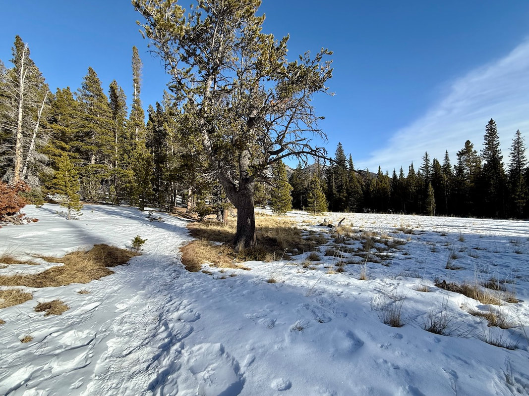 Moore Park. December 2024. Marlene Borneman About a half mile further a lovely meadow is reached named Moore Park which is often blown clear of snow. This spot provides a nice view of Estes Cone’s summit. Continue through the meadow entering the trees once again and coming to a junction with Storm Pass and private property. Take a left heading northwest to Storm Pass. At this point the trail can become windblown with snow drifts making it difficult to follow in winter. Climb 2.6 miles to Storm Pass with another trail junction. At this junction it is 0.7 miles to the summit with some difficult terrain to cross: snow covered rocks, ice and tree roots. Turn east toward the summit of Estes Cone. 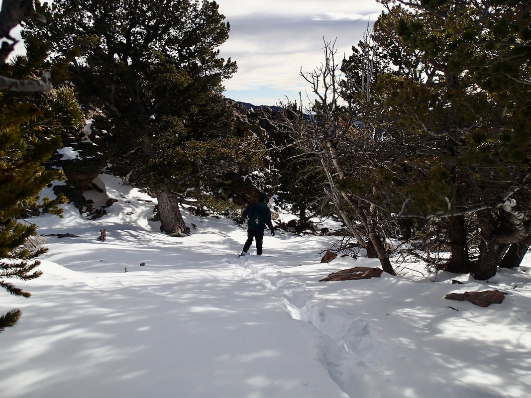 Breaking a fresh trail to Estes Cone on snowshoes. Marlene Borneman The snow/ice-covered trail can be difficult to follow. If proper equipment, (i.e. spikes, snowshoes, and warm clothing), is not carried it can be dangerous to continue, so turning around is ok. Spikes and/or snowshoes are necessary most of the time to reach the summit from here. The last half mile becomes especially difficult if one is not familiar with the area as the trail climbs very steeply up several switchbacks through a thick forest. There are cairns along the trail; however, these maybe covered in snow. 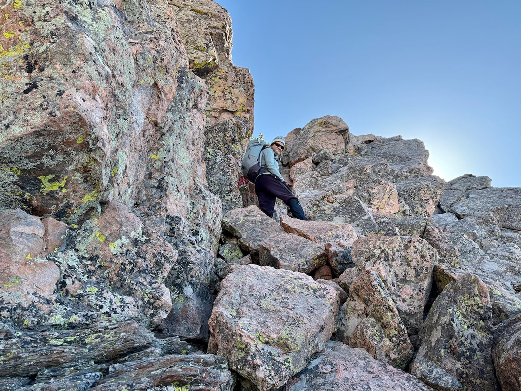 Marlene Borneman, near the top of the short but steep gully to a large rock outcropping forming a false summit. Walt Borneman Climb up the switchbacks, reaching the top of the ridge before veering south until a steep gully is reached. Before climbing into the gully look west for a breathtaking view of Longs Peak. This gully has large loose rocks to negotiate that are often ice covered so take care and go slowly. Top out on the rock outcropping and turn east heading through fine looking limber pines to another gully to scramble to the summit. 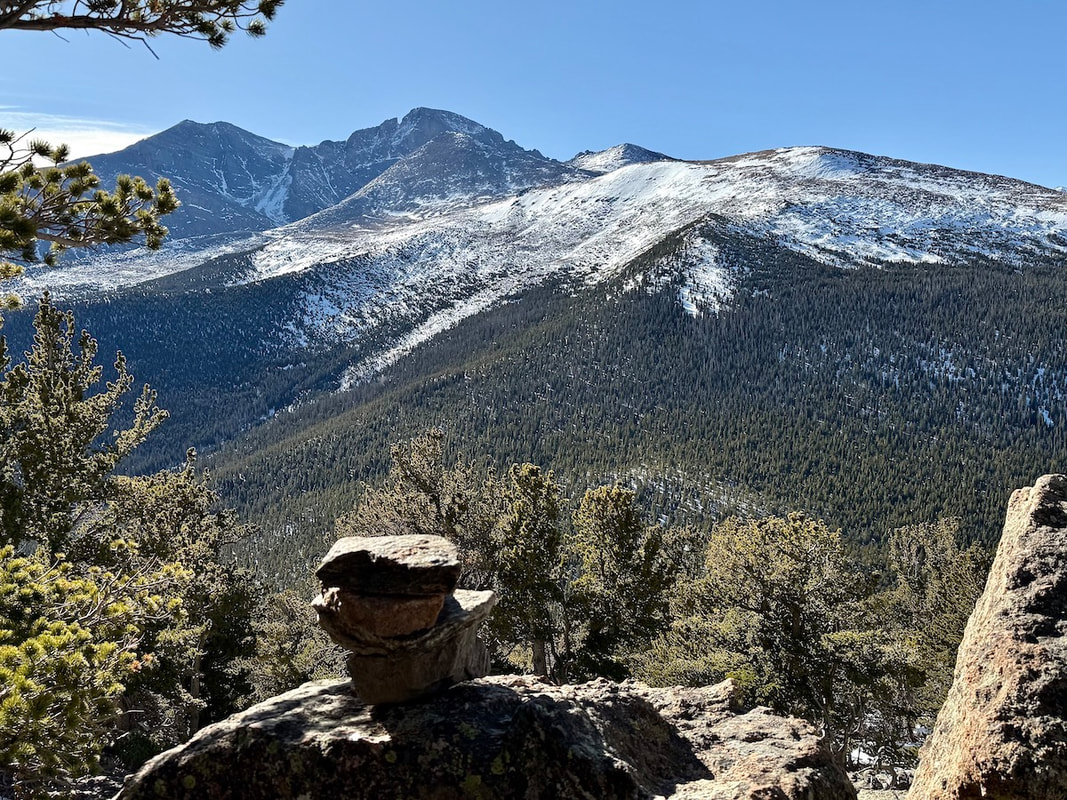 Tremendous views of Longs massive. Marlene Borneman The summit of the cone offers outstanding views of Longs Peak, Twin Sisters, the Mummy Range, Lily Lake, and the Estes Valley. Retrace your steps back to the trailhead. Five-point moves may be necessary coming down (hands, feet and butt) especially in the gullies and on the switchbacks! 
0 Comments
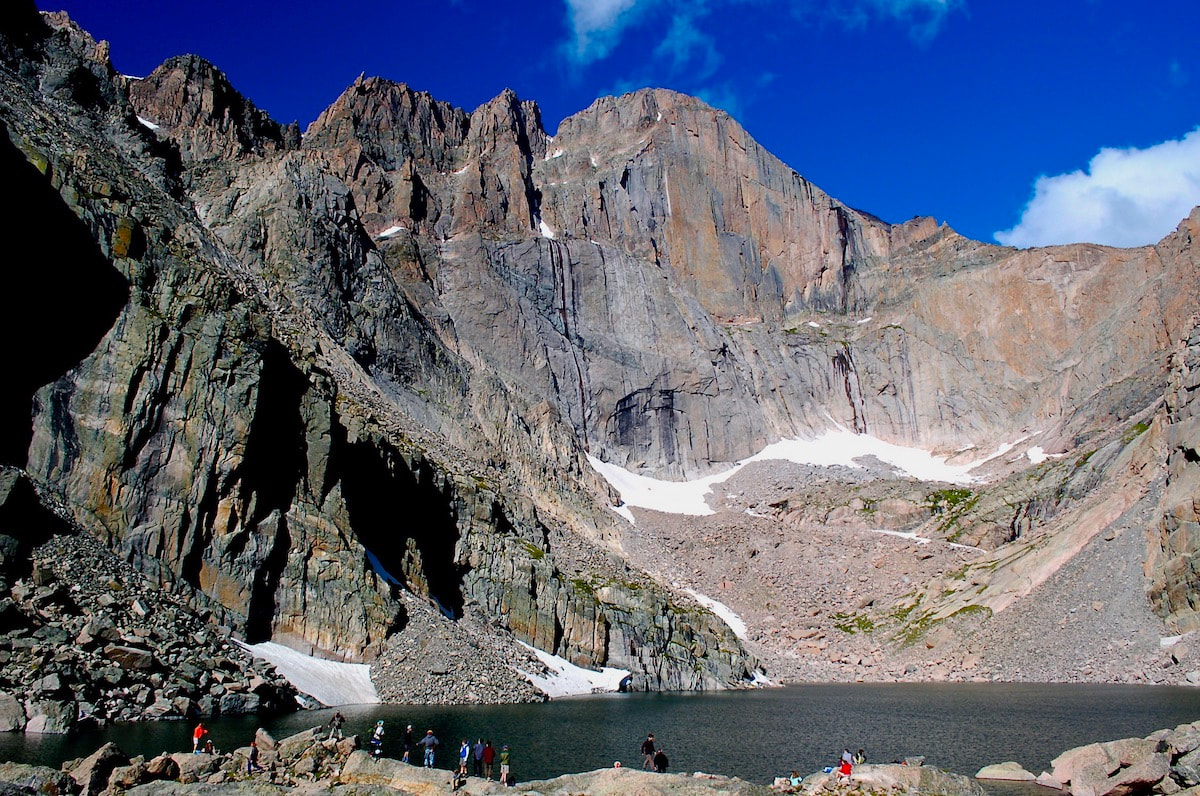
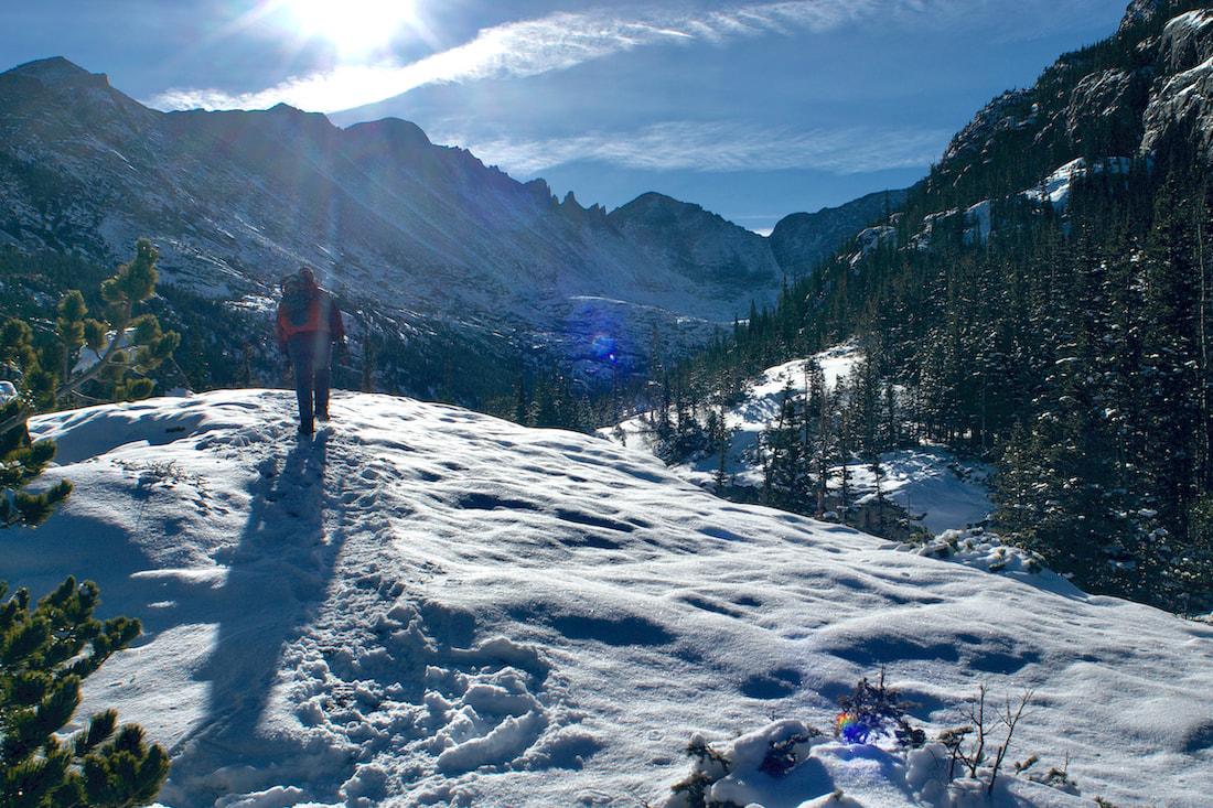
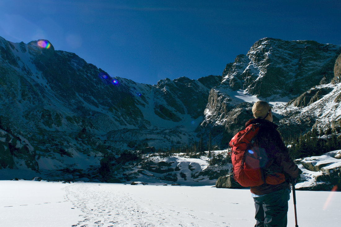
This winter, why not try a trek to a Rocky Mountain National Park classic, Chasm Lake.
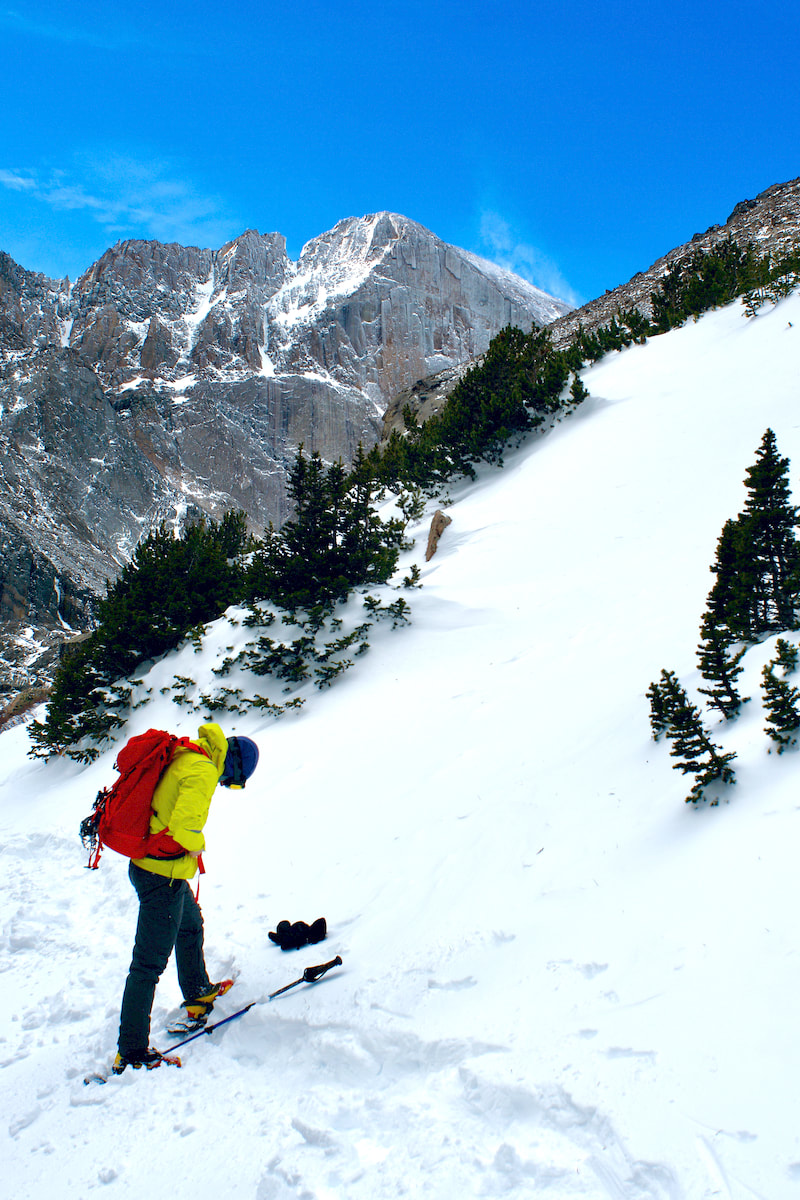
It is important to pay attention to the conditions, namely the weather. Besides looking for a sunny day, check the winter weather for the wind forecast; strong winds and blowing snow create hazardous conditions. When winter trekking on this trail, plan to bring both snowshoes and good traction devices like spikes, and pay special attention to winter wear. When deciding your winter wear, if it’s a good weather day, the conditions could be anything from almost balmy to bitter cold in the shade. Be prepared to layer up or down. If, for whatever reason, you have decided to go up on a nasty day, goggles are a must. But do check the weather the night before. The Trail Out of the car, you are at the Longs Peak trailhead with a beginning elevation of 9,400’. The lake from here is 4.2 miles away and 2,360’ higher. The trail begins in smaller lodge pole pine, the pines are not as tall here because of the higher elevation. Although it is also possible that the area could have been logged during the time of the Enos Mills Longs Peak Inn era of the early 1900’s, and so they may not be that old either. The January trail is likely to be completely snow covered and snowshoes work best for this first part in the trees, although depending on how long it’s been since it snowed, you might find the trial is packed enough that snowshoes are not necessary. 'Tis better to carry them and not need them than to not carry them and wished you had. It's also better to wear them than to post hole and wreck the trail.
Shortly after that, the trail switchbacks at about a 140 degree angle to the south and you begin to steadily gain elevation. You are rewarded at the end of that traverse with a switchback at Alpine Brook, a nice little babbling brook in spruce and probably why the trail goes to this point. It makes for a pleasant early resting spot, even in winter.
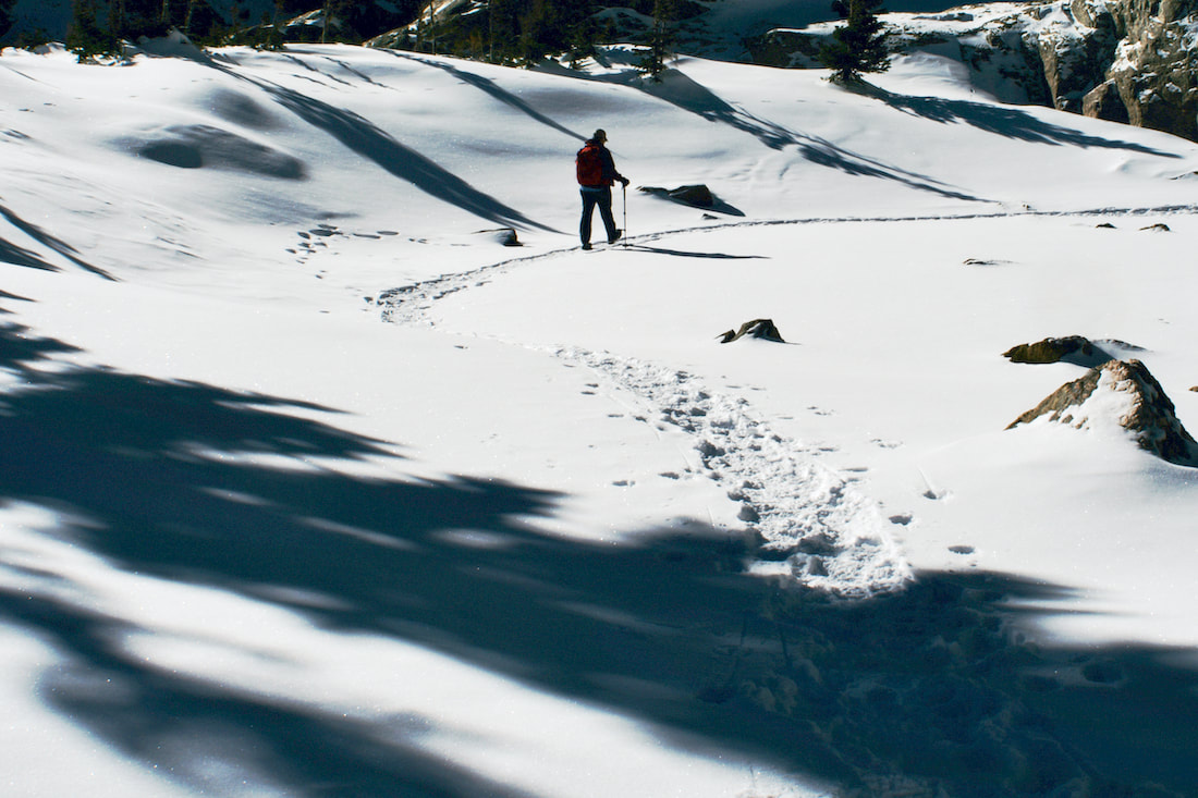
Not long after, the trail turns left crossing tiny Larkspur Creek and begins a traverse up and across an east facing slope, so there are more spruce now. Four switchbacks more continues to gain elevation before crossing one more notable bridge at Alpine Brook. At this point, you are traveling through the treeline transition zone, an elevation above which no trees grow, about 11,000’. Isabella Bird wrote upon entering the Estes Valley that, “The scenery is the most glorious I have ever seen, and is above us, around us, at the very door.” So it is as you enter into the open alpine zone and Longs Peak comes into view. Here you will find an entirely different looking landscape than the one you just walked out of, and potentially an entirely different weather situation in the winter. From here, the lake sits another 797’ higher, and the trail is all in open, exposed alpine terrain. Consider the weather from this point on. During the winter months, the summer trail in this open area can be difficult to follow due to the trail being covered over with blowing snow. Even the winter trails made by previous snowshoers can get covered over easily and you may find yourself having to make your way as best you can picking up the trail when it becomes is visible. Because this stretch can be sketchy with the wind blowing the snow off in most areas, while accumulating in other areas, switching over from snowshoes to spikes can make the travel go easier. Also, make sure your wind jacket is handy if you have not put it on yet.
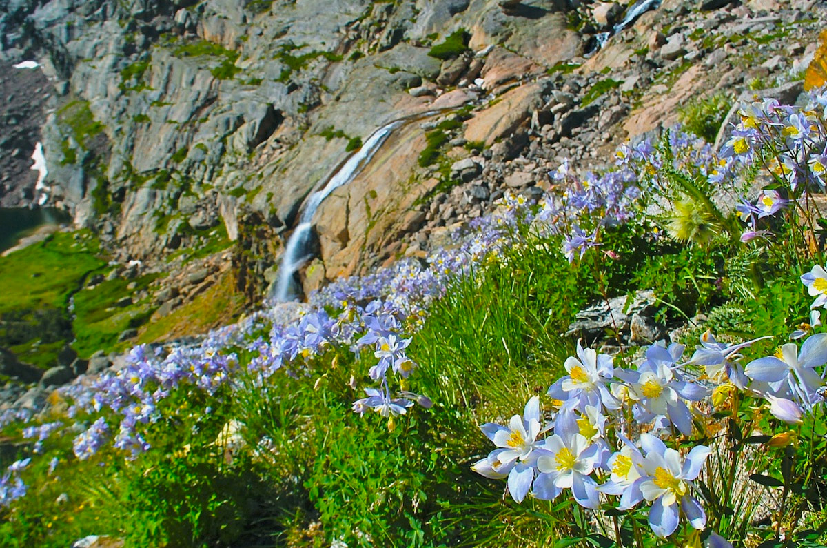
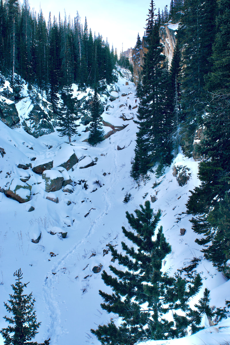
“When I woke, the moon was high shining through the silvery branches, whitening the bald Peak above, and glittering on the great abyss of snow behind, and pine logs were blazing like a bonfire in the cold still air. My feet were icy cold that I could not sleep again, and getting some blankets to sit in, and making a roll of them for my back, I sat for two-hours by the campfire. It was weird and gloriously beautiful.” 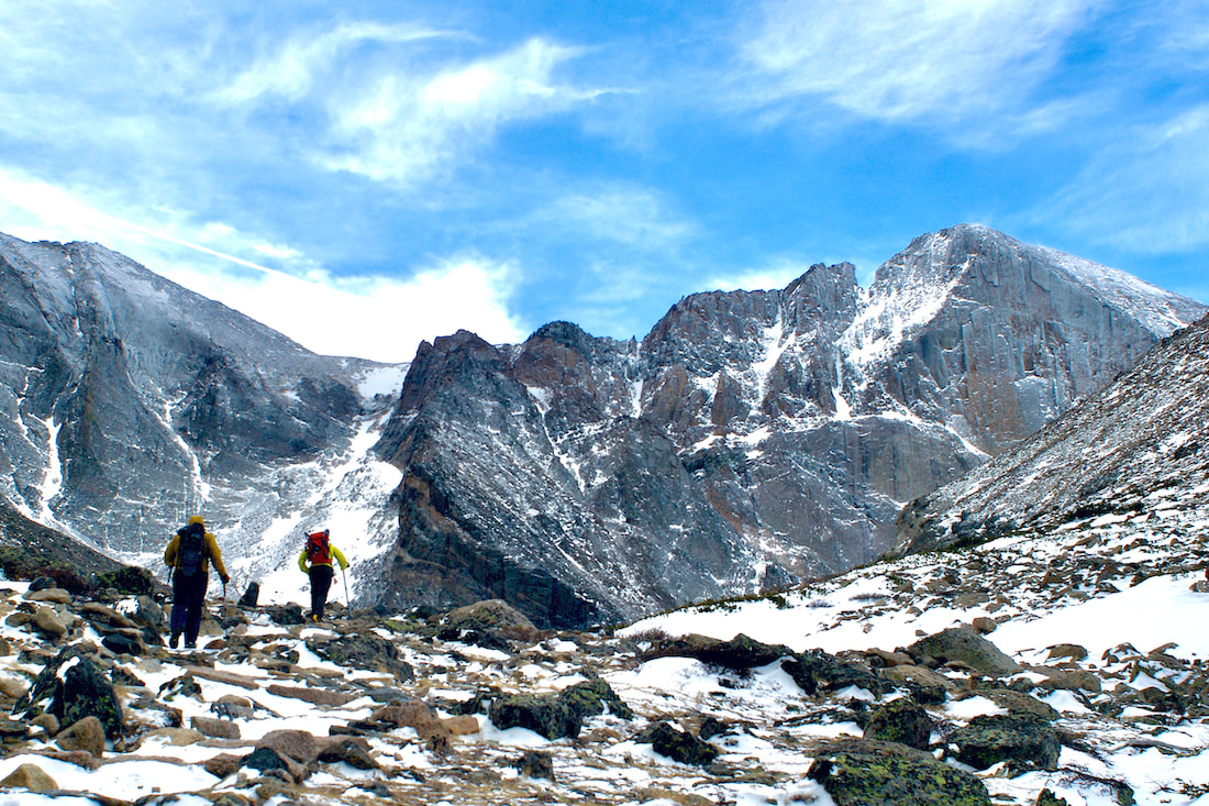 You will be traveling in a west to south west direction, steadily gaining elevation as you go. You are looking for a saddle of sorts on the south ridge of Mt Lady Washington up ahead. Once reaching that low spot on the ridge, you will find a trail sign indicating a trail branching off to the right, leading towards Granite Pass for Longs Peak and traversing the north eastern side of Mt. Lady Washington. However, our trail at this point starts across and under the south east ridge to begin the last third of your hike. 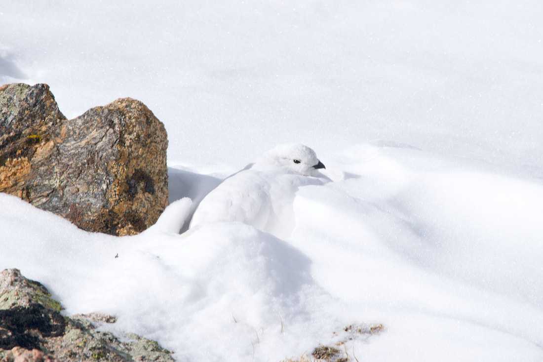 Snow accumulates along this next stretch of trail. Snow blows over the ridge you are now trekking under and settles, creating a snowfield that can last clear into June. Thus, the snow that falls here can be wind protected and softer, allowing for White-tailed Ptarmigan to nestle into the hillside among the rocks. Besides being somewhat wind protected, there are many days of sun along here and you might notice them sunning while nestling. But they can be amazingly difficult to see. You may see one at first, but then as you stare at it, you might notice a few more black eyes blinking at you. They might also be sitting on willow branches that they can poke their beaks down to and nibble on. According to the Rocky NPS website, they predominantly eat buds, leaves, and seeds, and are highly dependent on willow, especially in the winter. "They have been known, like other members of this group, to swallow grit to help grind coarse food in their gizzards. White-tailed Ptarmigans are permanent residents and lead a very sedentary lifestyle in winter. Warm weather may stress the White-tailed Ptarmigan. It can be seen bathing in snow when the temperature is higher than 21° C (70° F)." Rocky NPS
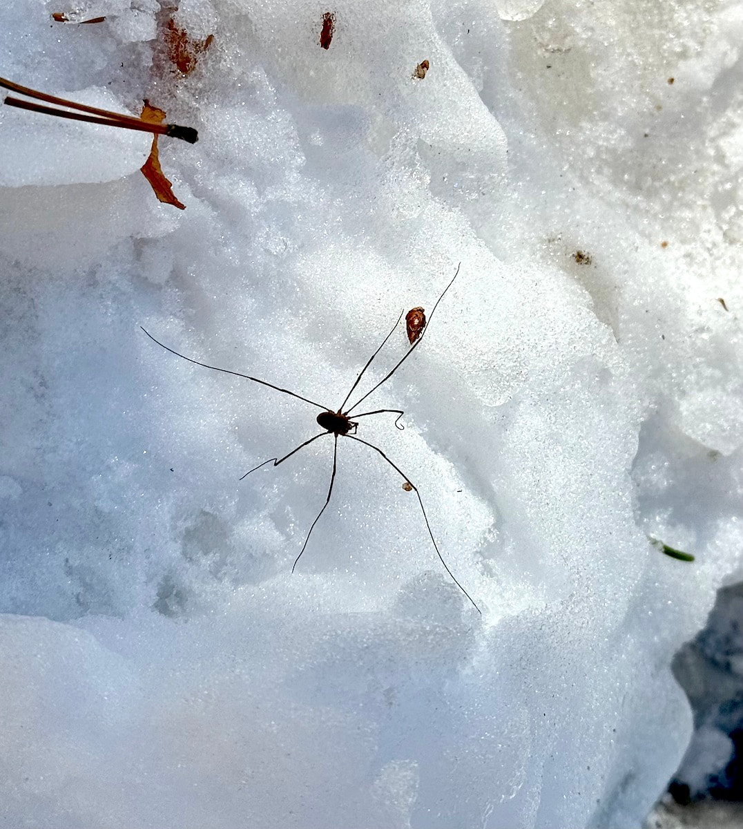
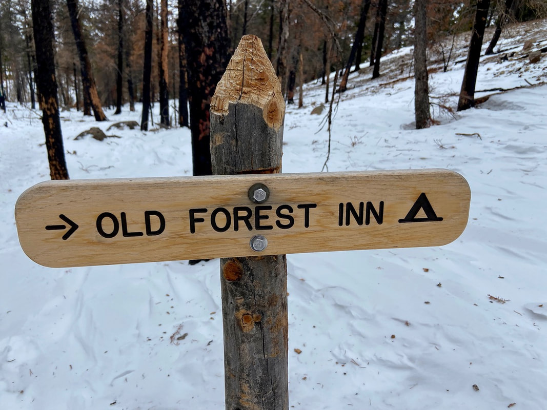
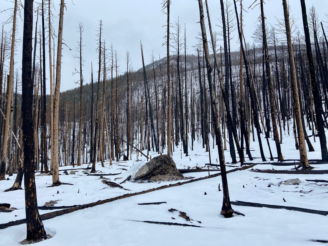
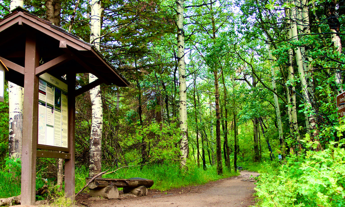
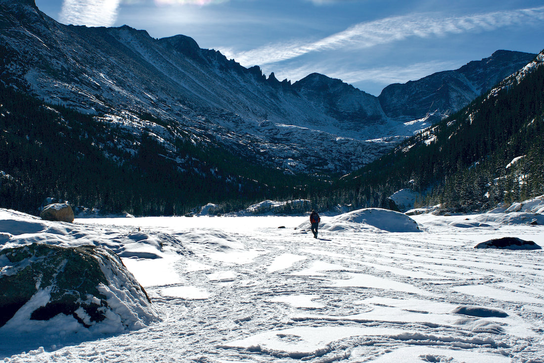
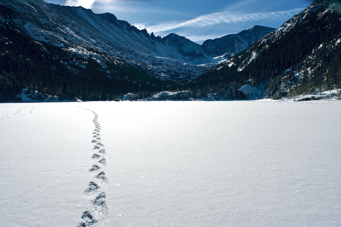
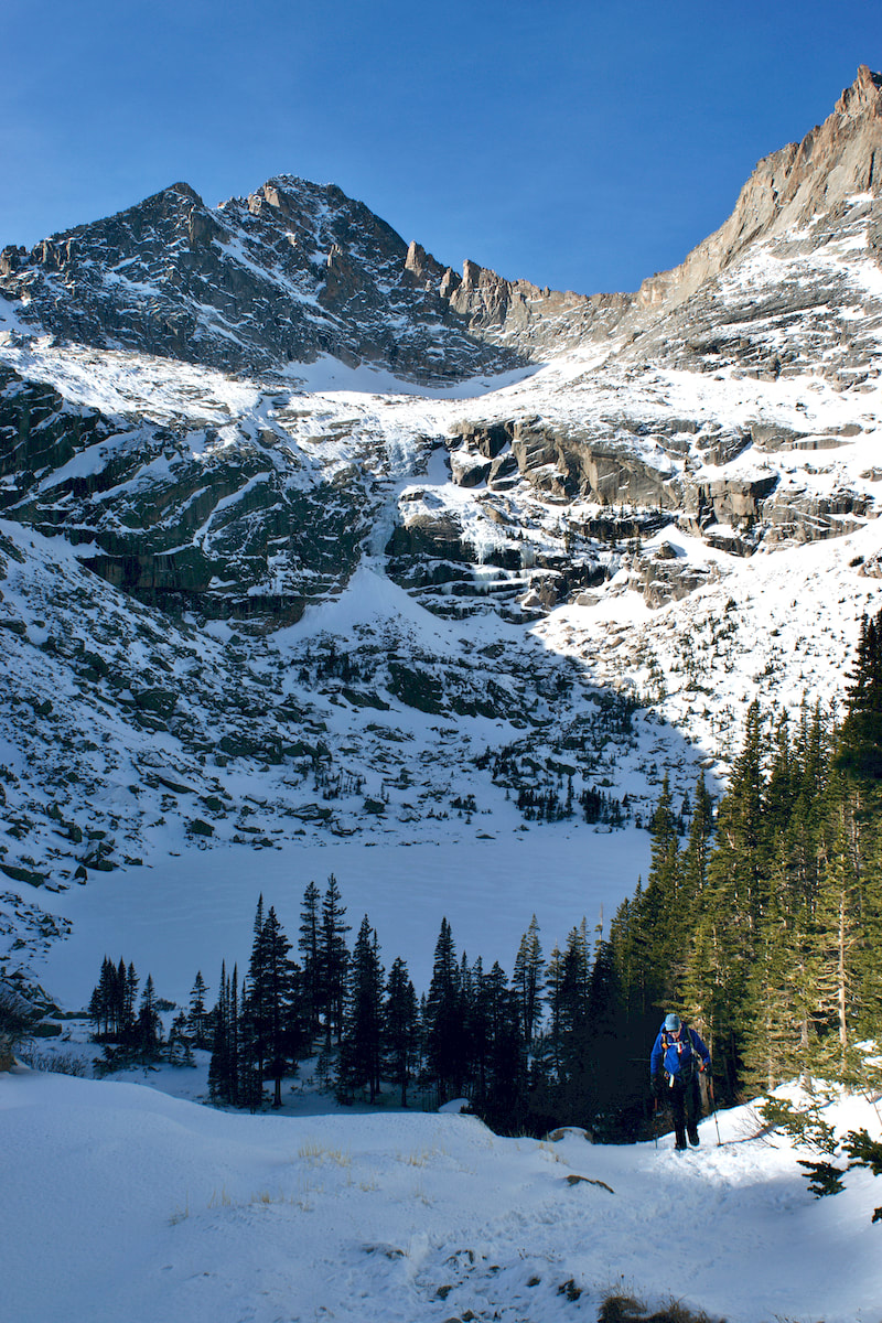
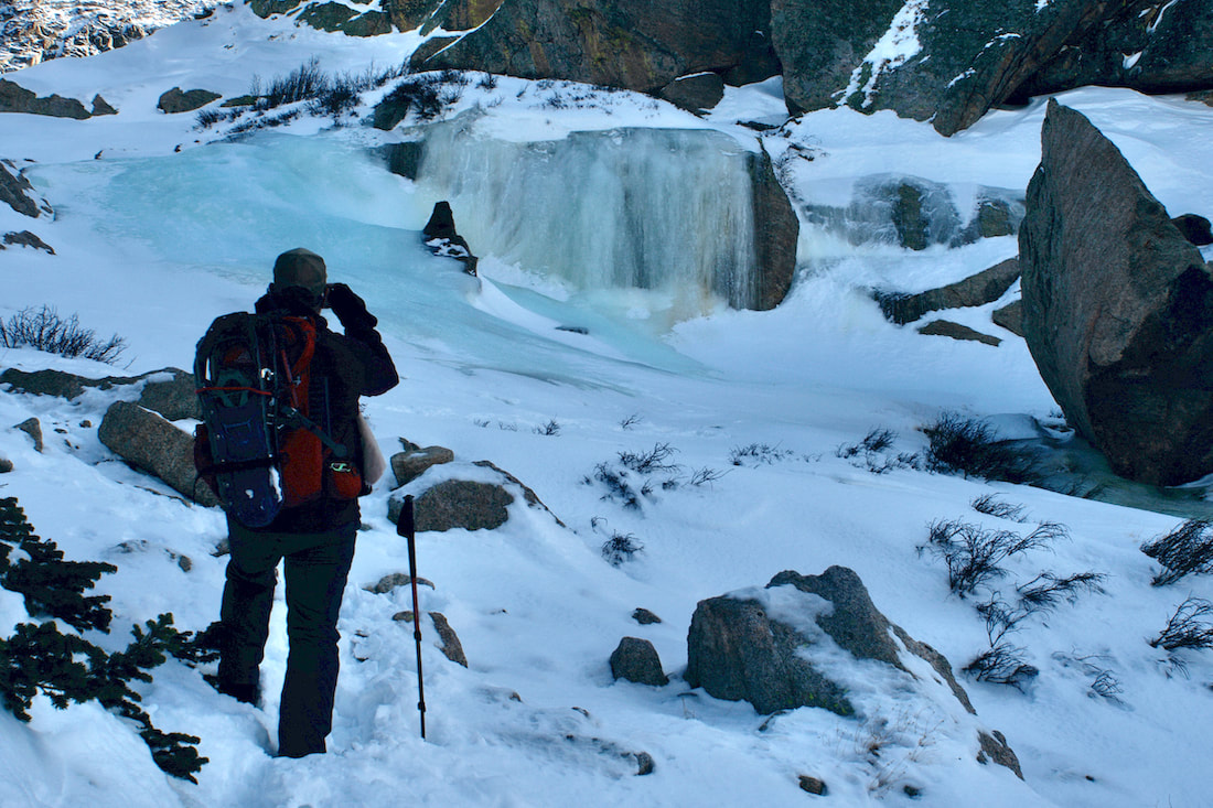
After a couple of tricky spots on this snowfield, you finish the traverse and cross onto an open flat alpine meadow, a large ledge left long ago by glacial retreat. The water from Chasm Lake, still higher up and not in sight, travels through this narrow spot before waterfalling down to Peacock Pool below. You will have to find a way across this very short stretch of frozen water, which can be polished and quite slick. But soon enough you are onto the open flat area and looking up at the looming cliff walls that is The Ships Prow emerging between Meeker Mtn and Longs. Searching for the final way up to the Lake, the direction to head is south, across the meadow. The trail here is often blown clear and easy enough to follow. It will take you to the base of a rocky area. Carefully work your way up. And then finally the frozen Chasm Lake. 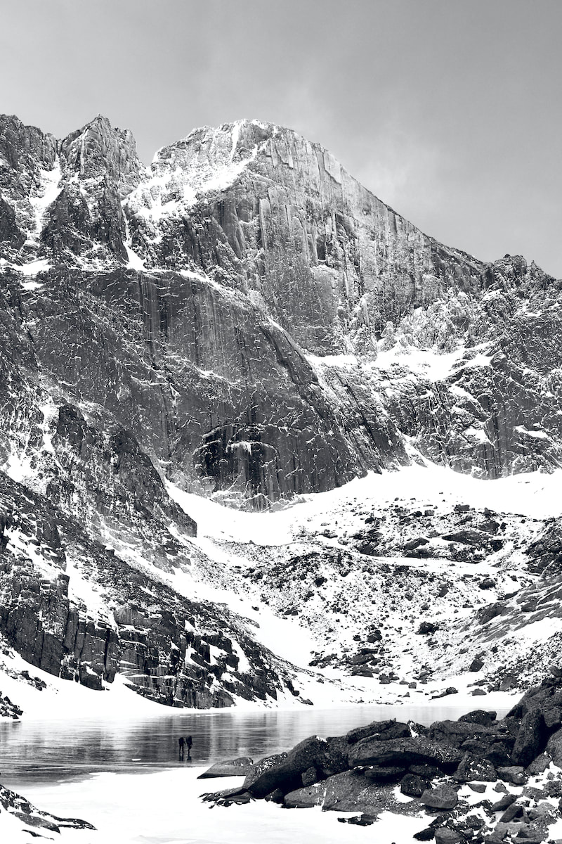 Unless you happen to come up not long after a snow fall and before any wind, the lake will be clear of snow. There are very large rock areas all over along the eastern edge of the lake that are enjoyable to hang out on in the summer, but you could be greeted with a cold steady breeze during the winter. Also, the sun sets behind Longs very early in the day this time of year and once that sun is gone, the temps can drop quickly. Sometimes sunny pockets protected from wind can be found among the rocks to re-hydrate and re-nourish before making the return trek. It can also be a good spot to pull out a thermous of something warm to drink or even fire up a small cook stove to heat up water for soup. Because once are here, you have made it, and it is worth clinking your water bottle with the rocks to celebrate this place. This amazing place. This weird and gloriously beautiful place.  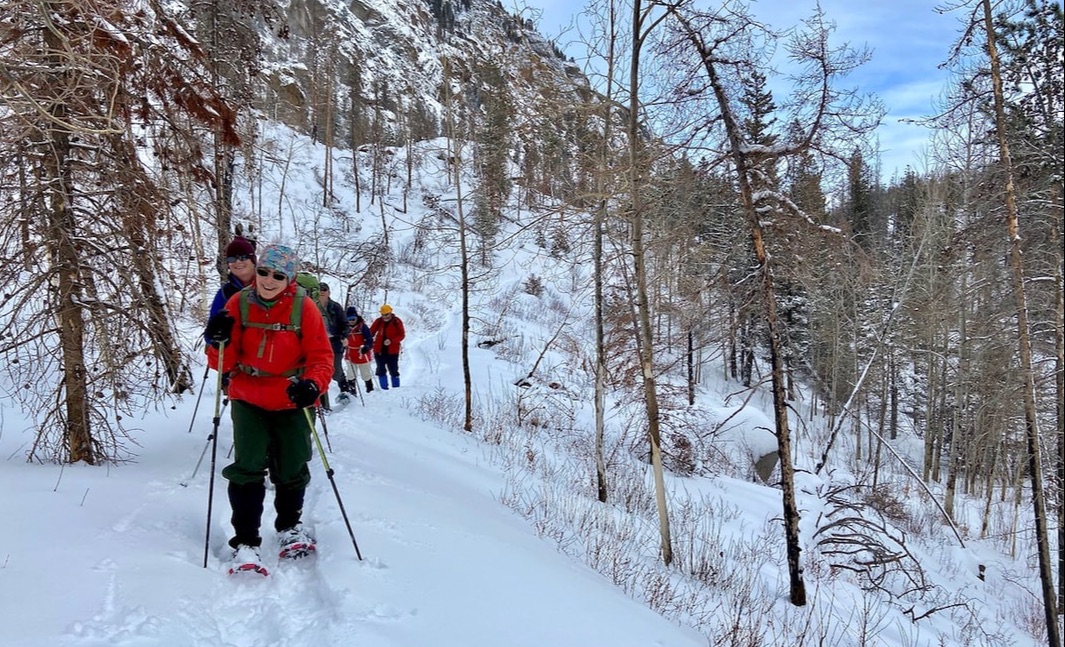 Snowshoers enjoying the hike up to Fern Lake, RMNP. Photo: Marlene Borneman by Marlene Borneman, author of Rocky Mountain Wildflowers 2Ed., The Best Front Range Wildflower Hikes, and Rocky Mountain Alpine Flowers. Hike Rating: Moderate Distance: 7.6 miles from Trailhead plus 1.4 miles on road from Shuttle/winter parking. Total 9 miles round trip in winter Elevation gain: 1,390 feet Rocky Mountain National Park offers a variety of winter hikes. Wearing winter spikes, snowshoes or skis are the most suitable forms of recreation. A popular destination in this frosty season is Fern Lake when the trail transforms to a carpet of shimmering snow. The trek to Fern Lake begins at the Summer Shuttle Stop 0.7 mile from the Fern Lake Trailhead as the road to the trailhead is closed from end of October through May. Be prepared for current conditions and weather by checking ahead at the Wilderness Office. Both trail conditions and weather can change rapidly. Rocky is often referred to the Land of Extremes for good reasons! Early in the season you may be wearing spikes for an icy start, but as you gain elevation you may need to switch to snowshoes. It is good practice to carry snowshoes strapped to your pack to avoid postholing. Postholing is a term used when with each step you are sinking deep into the snow past your knees which makes walking very fatiguing. Best to avoid. If there have been recent heavy snowfalls, you can start from the parking lot in snowshoes. Top Left: The icy Pool of the Big Thompson River. Top Right: Keep your eyes open for moose! Bottom Left: Spider on the snow. Bottom Right: Moose print. All photos by Marlene Borneman. Once at the trailhead it is an easy 1.75 miles hike up to The Pool, a deep collection of swirling water in the Big Thompson River. Hiking in the snow provides opportunities to investigate animal tracks, deer, moose, even field mice. Often these animals are seen along the snow-covered banks of the beautiful Big Thompson River. Spiders of all varieties may be seen on the snow in search of tiny insects. 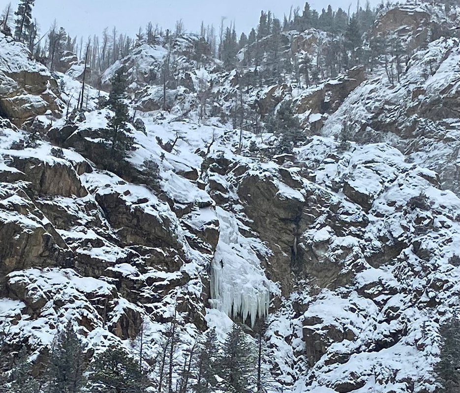 The "Jaws" icefall with an ice climber. Photo: Marlene Borneman About a mile and half from the trailhead look to your right (north) “The Jaws” maybe visible. “The Jaws” is a large ice formation formed from water dripping down steep rock slabs creating a dramatic icefall. Technical ice climbers like to take on this challenge. Old Forest Inn trail sign and burn scar from the 2020 East Troublesome Fire. Photos: Marlene Borneman The next feature you reach is a backcountry campsite named The Old Forest Inn. The Forest Inn was one of the early rustic lodges located in Rocky Mountain National Park, built around 1913. The Forest Inn provided peaceful rest for hikers. In 1959, the remains of the Forest Inn were removed by the Park Service. The trail now becomes steeper with several switchbacks up to Fern Falls. Here the snow can become very deep. You will see evidence of the 2020 East Troublesome Fire. Stands of black, scarred trees in the glistening snow create a desolate landscape in winter. 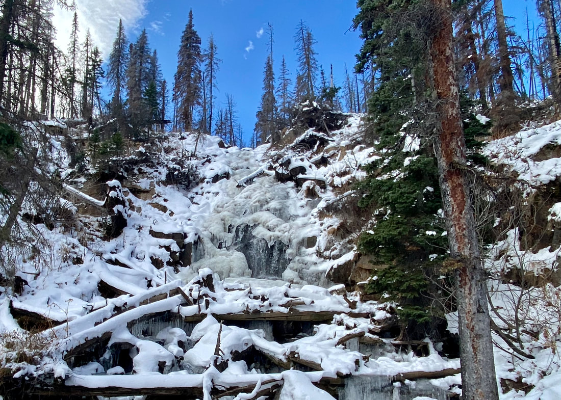 Fern Falls encased in winter. Photo: Marlene Borneman However, Fern Falls creates an intoxicating sparkling spectacle in the cold air. Fern Falls shows many faces in winter months, either completely covered in snow with only sounds of rushing water underneath, frozen water encased by snow sculptures, or cascades roaring down adorned by large sharp icicles or a mosaic combination. Leaving the falls, continue up a few more switchbacks. Soon you will see a hitch rack for summer horseback riders and just up a short hill Fern Lake comes into view. The shores of Fern Lake have a history of providing a restful spot for fishermen, hikers, and Park Rangers. Here stood Fern Lake Lodge, built in 1910 by Dr. William J. Workman from Kansas. His main interest was fishing and the lodge provided lodging and meals with some fishy stories thrown in. Later there were many others who managed the lodge with Rocky Mountain National Park taking over the property in 1958. Fern Lake Lodge was permanently closed in 1959. Due to the hazards of the deteriorating structure, the Park Service burned the lodge in 1976.  Remains of the Fern Lake Ranger Cabin. Photo: Marlene Borneman Look slightly to the north and you will see the remains of the Fern Lake Patrol Cabin that was destroyed in the 2020 East Troublesome fire. This beautifully built sturdy cabin provided Park Rangers shelter when patrolling on official duty. In 1989 this Patrol Cabin was placed on the National Register of Historic Places. Maybe the cabin will be rebuilt one day.  Fern Lake. Your reward for making an excellent winter hike! Photo: Marlene Borneman Fern Lake lies at 9,540 feet offering a striking vista more days than not with sunny blue skies overhead. Views of 12,129-foot Notchtop Mountain, 11,586-foot Little Matterhorn and 12,331-foot Knobtop Mountain make a picture-perfect backdrop to the shimmering frozen lake.  Spike season has returned to Rocky Mountain National Park. That is to say, if you are heading out for a hike in the Park, you should plan on winter trail conditions and it would be a good idea to have some kind of traction footwear handy. Current conditions can create slick and icy trails. November is a good month to get acclimated for winter. Regulating body temperature while hiking during this transition season can be tricky depending on elevation, aspect to the sun, and of course the daily weather conditions. Be prepared to stop frequently to either layer-up or dress-down. Our trail pages offer up National Weather Service trail specific weather conditions and forecasts to help you to be better prepared. Check them out to know before you go. And don't forget to admire this season of change. Beautiful ice formations are forming along open water, various signs of wildlife can be noticed as they prepare for the winter months, and the lower sun on the southern horizon creates dramatic light and shadows. Changes are in the air during the month of November. We are now 36 days away from Winter Solstice. 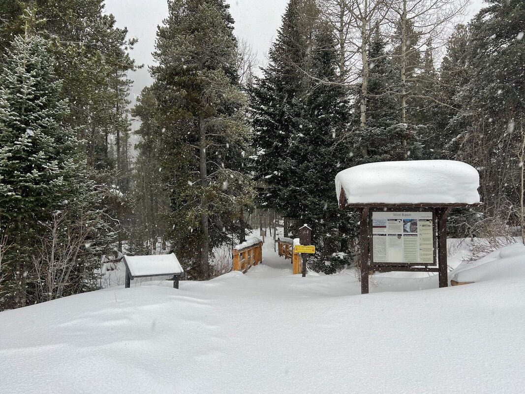 Wild Basin Trailhead after November 2nd, 2024 snowstorm. Photo NPS Dear Mtn Trail
A good trail for snowy mountain vistas on a sunny day. With the sun being lower to the horizon this time of year, try to be on the trail before 10am to capture the best lighting on the mountains for photos. Lumpy Ridge Loop
A lower elevation, longer loop hike. Good sunshine will keep the beginning of this trail along the south base of Lumpy Ridge snow free for much of the year, and some years the entire trail can remain snow free into November. But right now you can count on snow and ice covering over much of the trail on the back side of this hike. After your hike, stop in to Lumpy Ridge Brewery for an apes beer! Emerald Lake Trail
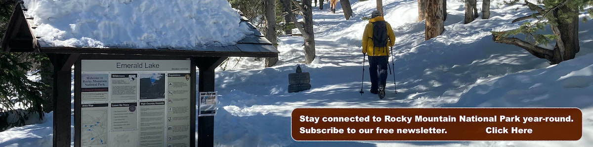
A good hike to get an early taste of winter. This alpine lake trail is popular no matter what time of year. Use this shorter hike to make sure you have all of your winter gear ready to go for this season. November is the month winter moves down to lower elevation in Rocky Mountain National Park. It can be a challenge for hiking as you will need to be ready for any and all conditions. So get out and enjoy the seasonal transition!
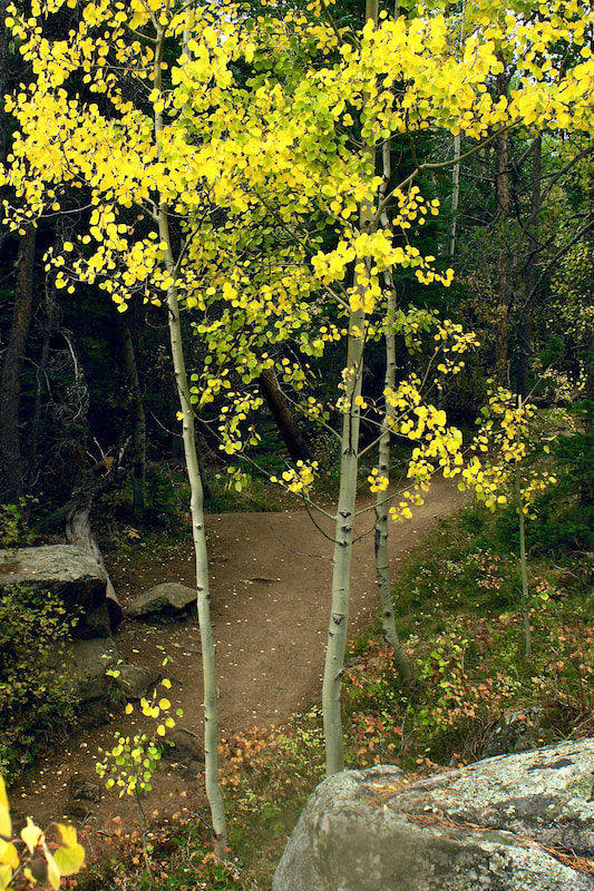
 by Jamie Palmesano - Brownfield’s “To everything there is a season, and a time to every purpose under the heaven.” We are graced by the changing seasons of life. All four seasons in Rocky Mountain National Park are magical, but there is something extra special about autumn in the mountains. From bugling elk to quaking aspen, the sights and sounds of fall in RMNP are unmatched. September has a beauty all of its own and there are plenty of easy and moderate hikes that will fully immerse you in the awe of autumn. These are my five favorite fall hikes in RMNP.  Bierstadt Lake Bierstadt Lake is nestled in the forest and boasts beautiful views of the Continental Divide. This shallow mountain lake has no streams flowing in or out of it. The lake is named after artist, Albert Bierstadt, whose 1870’s paintings of Longs Peak and Bierstadt Lake have inspired many for generations. I recommend starting this hike at the Bear Lake Trailhead and concluding it at the Bierstadt Lake Trailhead. As you start on the Bear Lake trail, you’ll climb towards the lake on the Flattop Mountain Trail and later follow the Bierstadt Lake Trail. Within the first half mile of the hike, you encounter a stunning grove of aspen on the Flattop Mountain Trail. Looking back, you can find some openings to peak through the aspen and glimpse Bear Lake in its golden glory. Views of Keyboard of the Winds on Longs Peak are also visible through the aspen. The trail is mostly flat after the first mile and winds through the evergreen forest. Once you have arrived at the lake, the best views are from the north side. The Continental Divide is reflected into Bierstadt Lake and makes for a perfect portrait of the mountains. You'll have marvelous panoramic views of the mountains (from left to right: Longs Peak, Chiefs Head Peak, McHenrys Peak, Powell Peak, Taylor Peak, Otis Peak, Hallett Peak and Flattop Mountain.) The key to capturing all of fall’s beauty on this hike is to descend down the Bierstadt Lake trail rather than returning to Bear Lake. You can take advantage of RMNP’s wonderful shuttle system and ride the free shuttle back to the Bear Lake parking lot. The Bierstadt Lake Trail steadily descends more than 600 feet along a series of switchbacks lined with lodgepole pines and aspens. Ahead of you, lies some of the most spectacular views of the Continental Divide with the colors of fall painted on the canvas of creation. It’s an iconic view of Rocky Mountain National Park in the fall and should be on every hiking bucket list.  Alberta Falls Alberta Falls is arguably the best waterfall in Rocky Mountain National Park. This 30-foot waterfall is tucked in a gorge on Glacier Creek surrounded by trees and rocks. Its thunderous roar fills the air and the mist from the falls can be felt by standing on the rocks below. This waterfall was named after Abner Sprague’s wife, Alberta, who were among the first settlers in Estes Park and homesteaded in Moraine Park in the 1870’s. The nearly one-mile trail to Alberta Falls is dotted with aspen trees glowing gold in the Colorado sunshine. This path is among my favorite for fall foliage. With approximately 200 feet of elevation gain, this is one of the most accessible waterfalls in RMNP. It is a very popular destination, so you may want to consider utilizing RMNP’s free shuttle service, as parking is limited. 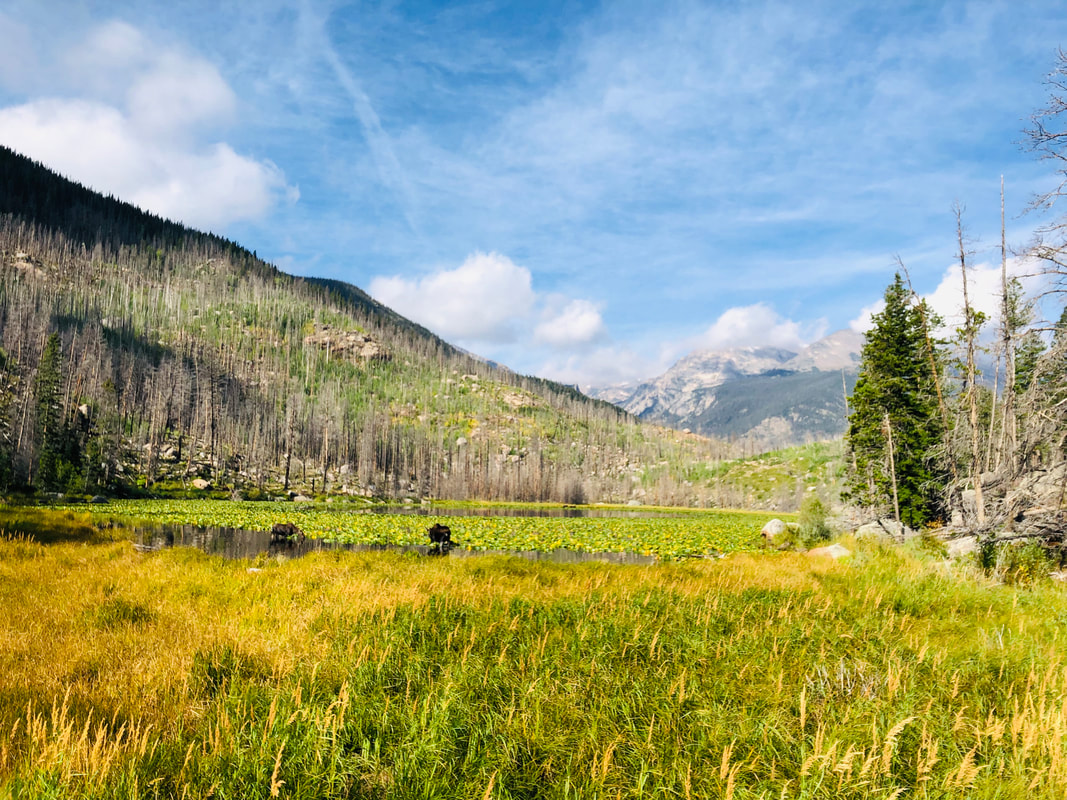 Cub Lake The hike to Cub Lake begins in the Moraine Park area of RMNP at the Cub Lake Trailhead. The hike starts by crossing the Big Thompson River and traveling around the edge of Moraine Park. Shortly into the hike, you will pass Beaver Ponds on your left. Moose and elk are frequently sighted along this trail, especially in the fall. The annual elk rut is a staple to the autumn experience in the Rocky Mountains. The word rut comes from the Latin word “rugire,” meaning "to roar" and is used to describe the mating season for the elk. As you wander along the path, you will often hear the unique call of the elk known as bugling and their sounds echo in the valley. Around the two-mile mark, you will pass through a healthy grove of aspen that shimmer and sparkle with their golden leaves. Once you arrive at the lake, you will see the underbrush, the ferns, grasses, and even the lily pads are dressed in yellows and oranges to honor the season. Unfortunately, the Fern Lake Fire in 2012 took a major toll on the area, so the lake is not as picturesque as it once was, but it still retains its rugged charm. 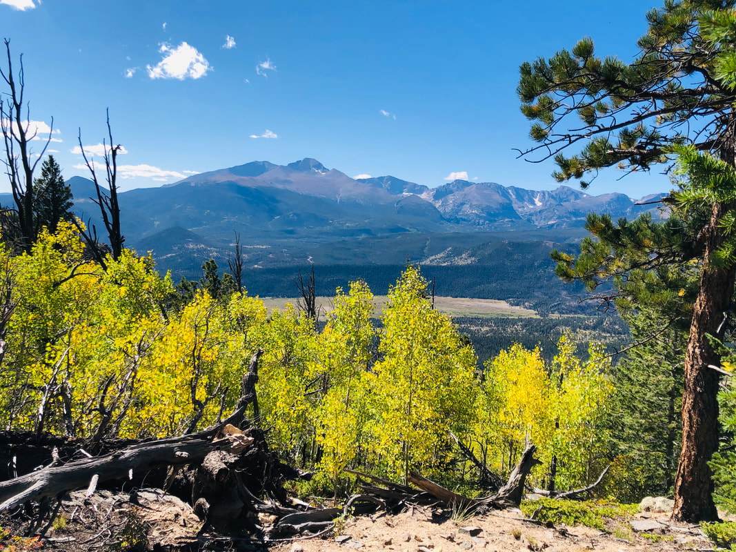 Deer Mountain Deer Mountain is a pleasant six mile out-and-back hike where you get the satisfaction of summiting a mountain without it being terribly strenuous. One of the defining characteristics of this hike is that it offers fantastic views of Longs Peak, Upper Beaver Meadows, Moraine Park and Estes Park. Aspen line the side of the trail within the first mile of the hike and show off their color in fall. Aspen trees are also sprinkled throughout the remainder of the hike. At the summit, the 360-degree panoramic views of the area are breath-taking. If you have a youngster itching to climb a mountain, this is a great “first summit hike” for kids.  Lily Lake Lily Lake is the most easily accessible area to take in the colors of fall and behold a beautiful mountain lake. Sitting right off Highway 7, Lily Lake offers a handicap accessible trail around the lake. For those who would like a bit more of a climb, you can take the ridge trail to the right of the lake and look down upon the lake. Perched proudly behind Lily Lake, stands Longs Peak at 14,259 ft. It is the area’s only fourteener and the most famous mountain in Rocky Mountain National Park. There are aspen trees along both sides of Highway 7 offering outstanding fall colors everywhere you look. Lauren DeStefano once said, “Fall has always been my favorite season. The time when everything bursts with its last beauty as if nature had been saving up all year for the grand finale.” I echo these sentiments. Fall in Rocky Mountain National Park is indeed the grand finale of the year. With each leaf underfoot, every tree swaying in the breeze, the call of the elk in the distance, and the sapphire sky above, I am reminded of the beauty of this majestic land. This incredible valley beckons you to come and enjoy this glorious playground with the child-like wonder you had when you first laid eyes on it. And, with a grateful heart, realize that each changing season is a good and perfect gift. All photos by Jamie Palmesano  Summer hiking season is fleeting and from the early days of summers warmer weather, a panic can overtake me that I won't get enough days on the trail before it's all over. It can feel hectic to make the time, make the reservations, set the alarm for early arising, hurry through the gate to get on the trail and get to the long planned destination, so that I can finally relax! A day on the trail is the best, but sometimes in the rush to get as much hiking as I can, I can feel as rushed on the trail as I do off the trail and I forget to slow down. The days of August can be the best days to practice taking time to slow time on the trail. It can be a time of nature immersion.
Immersion Tips
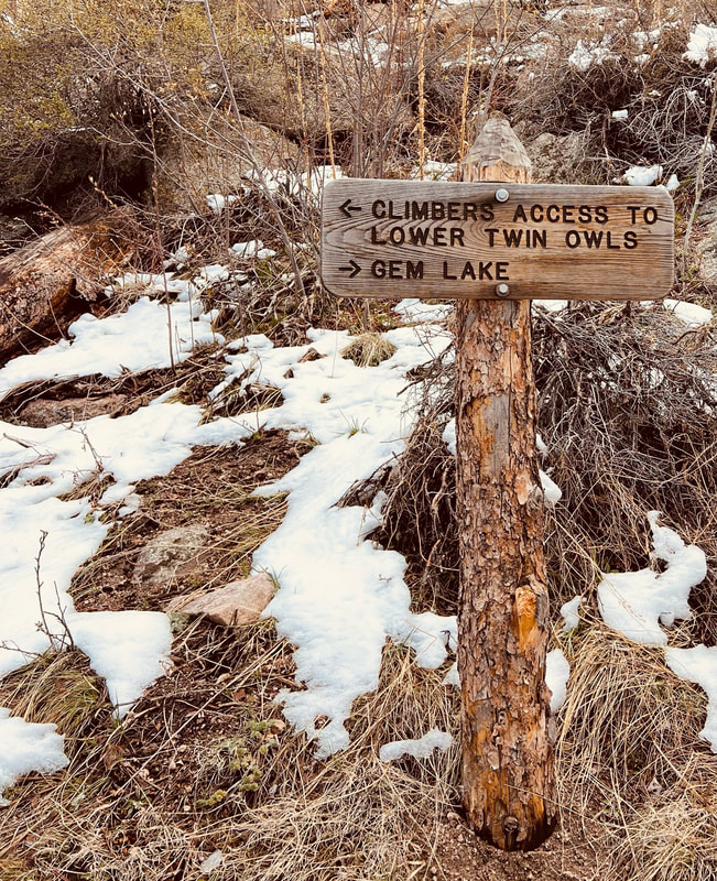
Don't hike. Instead feel what it's like to saunter or meander. It can be easier if done alone, but if you are with others, talk about what you hear, share interesting nature patterns you see. Speak through nodding. Don't plan on a destination. Instead find places to sit, close the eyes, and listen. Listening to the sound will make it easier to not think about everything else going on in your day to day life. It's the way to slow time. Though it can be difficult in busy Rocky Mountain National Park to become fully immersed, try going in the evening, when there are fewer people on the trails. Three trails for immersion While almost any trail can lend itself to immersion, here are three to practice on:
Coyote Valley
Copeland Falls
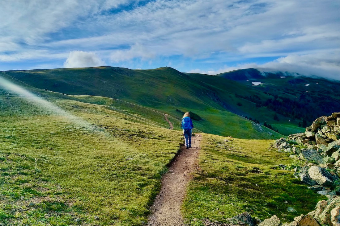
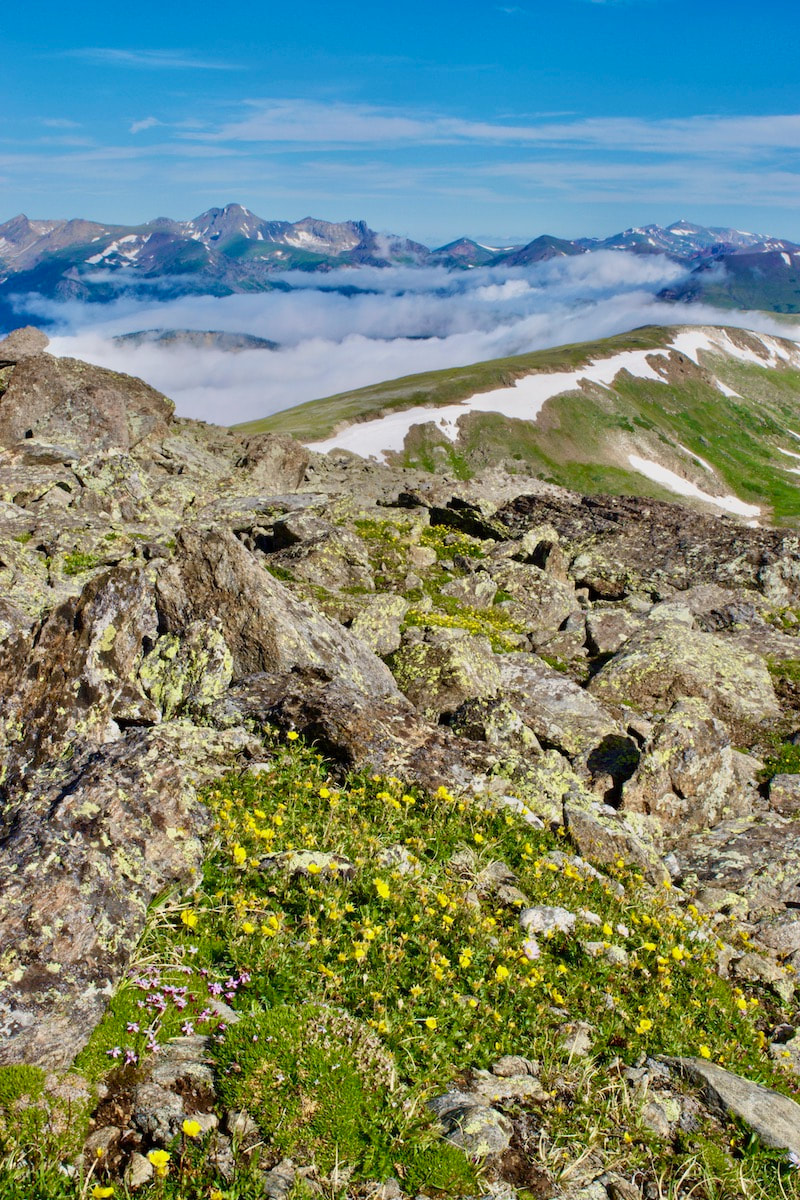
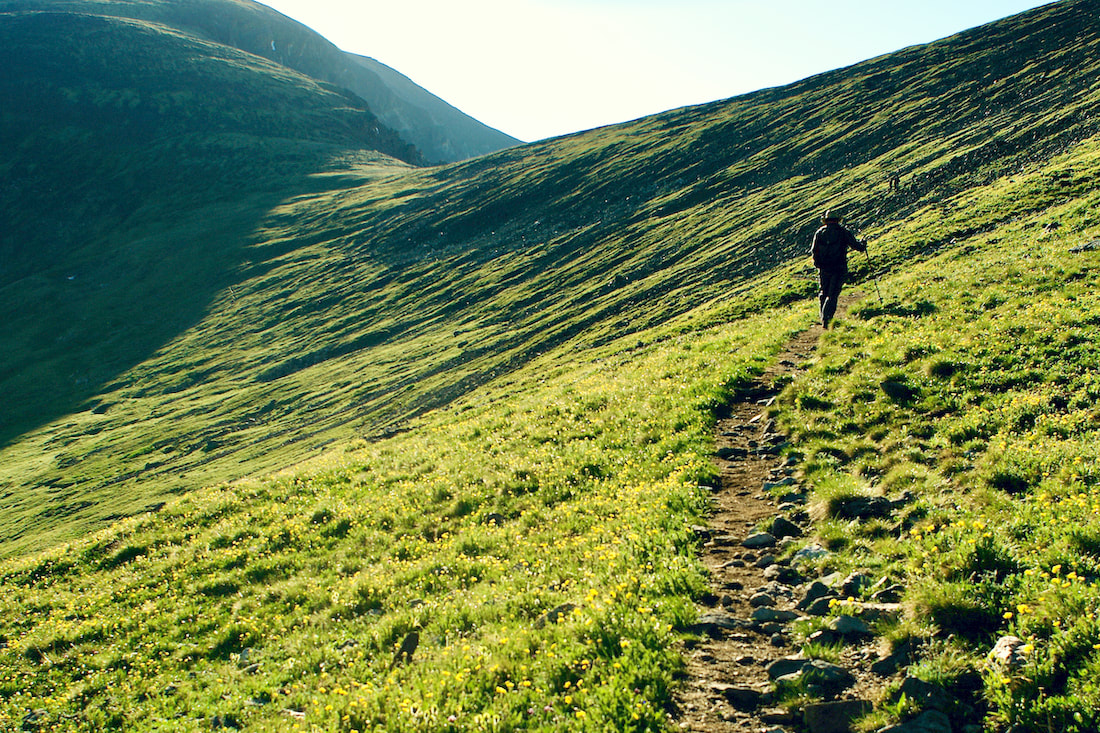
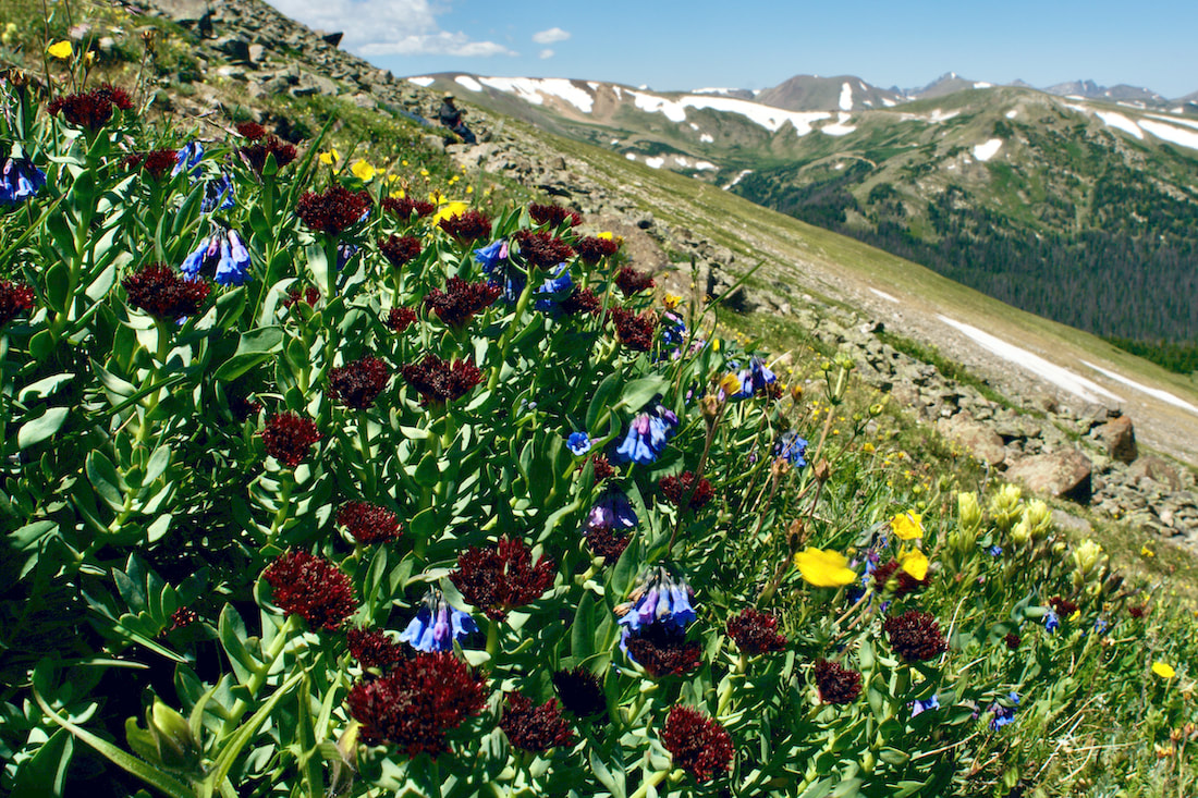
Take advantage of these late summer days to practice slowing time with an immersion in Rocky Mountain National Park.  Elevation defines Rocky Mountain National Park, with the world of the Alpine being an exciting place to be during the month of July. This Land-Above-the-Trees is the last place winter holds its grip in the spring and the first place it descends upon in the fall. That makes summer in the alpine zone short but spectacular. The burst of little tiny flowers can change almost daily. To truly appreciate these little gems, you really need to get on your belly. Now is the time to hike some high-elevation trails. Here are three hikes in Rocky Mountain National Park to enjoy this July. Note: As spectacular as alpine hikes are in July, it is also a time for thunder and lightening storms. So know before you go, start super early, and always be prepared to decend! For more on lightening safety tips, read more here.
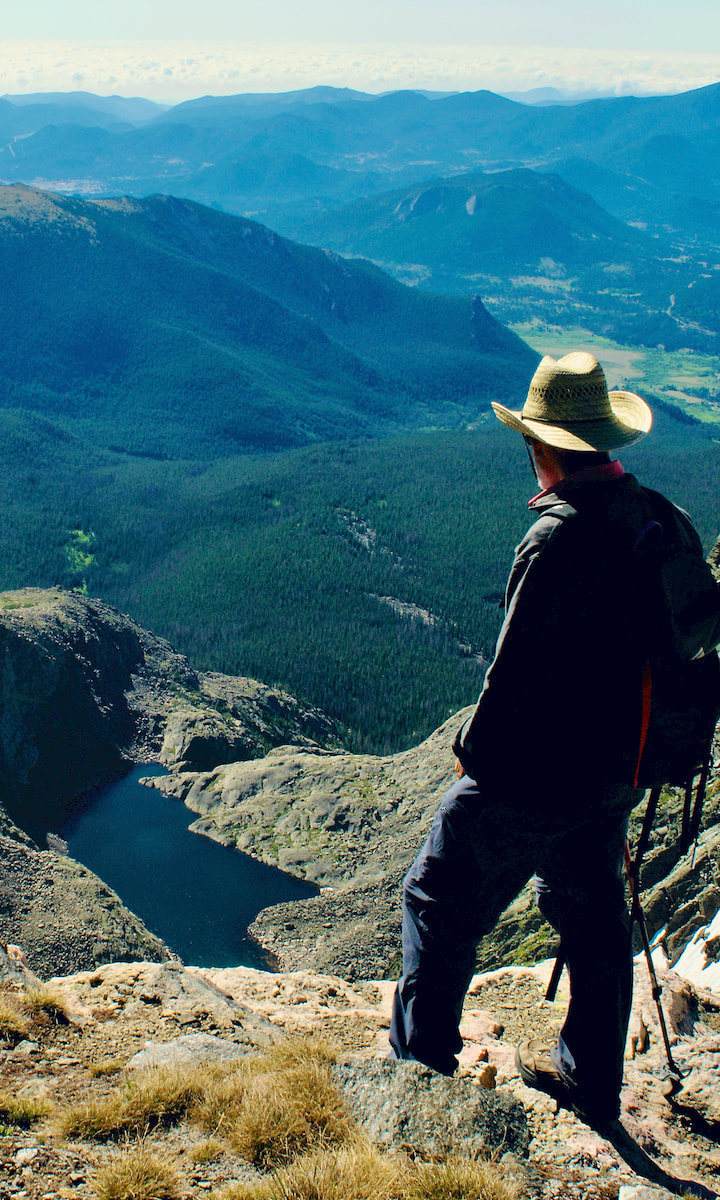
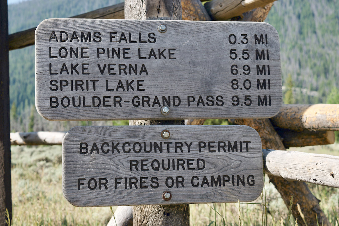
A Rocky Mountain National Park classic, this hike will take you right up to the east face of Longs Peak, known as The Diamond. Waterfalls and wildflowers greet the hiker with a little bit of rock scramble on the final push to the lake. For more on this trail, visit: Chasm Lake trail
Starting at Milner Pass on Trail Ridge road, this trail quickly gains in elevation and most of the hike is spent rolling across the open tundra before making a final push for the Mt Ida summit. The views are 360 with the Never Summer Range to the west. For more on this trail, visit: Mt Ida trail
Accessing this trail involves driving up the one-way Fall River Road to the Chapin Pass trailhead. The trail up these three summits is not maintained by the Park, so pay attention to where you are while you enjoy the thrill of tagging multiple summits. For more on this trail, visit: Chapin, Chiquita, Ypsilon trail
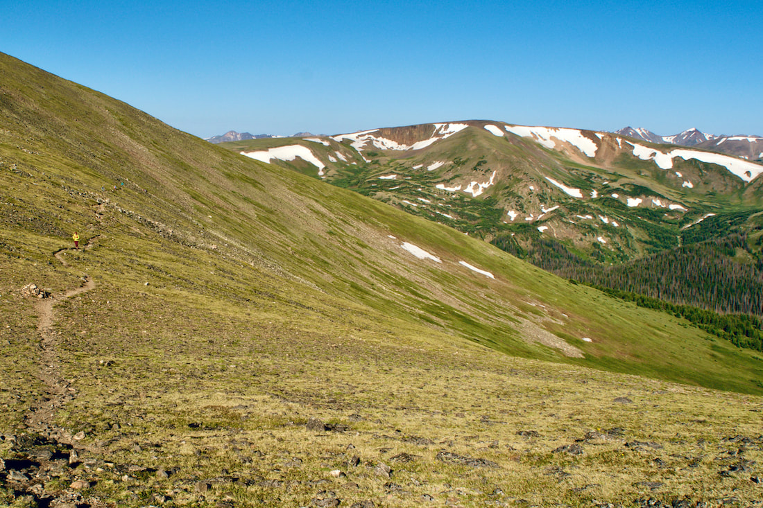
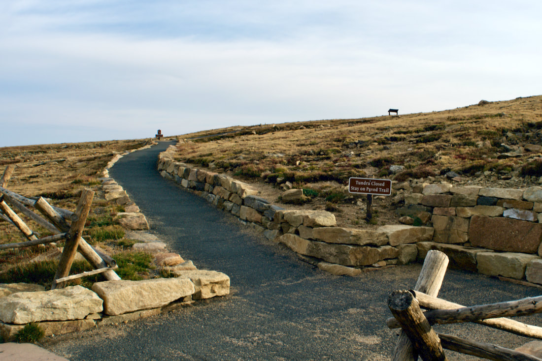
Hiking in the rarefied air of the alpine is truly a rarefied experience, and July is prime time to be there. You won't want to miss this!  by Dave Rusk It's almost the Summer Solstice, also known as the First Day of Summer. If you haven’t been out hiking by this time it’s time to get started! The daylight hours are long, the high trails in Rocky Mountain National Park are free of snow with prolific alpine flowers blooming. Here are four hikes from short and easy to long and challenging to get you out on this spectacular day of prolonged daylight. Tundra Communities Trail - 0.6 miles
Want to watch the sunrise from the top of the world? Head up Trail Ridge Road to the Rock Cut parking area and get on the Tundra Communities Trail. You will need to get there early, sunrise is at 5:32am on June 20th, and you will need to be there even earlier if you want to join the picas and watch the first light hit the summit of Longs Peak. A great way to celebrate the start the summer. Be sure to bring warm clothes though, temperatures can often drop to near freezing overnight on the tundra. After watching the sunrise, head down to Grand Lake for the day. And then end your solstice day by coming back to the Tundra Communities Trail for sunset at 8:36pm. For more on this trail visit: tundra-communities-trail Mill Lake - 2.8 miles
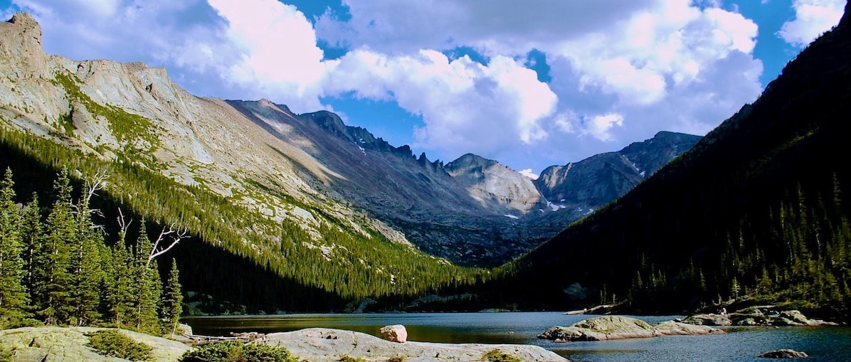
While Mills Lake is one of the very popular hikes in the Bear Lake corridor you can make it a special summer solstice evening hike after 6 pm when most visitors have gone home. Bring a thermos of tea, find a spot to settle in, and enjoy a spectacular sunset on the surrounding peaks. Plan to stay after dark and watch the full moon rise over Longs Peak (the actual full moon is on June 21 at 7:07pm). Plan to wrap up in something warm after the sun goes down and be sure to bring your headlamp for the hike out! Reminder: A timed-entry reservation is required for the Bear Lake corridor if you hike between the hours of 5am and 6pm. For more information on this trail visit: mills-lake-trail Lion Lakes Basin - 7 miles
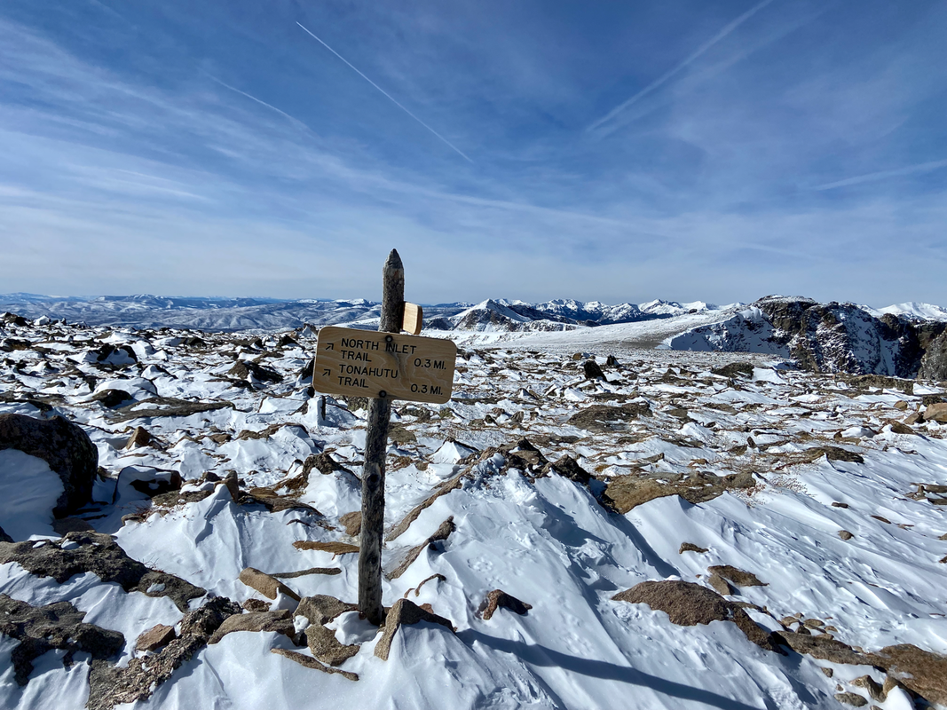
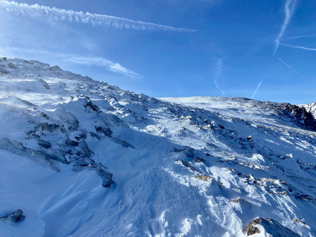
A hike to Lion Lake Basin requires a lot of day light, not just for the 14 miles out and back, but because you will want to have time to explore once you get there. The trail proper ends at Lion Lake No. 1. This is a spectacular destination on its own but after that there is Trio Falls, Lion Lake No. 2, and Snowbank Lake. Chiefs Head Peak and Mt. Alice serve as a spectacular scenic backdrop. There are no established trails to the upper lakes so travel carefully across these sensitive areas, and as always, watch the weather. All of these lakes are in the subalpine and alpine so plan and pack accordingly. For more information on this trail, visit: lion-lake-basin-trail Flattop Mtn-North Inlet Trail - 17.7 miles
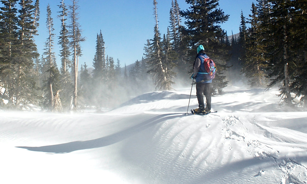
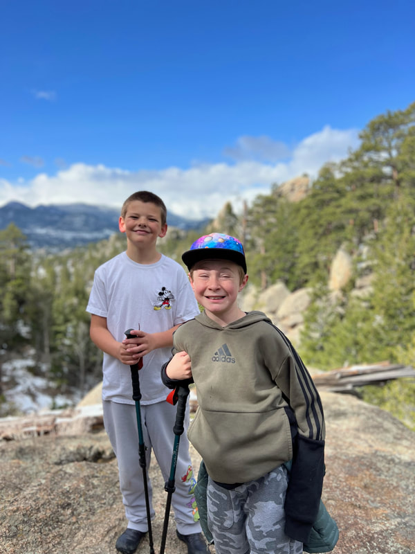
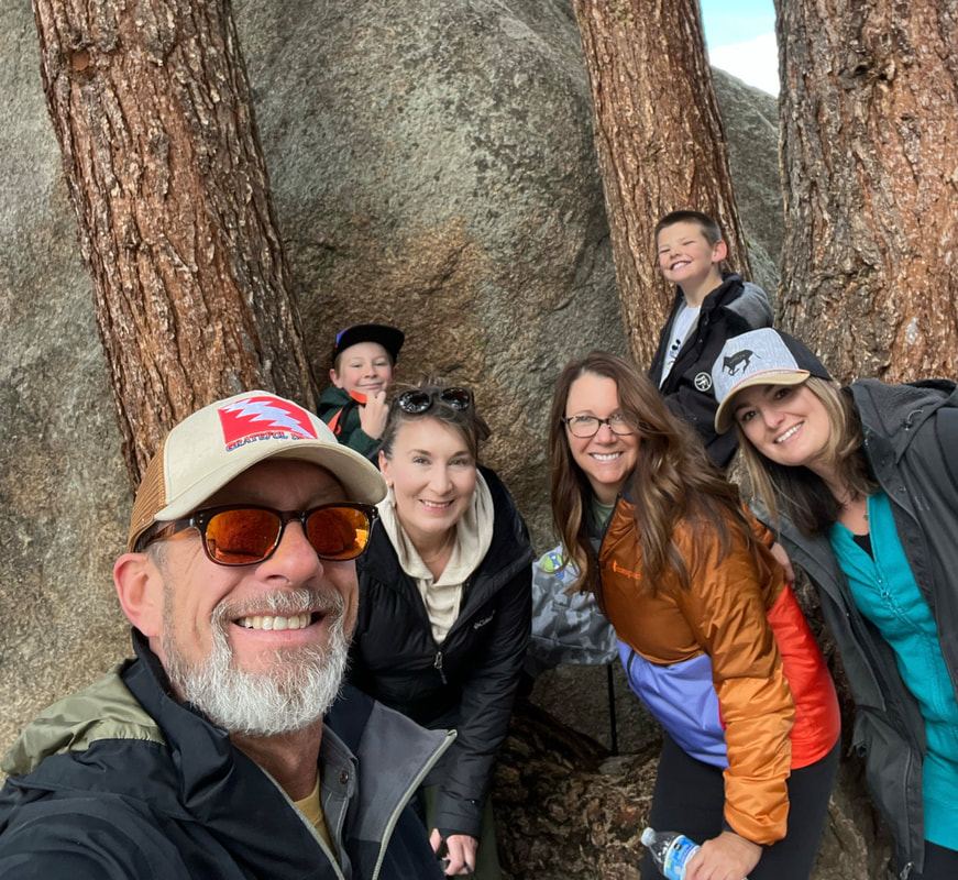
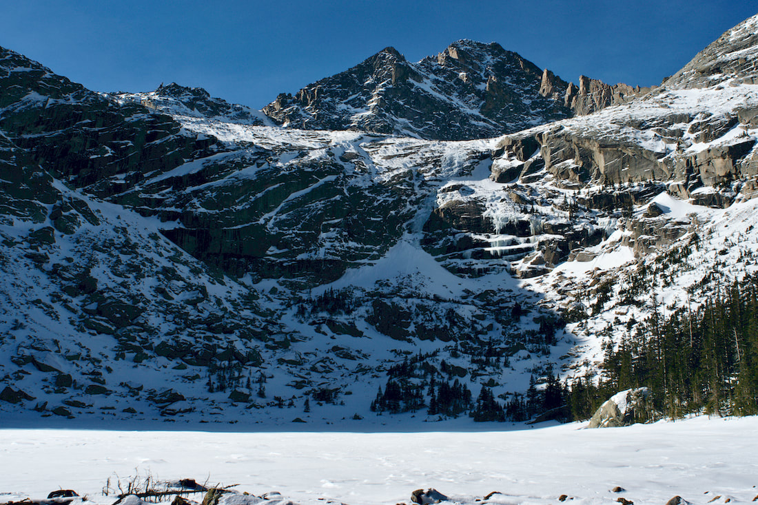
For the ultimate all day hike follow a trail that leads to dinner in Grand Lake. This thru-hike starts at Bear Lake and follows the Flattop trail to its broad summit before connecting with the trail to North Inlet. Be sure you have your hat, sunglasses and sunscreen as you will be traversing across the Continental Divide for a while. The trail then drops into the North Inlet drainage and eventually takes you right into downtown Grand Lake! Don't forget to make transportation arrangements to get back to Estes Park! Reminder: A timed-entry reservation is required for the Bear Lake corridor if you hike between the hours of 5am and 6pm. For more information on this trail, visit: Flattop-N.Inlet-trail Celebrate summer solstice with a sunrise or sunset hike. Wander down a mid-summer trail and find your path to be rejuvenated and re-connected with the magic of the longest day of the year. Then, make a commitment to keep wandering all summer long! "I do wander everywhere, Swifter than the moon's sphere"~ The Bard by Jason Miller This month we wanted to go on two different hikes that are EASY. After a long winter of sitting on the couch watching TV, it is best to ease back into the hiking season. We chose two hikes that are located outside the gates of Rocky Mountain National Park. You will still need to acquire a RMNP Entry Reservation (entry reservations begin May 24, 2024). The Lumpy Ridge Loop is only 1.6 miles but has some vertical gain which will get your blood pumping. Lily Lake Trail is just under one mile but is also a wonderful spot to begin your summer hiking season. Twin Owls via Lumpy Ridge Loop Located at the Gem Lake and Twin Owls parking lot you will find restrooms and the trailhead to this first hike. Scattered around the parking lot there are enormous boulders and rock features. This can provide your first photo opportunity if so desired. To begin the hike, you need to look for the sign that points to “Twin Owls Black Canyon Trail .6 miles." I suggest taking a picture of the trail map at the beginning of the hike and at the end. This gives you a time stamp and you can calculate your time on the trail. The trail starts off as a gentle climb on a pebble walkway. A few minutes into the walk we come to a sign. This sign informs us that we were crossing onto private property and that no pets are allowed on the trail. At this point you are on the MacGregor Ranch. This 3,600-acre ranch is nestled up against Rocky Mountain National Park. There are 41 structures including the ranch house, chicken house, milk shed, and “loafing shed." Be sure to stay on the trail and do not explore private buildings. Continuing, you will travel past the base of Twin Owls. Rock climber’s routes branch out in different spots along this section of The Black Canyon Trail. There are many signs along the way, but NONE have our trail name on them. Stay on the trail that points toward Gem Lake. We hugged the mountain side with fascinating views of the Rocky Mountains. When we came to a fork in the trail and a sign saying that Gem Lake is 1.2 miles away, we went right to continue our clockwise loop. At this juncture we were only .5 miles from the parking lot. Once we turned onto the last portion of the trail, it is a downhill grade all the way. Gentle switchbacks make it an easy walk down. We had a group of 6 people including two nine-year-old boys and completed the entire adventure in just over an hour. Total Distance - 1.6 miles Elevation Gain - 416 feet Average Time - 54 minutes Trail Rating - Easy to Moderate Lily Lake Trail Our second hike is one that I have always called a walk. Being a .8-mile flat loop with only 40 feet of elevation gain around a beautiful lake, most would not consider this as a worthy hike. Because of its expansive views of Longs Peek and Mount Meeker with this quaint lake in the front, we are placing it on our short list of must do hikes! Lily Lake Trailhead is located outside Estes Park on Highway 7 across the street from Twin Sisters Mountain. It was a clear day to start off and by the time we got to the trailhead the wind was blowing and temperature dropped 15 degrees. Dressing in layers ensured that we would be warm. We chose to walk around the lake counterclockwise which gave us the option of Lily Ridge Trail. If you are looking for a little harder hike, you can try this one. The entrance is only 75-100 yards up on the main trail. Look where you cross the river and there is a section of fencing. The trail is in front of the fence. This adds on .5 miles to the total route and changes the difficulty from easy to moderate. Choosing this route gives you views of Lily Lake from halfway up the side of Lily Mountain. Lily Lake Trail is a wide trail that is easily traveled no matter your ability. Strollers and wheelchair users are welcome. Today the trail is snow packed, so we needed to walk slowly and watch our footing. Walking along the north side of the lake gives you spectacular views of Longs Peak and Mount Meeker. There are a few benches sprinkled along the way that provide you with great resting opportunities and picture taking. At the far end of the lake, the landscape opens and mountains in the distance come into view. Moose sightings are rare, but they do occur in this area. Looking back across the lake toward the parking lot we could see Twin Sisters. Another massive mountain within the RMNP. Our trail continued alongside the water which gave us an opportunity to see numerous ducks. Wildlife is never far away from these great watering holes. On this side of the lake there are picnic tables so you can come, sit, and have dinner watching the sunset. Beautiful. We spent a total of 25 minutes on this easy hike. It's good to get outside, no matter the time or distance traveled. Be sure to eat a good breakfast, stretch, and plan well before hiking Rock Mountain National Park. Sunglasses, sunscreen, layers, and lunch are a must. Never forget to bring WATER! There are many options out there when it comes to hikes in the RMNP, but none this close to Estes Park with these kinds of views. Get Outside and use #HikeRocky when posting pictures on social media! All photos above by Jason Miller. Postscript: Mountain weather is tricky to predict at best. Jason went on his Lily Lake hike early May and his photos show a fair amount of snow. Dave Rusk hiked the same trail earlier on April 20th with practically dry conditions and minimal snow around Lily Lake. Proof positive it's important to keep up to date on weather and trail conditions in RMNP! Photos by Dave Rusk  by Marlene Borneman "Go to the winter woods: listen there, look, watch, and “the dead months” will give you a subtler secret than any you have yet found in the forest." Fiona Macleod, Where the Forest Murmurs The name Wild Basin dates back to the early days of Enos and Joe Mills. Wild Basin is the southeastern section of Rocky Mountain National Park and designated as wilderness. It holds the headwaters of the North St. Vrain River and is filled with many lakes, creeks, and waterfalls. It is also home to a number of the most remote and rugged high peaks in the park. Wild Basin is indeed wild!  Sandbeach Lake Trailhead. Sandbeach Trail January 4, 2024 - Little to no snow describes the beginning of the Sandbeach Lake trail early this year. In fact, there was no need for snowshoes or even microspikes until about 1.5 miles up the trail. Icy spots were manageable and in many places the trail was bare. The start of the trail is on the south facing slopes of a moraine exposing it to the sun. Nonetheless, I found the lack of snow very unusual for January. 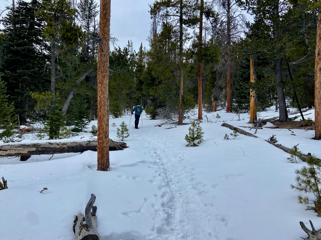 Meeker Park trail junction. Meeker Park Junction Approximately 1.5 miles up the trail we reach the Meeker Park Junction. At this point we hiked west where the trail follows a north facing slope. Here the snow became significant in the trees; however, the trail was well packed requiring only microspikes to be worn. It was very pleasant hiking along this section traveling through a thick conifer forest and aspen groves. Soon, we cross Campers Creek on a short foot bridge.  A frozen Hunter Creek. Hunters Creek at 3.2 miles At 3.2 miles we cross Hunters Creek over another foot bridge. Hunters Creek is a dazzling stream in any season. The winter snows and frigid temperatures transform this creek to a magical scene adorned with dramatic ice crystals and snow sculptures. In summer months its banks are decorated with spectacular wildflowers! At this point the trail becomes steeper and we begin the climb toward the Sandbeach Lake.  Sandbeach Lake is worth a visit in any season! Sandbeach Lake Sandbeach Lake sits at 10,283 feet. This destination is very popular in summer months as it hosts four individual campsites and one group site. The shoreline is just as its namesake implies. A beautiful serene setting surrounded by fine sand and large boulders complete with spectacular views. To the south St. Vrain and Meadow Mountains with massive Copeland Mountain capturing the scene. To the north there are views of Mount Meeker and Longs Peak. Be cautious about walking out on the lake even on the coldest of days as it is often not completely frozen.  A cozy Sandbeach Lake! The author enjoying lunch at Sandbeach Lake A Snickers bar is a favorite for lunch. Easy and light to carry with little trash to pack out. Winter months offer solitude in Wild Basin. Moose are often seen at the lake and wandering the trail. On this day we did not see any wildlife including no birds. This is rare as the Gray Jay aka “camp robber” is typically all over the place or rather all over your lunch! Sandbeach Lake: Sandbeach Lake elevation: 10,283 Round trip from Sandbeach Lake Trailhead: 8.4 miles Elevation gain: 1,943  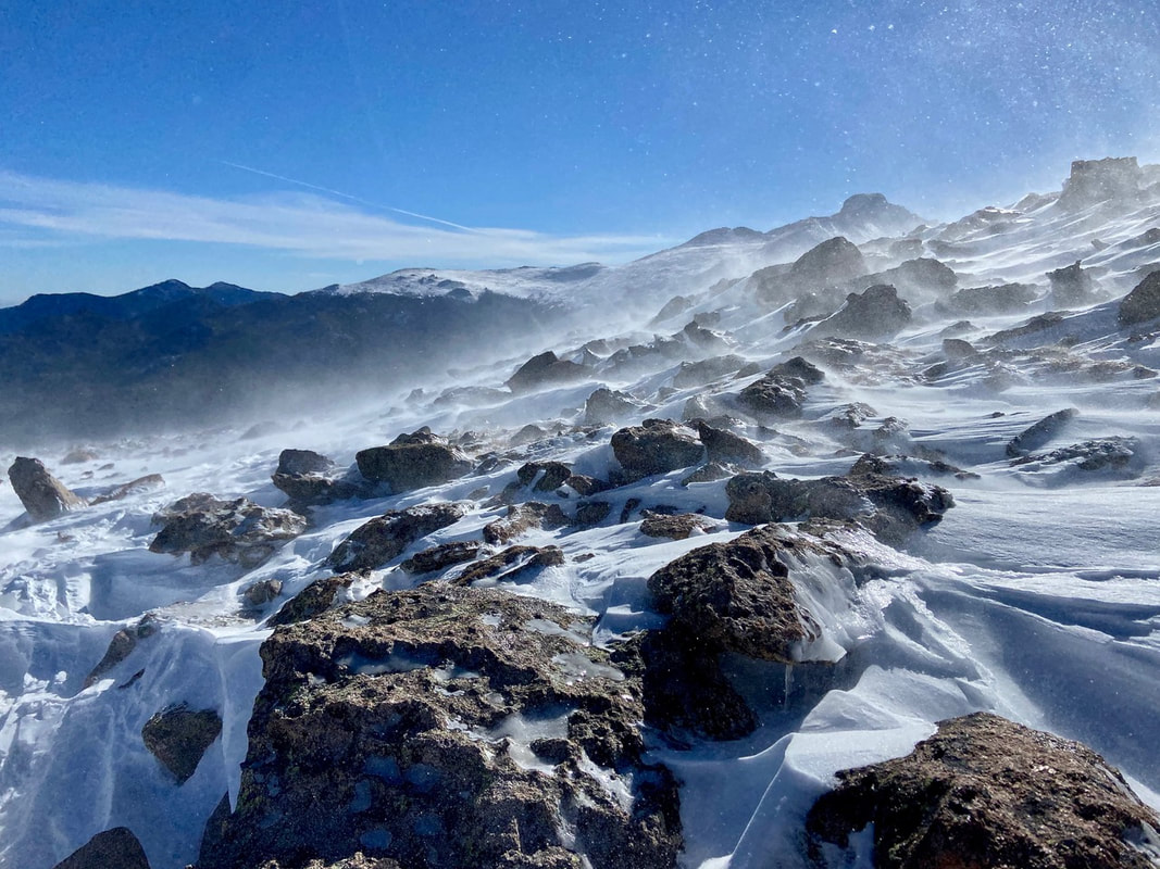 Flat Top Mountian in Rocky Mountain National Park showing off its potential for fierce winds, stinging spindrift, cold, and wind chill! (Photo: Marlene Borneman) by Marlene Bornean (Editor's Note: This article compares winters from 2020 through 2023 with photos showing a variety of conditions and what you can encounter while hiking up to and summiting Flat Top Mountain in Rocky Mountain National Park. “Alpine Weather bounces between sunlight and storms, strong winds and balmy breezes, violent weather and surprising calm… resilient plants, insects, birds, and mammal, flourish in harmony with the land.” Joyce Gellhorn, Song of the Alpine Rocky Mountain National Park provides year round recreational opportunities. In winter months back-country skiing, snowshoeing, ice skating and trekking on spikes are popular activities. With increasing winter visitation in Rocky the trails are often packed down enough spikes are the only equipment needed on popular trails. I prefer to ski the trails when the snow conditions are prime. My husband, Walt, and I are out in all weather and all conditions since Rocky is our backyard. One must be equipped and prepared in any season but particularity in winter months. Being familiar with the Ten Essentials as well as packing layers is the key to having a safe and fun winter experience. Knowing when to turn back is a “must” skill. 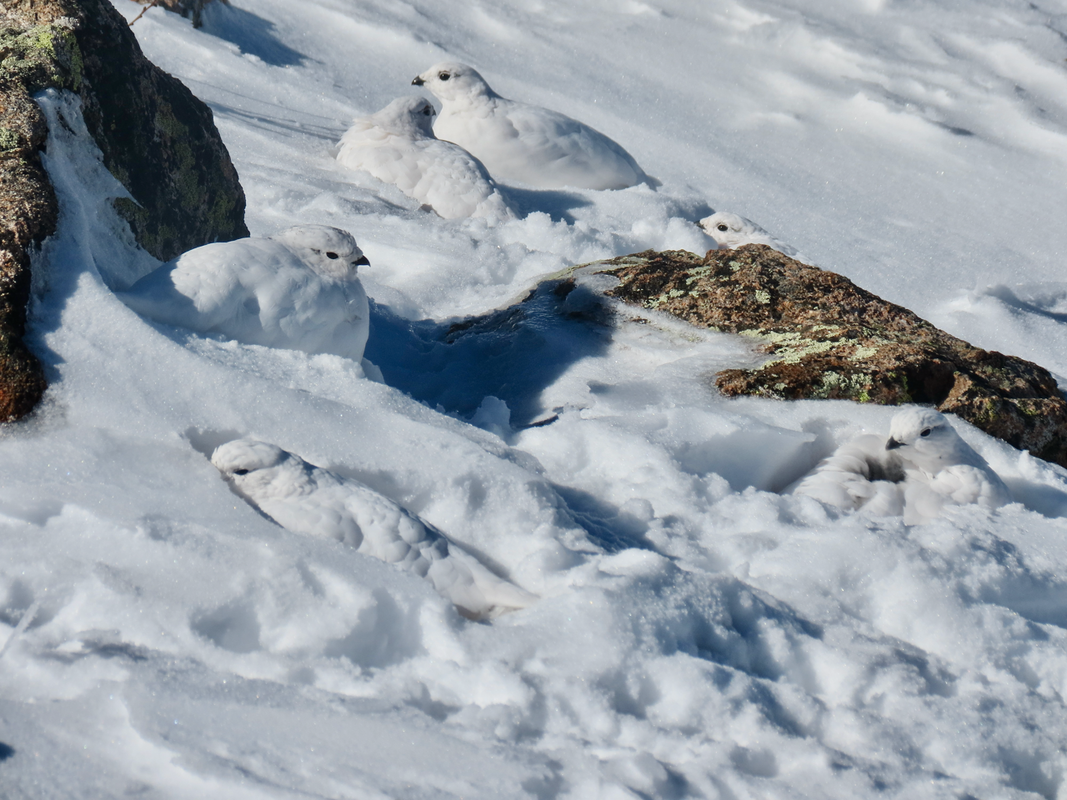 A covey of Ptarmigan on Flat Top Mountain. Can you spot all six? (Photo: Marlene Borneman) November 3, 2021 was very cold with extreme winds on the Flattop trail. We hiked above treeline but did not make the summit due to the harsh conditions. A frigid day with an unforeseen surprise, spotting a covey of white-tailed Ptarmigans on the snow covered tundra. I heard them before seeing them. Their clucking, soft hoots caused me to stop and search for tiny black eyes and bills in the pure white snow. I saw one, then two, then over a dozen in the deep snow. White-tail ptarmigans are the only birds to live on the alpine tundra year round with white plumage in winter and gray-brown in summer. Breeding males have a red eye comb. In winter months they use snow drifts for shelter and sustained themselves on willow buds. White-tailed ptarmigans have a thick layer of feathers on their legs, feet and toes not only adding warmth but acting like snowshoes. The day reminded me of a quote by John Muir, “…the blessings of one mountain day; whatever his fate, long life, short life, stormy or calm, his is rich forever.” 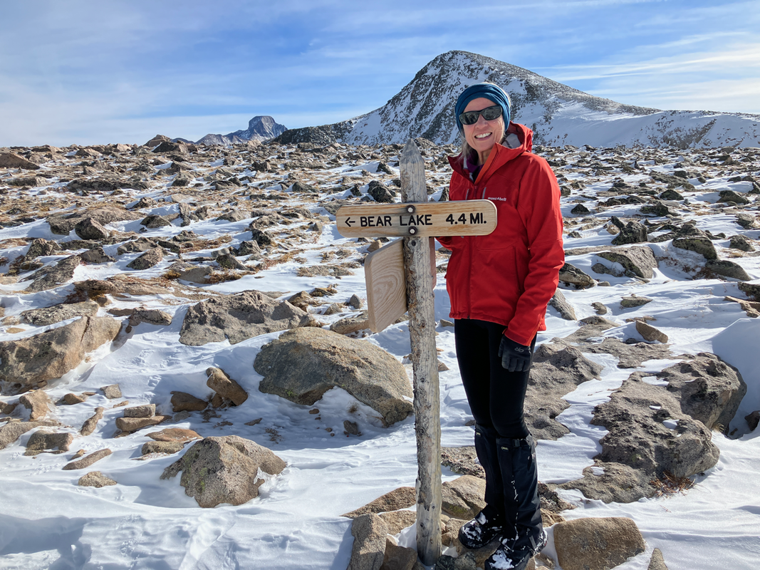 Marlene Borneman, on the summit of Flat Top Mountain, during an unusually warm and windless day. (Photo: Walt Borneman) This is me (Marlene) at the summit of Flat Top Mountain. What a contrast in weather conditions compared to one year earlier! This is a comparatively warm windless day on the summit. Nearly one year earlier, on the same mountain, we experienced significant cold and challenging wind (see the very top photo of this article). And isn't that why we keep coming back? Our mountain experiences, even on the same summit, are never the same but always wonderful. 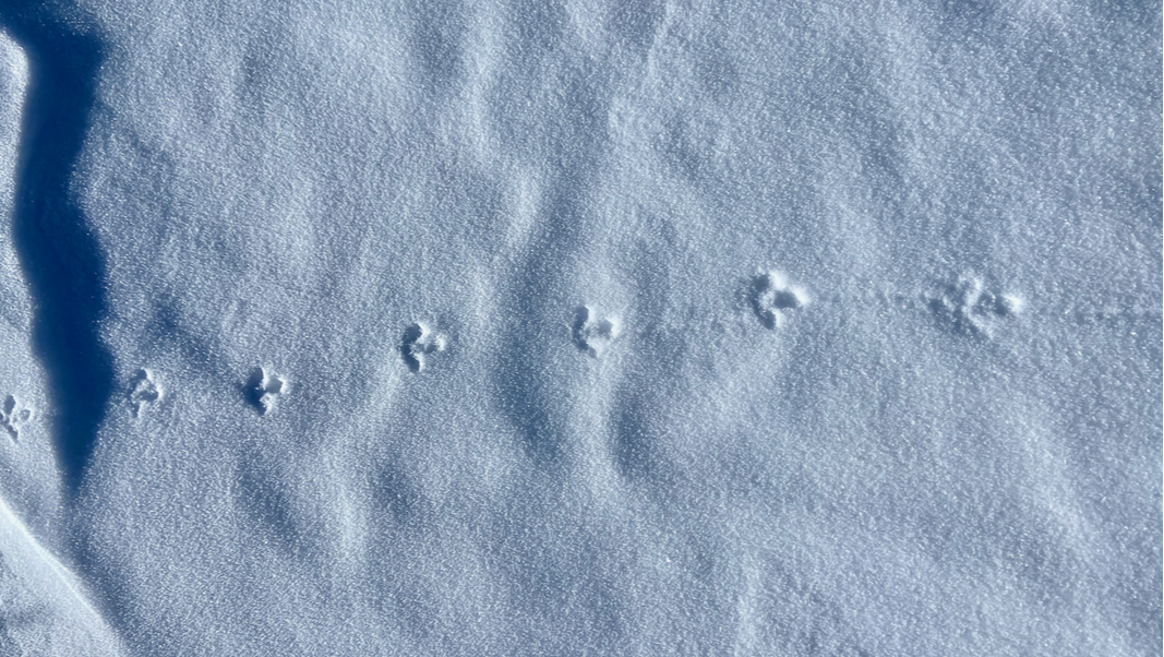 (Photo: Marlene Borneman) December 2023. Another very cold winter day on the Flattop Mountain trail. However, we did not have much wind until we reached treeline. No sightings of ptarmigans but their tracks where everywhere! 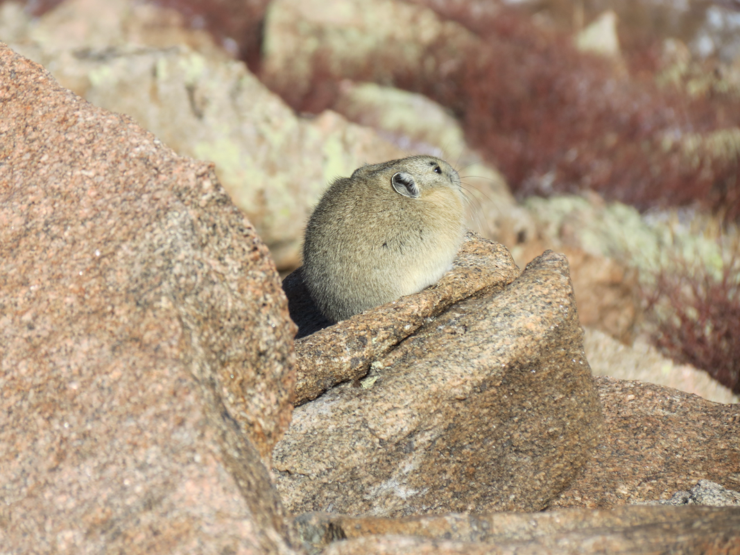 This little pika is sheltering from fierce winds on Flattop Mountain. (Photo: Marlene Borneman) December 21, 2023. This day did not reveal ptarmigans, but another creature known to the alpine tundra: the fascinating pika. Even though they belong to the rabbit family they appear more like a guinea pig! Pikas live in colonies on talus slopes making their homes among the rocks. They do not hibernate. They simply tolerate the harsh winters. In summer months you may see them harvesting their favorite food, alpine avens. Pikas store avens and other plants in “hay” piles deep in their rocky homes. They feed on these “hay” piles all winter. Sharp squeaks are their way of communicating to other pikas and alerting to danger. On this day we observed a pika quietly sheltering against a large boulder from the fierce strong winds. 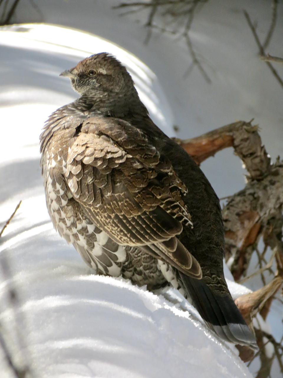 Dusky Grouse (Dendragapus obscurus) spotted on the Flattop Mountain Trail. (Photo: Marlene Borneman) Dusty grouse are often seen in the subalpine forest on the Flattop Mountain Trail. Grouse are rather large birds weighing up to three pounds. They have a pale gray band on a rounded tail. Dusky grouse enjoy the high country in winter and in spring move down slightly to lower meadows for nesting. 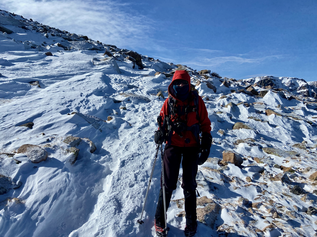 (Photo: Walt Borneman) December 2023. Marlene near a very cold Flat Top Mountain summit. 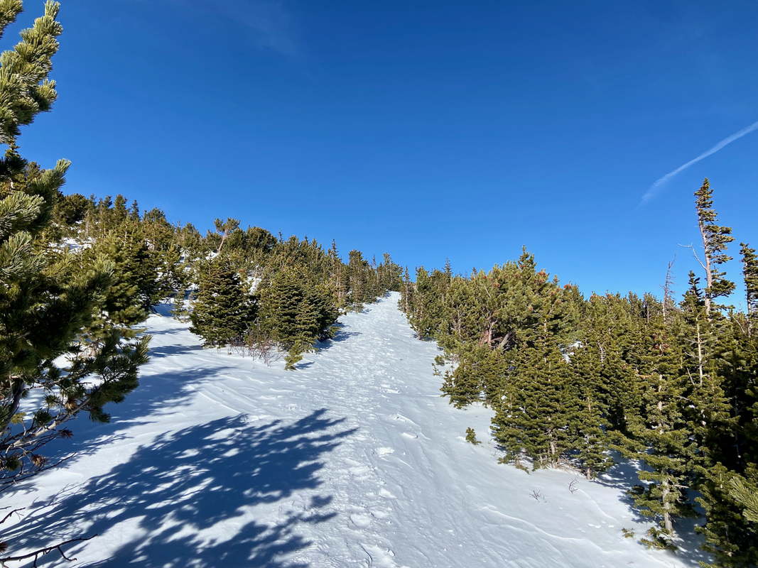 Trail at treeline on the Flattop Mountain Trail. December 22, 2023. (Photo: Marlene Borneman) Every winter season is different as is every day is in the high country of RMNP. So far, this 2023/2024 winter season has been lacking snow. Here the trail has a thin covering of packed snow. No need for snowshoes just spikes for traction.
These two photos show arctic conditions and strong gale force winds sculpturing snow into fine art during the winters of 2021 and 2023.. 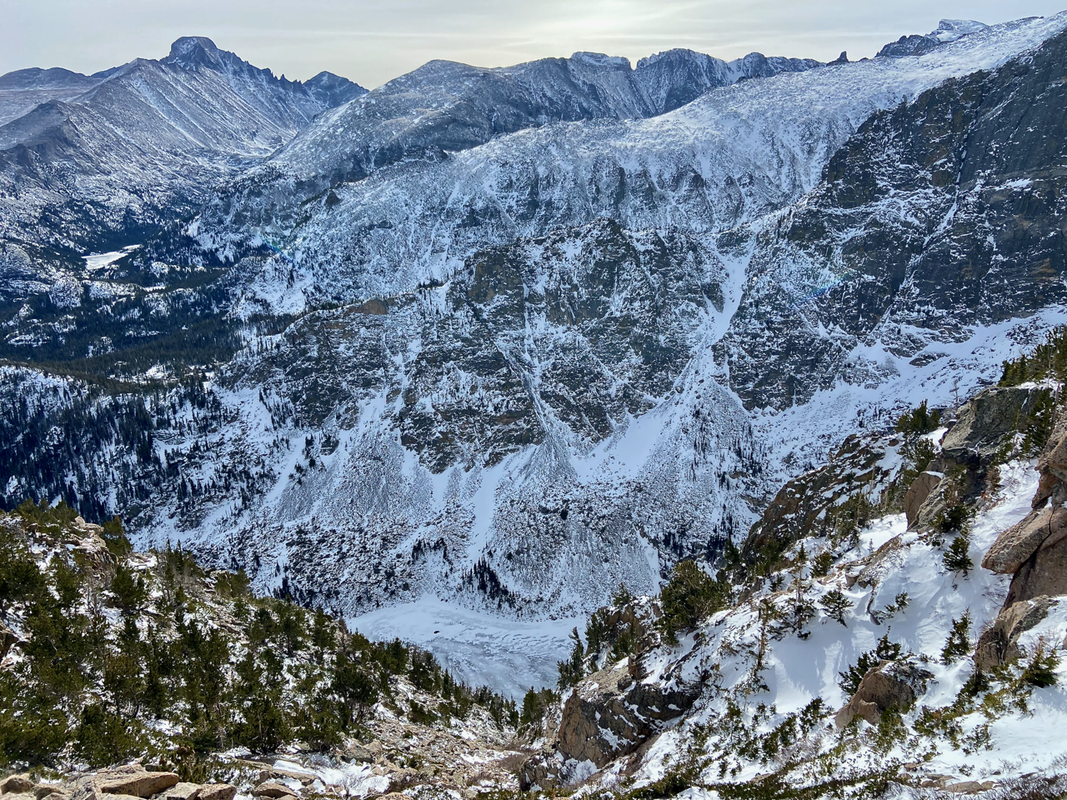 The Emerald Lake Overlook on the Flattop Mountain Trail. (Photo: Marlene Borneman) This overlook makes for a great second breakfast or snack stop. It provides shelter before reaching treeline with a stunning view of Emerald Lake below, Mills Lake in the distance and the striking Longs Peak massif. During the winter of 2020, as soon as I stopped at Emerald Lake Overlook, a curious and rather bold pika came right up to my boot! 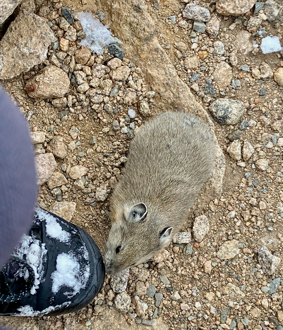 The bold and the beautiful. (Photo: Marlene Bornema) Flat Top Mountain and Flat Top Mountain Trail Flattop elevation: 12,324 Round Trip from Bear Lake: 8.8 miles Elevation gain: 2,874  What month is this? August? But it’s so cool and moist and green. However, there are signs that we are getting into the latter part of summer. The chartreuse green of spring aspen leaves have darkened to a deep emerald, large and shimmering in the summer breeze, while the tall grass sway with ripening seed-heads. I have observed the transition into late summer wildflowers and watched the streams lose their torrential flow. Lately, the weather pattern has brought us a heavy layer of California wildfire smoke, which is a strange mix with the cool moisture. Other than the hazy skies, it feels like a normal summer, which seems abnormal compared to other parts of the west this year. Is it even possible we might make it through the rest of the summer without some sort of cataclysmic event?
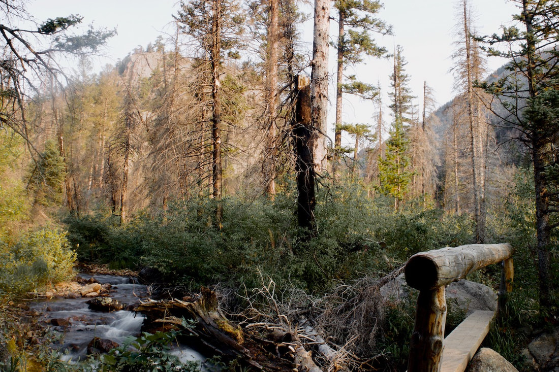
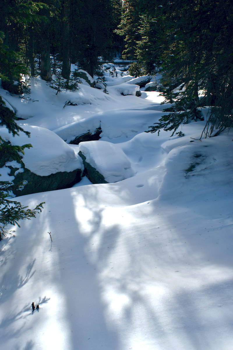
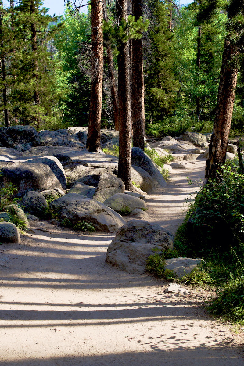
Fern Lake is a moderate 3.8 mile hike. While much of the hike sees a gradual increase in elevation, there is about a mile and a half in the second part of the hike where the trail switchbacks up a north facing slope, with Fern Falls midway at one of the switchbacks.
Once the trail begins its steady climb across the north facing slope, I remembered the shaded spruce and pine woodland environ with sun filtering through onto open forested terrain with a low growing but rich ground covering. I remembered how tall and slender the trees were with downed timber rotting and adding organic material to the thin soil. This was a favorite stretch of the trail for me.
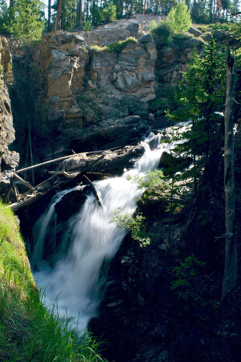
I walked up the slope in silence, overcome by how barren the landscape looked. Charred trees stood with bare branches, devoid of life. The morning sun blasted through, baking the ground. The ground lacked any cover, excepting for occasional patches of blooming Arnica, their happy yellow flowers loving the sun but seemingly out of place. 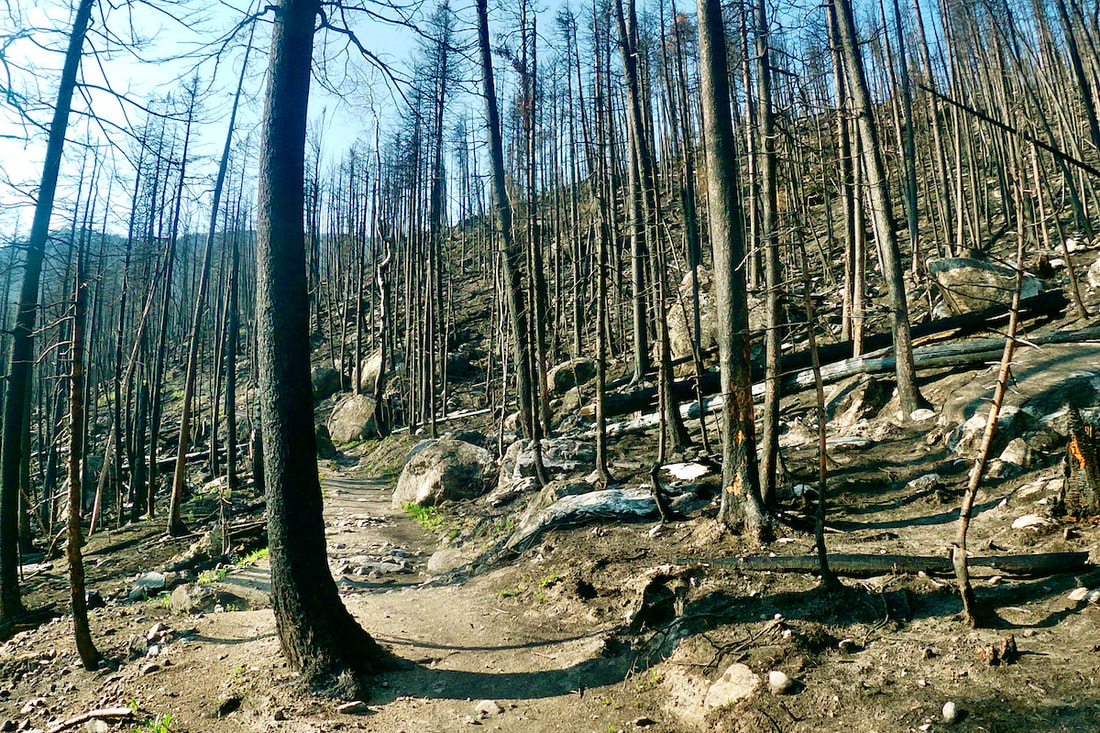 Fern Lake Trail, July 26, 2021 I make the turn at the first of three switchbacks and follow the trail east and towards Fern Falls. I’ve been curious to see how barren thing would look around one of the Park’s few notable waterfalls. The falls were always a fine respite mid-way up this part of the trail with the cool misty spray from the falls refreshing the laboring trail traveler. I feared something of its charm would be gone.
Walking silently along this last stretch of the trail before reaching the lake, I thought about the storied history of this trail dating back a little over a hundred years ago. This trail is one of many trails in the Park that qualify under the National Register of Historic Places. 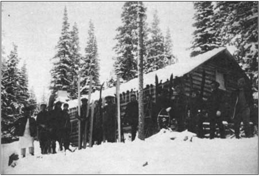 Colorado Mountain Club, 1920's Back in the very early 1900’s, tourism was at its beginnings in the region. A newly formed Estes Park Protective and Improvement Association was constructing a permanent trail to Fern Lake. By 1910, Dr. William Workman was busy building a Lodge at Fern Lake and by the 1920’s, the Colorado Mountain Club made annual winter trips to the Lodge. The local newspaper, the Estes Park Trail, reported in March, 1925 that as many as 100 CMC members were showing up for a “ten day frolic in the snow” using the lodge as a base. Ski runs and jumps were reported built for many of these events. That same year, a Park Patrol cabin was built adjacent to the lodge.
“Our memories float over the spring run-offs and the sunsets and sunrises as hikers take to the mountains to see the Columbines and Paintbrush, the leaping trout and the nutcrackers and Rocky Mountain bluebirds,” Ms. Collins recalled that summer in a 2016 facebook post. “The Lodge where we worked, I baking bread and pies on a wood stove and slept down on the river bank, are all gone, but the memories live on.” The Lodge closed for good the following year and sat vacant except by vandals before the Park finally removed it in 1976. Only the 1925 Patrol Cabin remained, and now that too is gone, one of the many casualties the Park endured from the East Troublesome Fire last October. Finally having reached the lake and standing in the very place where the Lodge once stood, I could see how the path of the fire split and pushed around the lake with one leg of the fire coming in from the northwest, engulfing the Patrol Cabin, and then skirting the western shoreline before racing east across the hillside that separated Fern Lake from Odessa Lake and heading up Mt Wuh, leaving the south and east shoreline mostly untouched.
I wandered down to the footbridge that crosses the outlet stream. Standing in the middle, I gazed into the clear mountain water of the little outlet pool surrounded by green vegetation and reflecting Notchtop Mtn above. The view across the lake was a mix of green and brown/black, but still an inspiring view. I decided to hike the additional 0.7 miles to Lake Odessa. Walking through another charred section of the trail, I observed the trail work that the Park described in their Historic Places report as, “some of the largest and most complex rock walls in the park and utilized Civilian Conservation Corps (CCC) labor.” What a relief when I finally I crossed out of the fire zone and back into beautiful subalpine terrain, walking along a cascading mountain stream with lush green ground cover and green forested hillsides spectacularly framing Notchtop on the path to Odessa Lake. Snacking on the lake shore along with other hikers that had dropped into this paradise on the trail from Bear Lake, I took in the quiet, watching small wispy clouds float along. This was truly Rocky Mountain splendor. 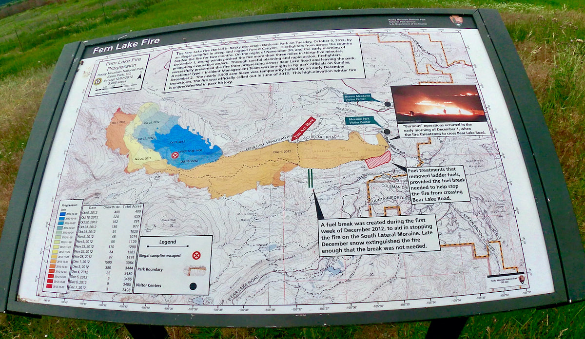 The weekly spring snowstorms rolled in like waves crashing onto the beach and like a surfer watching to ride the crest, I watched the weather to catch the sunny days. It was getting into the latter part of May and while we had been getting a few warm days causing the snow to begin melting off the trails, just as quickly the springs snows were adding inches back on. On this day, the trail remained snow-packed in the shade of the trees, but the summer sun was having it's effect and some areas where the sun could reach were snow free. The trail gradually climbs 500ft for the first mile, then drops 250ft the next 1/2 mile, before rising 600ft for another 1/2 mile to Storm Pass. The last seven tenths of a mile climbs 750 before obtaining the summit of Estes Cone at 11,006ft. (Continues below) Watch the video: Subscribe to the Rocky Mountain Day Hikes YouTube Channel: Click Here (Maps from GPSMyHike. To download GPSMyHike onto you phone, Click Here)
 Limber Pine near the summit of Estes Cone "Spring is when you feel like whistling even with a shoe full of slush." - Doug Larson Twin Sisters Mountain: East Summit 11,428 feet West Summit 11,413 feet 7.5 miles round trip 2,253 feet elevation gain Go to the Twin Sister Trail Profile in the RMNP Trail Guide by Trail Correspondent, Marlene Borneman May 1 is tied to folklore as well as historical significance. In some countries it is a celebration of laborers similar to our Labor Day in September. I remember May baskets and dancing around the maypole celebrating the return of spring. My husband and I started the month of May by hiking to the summit of Twin Sisters Mountain. This mountain has two distinct summits giving its name. The established trail leads to the west summit, the lower by fifteen feet. The day was a warm fifty-six degrees with clear skies and only a few cars in the parking lot at 6:30 a.m. April and May are mud season months as snow is rapidly melting with warmer temperatures; spring conditions. We walk a short distance on the snowy/muddy road leading to the trailhead kiosk. We found the trail snow-packed with a soft crust so no need for snowshoes or micro-spikes, however trekking poles were helpful.
 Viewpoint along the trail
Once across, the route becomes steep and indistinct in places. It is here we encountered some ice, cautiously take baby steps to avoid slipping. After a couple of short switchbacks we re-join the original trail.
Near treeline I see a familiar old snag “waving” us to a favorite resting spot; a smooth, large dead log. After enjoying a snack and water we return to the trail hiking through a subalpine fir forest. Subalpine refers to a transition zone between thick forest growth shifting to stunted small trees then to treeless alpine tundra. Fir trees are commonly seen at this altitude. They are sometimes called “friendly” firs as their needles are soft to the touch.
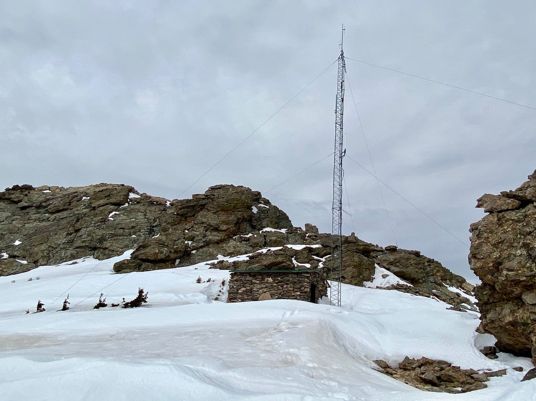
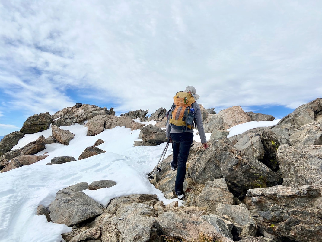
Suddenly, we break out of the trees where the trail cuts across a rocky talus slope, snow covered in these spring conditions. A couple more switchbacks brought us to the saddle between the two “sisters.” 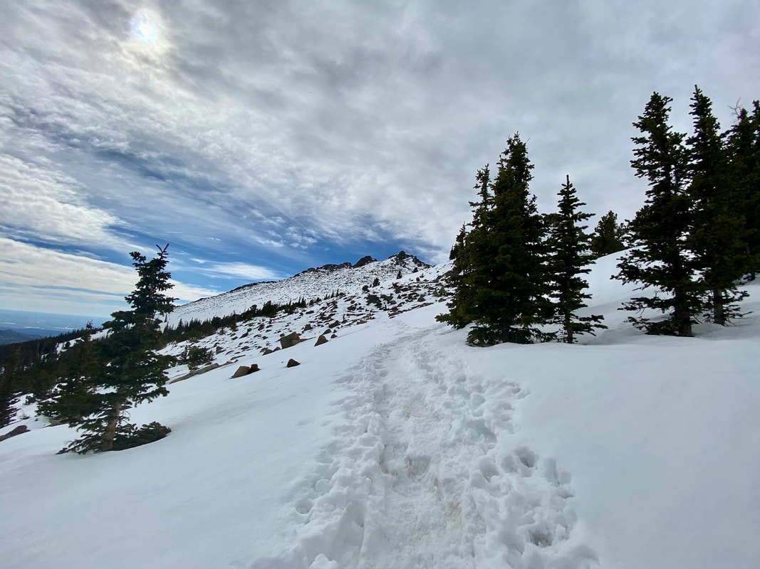 Above treeline Here a stone hut and a radio communication tower stand which are still used today for emergency purposes. We stay right of the stone hut then turn slightly left up a small gulley. Scrambling up the rock outcroppings we work our way up to the western summit. A fire lookout tower used to rest on the summit but now just a bit of history as it was taken out in 1977.
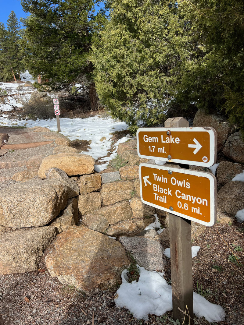
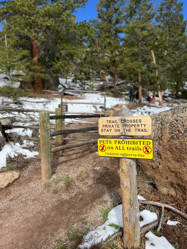
A commanding 360 view lies before us: Longs Peak, Mummy Range, Continental Divide, Estes Valley, the plains to the east, to the south Mount Evans and Pikes Peak. The summit was all ours for a brief time, but soon we made room for other hikers to enjoy this spot of earth. 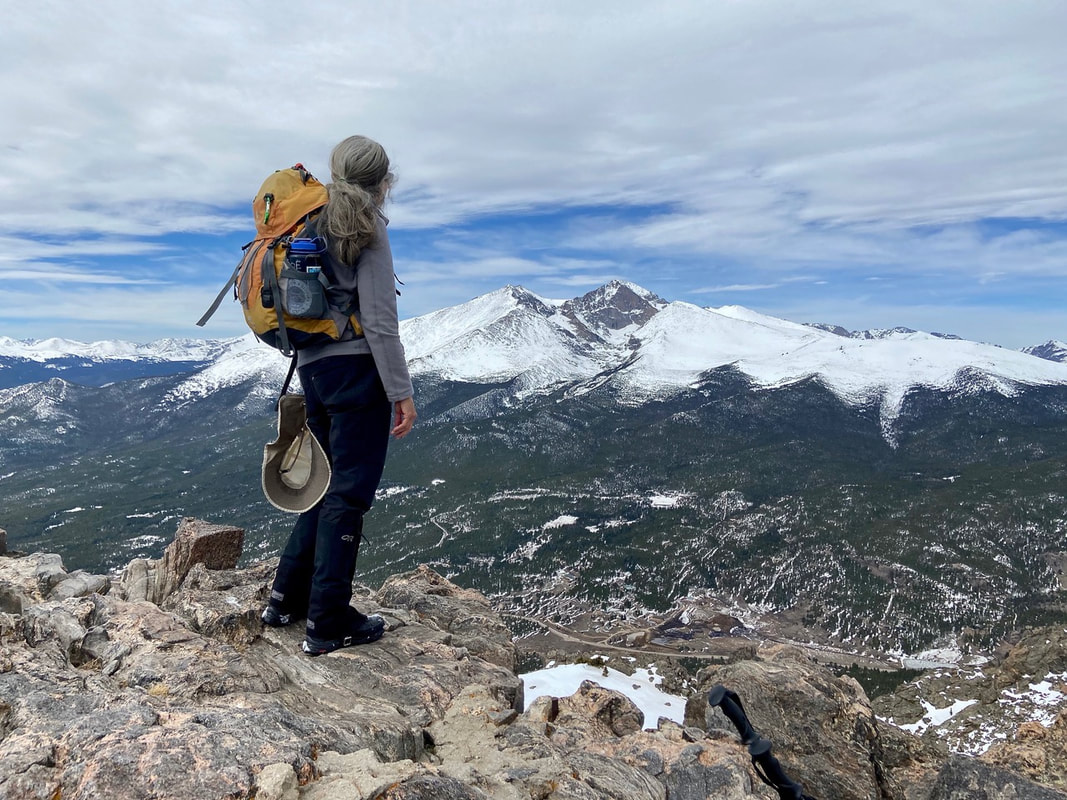 East summit with spectacular view of Longs Peak We headed down for lunch near the stone hut gazing over to the eastern summit. We decided to forgo the east summit and retrace our steps back in the snow. The snow had softened so much we could easily “boot-ski” to timberline! The snow had also melted considerably at the end of the trail leaving thick, sloppy mud behind. Mud season 2021 had officially arrived!  Mud season RMDH Trail Correspondent Marlene Borneman has climbed Colorado’s 54 14ers, the 126 USGS named peaks in Rocky Mountain National Park and 44 State High Points. She has been a member of the Colorado Mountain Club since 1979 and is a member of the Colorado Native Plant Society. 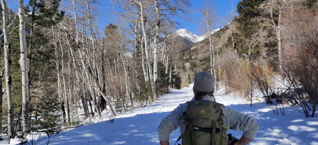 Dave Rusk accompanied me to Endovalley on my first ski tour in more than 20 years. Story and photos by Barb Boyer Buck Back on skis after 20 years! I broke my back 21 years ago. It was a fracture which resulted in spondylolisthesis and it brought on years of physical therapy, chiropractic treatments, loss of mobility, and pain. It was the time when orthopedic surgery was very much feared, and outcomes were relatively unpredictable. It was also the time when conservative treatment was recommended and surgery was avoided at all costs. I was told to give up skiing altogether, and especially snowboarding. "One wrong fall and you could be paralyzed," was the doctor's advice. Pretty scary stuff. But by 2018, I could barely walk, had to quit my job waiting tables (which supplemented my writing career) and I had pretty much given up most of the things that gave me pleasure, most notably outdoor recreation in the form of hiking and of course, skiing. I finally went to an orthopedic center to have an x-ray. After seeing the results, the surgeon scheduled me for an emergency 3-level spinal fusion the very next week. I can see why people avoid this surgery, recovery was long and extremely painful. To make a living, I crocheted and sold hats. It was incredibly boring, to say the least. But today, I am almost back to normal! So, I decided to try cross-country skiing again, something I had enjoyed for many years before my back injury. Dave Rusk, the publisher of Hike Rocky Magazine and an extremely patient man, agreed to accompany me and give me a refresher lesson. Here's a video of that day, which took place on March 1 of this year. We rented equipment from the Estes Park Mountain Shop, and I was very pleasantly surprised at how far cross-country skis had come! I definitely want to get the kind of skis I was using that day. In order to get the most out of my "lesson," I needed to start from scratch. The patience I had developed during my nearly three years of recovery helped with this. I approached xc skiing as if I had never done it before and thereby, I was able to take advantage of tips that Dave provided. First, I want to talk about the equipment. These days, you can opt for skis that have scaling on the bottom of them, where your boots clip in on the other side. This helps you when going up inclines - you can literally walk on the snow with them. Technically, they are called backcountry skis and you can "walk" up slopes and ski down them, which many people like to do at Hidden Valley. I'm not ready for that yet, by the way. Marlene Borneman explains about these type of skis in her piece, "Ski tracks in Rocky," published in the February, 2021, edition of HIKE ROCKY magazine. It's so much easier than waxing skis, or even putting on skins when you are doing a cross-country tour on sloped trails (most of the trails in Rocky Mountain National Park are sloped, by the way). The bindings on these new skis are so convenient. You can just toe-kick into them, and twist to take them off. I rented the entire package, which included poles and boots, too, for about $20. The place we chose for my first time back was Endovalley; the road to the picnic grounds is closed for the winter and can be used for skiing, snowshoeing, or when the snow melts off, walking. It extends past the Fall River Road fork and ends at the picnic grounds. The road is fairly level. 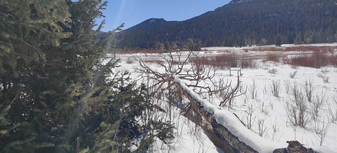 March 2, 2021, in Endovalley - a beautiful, still and warm day. I put on my skis just after the "road closed" gate and tried to recapture the feeling of skiing by taking a few tentative kick/glides. On the newer skis, it felt more stable.
If I stood straight, putting my full weight on the middle of the skis, they stopped sliding and I could "walk" on them. In order to ski, I needed to learn forward slightly, bend one knee and kick backward, with the other leg extending out. Alternating legs, eventually I started to feel a rhythm and began gliding. When I started to feel unsteady, I just straightened up again. This was a big difference from the skis I used to have; my cross country skis from the late 80s were much more narrow with very smooth bottoms. Stopping was always an adventure on those. The poles helped keep me steady, too - these need to fit into your hands while your elbows are bent at a 90-degree angle. Skiing on the road was a bit difficult because it was icy in spots and melting while we were on it. As you learned in the above video, the only time I fell was when I tried to ski off the road to a picnic bench, missing a turn on the slight downhill slope. It was a wonderful adventure and even though I'll probably need to wait until next year to do it again, I'm looking forward to it! by Dave Rusk
The forecast was billed as clear and mild, but there was a high level of thin clouds screening the sun with a mild breeze. Walking out of the treeline, there was also a dark and somewhat ominous lenticular cloud hovering like a giant UFO off somewhere over Netherland, or maybe Ward.
The tundra above treeline had been swept clear of any deep snow with the only snow accumulations occurring on the leeward side of willow shrubs. The Diamond of Longs came into view, obscured partially by Mt Lady Washington. We also could see our immediate destination, Granite Pass, to the north.
We advanced to the Chasm Lake trail junction without difficulty, and continued the traverse to Granite Pass where we observed more lenticular clouds off to the north.
We had anticipated an increase in wind once on the west side of Granite Pass, but it continued to stay mostly calm with occasional gusts, pretty pleasant for this first day of February.
Threading through the Boulderfield now, we turned our gaze to the north of Longs Peak along the north ridge to our destination, Storm Peak. Appearing as mostly a knob on the ridge next to the dominating Longs Peak, the summit of Storm is at a very respectful 13,326'.
Having traveled the 6 miles to get to the base of Storm Peak, the unknown question we had was what kind of snow would we find. It needed to be hard enough to make solid steps in. We had brought crampons if the conditions warranted them. 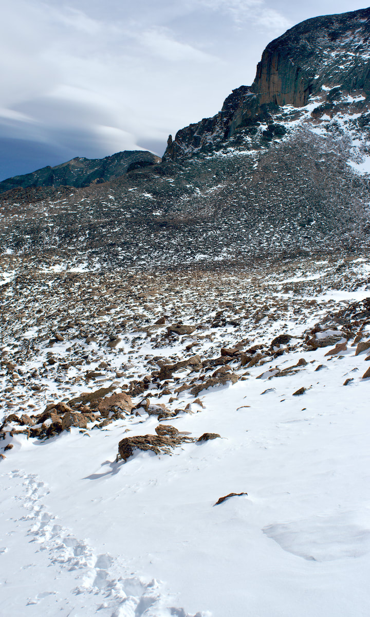 Photo: D. Rusk While there was some soft stuff layered on the surface, there was also some more solid footing underneath, so we continued to work our way up. 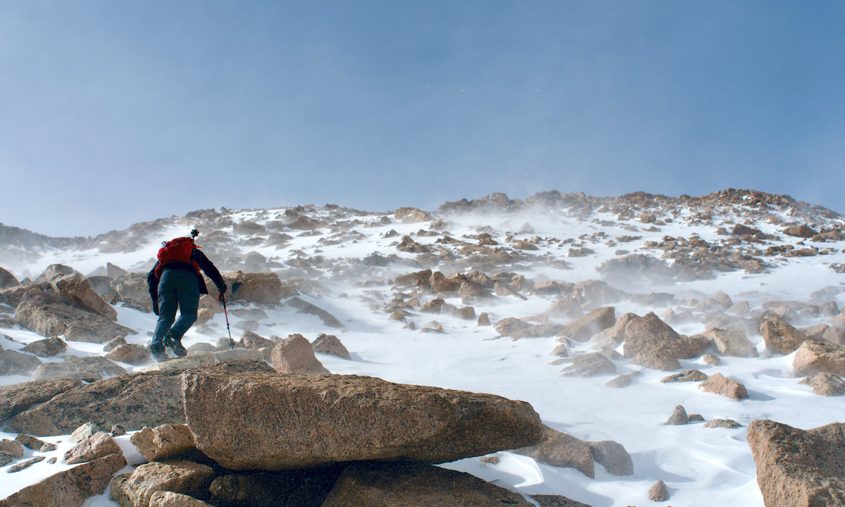 Photo: D. Rusk The sun made more of an appearance moving into the afternoon and when the wind wasn't blowing, it felt a little balmy. But when those wind gust did come up, picking up and blowing small snow particles into our face, we had to turn away and wait for the gust to blow off.
About three quarters of the way up, the slope angle became too steep for my comfort zone and I perched myself on a rock outcrop, pulled out a thermos, and took a coffee break while Kip completed the ascent to the ridge giving him a commanding view into the Glacier Gorge, with frozen Black Lake below and endless peaks to the west and north. 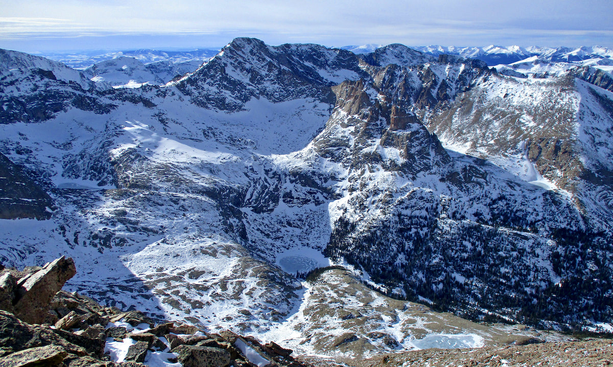 Photo: K. Rusk 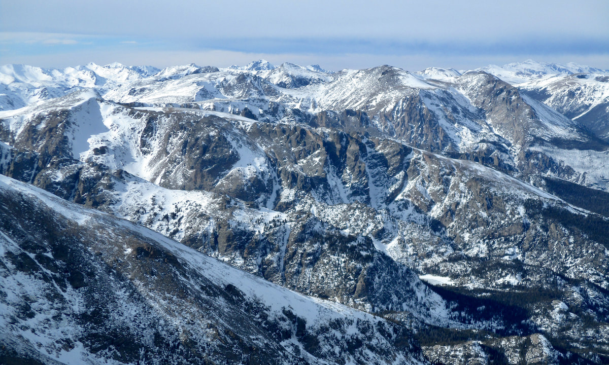 Photo: K. Rusk With shadows starting to grow long in the afternoon light, we descend through the Boulderfield.
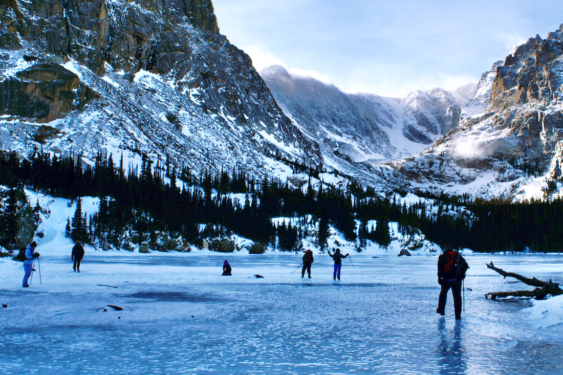
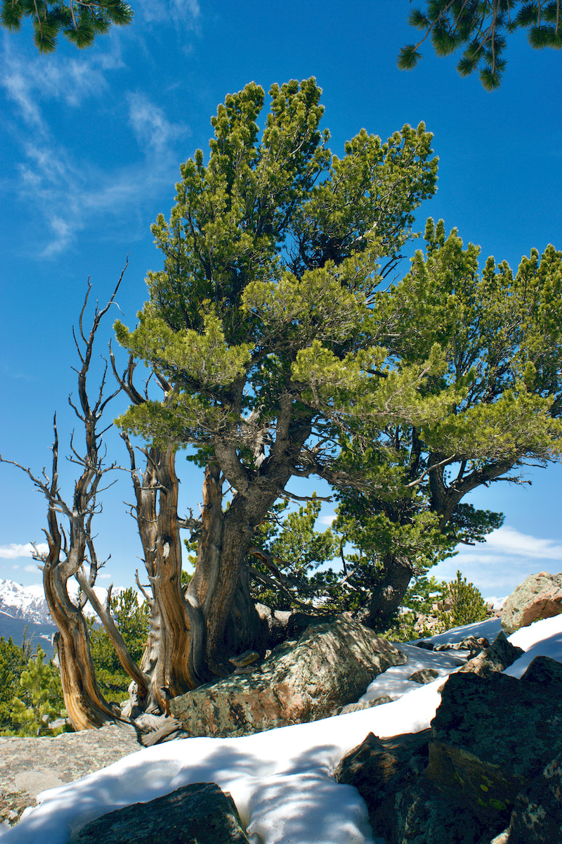
 Photo: D. Rusk 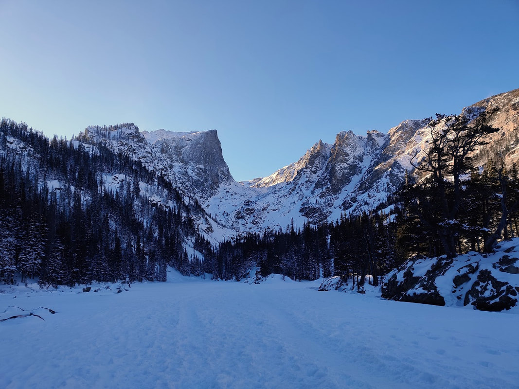 Dream Lake on a windless, perfect day in mid-January. Photo by Barb Boyer Buck Story and photos by Barb Boyer Buck A hike to Emerald Lake, that was the intention. It had lightly snowed overnight and the sky was a cloudless, cobalt blue. Most importantly, there wasn’t any wind. If you don’t know about the wind in the eastern foothills of Colorado – most notably in the valleys– well, It’s brutal. When air is forced over the Continental Divide and combines with Chinook upslope winds, the result is a cacophony of directionless and fierce wind. It’s just as crazy-making as the sound of a symphony warming up. When I was the renewable energy manager for the Town of Estes Park, my team thought perhaps wind turbines would be able to harness this crazy wind, but no. The wind comes from too many directions, is too fast (70-90 mph is not uncommon) and is never consistent. It’s either windy or it’s not, at least from October through April. I was excited to take a hike in the fresh snow with no wind. But it was a late start – we probably didn’t reach the Emerald Lake Trailhead until close to 1 p.m. I brought my snowshoes just in case, but micro-spikes and poles worked just fine. From its trailhead, Emerald Lake is 1.8 miles, so we figured we’d get there around 3 and have plenty of time to get back down before dark. It was nearly a month after Winter Solstice and the days were getting a bit longer.  Beautiful lighting, fresh snow, and fresh bunny tracks! Beautiful lighting, fresh snow, and fresh bunny tracks! But we were stopped quite literally in our tracks with almost every step. Snow doesn’t usually stay on the tress very long in RMNP (again, the wind) but that day, it covered every branch like fluffy icing, it sparkled in the full sun. The views along the way were spectacular and even with my cell phone, I was able to capture amazingly clear photos with great detail. This was a function of the afternoon lighting as well, which became increasingly rich as the day wore on. The Emerald Lake Trailhead is by far the most popular one in Rocky Mountain National Park, any time of the year. This day, a Tuesday in mid-January, was no exception. There were a lot less people than in the summer months, but the route was still fairly crowded. 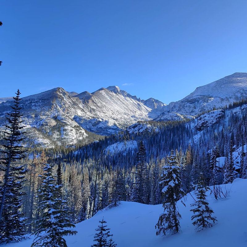 Longs Peak, Keyboard of the Winds, Pagoda Mountain, and Thatchtop from the Emerald Lake Trail. Here’s the etiquette for passing on the trail: those traveling up have the right-of-way. This is especially important when the trail is snow packed and/or icy. Further measures to take during these COVID times is to step aside, pull up your mask (if it’s down), and turn your back to the trail. Six feet of distance is just not possible on these popular trails. 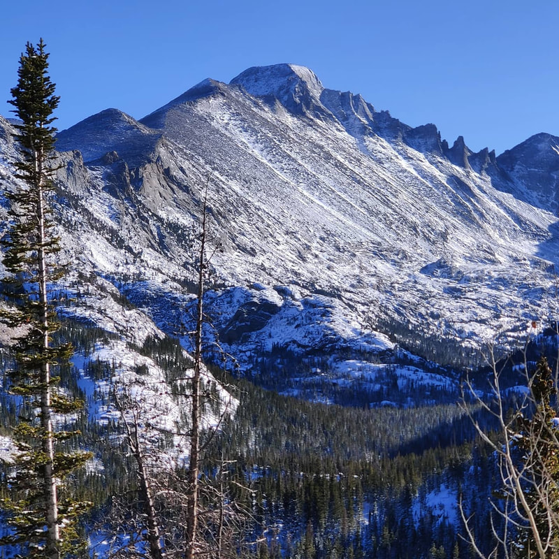 The Keyboard of the Winds and the top of Longs Peak were visible the entire way. Photo by Barb Boyer Buck But I found myself stopping many more times than I technically needed to because of the stunning sights, especially of the Keyboard of the Winds formation on the “back” side of Longs Peak. The wind I was talking about earlier can make some unearthly sounds as it passes through this jagged ridge. The trail to Emerald Lake is packed full of amazing views and destinations – if you count Bear Lake (which is just a few steps from the trailhead) you see four lakes, amazing views of Longs Peak, many other stunning peaks, and beautiful geologic formations.  A bunny convention in the waning afternoon light. A bunny convention in the waning afternoon light. The first destination along the trail is Nymph Lake. In the winter, when the lakes are frozen over “winter trails” are established at each lake which cross over the frozen waters. Be very careful when you do this – sometimes the ice is thin in places you cannot see. Make sure that every lake is completely frozen on all edges before you try to walk across it. Views of Hallet Peak, first seen over Bear Lake, were now joined with the spires of Flattop Mountain.  The trail to Dream Lake The trail to Dream Lake A bit further up, and you reach Dream Lake with more stunning views of these features. Other things we noticed at Dream Lake were the limber pines (colloquially, twisted pines). These trees are actually shaped by the wind as they grow, and they are some of the oldest living organisms on earth. Some limber pines in RMNP date back over 1,000 years, according to a report by several federal forestry agencies, “Limber Pine Conservation in Rocky Mountain National Park,” published in 2013. At this point on our hike, the sun was setting – as it sank over the peaks shading Dream Lake, a final alpenglow lit the scene in a spectacular way. 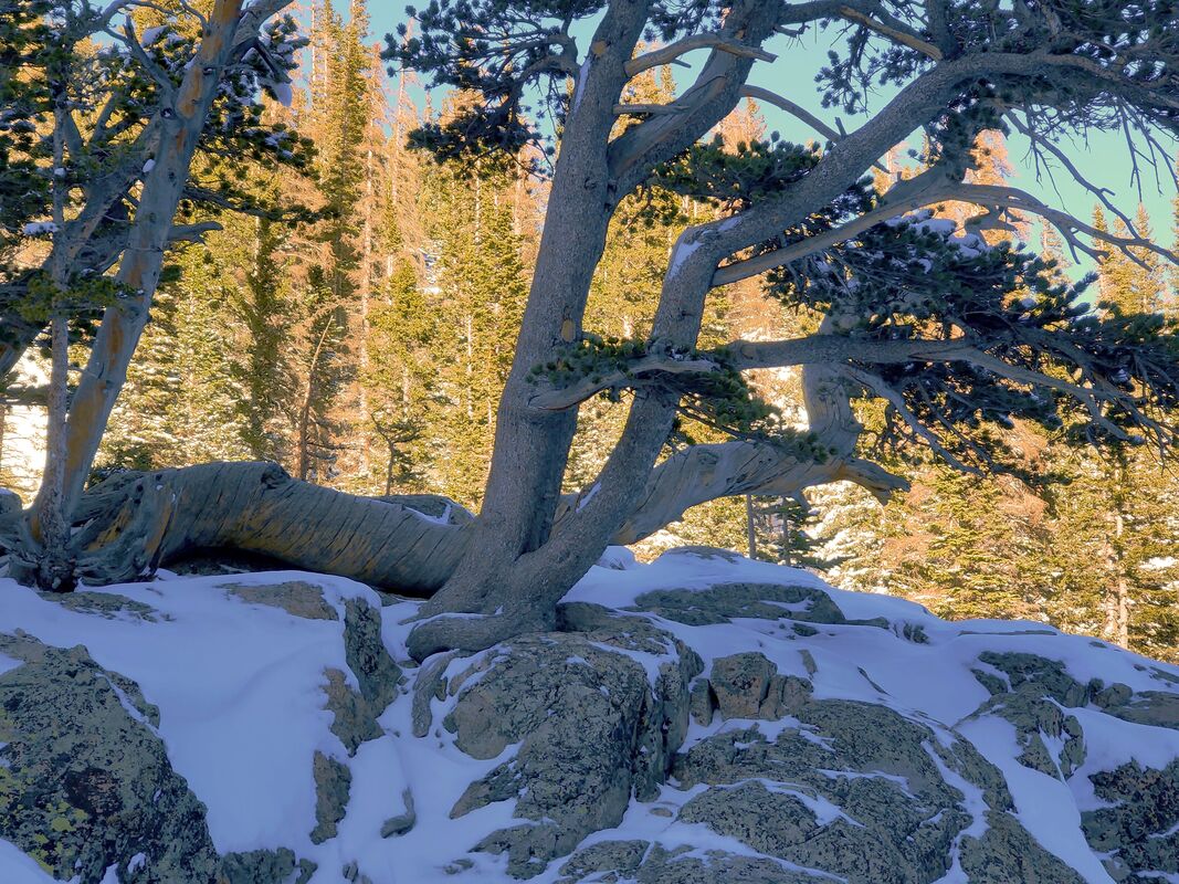 Limber pines are shaped by the fierce winds in exposed areas such as Dream Lake. These are the oldest living organisms in RMNP. Emerald Lake was not to be, not that day. But it’s days like that which make me glad to be alive. For me, rushing past the gifts of Nature, especially when they were laid out so beautifully for us to experience, is unforgivable. Emerald Lake isn’t going anywhere, and neither am I. 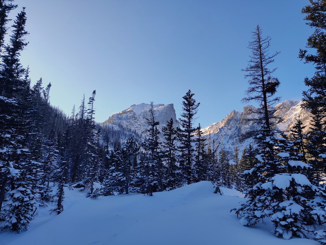 This Narnia-like scene was just before we reached Dream Lake. By Dave Rusk It was 20 days past the Winter Solstice last week when we ventured up into the Glacier Gorge area. Even though it was still 60 days until the Spring Equinox, the snowpack at the trailhead was very thin and it seemed like it wouldn't take much warmth to melt it away. But on this day, the trail was still snow covered, the skies were blue, and there was hardly a wiff of wind. The morning temperature was still cold.
We quickly moved up the trail to where the mostly snowed over Icy Brook dropping out of the Loch Vale joins with Glacier Creek. The snow was deeper here where it is sun and wind protected.
 We climbed up out of the drainage heading toward Mills Lake. The lake was frozen solid and there was still a couple of inches of snow on the lake that had fallen a few days before. We trudged across the middle of the lake to the far end.
Once at the south end of Mills Lake, we followed the short drainage that connects Mills Lake to the small Jewell Lake and crossed it. At the south end of that lake, there was an area where Glacier Creek flows into Jewel Lake where the snow did not stick, like maybe the warmth of the water melted the snow, but left these odd puff balls of large flakes. It was kind of an odd phenomenon that was hard to explain. 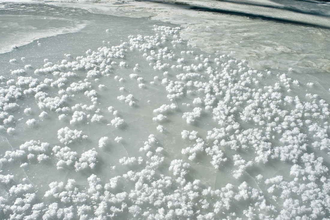
After Jewel Lake, we returned to the trail and worked through the blowdown area from a Nov 2011 wind event and started to move into the upper part of Glacier Basin with Arrowhead appearing to the west and then finally McHenry's Peak. 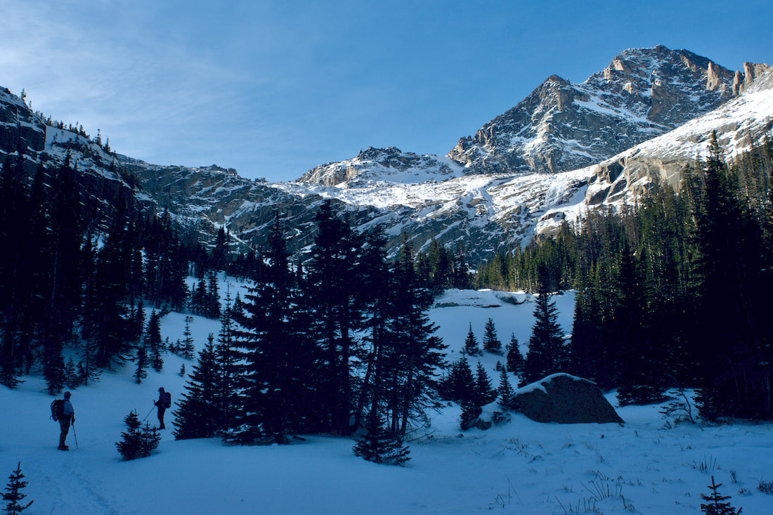
Once at Black Lake, also with a thin layer of of snow on it, we moved up the drainage that leads to the upper hanging valley. Part way up, now at about noon, with the sun at it's zenith for the day, we stopped for a bite to eat and take in the amazing view. The day had been warm and we were casual on our break. In the summer, there are lots of seeps, water that flows out of the cracks on down the rock face. These had turned into ice flows as the winter temperatures settled in.
Up to this point, the trail to Black Lake was pretty well packed from snowshoers the previous day and shoe spikes was all that was needed for travel. But for moving into the upper basin, we decided to go with snowshoes. 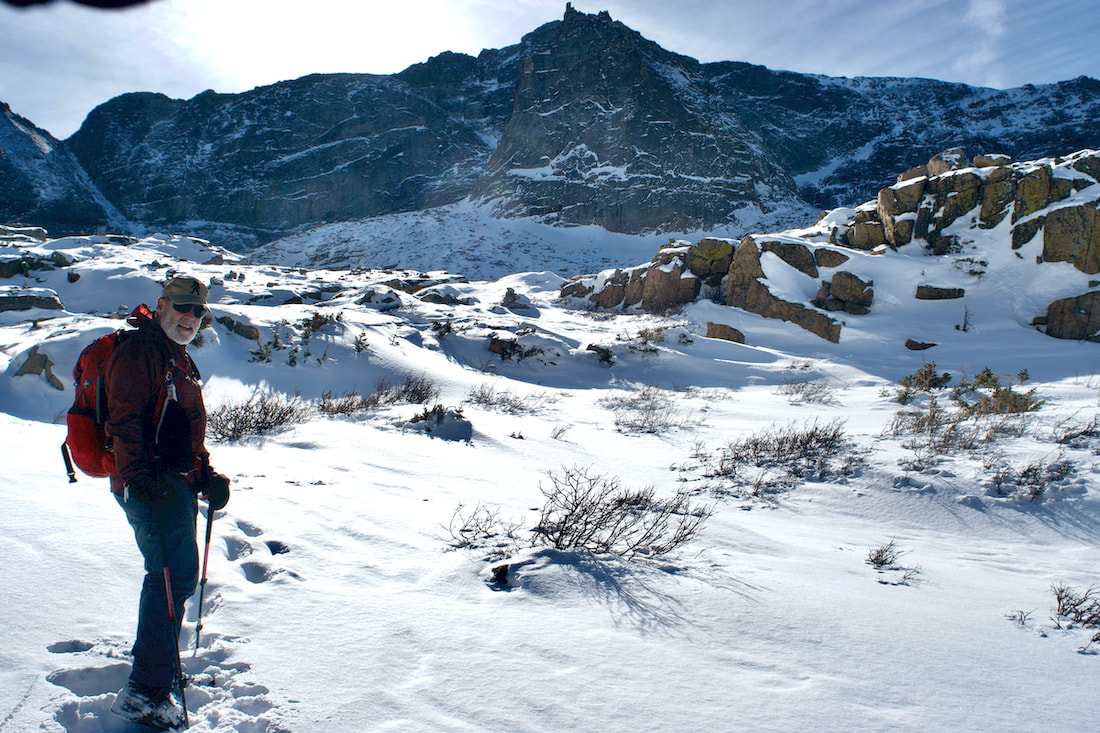 We climbed up into the Upper Basin that sits at the western base of Longs Peak. There was only one set of tracks and they were several days old, someone without snowshoes. Despite being mid day, the sun sat low on the horizon and I needed to use my gloved hand to shade the camera lens.
From the upper basin, McHenrys Peak and Arrowhead rise dramatically to the west and turning behind us, we could see all the way across to the Mummy Range in the north. Jet contrails were the only things breaking up the blue sky. 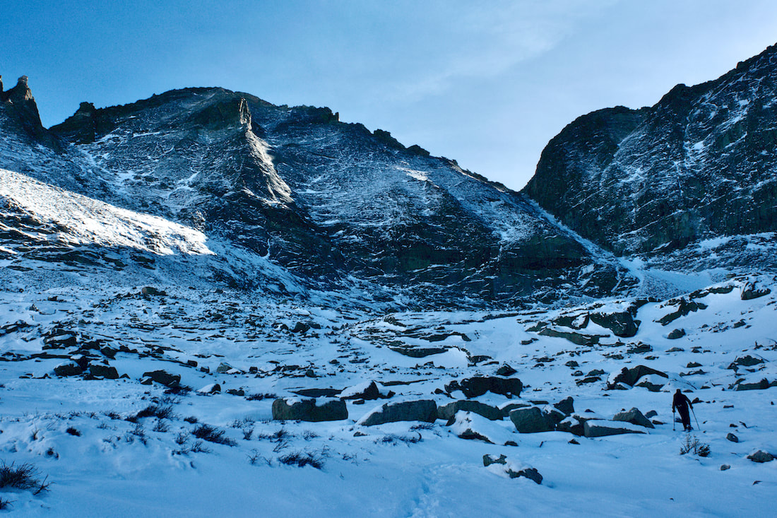 We navigated our way through the boulder fields heading for Green Lake. There was snow coverage over the krumholtz shrubs, but grass, willows and rock cairns were poking through the thin layer of snow.
The sun had now dropped behind Chiefs Head Mtn and the temperature started to drop and the downslope wind picked up. But the Key Board of the Winds rock formation continued to bask in the afternoon light. Finally at Green Lake at the base of Pagoda Mtn, we stopped for some more food and water before heading back down. We had caught a beautiful day in the Park.
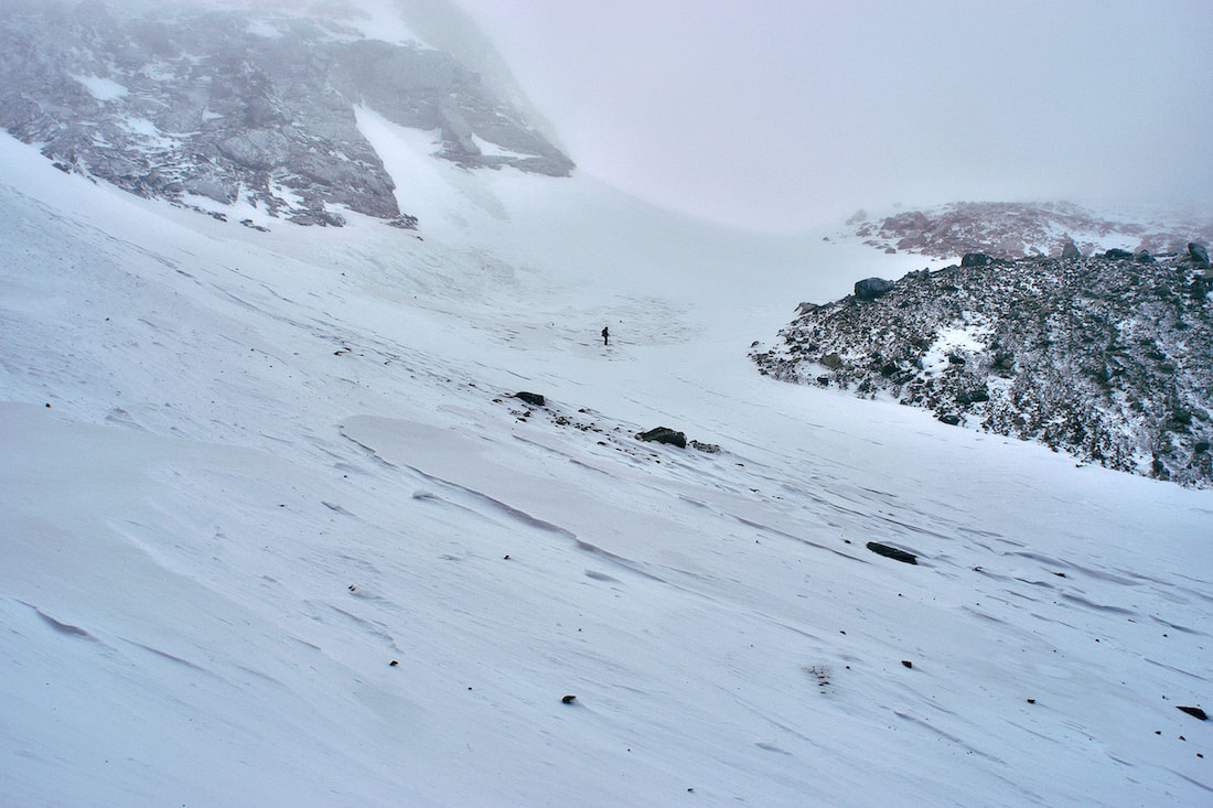
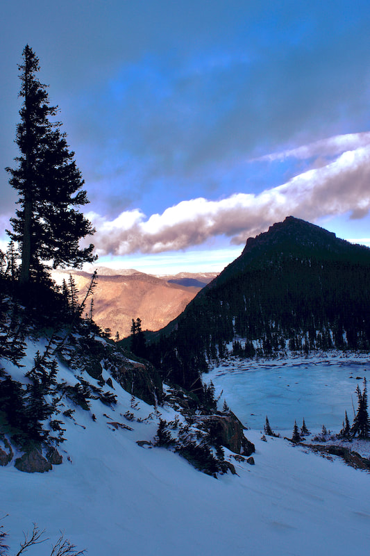
Trails Correspondent Marlene Borneman reports in on her recent trip to the West Side Of Rocky Mountain National Park: West Side RMNP This past week my husband and I got to spend time on the west side of RMNP. Please do not misunderstand when I say we have held the west side of Rocky special in our hearts for many years. We enjoy every square inch of Rocky from corner to corner. However, as soon as Trail Ridge Road opens in the spring until it closes in the fall, we hike, climb and backpack as much as possible on the west side of the divide. There is something about fewer trails, remote lakes/peaks and the sheer ruggedness that is a strong pull. The west side of the divide receives more precipitation resulting in lush, captivating forest, powerful waterfalls, vast meadows and a variety of plant life. Summer 2020 was no exception. We did several cross-country hikes and backpacking trips to remote areas. I’m pleased we took the time and effort to make these trips happen and fully took in all that surrounded us. Who knew what was to happen in the coming weeks that would dramatically take that away? I read reports and have seen a few photos of the trailheads from the fire damage, but nothing prepares you for hiking/snowshoeing the trails that are affected by the Troublesome Creek fire! The blacken sticks on the hillsides, charred lichen on rocks, the private cabin in Summerland Park along the North Inlet Trail destroyed. I worry about the streams; will they be healthy? I feel much discomfort, but strangely also comfort in nature’s healing. I am thankful for what the fire did not take away. Much of the Never Summer Range is intact, Timber Lake Trail, Colorado River Trail, Holzwarth Ranch intact. I saw bright spots among the destruction; snow on the ground and frozen ice crystals that will nourish plant life, a green ponderosa pine sapling, , the sunset over Mount Craig and Grand Avenue with shops and restaurants open for business.  Looking across frozen Grand Lake to the west viewing hillsides of sticks...  The Ranger Station at the entrance of RMNP on the West Side  Another view of Ranger Station at entrance west side RMNP  Near the Kawuneeche Visitor Center  A work of art by the hands of the Troublesome fire along the connector trail from the Kawuneeche Visitor Center down to the Tonahutu Trail 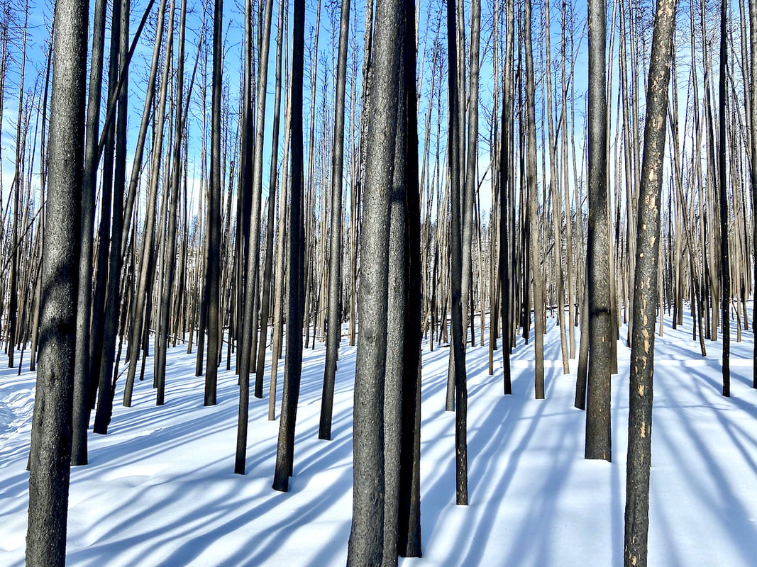 Long winter shadows on a forlorn forest in the wake of the Troublesome creek fire... 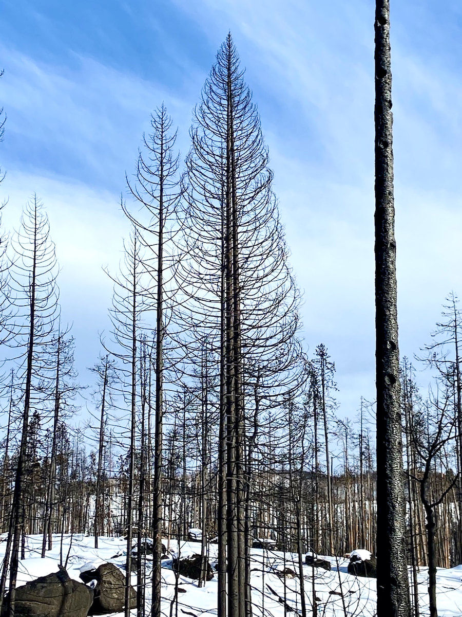 A large pine stripped from top to bottom left with a skeleton view along the Tonahutu Trail 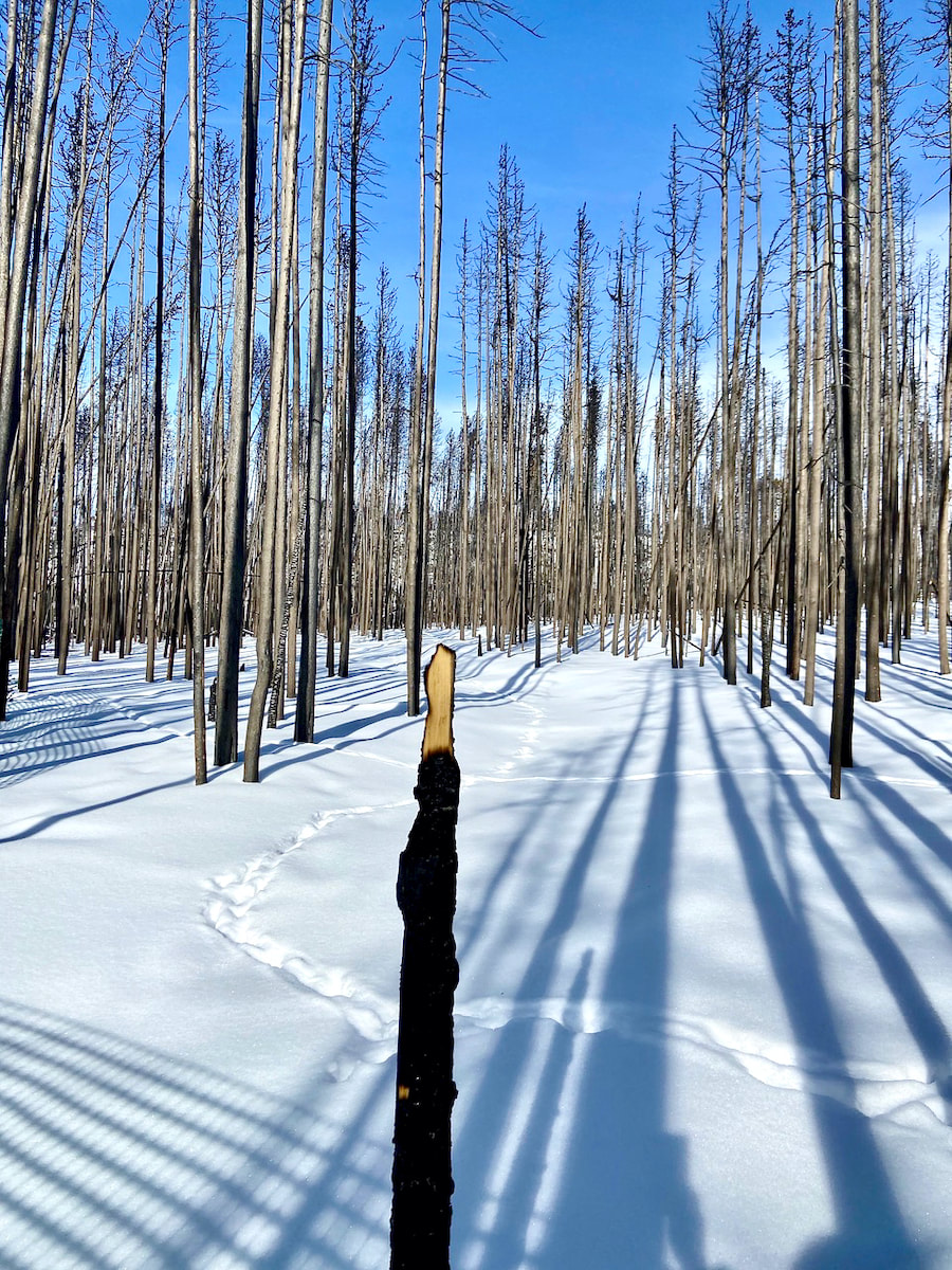 Remains of the sign post at the junction of the Tonahutu Trail and Kawuneeche Visitor Center 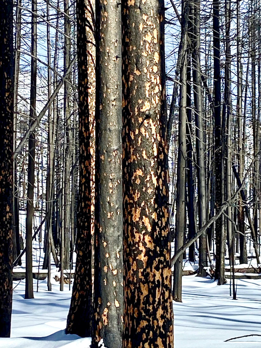 somehow these markings are beautiful! 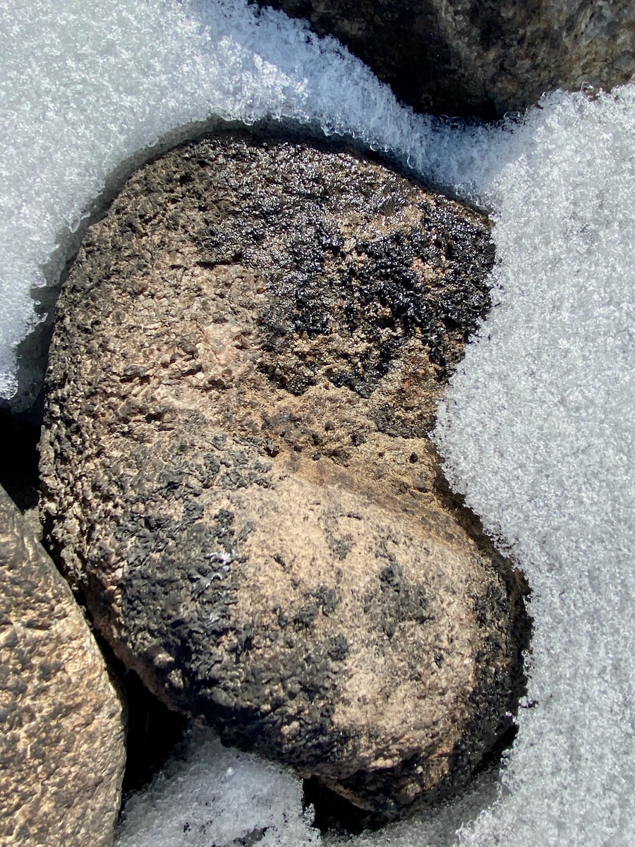 Burned lichen on a rock 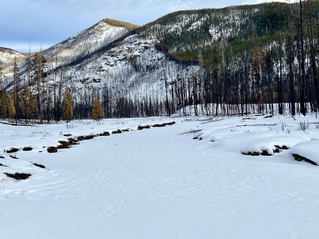 Along the North Inlet Trail 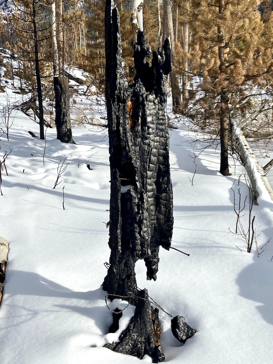 Along the North Inlet Trail 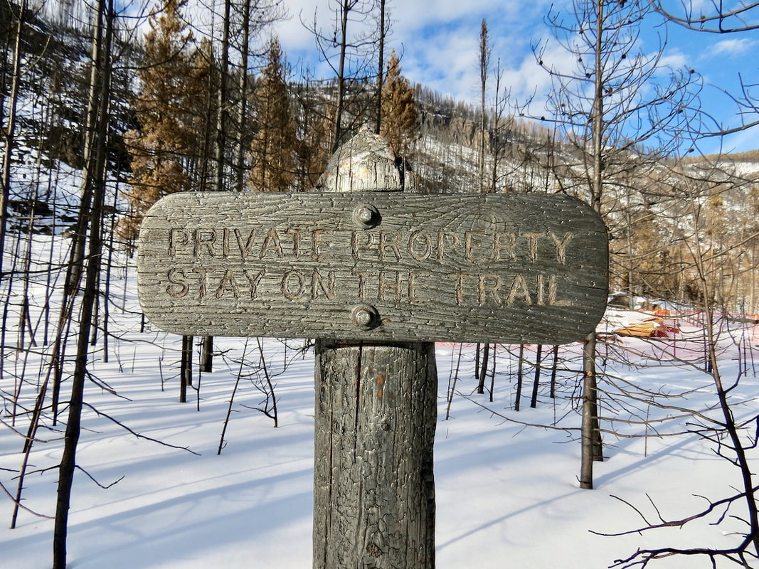 In Summerland Park along the North Inlet Trail RMNP charred sign marking private property with a cabin that burned 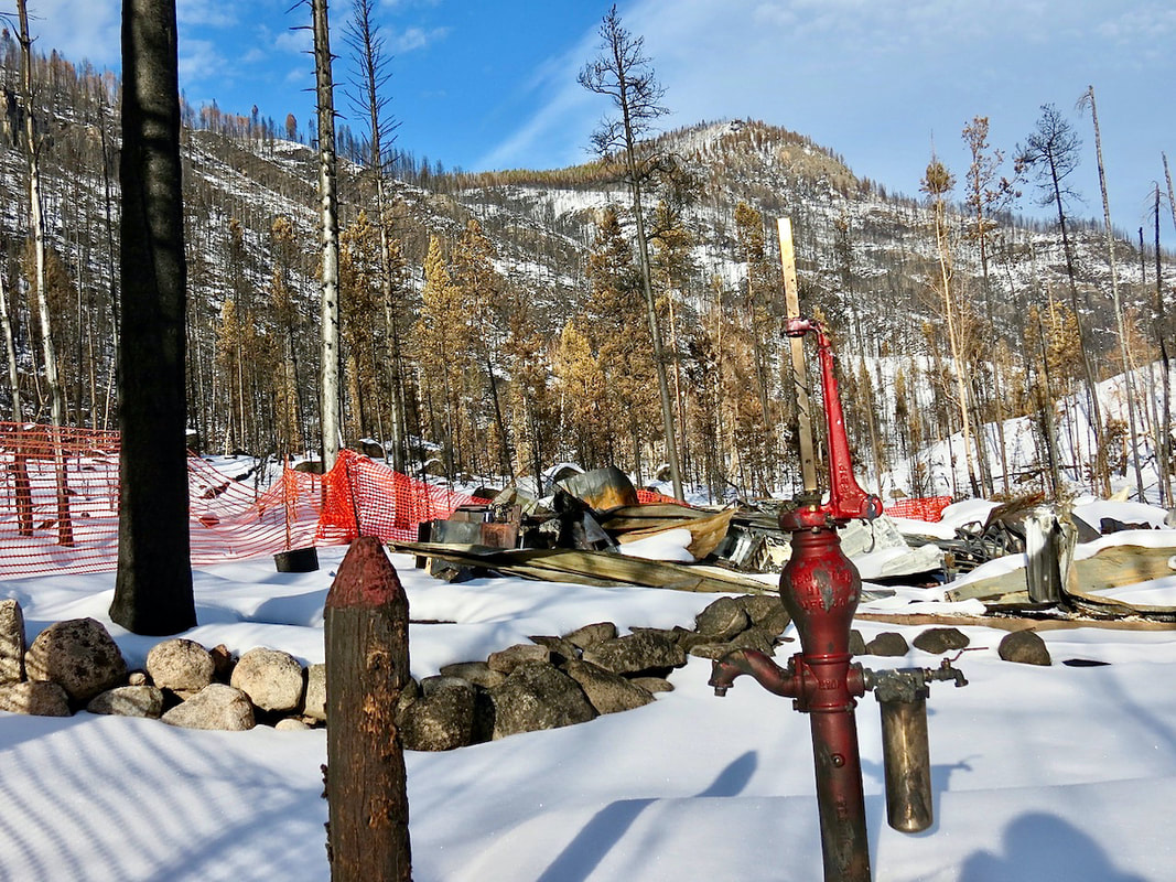 The private cabin in Summerland Park along the North Inlet Trail…. 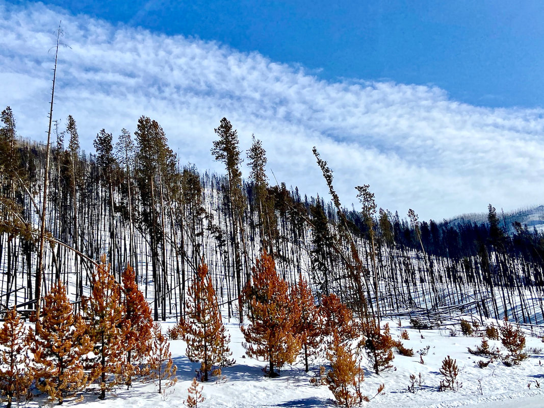 Right on Trail Ridge Road 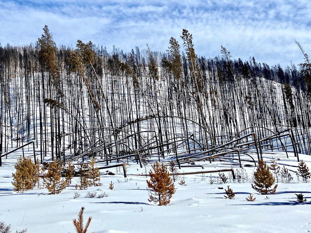 Right off Trail Ridge Road before leaving RMNP. Interesting with the trees snapped/ bent to the ground???  Looking west on Trail Ridge Road cleared hills as far as the eye can see... 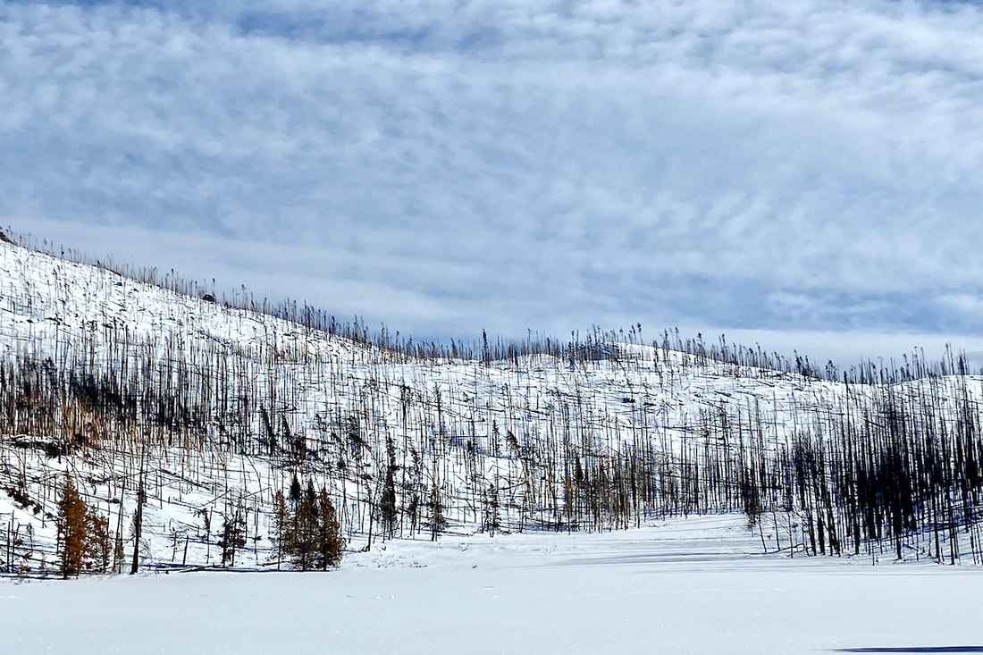 Driving on TRR 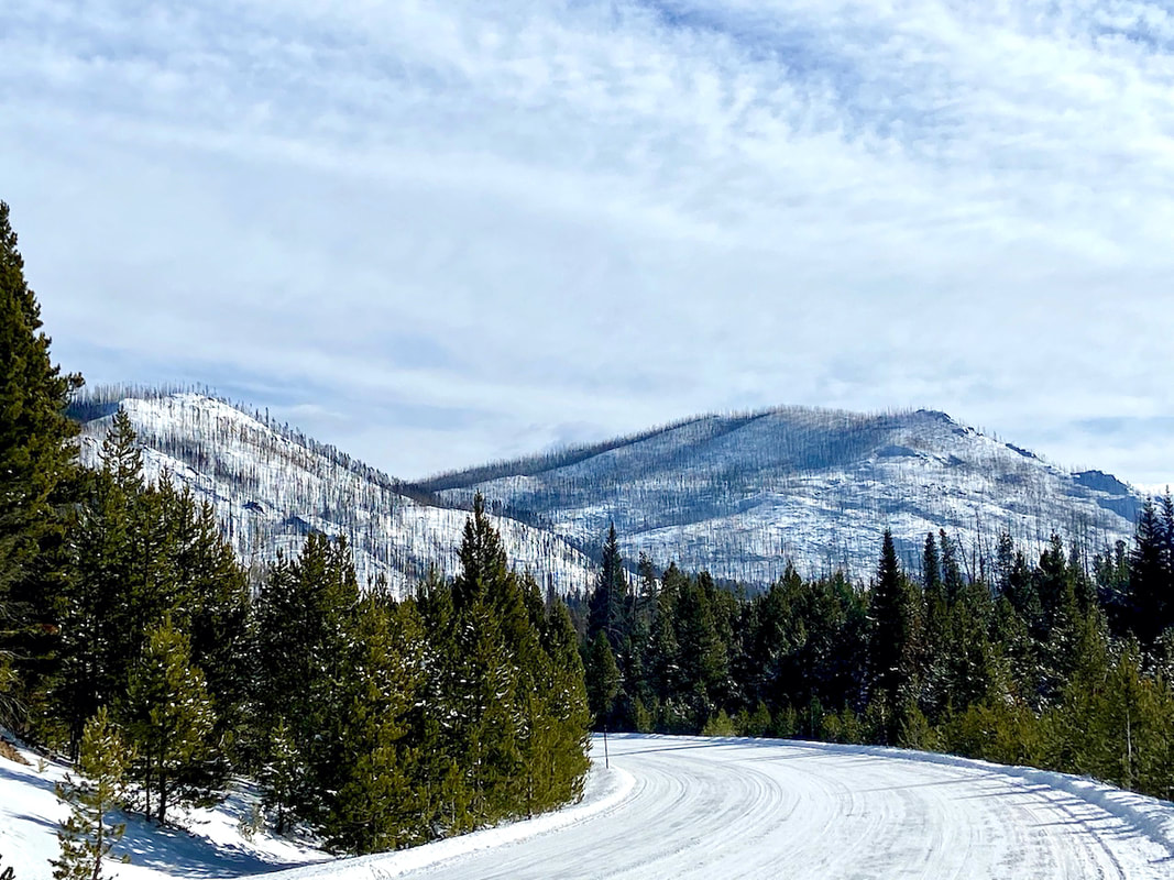 Heading into Grand Lake on Trail Ridge Road  One of my husband’s (Walt) favorite tree in the RMNP a Douglass Fir spared...  Timber Lake Parking Lot empty on a winter’s day 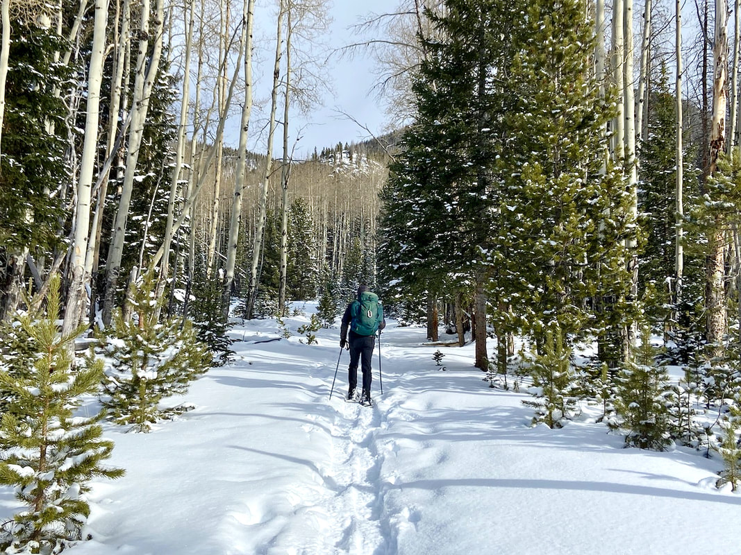 Snowshoeing Timber Lake Trail  Bluebird skis and white snow fluff on the Timber Lake Trail  Breaking trail on the Timber Lake Trail  Timber Lake Trail in winter 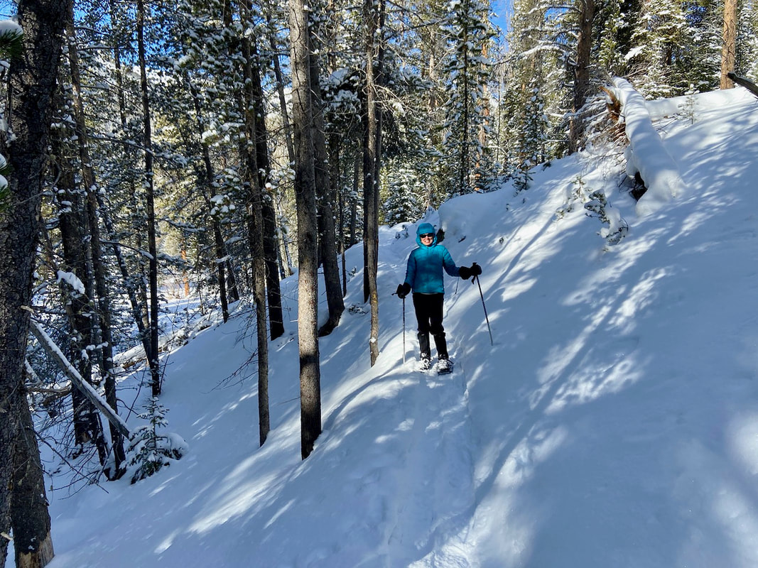 Snowshoeing Timber Lake Trail  Looked for signs of nature already healing form the Troublesome Creek Fire... Thank you Snowy Peaks Winery for sponsoring Notes From the Trail  Visit : www.snowypeakswinery.com The weather prediction for Estes Park was for sun on this first day of winter, the shortest day of the year, but a blanket of clouds hung low on the mountain peaks as we began our trek up the Flattop Mtn trail from Bear Lake on our way toward Odessa Lake.
The trail was mostly packed, but there was enough soft snow that we decided to put the snowshoes on early, we knew we would eventually. Morning sun filtered through the trees and the temperature was moderate.
 Most of the trail along the lower eastern flank of Flattop Mtn was packed and as we looked east into the Estes Valley, we could see that it was sunny, and lacking snow. But where we were, at just over 10,000ft, there was about 1-3 ft of settled snow. A little further on and you can see the fire scar on Mt Wuh.
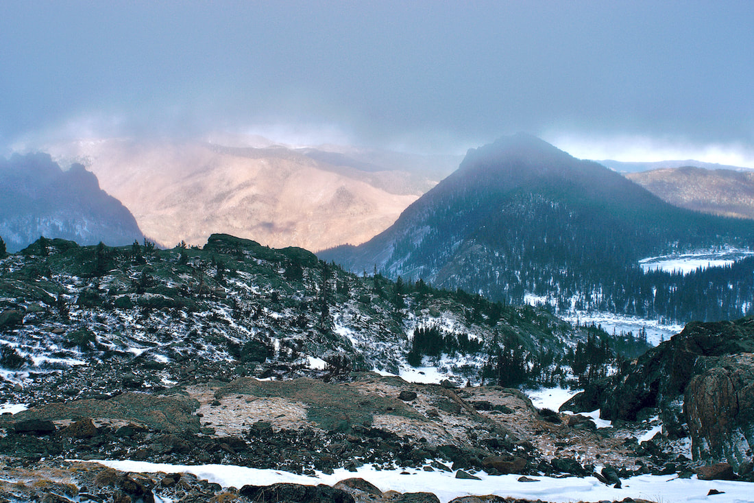
The trail travels through subalpine spruce and even though we were close to treeline at this point, there are some big spruce trees in this part. This is also a difficult section of trail to route fine in the winter as the trail often gets covered over with blown snow off Flattop Mtn in an area known in the winter as the Flattop Drift. 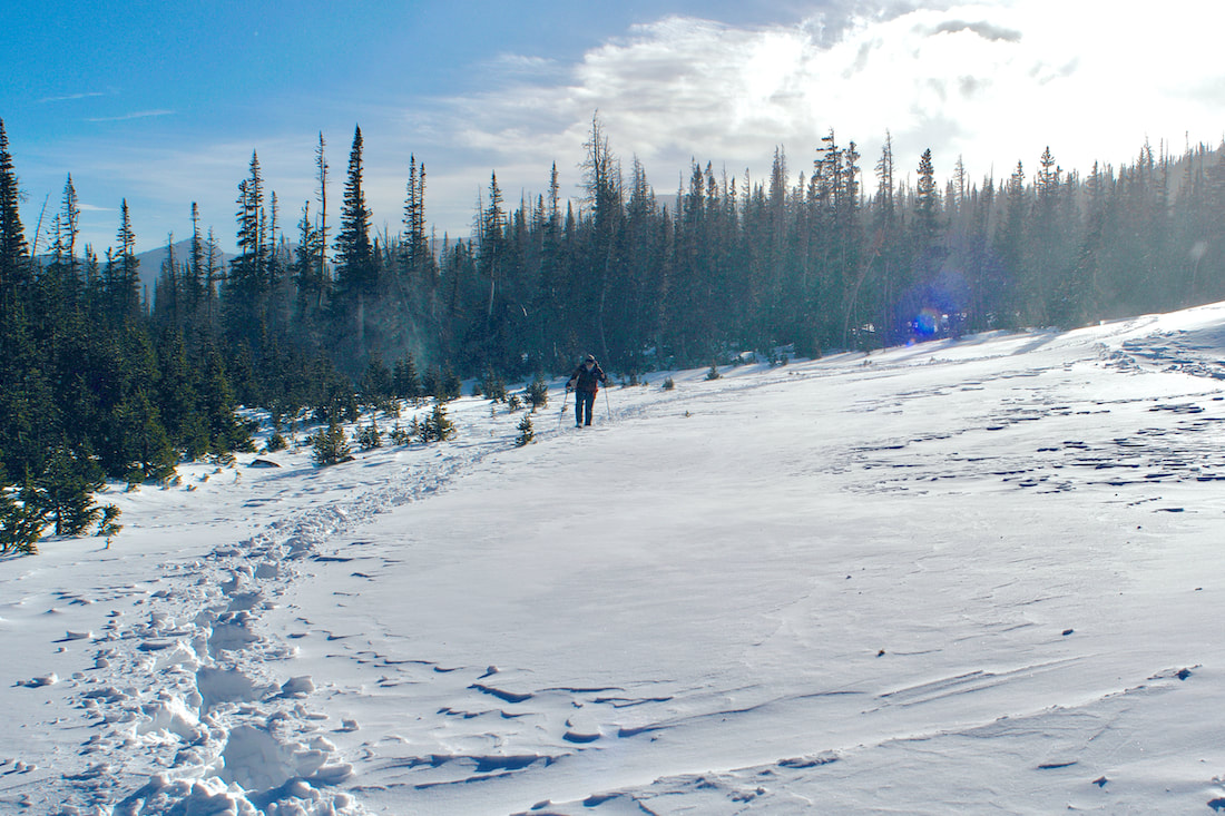 Keeping track of where to go can be difficult if no one has traveled through recently. It can also be a spot where you can follow the tracks of someone who doesn't know where the trail goes and you end up wandering around until you eventually happen upon the trail, or just make your own way. 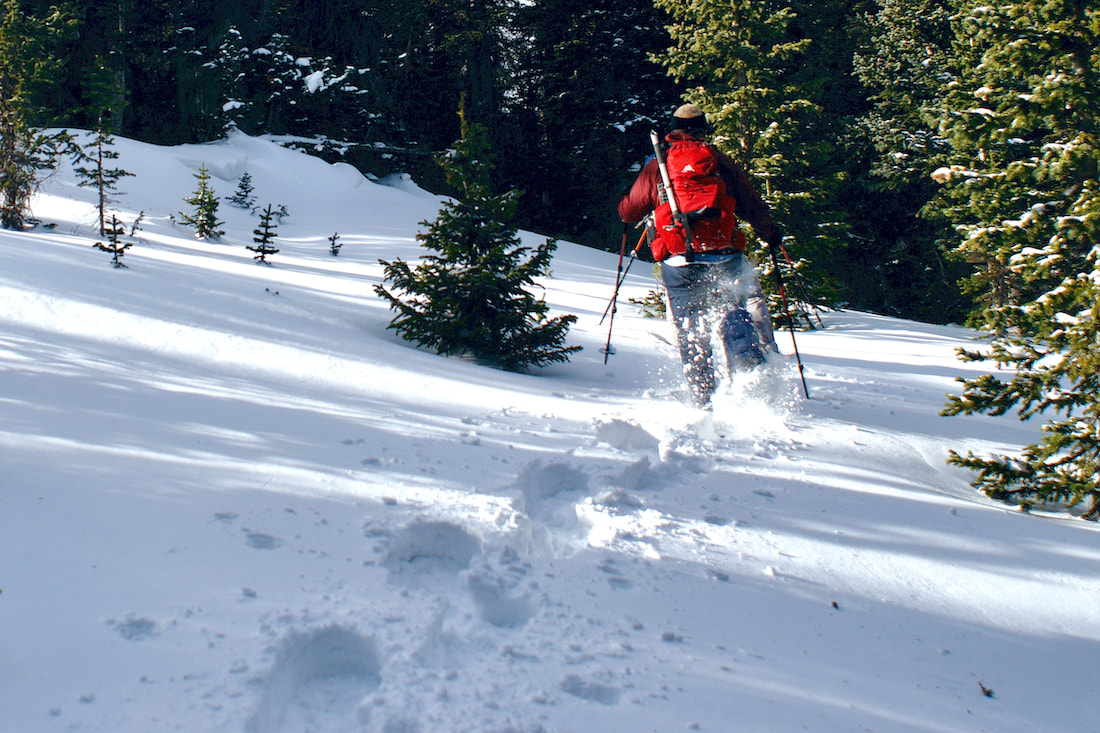 Once around on the north side of Flattop Mtn, before the trail descends into the Odessa Gorge, there are two smallish ponds, Two Rivers Lake and Lake Helene, that most people pass by in the summertime on their way to Odessa Lake, but become the common destinations in the winter. On a clear day, Notchtop Mtn rises dramatically and there are fabulous views from these two lakes. But on this day, unless the clouds began to lift off, most of Notchtop Mtn remained hidden from view.
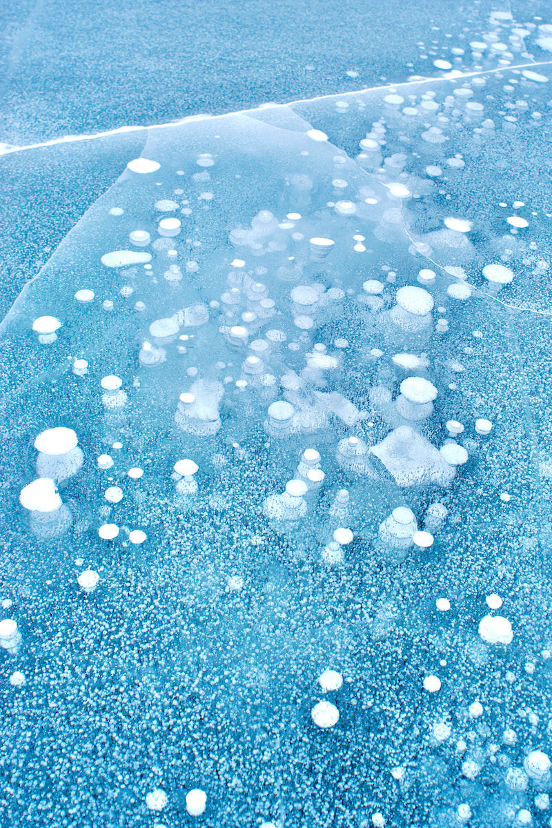
It was very windy at Lake Helene as is usually the case in the winter, and the lake was frozen over but free of snow. We braced ourselves against the wind and crossed over. We could tell we were right at the edge of the clouds, looking north Joe Mills Mtn kept appearing and then disappearing into the clouds. It would be like that all day. We continued past Lake Helene and started up towards Ptarmigan Glacier and into the clouds.   We really didn't have a specific destination at this point. It was a matter of how far could we safely go and leave enough time for the return before dark. Higher up, there is an unnamed tarn that sits roughly at the bottom of Ptarmigan Glacier.  We crossed over and marveled at the designs of the frozen air bubbles.
We had switched from snowshoes to spikes at this point and the travel up was slow, but it was easy to pick our way up the hillside. We were getting into some steeper terrain and in certain places there was a lot of debris on the snow that had come down from above. 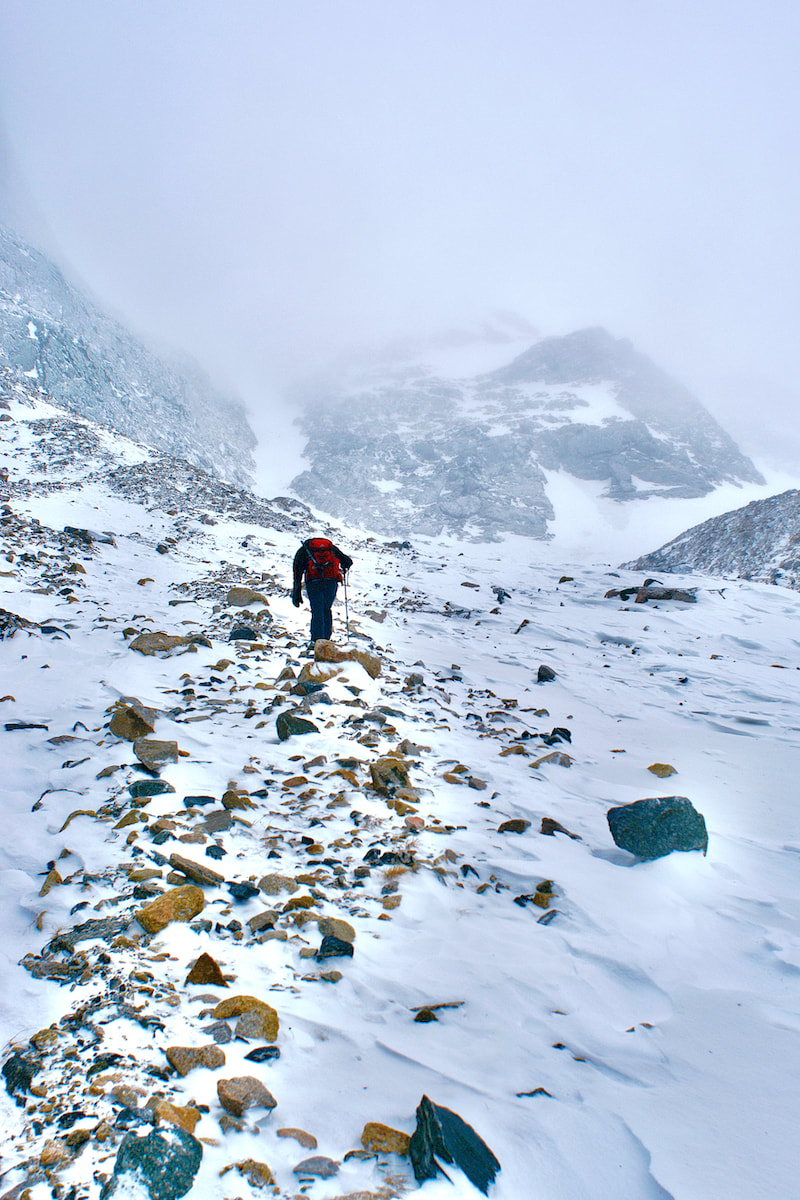 We crossed over a snowfield to a rock outcrop and decided we had reached our high point for the day.
It had been our hope that as the day went on the clouds would begin to lift and give us that magical site of mountains emerging through the clouds. But the clouds just hung in there only giving us glimpses of the sunny day beyond. We made our way over to Two Rivers Lake before returning to the trail.
It had been a great first day of winter!
Yesterday was Winter Solstice. Over the last 48 hours or so, on the last day of Fall, we have been experiencing a winter wind storm with steady nonstop high winds and incredibly forceful gusts. The kind of wind that if you were a pica up in the tundra, you would want to be deep in your little cozy hole, far below the surface, surrounded by lots of dry flowers and grasses, curled up in a tight ball, fast sleep with visions of sugar-plums dancing in your head, while the wind ravaged those poor little tundra plants at the surface. It’s the kind of wind that sculptures bristlecone pine trees into marvelous twisted living art. The kind of wind that is so forceful it inspires awe. Having completed our shakedown trek to Sky Pond two weeks earlier, my brother and I felt ready to take on winter as it is on the east side of the Divide. So, late in the week last week we decided to head to Andrews Glacier, one of the eight named glaciers in Rocky Mountain National Park. Andrews Glacier sits between Taylor Peak to the south and Otis Peak to the north. Andrews Tarn is nestled at the base of the Andrews Glacier which, over the centuries, carved out a very high hanging valley that sits on the other side of The Sharkstooth Ridge from Sky Pond.
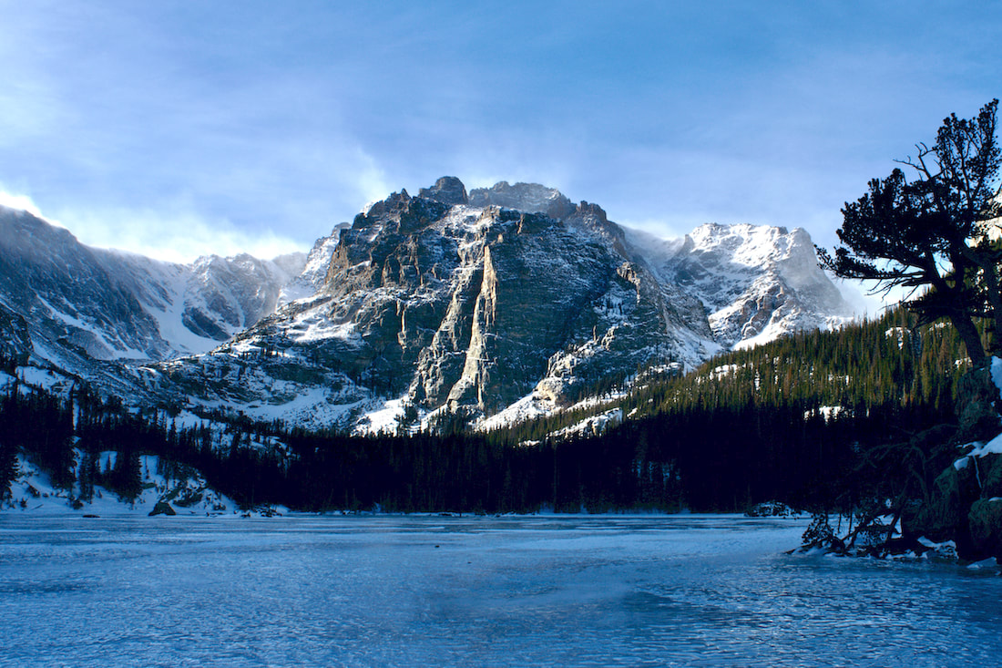
Still, it was warm enough that as we worked our way up, I would occasionally pull off my cap off my head to regulate my body temperature. Once I cooled down enough, the cap went back on. We continued up the Sky Pond trail until crossing on the footbridge that spans Andrews Creek, and then branched off the main trail and began heading into the Andrews Creek drainage.
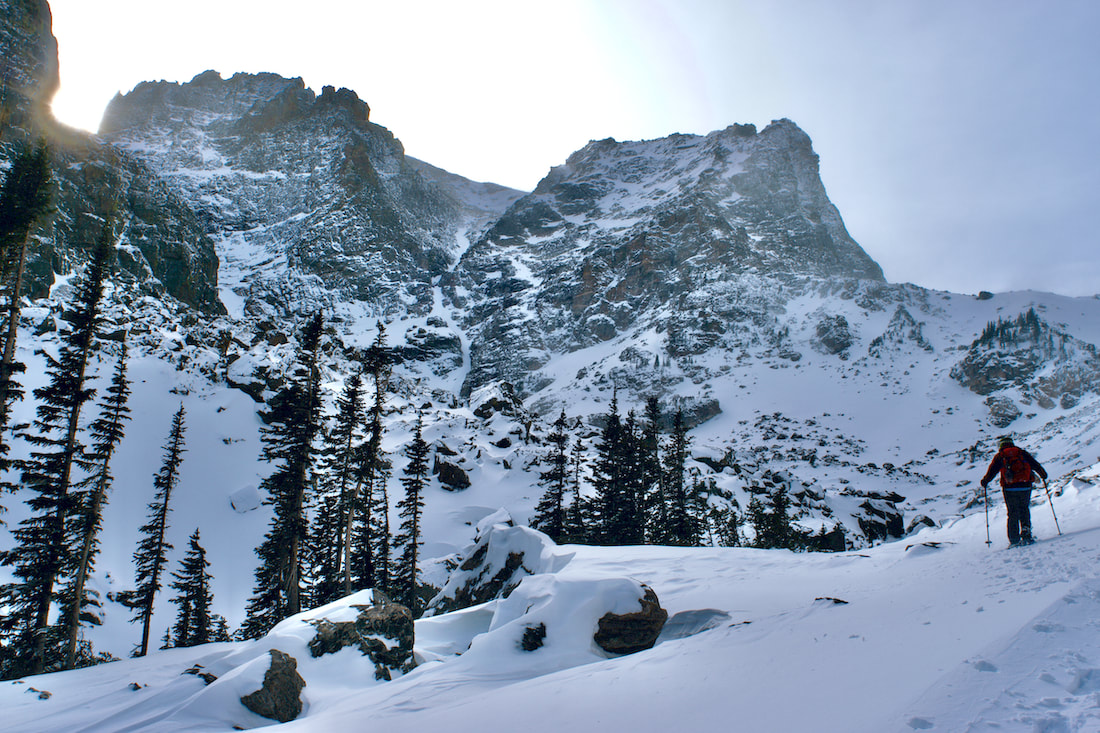
 The snow remained soft and we were aware that, in certain places, there was the potential for creating a small snow slide, so we stayed near the trees until we ascertained the small ridge that led up to the Tarn. That was the last stretch, and it proved to be a challenge. 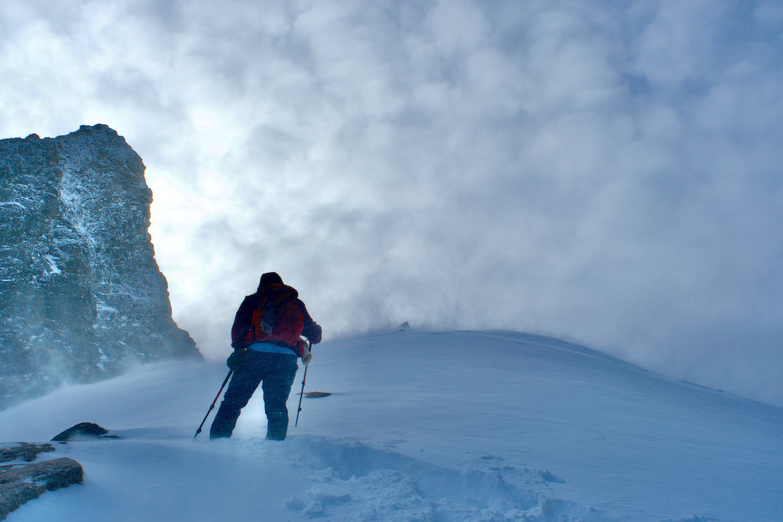 The wind was steady at this point and the snow, even on the crest of the ridge, was fairly deep and sugary. Every time Kip would attempt a big step up, the snow underneath slid and he would loose his footing. The day of breaking trail had taken a toll and making progress became frustrating. Having taken the easier task of following for most of the day, I offered to make an attempt to break the path up this final stretch. I jammed the toe of my snowshoes deep into the snow and pushed down trying to make a step, which worked most of the time. Slow progress with rests kept us moving up and we finally made it to The Tarn. Our hard efforts were rewarded with the strongest, most forceful winds of the day. The wind was ferocious. There would be no lingering for afternoon snacks here. I quickly moved into a position to snap a few photos that I hoped would turn out, then we carefully worked our way back down out of the blast. 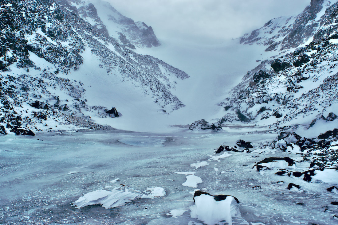 Once down into the treeline, we did not follow our tracks out, but choose instead to stay in the basin until we reached the Sky Pond trail, completing our loop. Our legs were tired, but we knew darkness was approaching quickly. We barely beat the darkness back to the parking lot and found that we were the last car in the lot. Cheers went up at what had turned into an adventurous day. It was 17 days before the Winter Solstice and the sun was getting low on the horizon. The temperature above 9,000ft had stayed below freezing, but on this day, the temperature hovered near the freezing mark and the sun felt warm, even spring like. 17 days after Winter Solstice would put us into early January and I would hope by then the temperature would feel considerably colder. (Click on the photos for a larger image)
In other words, it was a pretty mild day, on top a string of mild days, for our first winter venture out for the season. My hiking partner and I were heading up the four and a half miles to Sky Pond. We found the trail covered with packed snow, but not icy, so we knew there had not been very many days above freezing, which would make the trail icy with the melting and freezing.
Alberta Falls was pretty well frozen over with thick ice for the winter, though we could hear the water flowing below the ice, but snow had not yet covered over the falls. It had been a while since there had been any significant snowfall.
Not far past the falls and a short step off the trail there's an overlook that looks off to the north. To the left, the crags of Flattop Mtn above Emerald Lake are barely visible. In the foreground, the Bear Lake Road switchbacks up, and off in the distance were the snowy Mummy Range. Normally, those would be the notable features to point out at this spot. But this year, sitting in the middle of all of that is Mt Wuh and the burn scar visible on its' western slope from the recent Troublesome fire. That part of the Park is currently closed to hikers.
We continue on, following the windy trail around the east Glacier Knob until, finally around its east flank, the Loch Vale comes into spectacular view. Even though it was near mid-day, the low sun cast bands of sunlight across the scene. But in the far distance, the Taylor Peak massif basked in the midday sun.
It was quite a stellar day once we reach The Loch. The lake had completely frozen over and there were many tracks that headed across it, which we followed. There was about and inch of snow on top of the ice, which indicated that there had not been even a wiff of wind since whenever the last little bit of snow fell, very unusual. Timberline Falls was, of course, spectacularly frozen over and on the return, we watched as a couple of ice climbers make short work of a one pitch ascent of the right falls.
This was a shake down hike. We had gathered our winter gear and needed to figure out what we had forgotten for future trips. But we felt we scored a pretty good first winter day out with fantastic conditions.
Now, bring on the snowstorms!! We're ready!! by Marlene Borneman 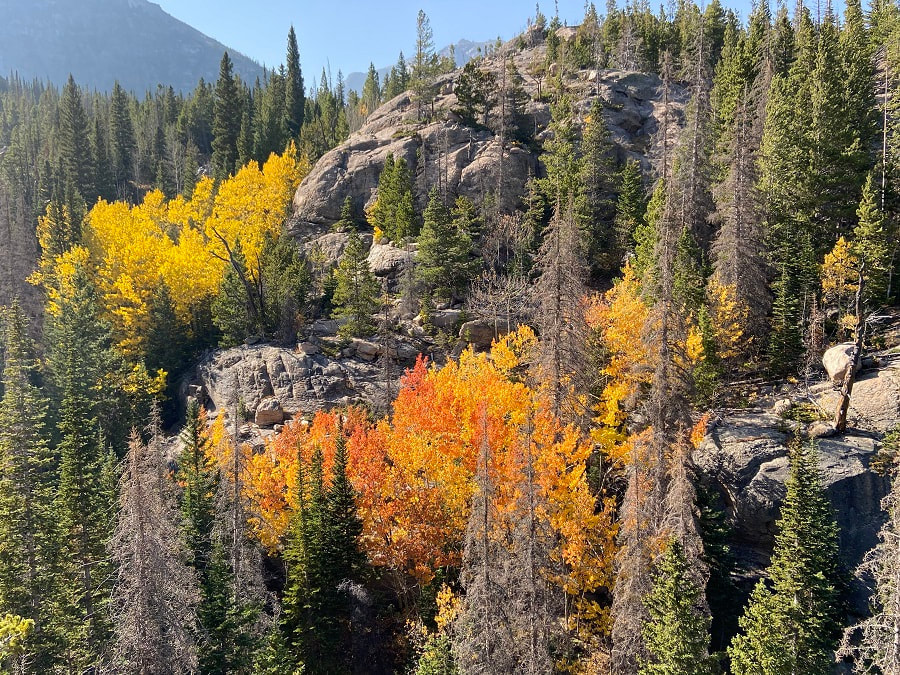 I began at the Glacier Gorge trailhead around 6:30a.m as it was getting light. I was greeted by Colorado’s golden aspen trees. I followed the well marked trail up about a quarter of a mile to the Glacier Gorge Junction. I revel in the subalpine and alpine environments in Rocky Mountain National Park. So with the perfect autumn weather this past week my husband and I headed out for Frozen Lake. I note this is a cross-country hike. I would recommend be familiar with Leave No Trace ethics, be prepared with the ten essentials, have experienced hiking in uneven terrain, boulder/scree slopes, slabs, route finding and lastly do not hike off trail alone. Trailhead: Glacier Gorge Round trip miles: 12 Destination elevation: 11,580 feet Trailhead elevation: 9,180 feet Elevation gain: 2,400 feet I headed south passing Alberta Falls, Mills Lake, Jewel Lake and about at mile five arrived at Black Lake. Right before Black Lake came into view I enjoyed a snack at Ribbon Falls. 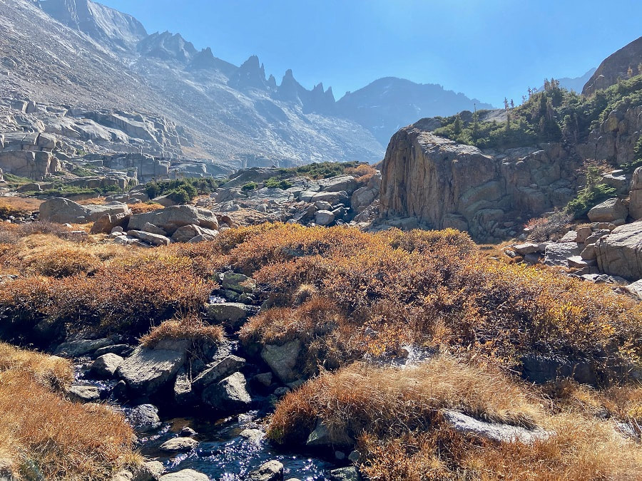 Shimmering willows Then, I headed east up a use trail along the outlet stream with shimmering willows in the sunlight. I was careful not to slip on the slab rocks guiding the stream. I soon topped out to a glorious view that made me dizzy… (from left going right) Longs Peak, Pagoda, Spearhead, Chiefs Head, McHenrys and Arrowhead. There are many cairns going in different directions. But I avoided the krummholz and headed around a small tarn; then, I skirted the north side of Spearhead following sparsely-spaced cairns. The terrain was steep, so again I paid close attention to my footing. I found a use trail at the base of Spearhead and followed it on loose rock to the west side. I then found myself on a little easier ground heading southwest crossing large slabs to Frozen Lake. 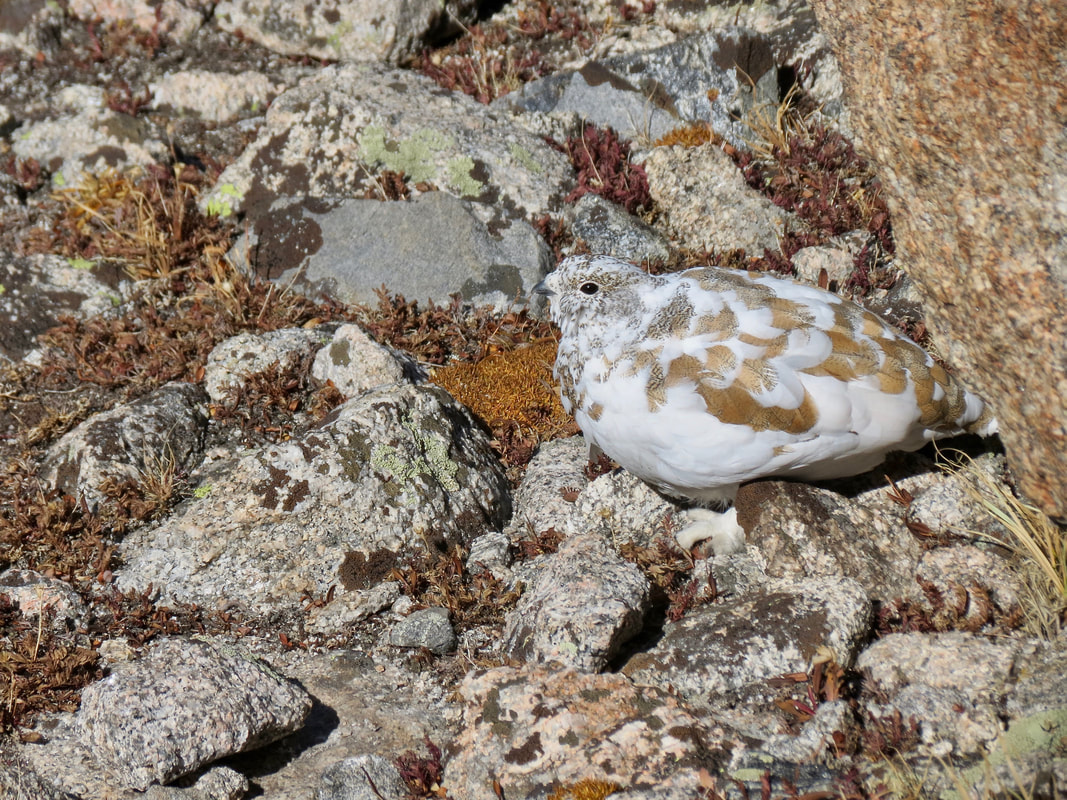 A white-tailed ptarmigan changing into its winter coat. 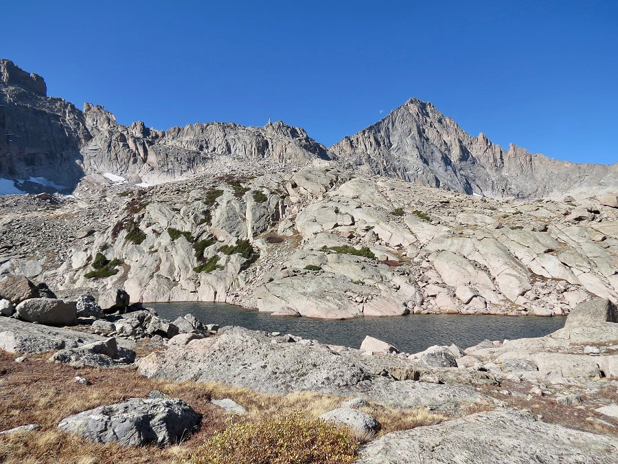 McHenrys Peak and Stone Man Pass make a stunning setting for Frozen Lake.
The days are getting shorter and a sunrise start for the dayhiker is much later now. As I met my hiking partner in Grand Lake, there was a definite autumn wind that was rustling the gold aspen leaves around town. A mild cool front had moved into the area the night before and there was more than a little winter nip in the air on this morning. Our destination on this crisp, blue sky day was Lake Verna, and then perhaps to some of the lakes beyond, as the shorter daylight of late September would allow.
This is an excellent trail with a lot of diverse terrain and numerous destinations at different lengths. As with many trails in the Park, this one starts wide and smooth, the short hike to Adams Falls is very popular with many of the visitors to Grand Lake. After taking the short detour off the main trail to check out the falls, the valley opens wide into the East Meadow where the East Inlet Creek meanders through before eventually flowing into the east end of Grand Lake.
We listened to the echoing sound of a bull elk bugling somewhere in the meadow, but he was no where to be seen. At this time of year, the wide creek is moving so slow that the breeze coming from Grand Lake put a ripple on the stream that made it look like it was flowing backwards, I had to give it a double look to figure out what I was seeing. Farther up the hill, we could see fall aspen leaves and pretty soon the trail led us right into the aspen grove.
This is the first of several uphill stretches on the trail. This one leads to a second possible destination 3 miles from the trailhead, some broad rock outcrops that overlooks Grand Lake at the end of the wide, glaciated U-shaped valley.
These rock outcrops provide a nice place for a snack break or even a picnic if you wish to make this your destination. One of the things that is noticeable from here are the many dead lodgepole pines from the Pine Beetle epidemic. It is hard for me to imagine that the most significant damage occurred over 15 years ago. But I also noticed a healthy stand of trees coming up in their place. For more information, click here, here, and here. One of the interesting parts of this trail are the pockets of large spruce forests that seem more out of the Pacific Northwest than the rocky mountains. As we walked through these beautiful sections, we were struck by a large number of very recent blow down trees, and these were big trees.
A few weeks earlier in September, Rocky Mountain National Park received an unusually early snow storm. Apparently, there were significant high winds in Grand County associated with that storm. Fortunately for us, the Park trail crews had been very busy, and much of the trail was clear. A second stretch of uphill lands us at Lone Pine Lake, now 5.5 miles from the trailhead and another good destination or a break spot. The ducks swimming around seemed unconcerned by how late in the season it was or how cold it was getting at night. It was warm and calm when we arrived there. 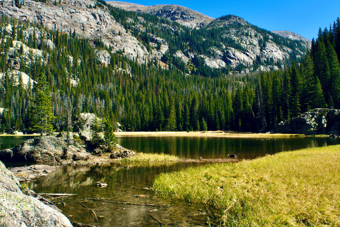 Lone Pine Lake The trail travels around the southeast shoreline of the lake before dipping briefly back into another deep and beautiful spruce forest. The trail then switchbacks up through the forest before popping out into more familiar rocky mountain terrain.
At this point, most of the elevation has been gained and before too long, the long Lake Verna suddenly comes into into view, 6.9 miles in. Verna was apparently a sweetheart of a member of the US Geological Survey (according to the book, High Country Names, 1977). 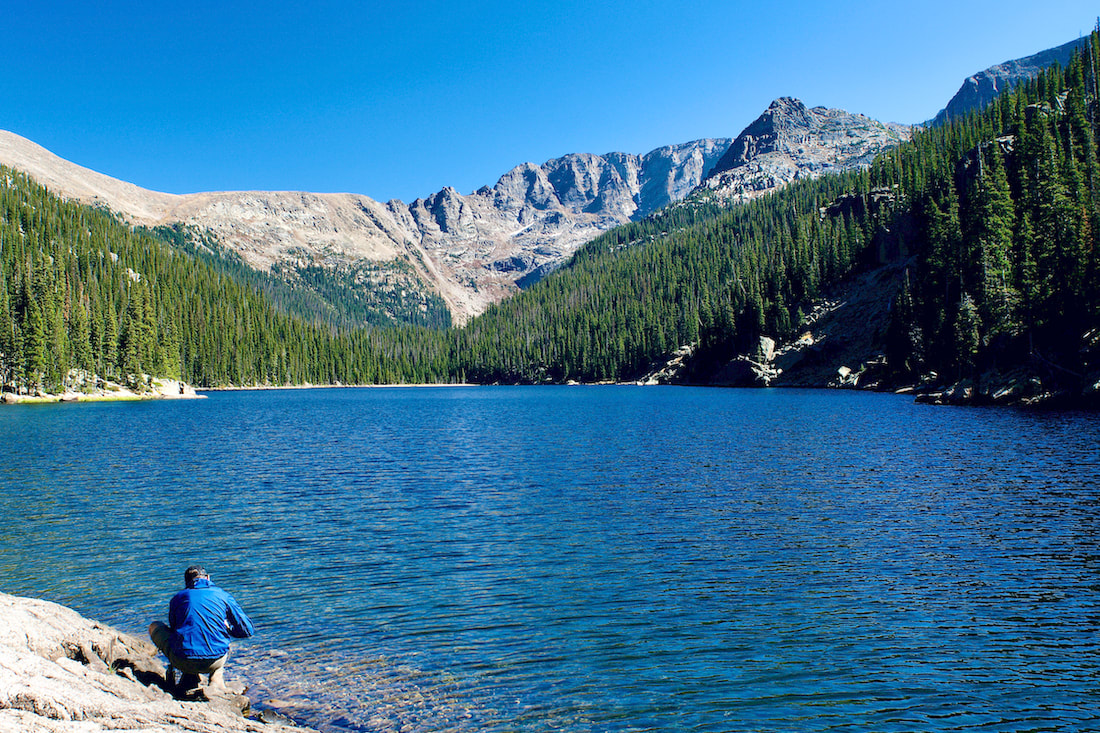 Lake Verna Looking up to the eastern ridge line, you can see the Boulder-Grand Pass to the left. The maintained trail ends at the beginning of the lake, but a smaller unimproved trail continues tight along the northern shoreline and on up into the valley. Two more large lakes, Spirit Lake and Fourth Lake can be found following this narrow trail, though we also encountered some new blow down to navigate around.
On our hike, we watched a couple of Bald Eagles soaring over Fourth Lake. There was also an immature Bald Eagle that flew right overhead. On this day, with the shorter days upon us, this was as far as we made it. But I have journeyed up to Fifth Lake on another hike, a beautiful but smaller alpine lake that sits right at treeline at the base of Isolation Peak. 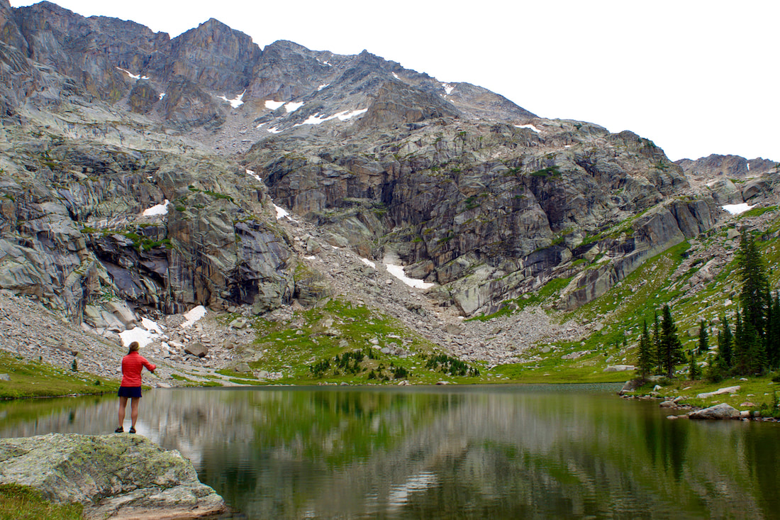 Rebecca Detterline fly fishing at Fifth Lake The late day sunlight on our return gave a new look to the territory we had already seen earlier.
Dropping back into the East Meadow at dusk, we watch a young bull moose strolling across the meadow, taking a snack break when he crossed the stream. My wide angle lens didn't do much to bring that moose closer, but what a magnificent scene! 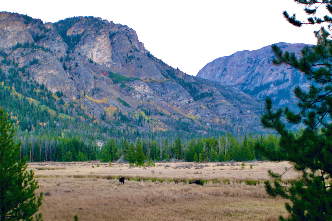 Having covered most of the distance back, we paused to watch the nearly full Harvest moon rise at sunset over Mt Craig. A beautiful hike on a beautiful day! 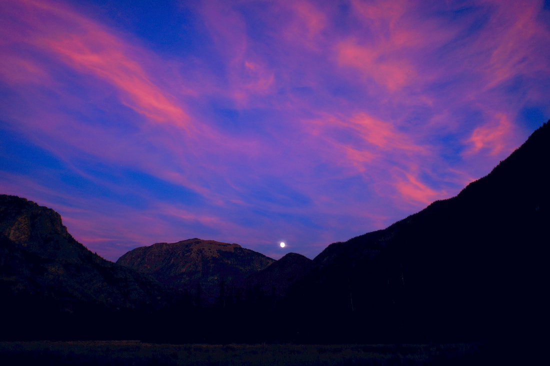 Trailhead: Wild Basin Trailhead Elevation: 8,500' Destination Elevation: 10,025' Elevation Gain: 1,525' Roundtrip Miles: 9.8 Recently, the Cameron Peak fire was blown into the northwest section of the Park. The devastation from that fire will be noticeable for many years to come. By taking a hike up to Ouzel Lake, we can imagine how things will look in that section of the Park in another 40 years. This last August marked the 42nd anniversary of the Ouzel Fire which started as a lightening strike in the southeast corner of the Park. Last week, on an afternoon when the fall colors were starting to come into their own, I ventured up the 4.9 miles to Ouzel Lake. 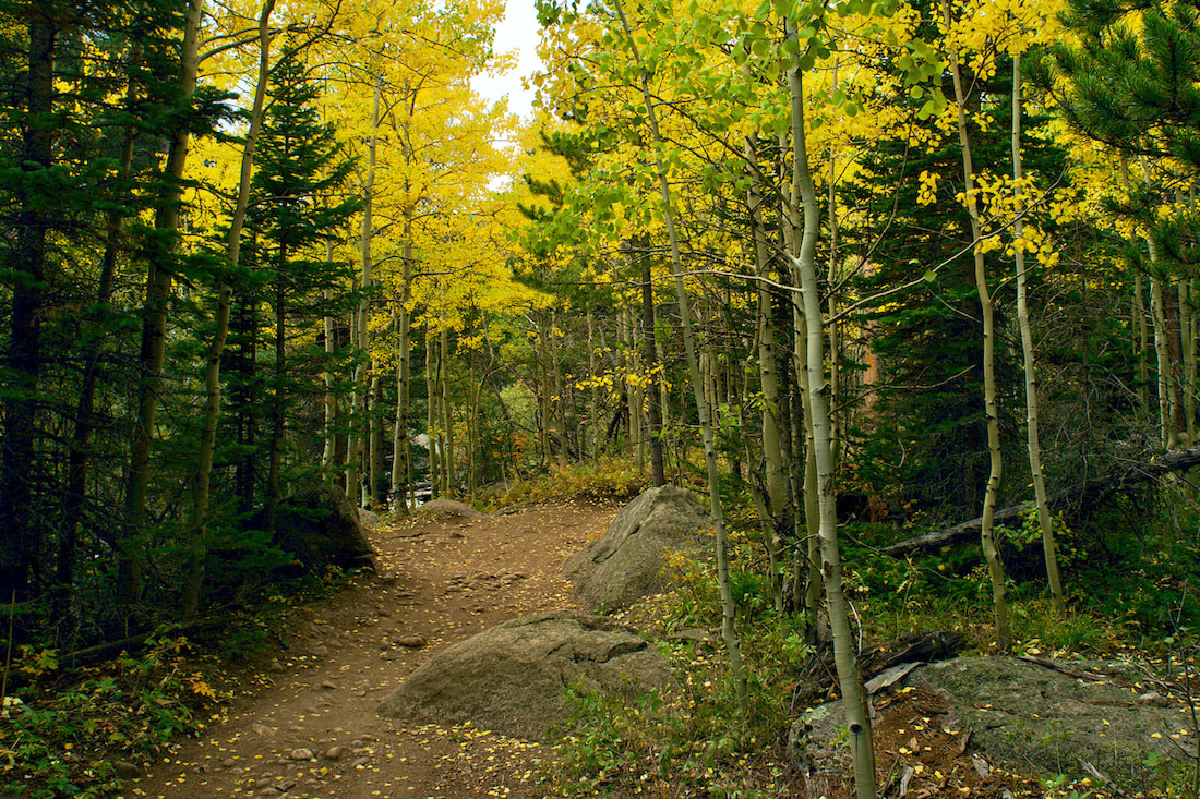 It was a late day hike. I didn't leave the Wild Basin trailhead until almost 3:30 in the afternoon. I knew that by the time I walked the 4.9 miles to Ouzel Lake, it would be 6 or 6:30 and it would be dark by the time I returned to the lot, so I checked the batteries for my head lamp and threw that in the pack.
The afternoon had clouded up and I encountered some rain on the drive south from Estes Park toward Wild Basin. But there was just occasional drizzle as I started my hike, not enough to get anything damp. Many of the aspen tree were still green, but those that had turned colors looked spectacular! 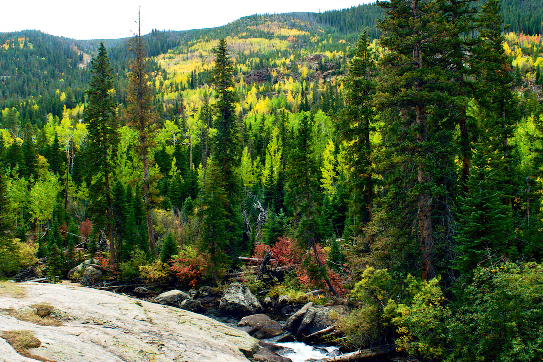 An open hillside from the Ouzel Fire filling in with aspens As I hiked on, I wasn't too sure if the rain would pick back up, or would clear up. There wasn't a lot of water flowing down the Calypso Cascades when I crossed the bridges there and, knowing the water flow would be light, I went by the Ouzel Falls without much of a look there. 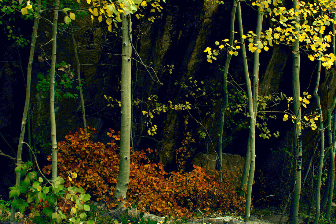 My attention was mostly toward stopping to capture the fall colors as I quickly moved up the trail. I was glad to see the clouds breaking up once I hiked past Ouzel Falls. 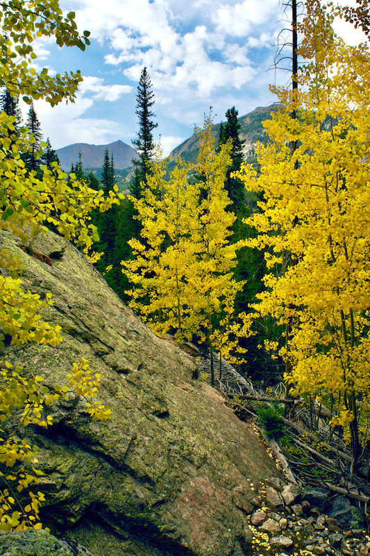 Mt Alice Sun was starting to get low on the western horizon when I reached the Bluebird Lake trail cutoff at just over 3 miles. The trail junction is in deep, dark forest being surrounded by tall spruce. But the trail quickly switchbacks up to the more open ridge that follows Ouzel Creek. This is where the hiker can best experience the 40 year natural restoration from the Ouzel Fire. 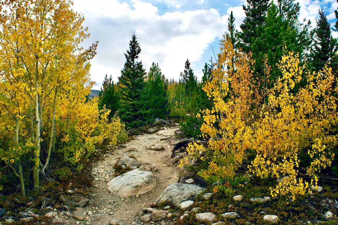 Fall Colors Along the Bluebird Lake trail I remember hiking this section of trail the summer after the fire in '79 and noticing how terrible things looked. It was a mostly barren landscape then. 40 years later, I could see the area was still a very long way from being fully recovered, but there was a healthy mix of aspen and spruce that were well on there way. 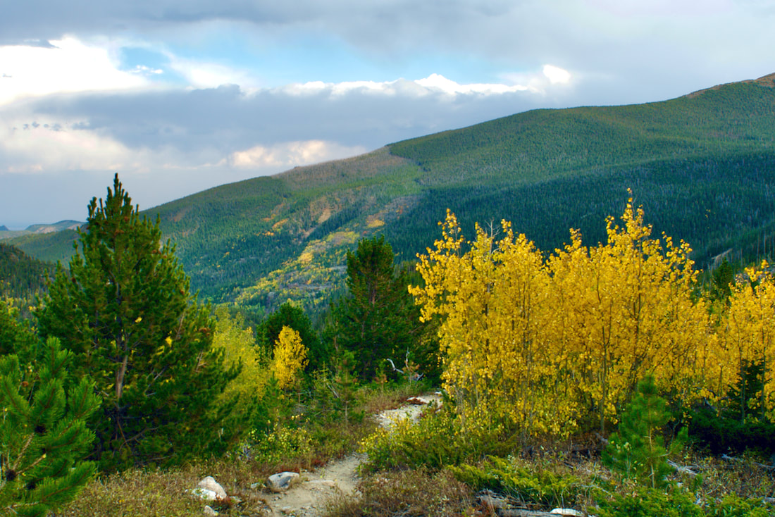 The path of the Ouzel Fire can be seen on the hillside in the distance  Along this section of the trail, there were a few scattered dead trees that rose up over the new growth, ghostly remnants of the fire that sometimes gave the appearance of flames. One burned out log had fallen across the trail and I hoped the trail crews would leave it lay instead of cutting it up. I felt like it was an old soldier with the scars of battle showing.
The fire opened the once forested ground to sunlight and part of the evolving ecological revegetation cycle allows for new plants and wildflowers to thrive.
The late day sun made for good photography with long shadows and backlit leaves. But I knew I wouldn't have too much daylight left by the time I got to the lake. Fortunately, I was near the trail cutoff.  There was just a little bit of daylight on the hillside as I approached the lake. Barely enough light to get some photographs if I hurried.  Ouzel Lake I loved the orange tinged grass that highlighted the edge of the eastern shoreline  The grassy shoreline was muddy and in places showed a little too much trampling from people walking around. I tried to step carefully so as to not contribute to the trampling. It took me two and a half hours to get to the lake, stopping for photographs along the way. I packed my camera into my day pack and left the lake at 6:30. It only took me an hour and a half to get back to the car. What a great hike! 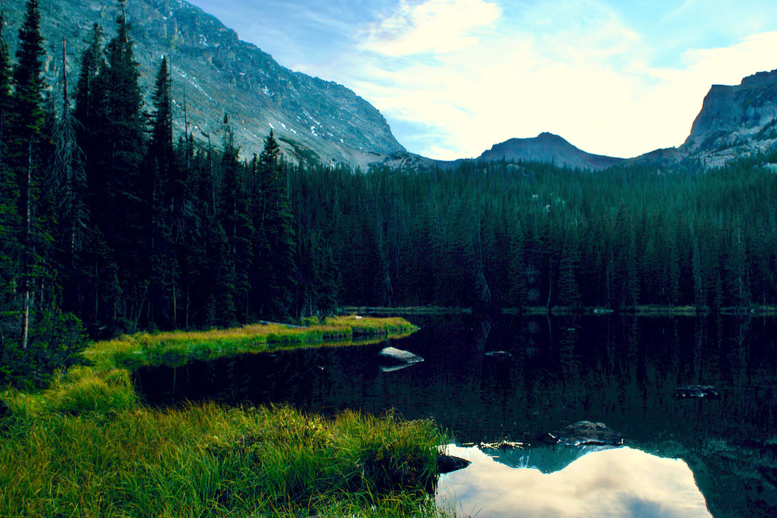 Ouzel Lake with Ouzel Peak |
"The wild requires that we learn the terrain, nod to all the plants and animals and birds, ford the streams and cross the ridges, and tell a good story when we get back home." ~ Gary Snyder
Categories
All
“Hiking -I don’t like either the word or the thing. People ought to saunter in the mountains - not hike! Do you know the origin of the word ‘saunter?’ It’s a beautiful word. Away back in the Middle Ages people used to go on pilgrimages to the Holy Land, and when people in the villages through which they passed asked where they were going, they would reply, A la sainte terre,’ ‘To the Holy Land.’ And so they became known as sainte-terre-ers or saunterers. Now these mountains are our Holy Land, and we ought to saunter through them reverently, not ‘hike’ through them.” ~ John Muir 
|