|
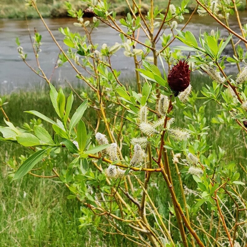
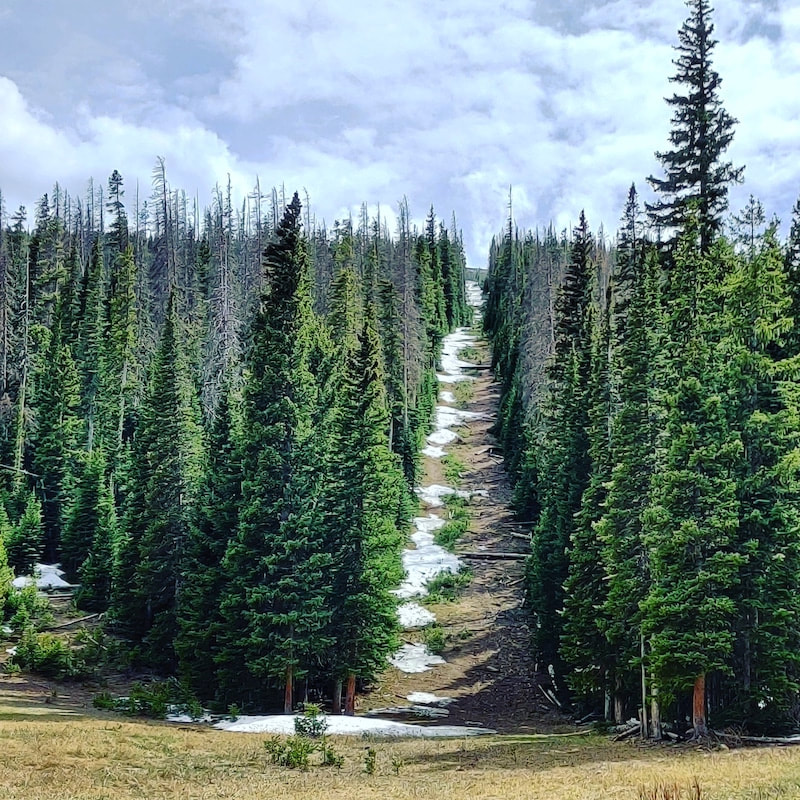
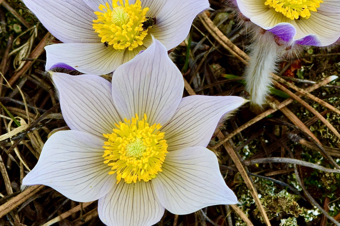
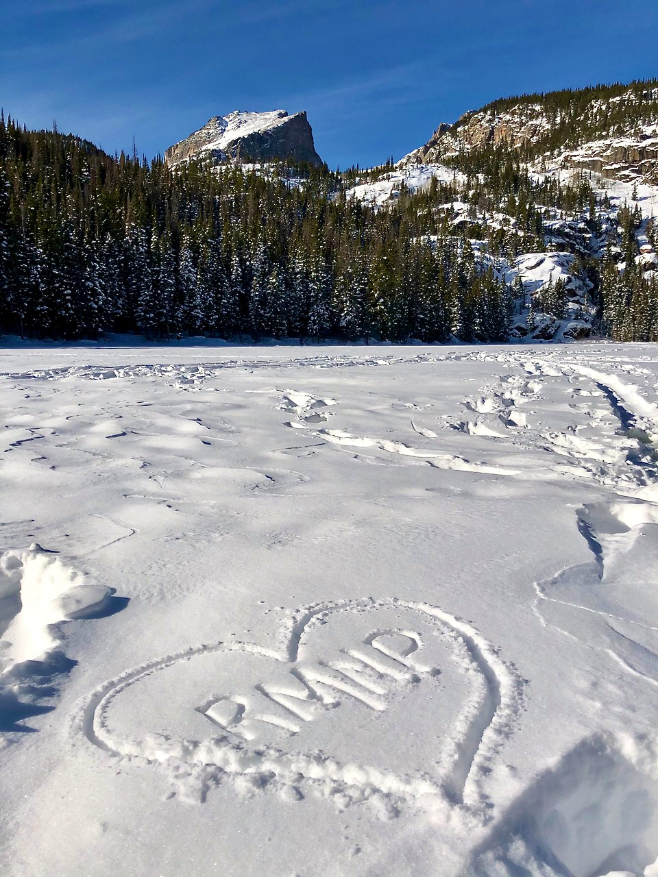
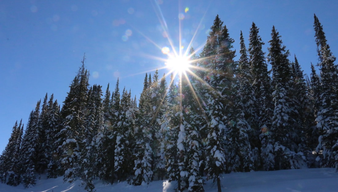
by Murray Selleck Snow is the lifeblood of Colorado. It is the surface of our winter playground and it is the source of our springtime and summer water. Without snow, Colorado itself (and lots of other western states) would be impossible! All snow is good and there are all kinds of it. No matter how it falls, or floats, or gets blown from the sky we need every flake. However, just because all snow is good doesn’t mean all snow is easy. Some snow is difficult if not outright dangerous. Heavy wet spring snow is tough to shovel and when snow layers pile up on top of one another avalanches are a constant hazard, especially in Colorado. The good news is more times than not snow is fun, beautiful, and inspiring. Fun with all its options to go out and play in it. Beautiful in the way it changes color when its surface reflects the light from our sunrises and sunsets. And inspiring in the way that your imagination can run with possibilities. Snowmen, snow caves, snow forts, igloos, and snow sculptures all show how creative and malleable snow can be. Snow is not monolithic. There is not one kind of snow and it is constantly changing as it falls, as the wind blows, or as temperatures rise and fall. With those thoughts in mind here is a list of snow types, conditions, and a bit of winter time slang that you may encounter in Rocky Mountain National Park. What follows is our best attempt at naming all the different kinds of snow we could think of and a brief sentence on how to use it in a conversation. 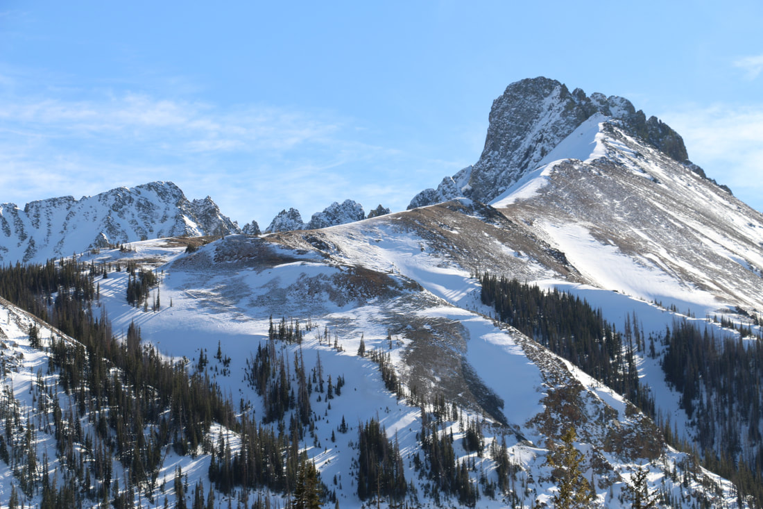 The food group of defined snow: Corn snow is typically found in springtime after a few freeze/thaw cycles. Clear starry nights with bone cold temperatures followed by warm spring-like temperatures will form corn snow. Early in the morning the snow will be crusty hard but as the sun works its magic the crust layer loosens. It is this thin loose layer on top that is corn snow. It becomes easy to ski since it is so carvy and the firm crust underneath supports your weight so you won’t break through. “We harvested that corn like it was nobody’s business!” Sugar snow is found deep within the snowpack often right at ground level. The earth gives off heat even in the dead of winter and the first few snowfalls of the season often transform into an incredibly weak, sugary layer that will not bond to itself or anything else for that matter. It may also be referred to as rotten snow due to its loose nature. You’ll sink right through it if you find a pocket of it close enough to the surface. “This sugar snow ain’t sweet.” Chowder is a mixed bag of wet, clumpy, and really thick snow. Homemade chowder is good eating but chowder snow is nasty skiing. You have to show a great deal of determination to keep your skis going the direction you want them to. Skis tend to deflect off chowder snow sending you and your skis in different directions! “This chowda sucks!” (Say it like you’re from Maine). Mashed potatoes snow is similar to chowder in that both snow types are thick and heavy. The only good news is mashed potatoe snow is a bit more consistent but no less energy draining. “Nothing but mashed potatoes and no gravy today.” Butter snow is dreamy. Think of a hot knife slicing through butter in your kitchen. Then think of a pair of skis slicing through a layer of snow so easy all you can imagine is carving butter. As with skiing and French cooking butter is an essential ingredient. “It was sooo good. It was butter!” Champagne snow is synonymous with the Steamboat Ski Resort. Champagne snow is some of the driest fluffiest snow on earth. Other definitions of this type of snow are listed below including blower. Snow so light all you have to do to clean your windshield is blow and viola, your done! “Champagne don’t make me crazy.” 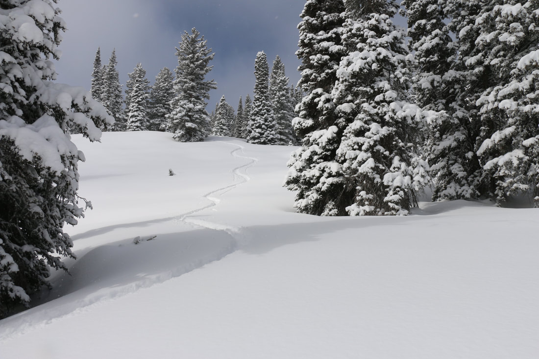 The Soft Stuff: Powder snow is the friendliest. Light and soft and the deeper the better. Easy to ski through, easy to break trail through whether on skis or snowshoes, easy to shovel, and easy to exaggerate its depth. “36 inches easy. In places I bet the powder was up to here!” (Lift your hand up as far up as you can above your head). Fluff is powder snow… so fluffy it almost doesn’t fall from the sky it is so light. Blower snow is mentioned above with champagne snow. Blower snow can leave a snowy airborne contrail behind a skier as he or she is making turns. So light and blower it becomes airborne a second or third or fourth time! “I sneezed and my windshield cleaned itself… it was blower.” Der is short for powder. “There's der in those woods!” Freshies is slang for fresh snow that has fallen overnight. “Freshies are the best!” Pow Pow is when you just can’t think of another description for powder snow. "Nothing’s greater than rippin’ (making turns in) pow pow!” 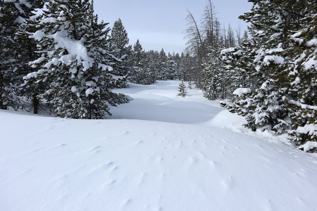 The Tough Snow Conditions. Mean snow. Unforgiving snow: Crud snow is just as it sounds. Cruddy, chopped, inconsistent, and windblown all together at once. “I can’t ski this crud. I’m going home.” Mank is another name for cruddy snow. Mank has a wetter and heavier element to it beyond just cruddy. Mank is thick and not funny snow. “I can’t ski this mank. No joke. I’m going home.” Sierra cement could be used for home construction right up until the sun shines. Before then sierra cement is the most humid, wet, and thick snow to fall from the sky. While the Sierra Mountains made this snow type infamous it can fall just about anywhere in the mountains if the conditions are right. Three feet of sierra cement could fall overnight and you would still only ski the top few inches of it because of how thick it is. “This sierra cement is a poor man’s champagne.” Suncupped snow is amazing to look at and tough to ski tour or snowshoe over. Think of an empty egg carton… the side that holds the eggs. The deep depressions with curved upped peaks defines suncupped snow nicely. Suncups form in the spring and typically are found on large snowfields. They are a challenge to hike through or ski over since the uneven surface with potentially deep pockets and substantial ridges inhibit an easy stride or surface to balance on. “Suncups suck but they’re amazing to look at.” 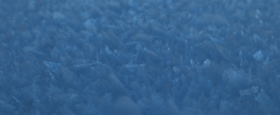 Snow on the Surface: Hoarfrost are some of the most beautiful snow crystals to be seen. It is worth one's while to look at hoarfrost crystals closely. They occur in an intricate variety of forms. Some of the most beautiful hoarfrost appears like leaves of a fern or feathers from a bird. Hoarfrost can develop on the snowpack surface, tree branches, ski poles left outside, pretty much anywhere. It forms on the ground by direct condensation at temperatures below freezing. See photo above. "A hoarfrost is beautiful to see but it is also the next weakest layer once new snow buries it." Crust forms after sunny warm days followed by freezing nights. Crusts are typically found on south facing slopes, or certainly, where the sun shines brightest including open meadows. Crust snow is very loud snow as you travel over it. If a strong enough crust forms that will support your weight it can be quite fun to ski. Nordic skate skiers will ski a backcountry crust for miles on end and have a blast. Timing is everything since once the day warms up your solid crust may become thick like a slushy. “Nothing beats a great spring crust day.” Breakable or Fry-able crust is a nasty crust. The crust layer may support you up to a moment, typically just as your confidence builds, only to have it give way underneath you. You may rasp your shin against the crust that remains as it rakes into your legs. It can hurt. It’s worse than snow snakes in powder because of the painful element to your lower legs. Once you have broken through a crust it is tough to regain your balance and get back on top because it will only giveaway again. “This breakable crust is like the worst *&^#{!! yuck I've ever tried to ski!” Dust on crust is when a light snow has fallen overnight on a crusty snow layer. There really isn’t enough snow to make it carvable or to quiet the loud crunch underneath your skis or snowshoes. Dust on crust considered a why bother snow? “Coma se coma saw… it’s just dust on crust.” Windblown and Spindrift are just as the name suggests. Windblown snow races along the surface creating solid drifts and filling in snowshoe and ski trails until they completely disappear. Windblown snow and spindrift can hurt when it hits you in the face. Little stinging shards of icy snow will have you trying to moonwalk to keep your face out of the wind. On the other hand spindrift can beautiful as it catches sunlight and become tiny airborne rainbows. 1st skier - “This spindrift hurts my face!” 2nd skier - "Your face hurts my face, too!" Bullet proof is similar to a crust snow only this snow is so hard it feels like it could stop a bullet. Bullet proof snow can be formed by freeze/thaw cycles or a hard wind or a long duration between snowstorms. It is so hard you can’t even kick step your way up a slope and climbing skins on your skis are borderline ineffective. “Ice axes and crampons are the way to go when its bullet proof.” 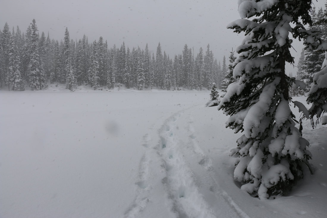 Falling Snow:
Charlie Brown Snow. There is a scene in a Charlie Brown Christmas when Charlie and Linus and walking to the Christmas tree lot. Snow is falling so lightly you can practically count the snowflakes as they descend. This kind of snow falls with no trace of wind and falls gracefully, smoothly, slowly, magically. “I love that scene in a Charlie Brown Christmas with the snow falling and a nice mellow jazzy riff as a background soundtrack." Wind driven, stinging, white out, or blizzard snow can be horrible to be out in. These kind of snows are horizontal snow. It is blowing so hard the snow has zero chance of landing. Of course, it will accumulate somewhere and that will typically be in your ears, nose, eyes, against your back and legs pretty much everywhere you don’t want it to be. 1st person, “I can’t hear or see you!” 2nd person, “What did you say? I can’t even see you!” Silver dollar snow are snowflakes that are as big or bigger than silver dollars. They’re huge. Typically silver dollar snow falls in the spring as remnants as a storm is on its way out. “If I had a silver dollar for each of those flakes I could _____ (fill in the blank).” Graupel is a kind of styrofoamy hail but it is softer than hail and never becomes as big as hail can become. I once had the pleasure of skiing in the backcountry down a slope with practically a foot of graupel. Very unusual to see that much accumulation but really fun to ski. Graupel is a mix of snow crystals and ice but softer and styrofoamy. "I usually don't grovel about graupel but today I'll make an exception." Snirt and Snain. Are these even real snowflakes? Snirt is snow mixed with dirt. In Colorado the dirty snow that falls can come from the Utah desert or even as far as the Gobi desert. The unfortunate fact about snirt is come springtime dirty snow melts faster than clean snow. Dirty snow can shorten the spring runoff time reducing the amount of moisture that soaks into the ground versus just running off downstream. Snain is snow mixed with rain. Talk about yuck. It is neither snow or rain it is just wet and miserable. "Snirt, snain, burp, snort, poop... It kinda is all the same thing." This sums up our snow effort. March can be a banner month for adding to our snowpack. Typically, it is a warmer month so the snow that falls is wetter and heavier. But as we said at the outset... All snow is good snow so the more snow the better. No matter what you call it!
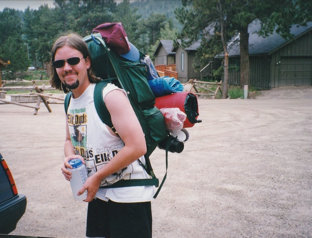
0 Comments
 "A National Park is a fountain of life. It is a matchless potential factor for good in national life. It holds within in its magic realm benefits that are health giving, educational, economic, that further efficiency and ethical relations and are inspirational. Without parks and outdoor life, all that is best will be smothered. Within National Parks is room, glorious room, room in which to think and hope, to dream and plan, to rest and resolve. This is the proudest moment of my life. I have lived to see the realization of a great dream come true. The day is at hand when these wonderful hills and matchless valleys are to be the playground of the world." Enos Mills. Founding Father of Rocky Mountain National Park. Quote from the Day of Dedication establishing RMNP. 1915 I fell in love with Rocky Mountain National Park in 1971 when I worked a summer at Cheley Colorado Camps. I spent the next 47 years trying to make the Estes Park area my permanent residence. During those years, Rocky was always "home" to me in my heart. For the past 10 years, I have been able to call Rocky not only the home of my heart but the home of my daily life. Helping to preserve beautiful landscapes and wildlife habitat as a steward of the park is my true love. Karla H - NSCU Education I remember being 6 years old. My family drove to Rocky Mountain National Park each summer when we were kids. We would set up a tent at Glacier Basin campground in the late 1950s and early 1960s. No reservation needed. We would spend 2 weeks each summer hiking the same trails that I now enjoy as a retired, 71-year-old. I moved to Estes Park in 2016. I hike every day that it is safe for hiking. I have every trail tag I can get except for summiting Longs Peak and the hikes that require ropes and/or an overnight on the trail. I get goose bumps every day I drive in to the park. - Kathy Granas, Estes Park resident and hiker. Rocky Mountain National Park is like the partner you constantly can't believe you're lucky enough to be with. Its stunning beauty is the backdrop to our lives, and its recreational opportunities feed our souls and make us feel complete. We're so fortunate to have Rocky in our big backyard and we're thankful every day! Rachel Ward Oppermann - Director of Advocacy and Sustainability at Visit Estes Park. My Beloved Rocky Mountain National Park Why I’m in love with Rocky. In 1974 Rocky changed my lifestyle forever! From 1974-1976 I hiked, climbed, skied, snowshoed in Rocky more days than not. Then came a career, however I always made time to spend in Rocky Mountain National Park. This Park defines who I am from wildflowers to summits and the best thing Rocky Mountain National Park gave me was life-long friendships. Marlene Borneman, Author, Mountaineer, Naturalist, Backcountry Skier, and Estes Park resident. I've written before how I had lost interest in national parks for a very long time. The news reports of visitors behaving badly with wildlife, long lines of traffic, and packed parking lots only confirmed I wanted no part of that scene. However, it was reconnecting with a friend, and going on a multi-day backpacking trip into Rocky Mountain National Park that made me realize how mistaken I had been. Seeing and feeling the grandeur and beauty of RMNP's backcountry after such a long time was overwhelming. How could I have stayed away for so long? My Valentine thoughts go out to all of RMNP's Rangers, staff, volunteers, and visitors that love RMNP as much as each of us do. Thank you for caring for our national treasure. Thank you for acknowledging its importance to our world and all that this park offers: beauty beyond measure, solitude and sanctuary, peace and quiet, reflection, and inspiration. Murray Selleck - Rocky Mountain Day Hikes contributor, skier, snowshoer, hiker, and backpacker. Oh Rocky, My Rocky (with apologies to the Bard) Oh Rocky, my Rocky How do I embrace thee? I love thy terrain and elevation Thy montane, subalpine, and alpine I roam beneath your budding aspen in springtime, Their quaking leaves of summertime, Their illumination of brilliant yellow, rich gold, and Autumn shades of orange. I meander beneath your towering Ponderosa Pines of the montane, Your snow-laden Engelmann Spruce glens of the the subalpine, Your gnarled and twisted Limber Pines Clinging to the rock outcrops in the windswept terrain I close my eyes and soak in the radiant rays of sunlight beside your icy lakes, your glassy lakes, your Lake of Glass, Your Lion Lakes and Spectacle Lakes, Your Odessa and Spirit Lakes. I long to rest along your clear and cold, babbling Boulder Brook, Your Icy Brook, your Roaring Fork and Roaring River, To feel the exhilaration and force of your Grace Falls, Your Timberline Falls, Your Cascade Falls, Your Thousand Falls I love to listen to the spring song of the Green-tailed Towhee To dream of the Dark-eyed Junco, To marvel at the agility of the Pygmy Nuthatch, and To gaze at the sharp eyed Mountain Chikadee-dee-dee, With adoration I outstare the Stellers Jay and the Clark’s Nutcraker, I soar aloft with Birds of Prey and dance to the rhythm of the American Dipper, I spy the hidden White-tailed Ptarmigan in summer and winter, I follow the fluttering Mountain Bluebird in the early spring and Ruby-throated Hummingbird appraising the mid-summer flowers. I am over-joyed to give ear to the solitary song of the White-crowned Sparrow As I approach the hushed sound of Crystal Lake lying beneath Fairchild Mtn. I knell to honor your Fairyslipper, your Snow-lily, and your Elephantella, I sing praise to your Colorado Columbine, your Parry Primrose, and your Mountain Iris, I bow bedazzled before your Alpine Forget-me-not, your Old-Man-of-the-Mountain, and Your Arctic Gentian, I wish to be the buzzing Bumble bee probing the depths of the glorious Golden Banner. How can I not be astonished by the bugling bull Elk, and the head-butting bighorn, How can I not wonder about the elusive black bear and the stealthy mountain lion, How can I not grin at the spectacle of the Least Chipmunk, the Chickaree, and the Abert’s Squirrel. How can I not adore the hairy feet of the Snowshoe hare and the rounded ears of the Pika. My eyes lift upward in spiritual wonderment at your jagged peaks that divide a continent, With awe I am inspired by the Ypsilon Mtn, the Pagoda Mtn, and the Notchtop Mtn. I ponder the miraculous centuries of creation of the Little Matterhorn, the Spearhead, and the Hayden Spire, I long for Longs Peak giving its Diamond to Mt Lady Washington. Oh Rocky, my Rocky, Rocky of the masses, Rocky of the ages, What a rogue and peasant slave am I. I am that merry wanderer of the trail. A merrier hour was never wasted. Dave Rusk, rockymountaindayhikes.com & Hike Rocky Magazine publisher, hiker, backpacker, photographer, Estes Park resident, RMNP volunteer and philosopher. Thanks to everyone who contributed their Valentine thoughts and wishes to RMNP. Our hope is for another 109 years (and beyond) of Rocky Mountain Mountain National Park thriving, inspiring, and nurturing all the souls who live in and visit our national treasure.
 Winter is magical. It is awe inspiring and... mythical. Some of the mythical part comes from people believing in lots of misconceptions about winter. These wintertime myths keep far too many people cooped up indoors. Repeated often enough folks believe these myths to be true and they wind up resenting winter or worse, hating it. Their misery only intensifies as the days become shorter and the snow deeper. Symptoms like seasonal affective disorder (sad), boredom, depression, and lethargy are no way to live. The cure is to not believe everything you hear about winter. At Rocky Mountain Day Hikes we love winter and all it has to offer. So as we debunk as many of these myths we can think of put on your warm clothes, hat, jacket and gloves. Grab your snowshoes or skis and lets get outside and enjoy winter for all its worth!  Myth: No-wax cross country skis don’t need wax. False. A "No Wax" ski is an unfortunate description. XC skis that have a fish scale pattern that provides the "kick" help you glide forward. The pattern does not require kick wax. However, these skis will benefit from glide wax. There are many brands of liquid glide wax that are easy to apply and will enhance your XC ski day. Apply a liquid glide wax from tip to tail right through the "no wax" pattern. This will prevent the ski from icing up or glomming up with packed snow. Glide waxing your "no wax" skis will keep you skiing and very happy. Myth: If it's cold dress in as many layers as you can to stay warm. False. We recommend you dress for your winter activity not necessarily the weather. On a cold day a snowshoer or XC skier may dress pretty light with minimal breathable layers while a downhill skier may layer up significantly more including jacket and pant shells that are both windproof and waterproof. An aerobic activity will produce more consistent body heat than perhaps a downhill skier who has to also dress for a cold chair ride up the ski hill. On the same cold day, playing at different winter activities, you'll benefit with different layering options. 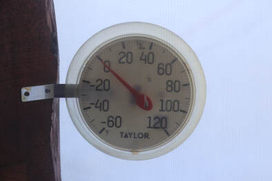 Myth: Cold is cold no matter what. False. It's funny to think about a 32 degree day in October feeling really cold and a 32 degree day in January feeling down right balmy! If time is relative so is cold. Sunshine, clouds, wind, and humidity all play a role in how cold a day feels. Be active all winter long and embrace the season no matter what the thermometer says! Myth: There are less hours in a winter day with Standard Time. False. Switching from Daylight Saving Time to Standard Time in November does not reduce the length or hours of a day. We heard a Denver weather forecaster misspeak on air before the Winter Solstice and say “since there are less hours in the day the sun is setting earlier.” This drives us crazy and often folks blame Standard Time for the reduction of daylight in the winter. This natural earth science event will occur whether we are on Standard Time or Daylight Saving Time. The point is to make as much of a winter day as possible. And that can include wearing a headlamp and going for a snowshoe tour at night! 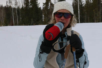 Myth: You don’t need to hydrate as much in winter as in summer because you don’t get as hot or thirsty. False. You need to hydrate equally all year long. And, hydrating in winter will actually help keep you warmer. Bring along a thermos filled with a hot drink on your winter excursion. The warmth of the drink will fill you with a very cozy feeling filled with gratitude for winter! Myth: Alcohol keeps you in warm on the trail in winter. False. The opposite is true. Alcohol drops your body temperature. Drinking alcohol may make you feel warm outside in winter because it causes blood to rush to your skin’s surface. This causes your blood vessels to widen and makes you lose heat faster. The best place to partake in an adult beverage during winter is at the end of the day, inside sitting in a comfortable chair beside the wood stove, sipping your libation in moderation and trading stories about the day’s adventure. Myth: You lose tons of body heat through the top of your head. False. While it is smart to always wear a hat outside in winter you lose only about 10% of your body heat through your head. 10% is not very much but who wants a cold head in winter anyway?. Just wear a hat no matter how little body heat you lose from the top of your head. And by the way, wearing a hat and protecting your ears from frostbite is a smart thing as well. 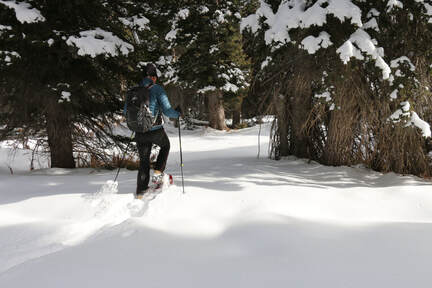 Myth: XC skiing and snowshoeing are boring. False. “We just went for a snowshoe tour.” I use to hear this disparaging remark often when I worked retail in a mountain shop. This phrase, with the emphasis on "just" discounts these activities as if the only worthy winter sport is downhill skiing. In fact, xc skiing and snowshoeing are equally as exciting or even more so. Hands down these two winter activities provide a major boost to your overall physical and mental health. They provide a great cardiovascular workout increasing heart and lung health. And, arguably, they allow you to connect with nature in a more significant way by slowing down and acknowledging the beauty surrounding you.  Photo: CAIC Photo: CAIC Myth: If avalanche risk is rated at low or moderate you can ski or ride anywhere. False. Always keep your guard up when traveling through the backcountry whether you are snowshoeing, skiing, snowboarding, or hiking. Avalanches can occur year round. A reduced risk does not eliminate risk. Take avalanche awareness courses to educate yourself and your backcountry partners. Be aware of the overall avalanche danger by checking the CAIC website. And always play it smart. Myth: If avalanche risk is rated at high or extreme stay out of the backcountry no matter what. False. There are many places that are safe to travel in the backcountry when conditions are ripe for avalanches. It is easy to avoid avalanche terrain. Stay on flat or very low angle terrain. Tour through wide open meadows. Avoid all suspicious slopes. Be aware of potential avalanche terrain above you. You may be on flat terrain but what do the slopes and ridges above you look like? Avoid terrain traps where an avalanche (big or small) might trap you. Do not take unnecessary risks, stay off all slopes that look suspicious. Typically when avalanche risk is at its highest the winter weather is at its stormiest. While it can be fun to ski or snowshoe during a winter storm take all precautions to stay safe and warm so you can and enjoy many winter days to come! Myth: Winter can be enjoyed each and every day. TRUE! No matter the weather, no matter the outside temperature or wind speed, no matter how deep or thin the snowpack might be, no matter if the sun is shining or the day is cloudy, no matter how old your winter equipment or clothing is, or if you live in the country or city... Winter can be enjoyed each and every day by acknowledging its beauty and in turn, knowing it is another great day to be outside!  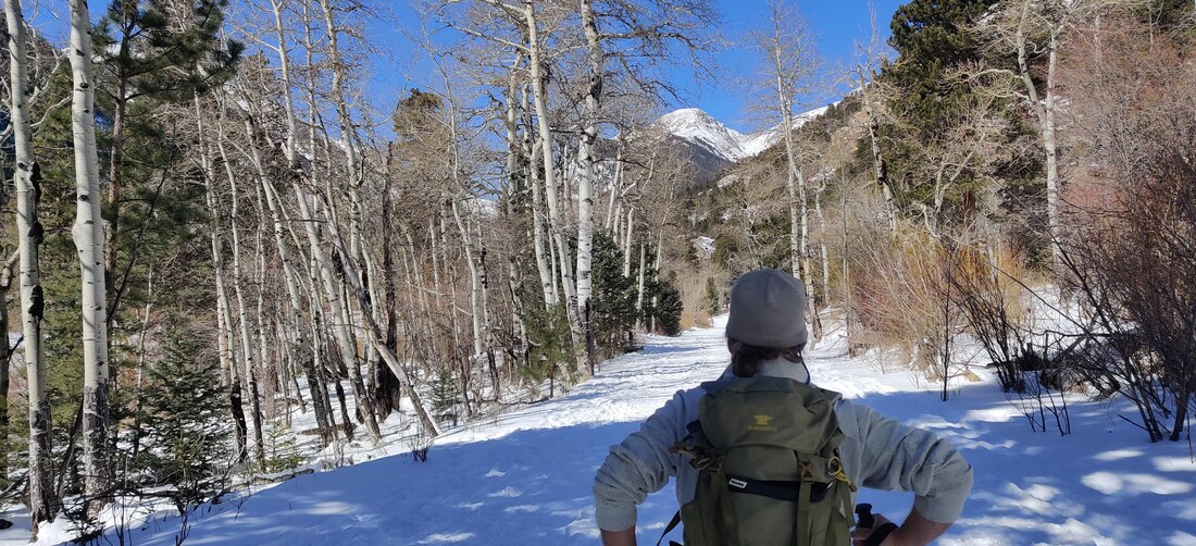 Dave Rusk accompanied me to Endovalley on my first ski tour in more than 20 years. Story and photos by Barb Boyer Buck Back on skis after 20 years! I broke my back 21 years ago. It was a fracture which resulted in spondylolisthesis and it brought on years of physical therapy, chiropractic treatments, loss of mobility, and pain. It was the time when orthopedic surgery was very much feared, and outcomes were relatively unpredictable. It was also the time when conservative treatment was recommended and surgery was avoided at all costs. I was told to give up skiing altogether, and especially snowboarding. "One wrong fall and you could be paralyzed," was the doctor's advice. Pretty scary stuff. But by 2018, I could barely walk, had to quit my job waiting tables (which supplemented my writing career) and I had pretty much given up most of the things that gave me pleasure, most notably outdoor recreation in the form of hiking and of course, skiing. I finally went to an orthopedic center to have an x-ray. After seeing the results, the surgeon scheduled me for an emergency 3-level spinal fusion the very next week. I can see why people avoid this surgery, recovery was long and extremely painful. To make a living, I crocheted and sold hats. It was incredibly boring, to say the least. But today, I am almost back to normal! So, I decided to try cross-country skiing again, something I had enjoyed for many years before my back injury. Dave Rusk, the publisher of Hike Rocky Magazine and an extremely patient man, agreed to accompany me and give me a refresher lesson. Here's a video of that day, which took place on March 1 of this year. We rented equipment from the Estes Park Mountain Shop, and I was very pleasantly surprised at how far cross-country skis had come! I definitely want to get the kind of skis I was using that day. In order to get the most out of my "lesson," I needed to start from scratch. The patience I had developed during my nearly three years of recovery helped with this. I approached xc skiing as if I had never done it before and thereby, I was able to take advantage of tips that Dave provided. First, I want to talk about the equipment. These days, you can opt for skis that have scaling on the bottom of them, where your boots clip in on the other side. This helps you when going up inclines - you can literally walk on the snow with them. Technically, they are called backcountry skis and you can "walk" up slopes and ski down them, which many people like to do at Hidden Valley. I'm not ready for that yet, by the way. Marlene Borneman explains about these type of skis in her piece, "Ski tracks in Rocky," published in the February, 2021, edition of HIKE ROCKY magazine. It's so much easier than waxing skis, or even putting on skins when you are doing a cross-country tour on sloped trails (most of the trails in Rocky Mountain National Park are sloped, by the way). The bindings on these new skis are so convenient. You can just toe-kick into them, and twist to take them off. I rented the entire package, which included poles and boots, too, for about $20. The place we chose for my first time back was Endovalley; the road to the picnic grounds is closed for the winter and can be used for skiing, snowshoeing, or when the snow melts off, walking. It extends past the Fall River Road fork and ends at the picnic grounds. The road is fairly level.  March 2, 2021, in Endovalley - a beautiful, still and warm day. I put on my skis just after the "road closed" gate and tried to recapture the feeling of skiing by taking a few tentative kick/glides. On the newer skis, it felt more stable.
If I stood straight, putting my full weight on the middle of the skis, they stopped sliding and I could "walk" on them. In order to ski, I needed to learn forward slightly, bend one knee and kick backward, with the other leg extending out. Alternating legs, eventually I started to feel a rhythm and began gliding. When I started to feel unsteady, I just straightened up again. This was a big difference from the skis I used to have; my cross country skis from the late 80s were much more narrow with very smooth bottoms. Stopping was always an adventure on those. The poles helped keep me steady, too - these need to fit into your hands while your elbows are bent at a 90-degree angle. Skiing on the road was a bit difficult because it was icy in spots and melting while we were on it. As you learned in the above video, the only time I fell was when I tried to ski off the road to a picnic bench, missing a turn on the slight downhill slope. It was a wonderful adventure and even though I'll probably need to wait until next year to do it again, I'm looking forward to it! by Dave Rusk
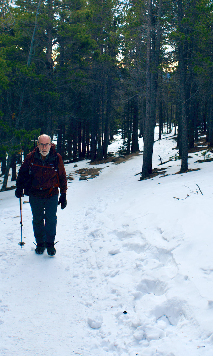
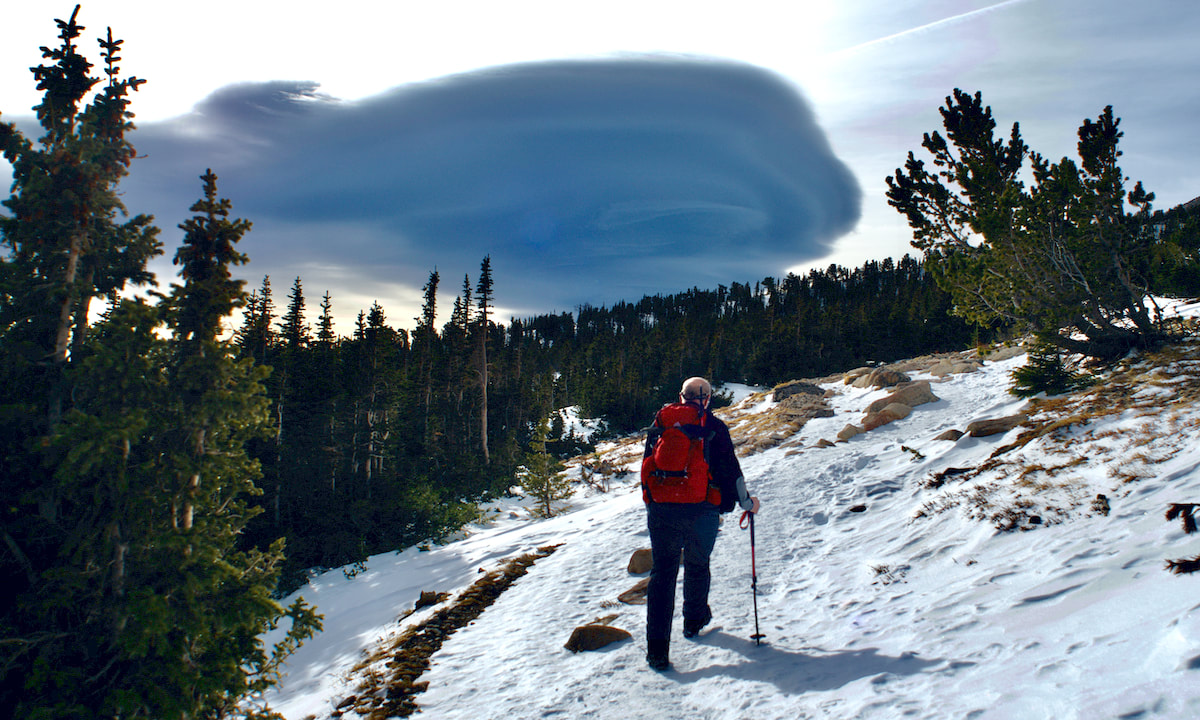
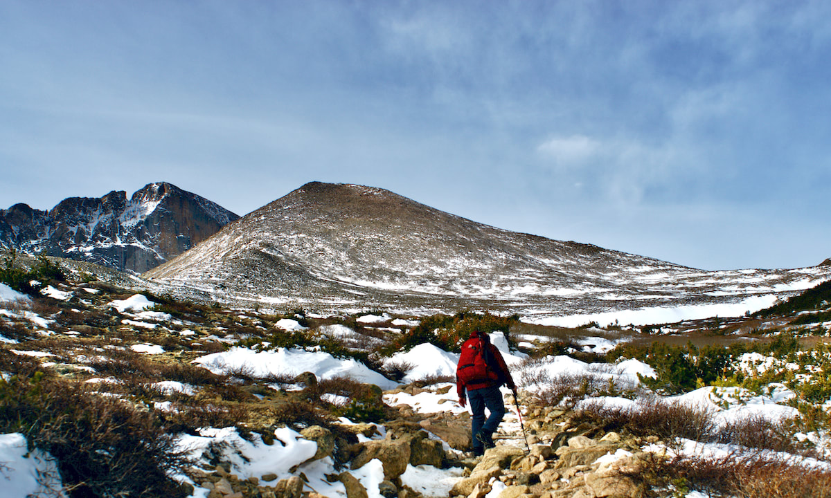
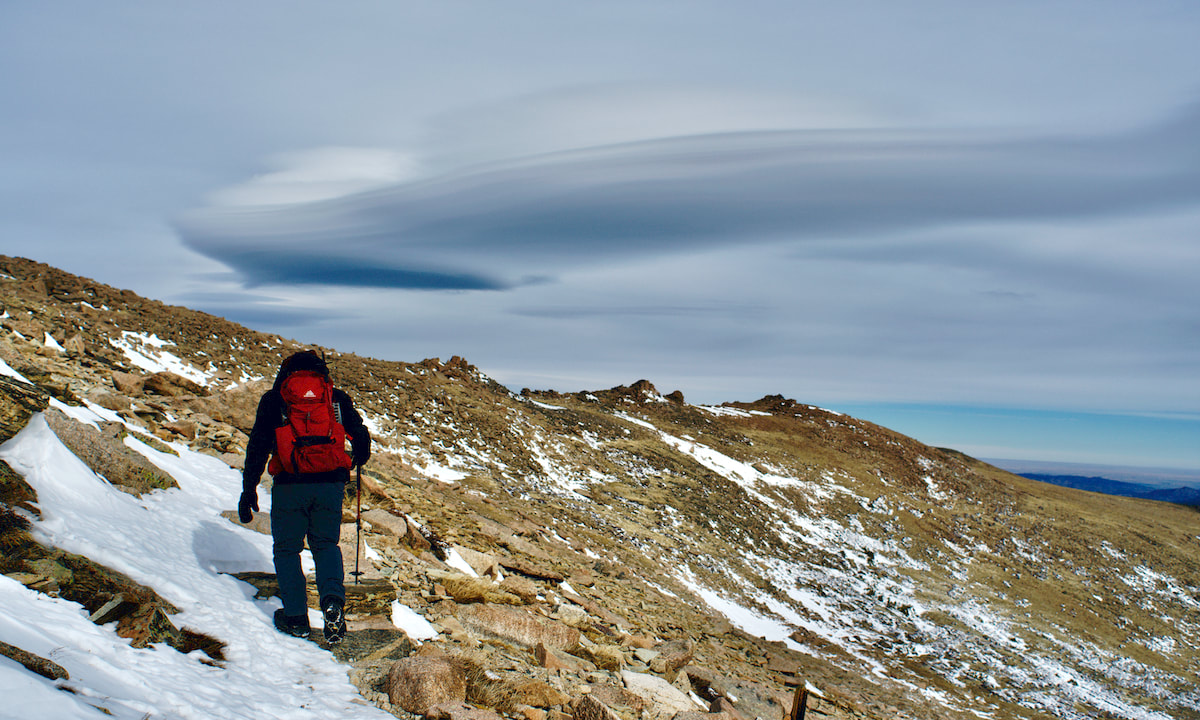
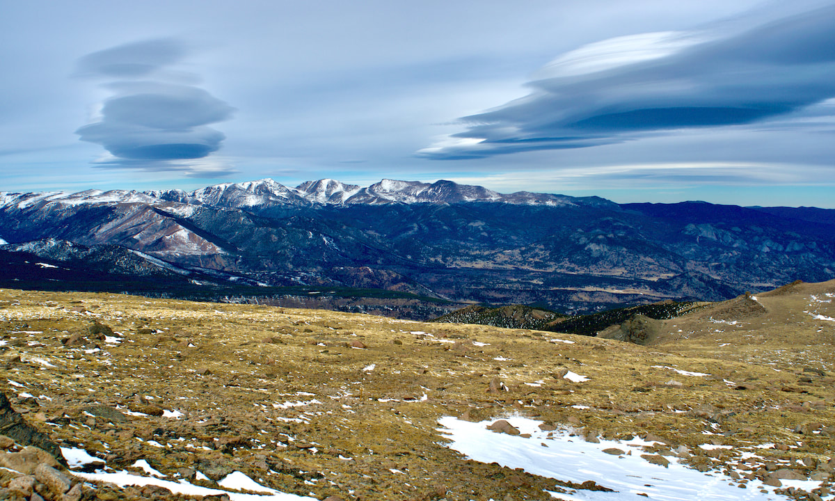
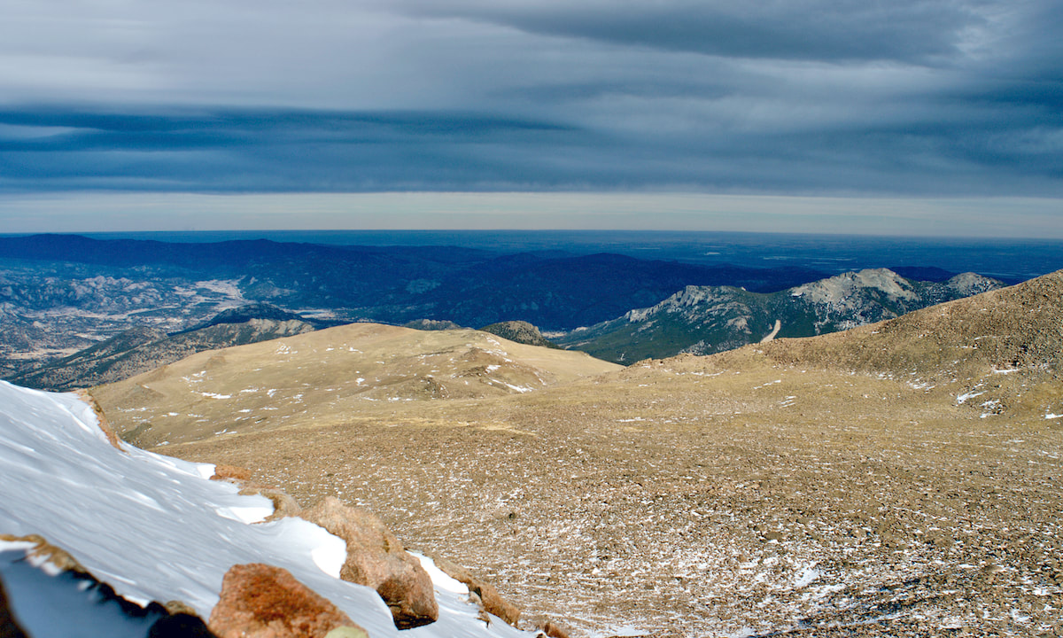
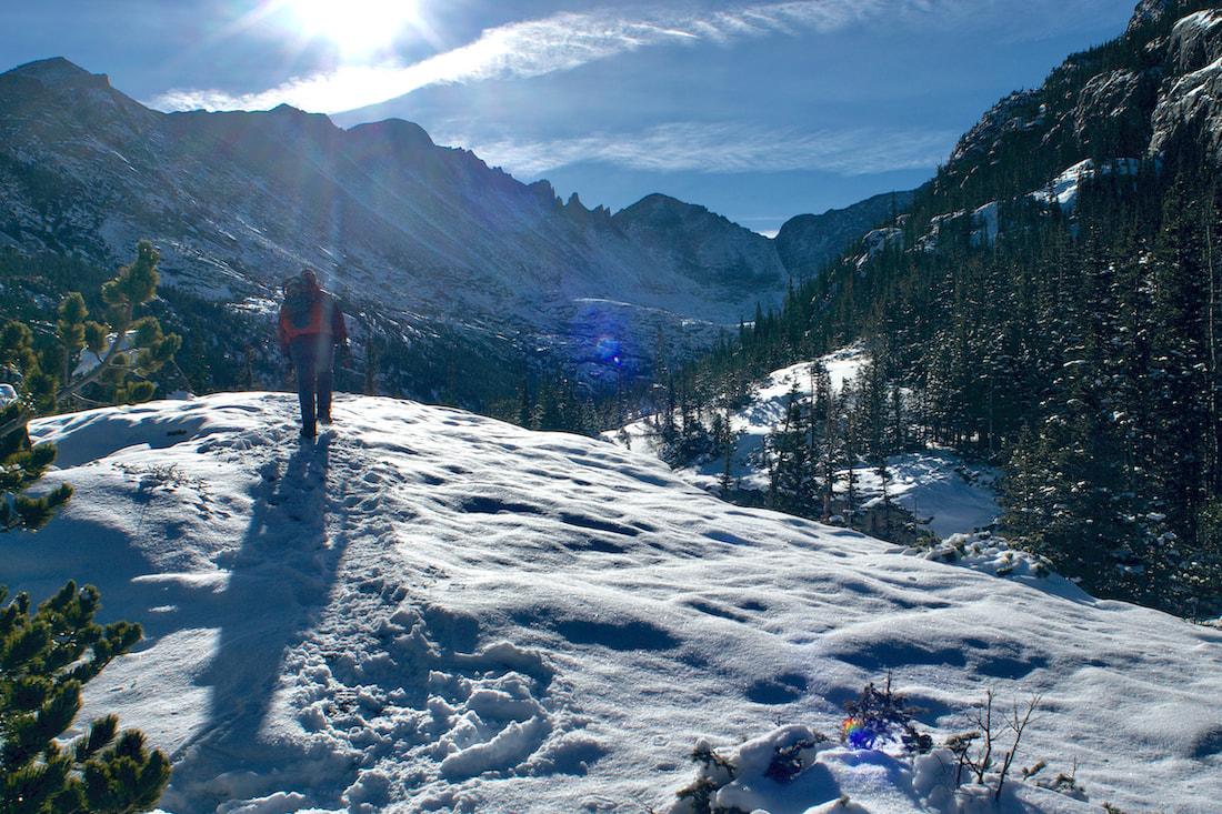
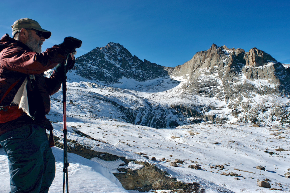
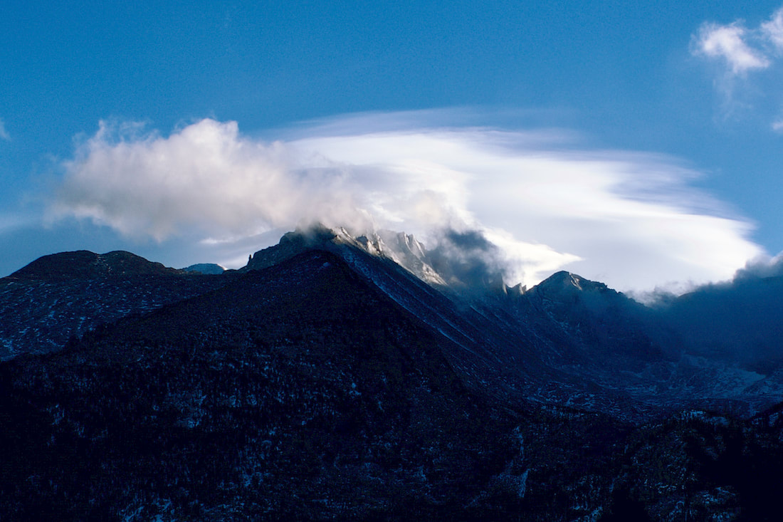
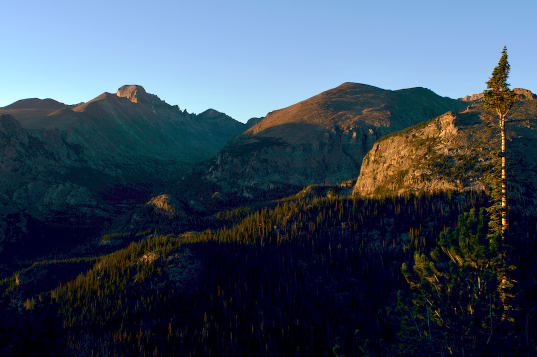
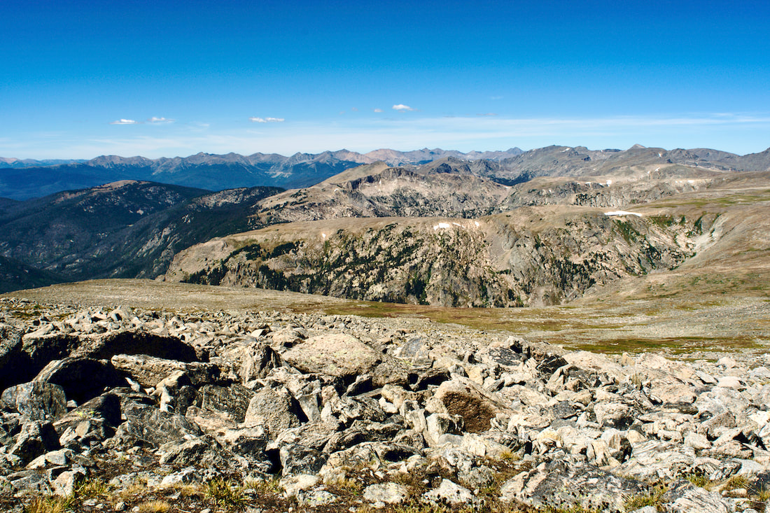
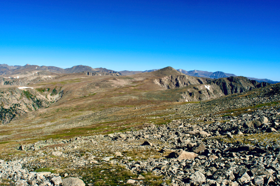
The forecast was billed as clear and mild, but there was a high level of thin clouds screening the sun with a mild breeze. Walking out of the treeline, there was also a dark and somewhat ominous lenticular cloud hovering like a giant UFO off somewhere over Netherland, or maybe Ward.
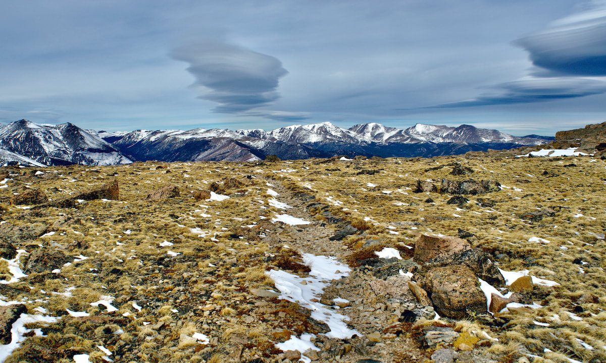
The tundra above treeline had been swept clear of any deep snow with the only snow accumulations occurring on the leeward side of willow shrubs. The Diamond of Longs came into view, obscured partially by Mt Lady Washington. We also could see our immediate destination, Granite Pass, to the north.
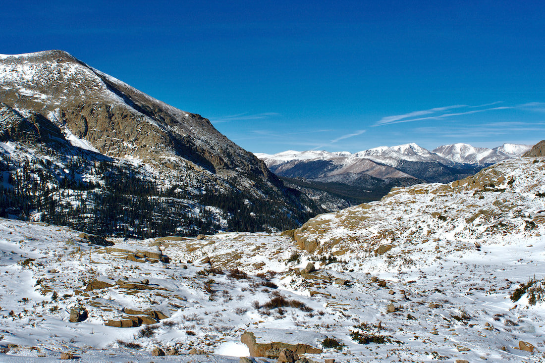
We advanced to the Chasm Lake trail junction without difficulty, and continued the traverse to Granite Pass where we observed more lenticular clouds off to the north.
We had anticipated an increase in wind once on the west side of Granite Pass, but it continued to stay mostly calm with occasional gusts, pretty pleasant for this first day of February.
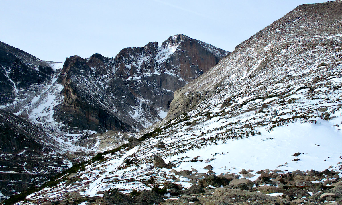
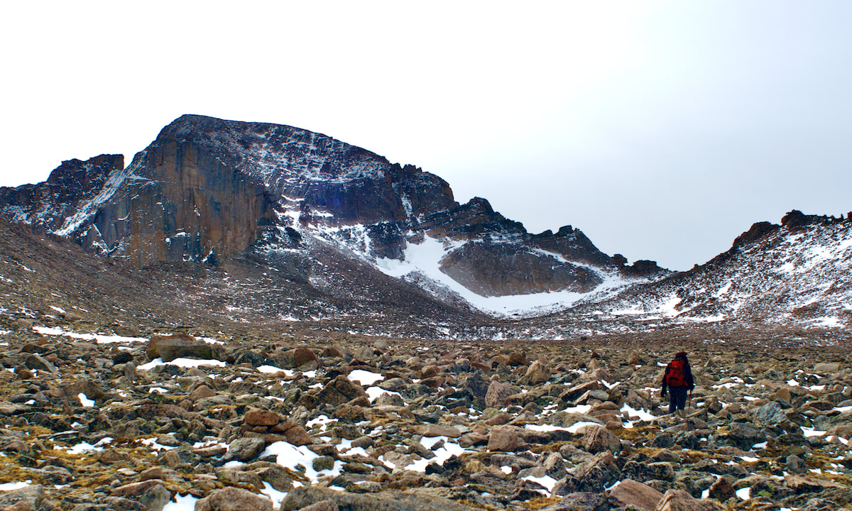
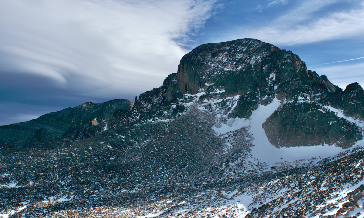
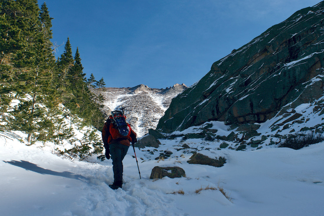
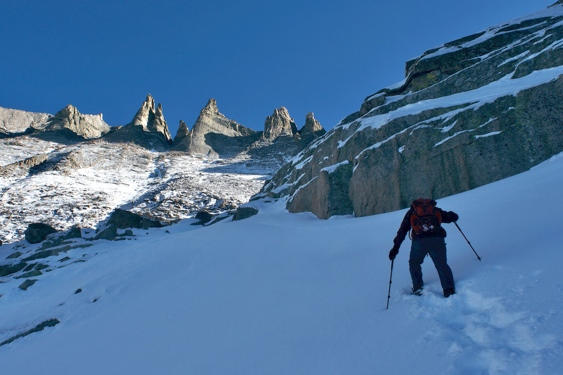
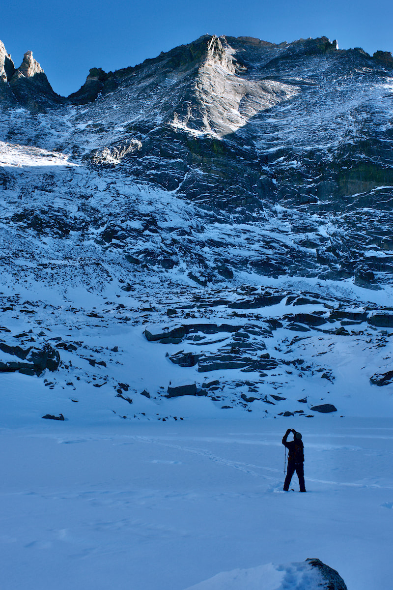
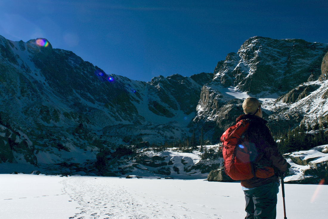
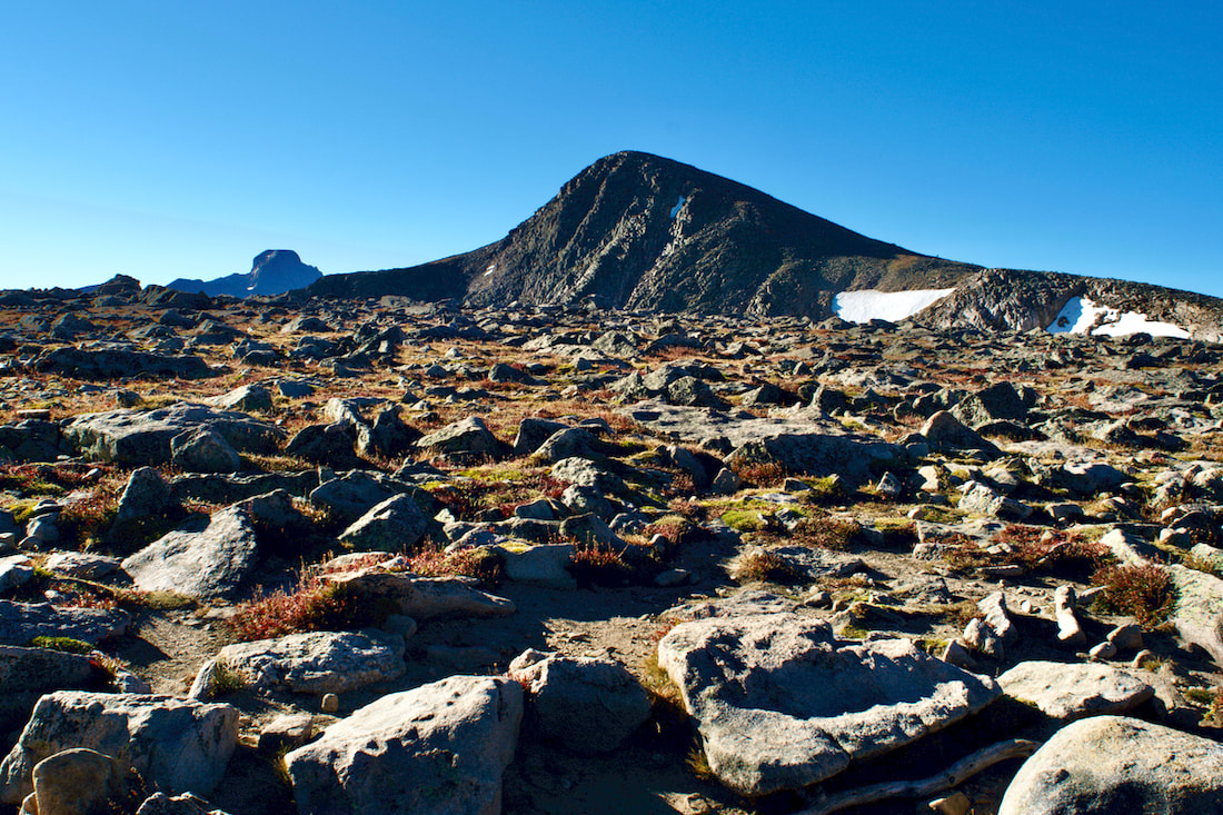
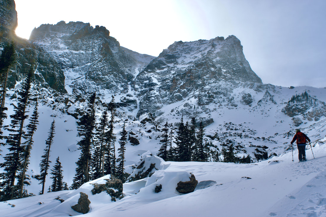
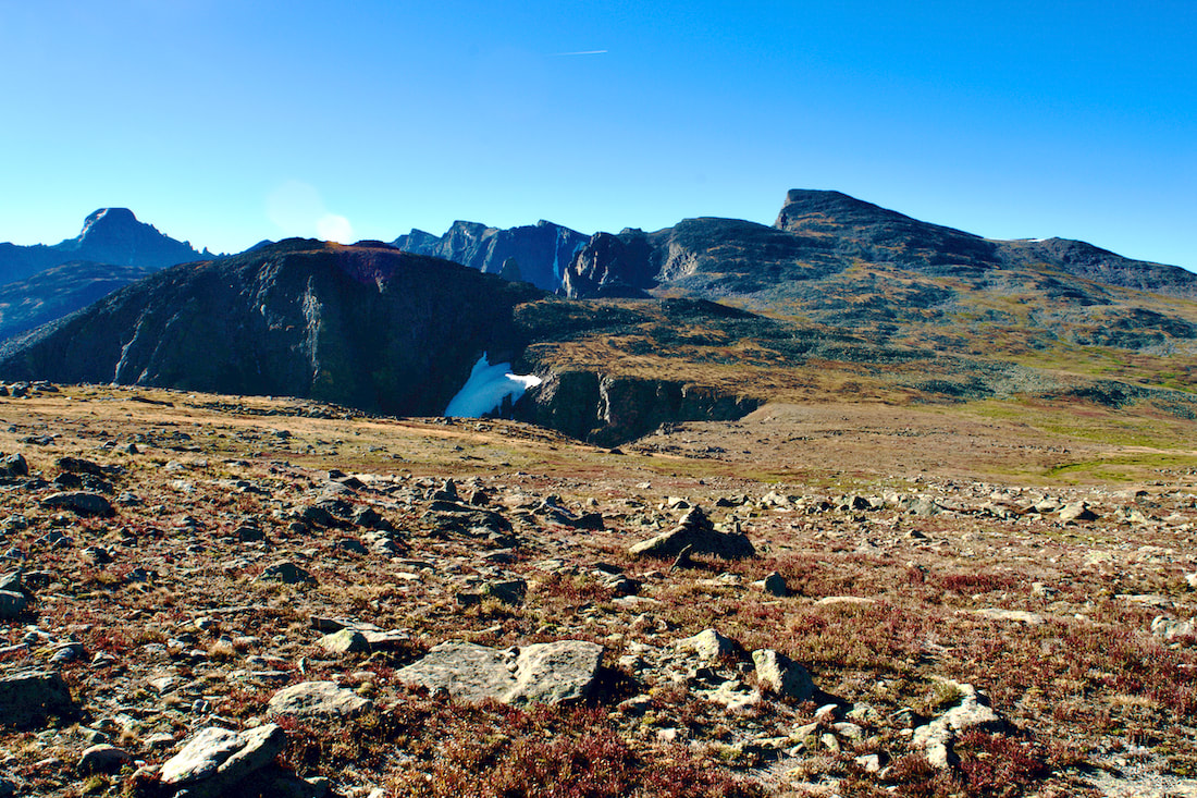
Threading through the Boulderfield now, we turned our gaze to the north of Longs Peak along the north ridge to our destination, Storm Peak. Appearing as mostly a knob on the ridge next to the dominating Longs Peak, the summit of Storm is at a very respectful 13,326'.
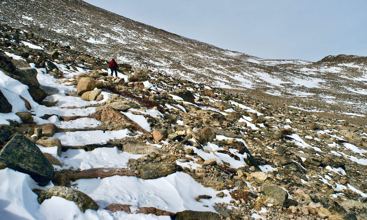
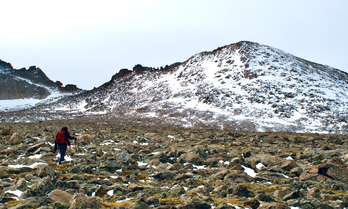
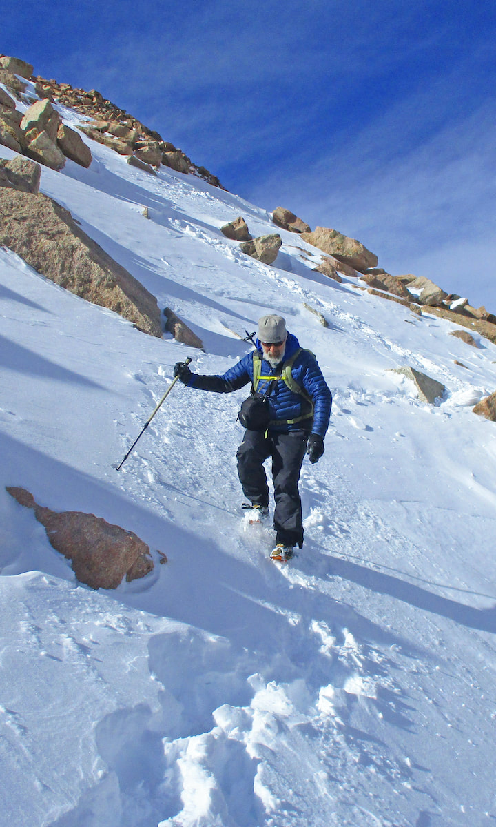
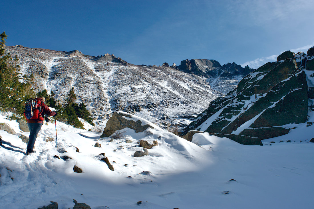
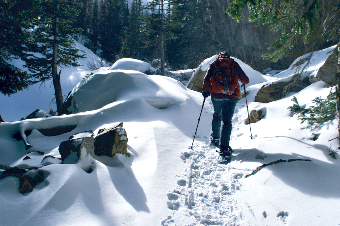
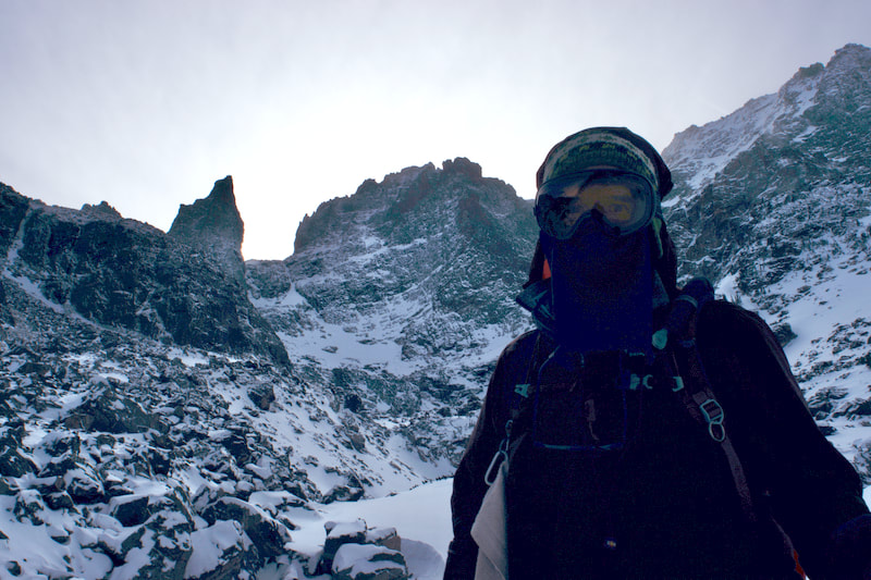
Having traveled the 6 miles to get to the base of Storm Peak, the unknown question we had was what kind of snow would we find. It needed to be hard enough to make solid steps in. We had brought crampons if the conditions warranted them. 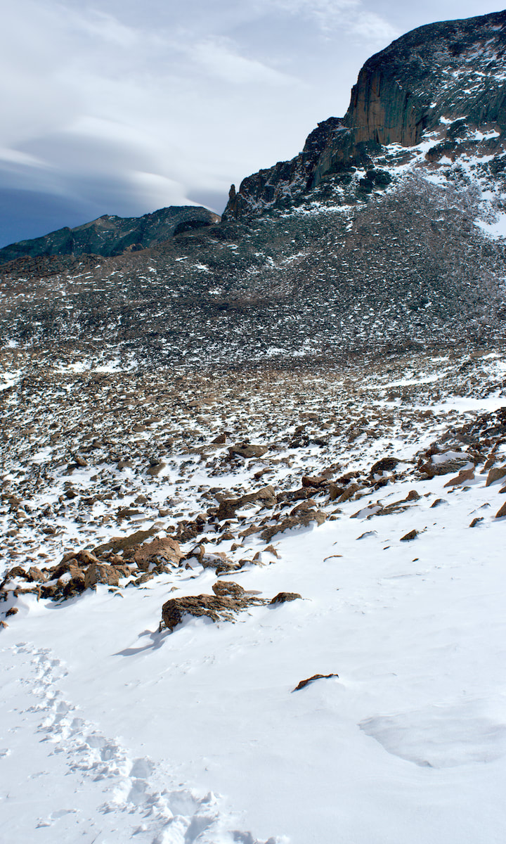 Photo: D. Rusk While there was some soft stuff layered on the surface, there was also some more solid footing underneath, so we continued to work our way up. 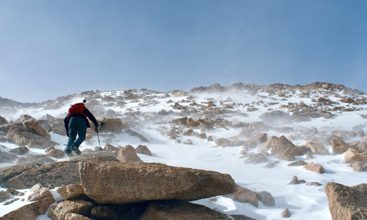 Photo: D. Rusk The sun made more of an appearance moving into the afternoon and when the wind wasn't blowing, it felt a little balmy. But when those wind gust did come up, picking up and blowing small snow particles into our face, we had to turn away and wait for the gust to blow off.
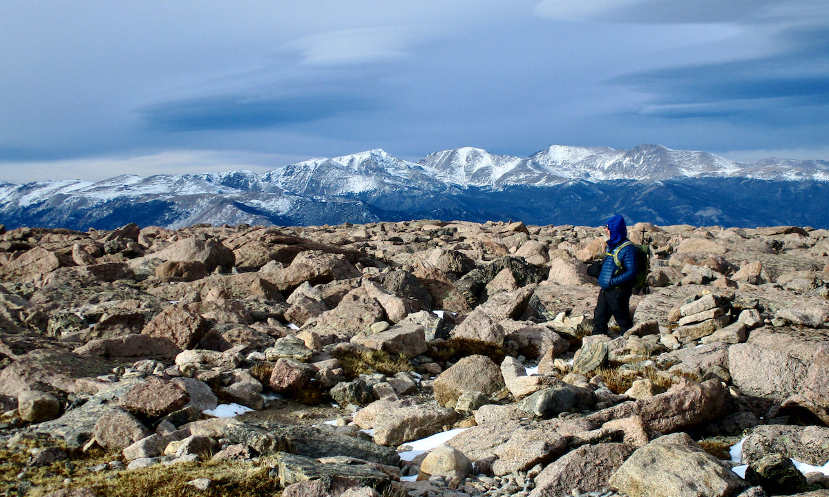
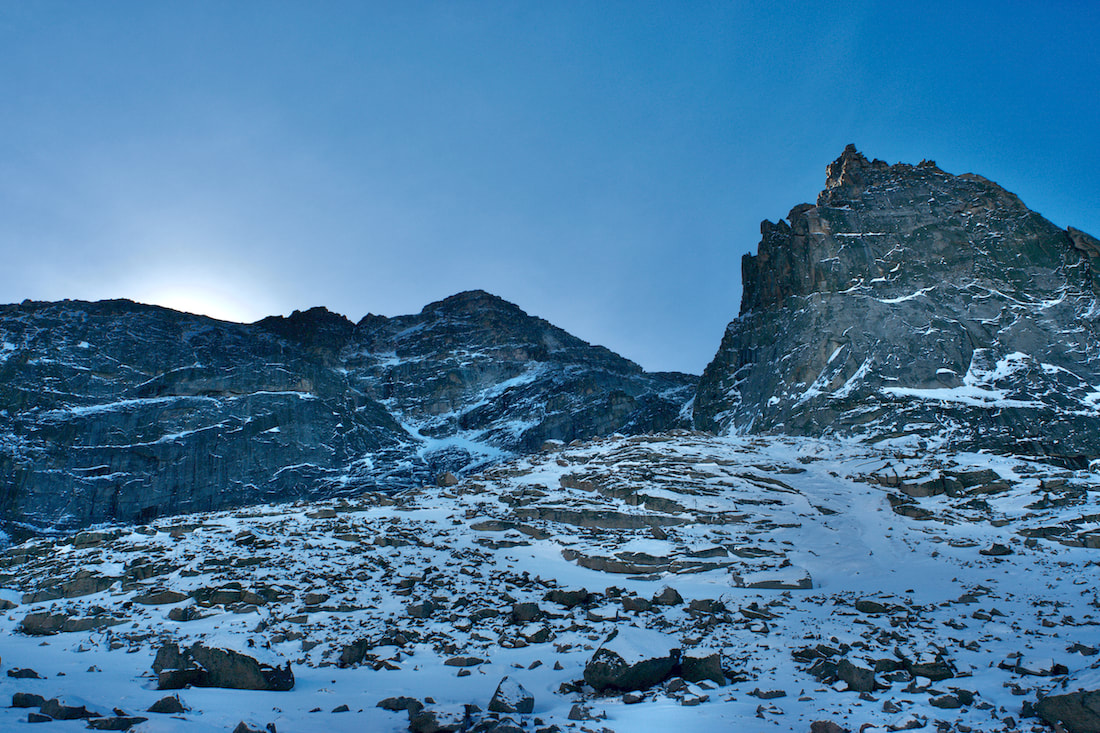
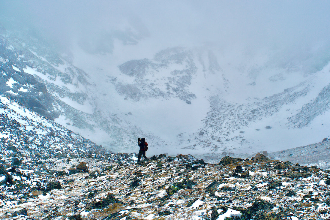
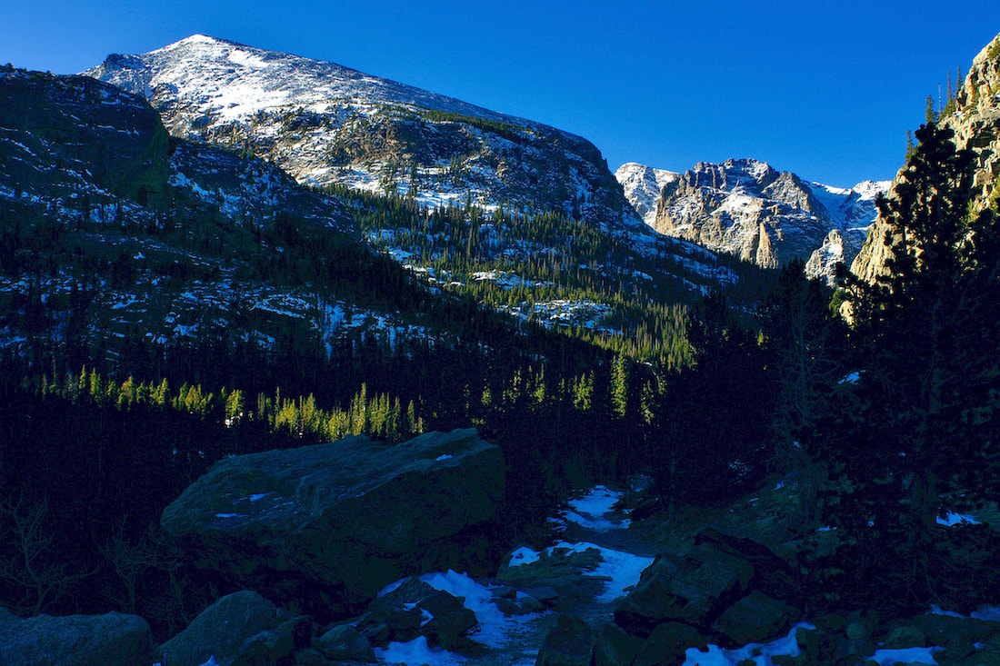
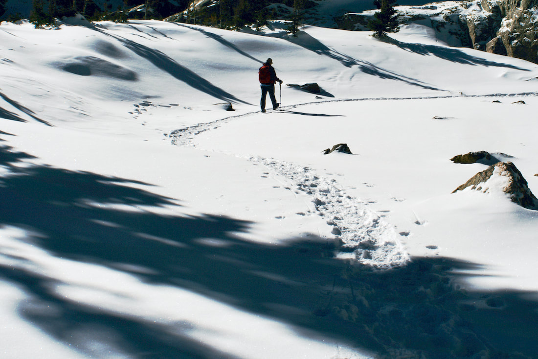
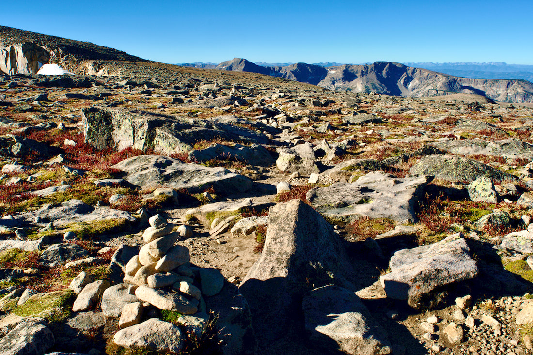
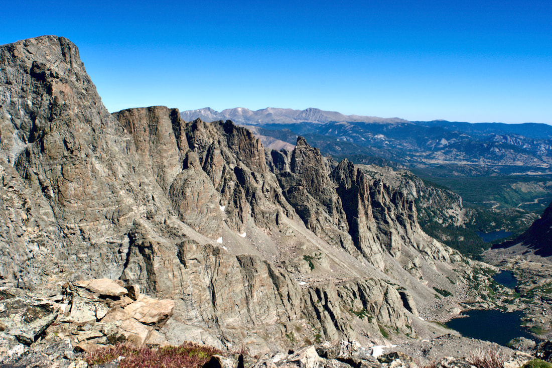
About three quarters of the way up, the slope angle became too steep for my comfort zone and I perched myself on a rock outcrop, pulled out a thermos, and took a coffee break while Kip completed the ascent to the ridge giving him a commanding view into the Glacier Gorge, with frozen Black Lake below and endless peaks to the west and north. 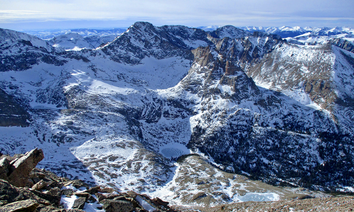 Photo: K. Rusk 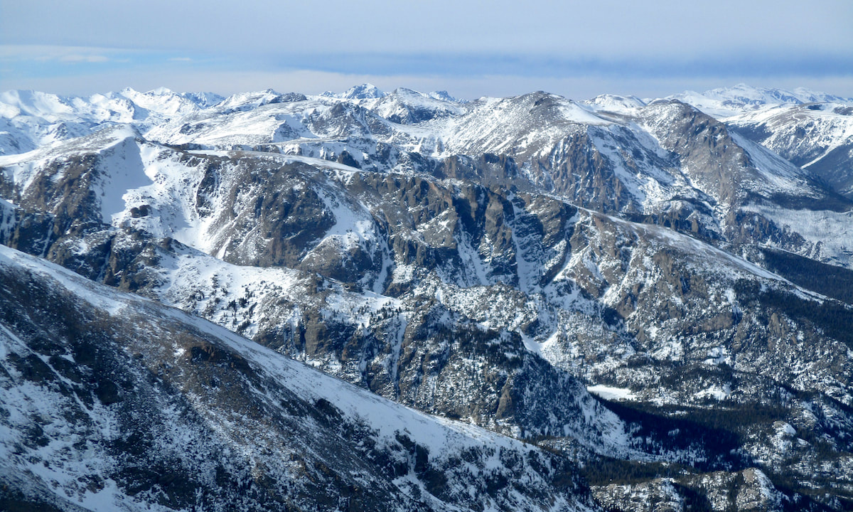 Photo: K. Rusk With shadows starting to grow long in the afternoon light, we descend through the Boulderfield.
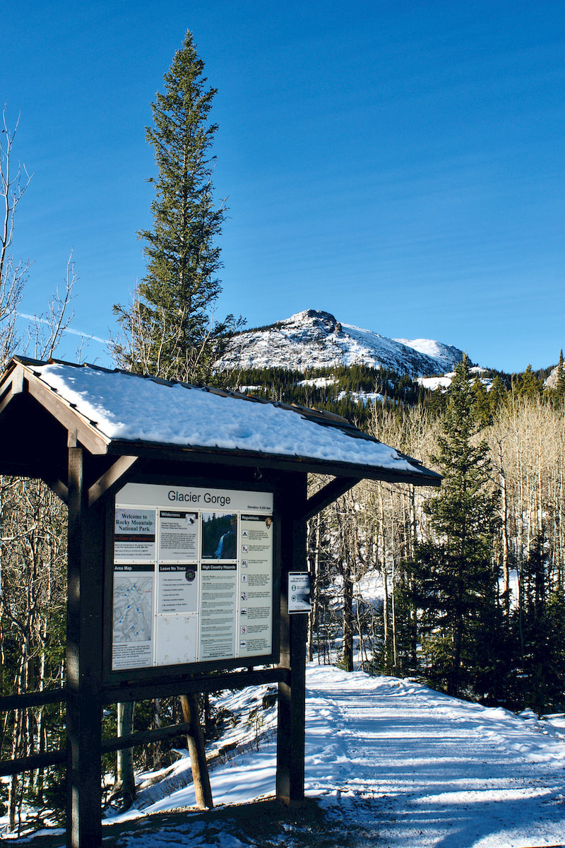
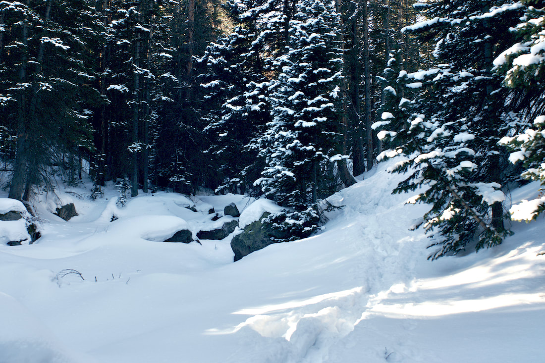
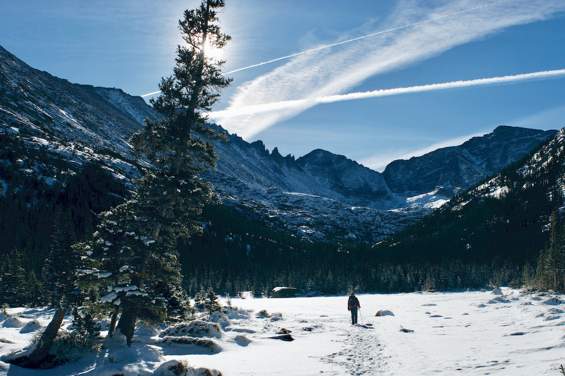
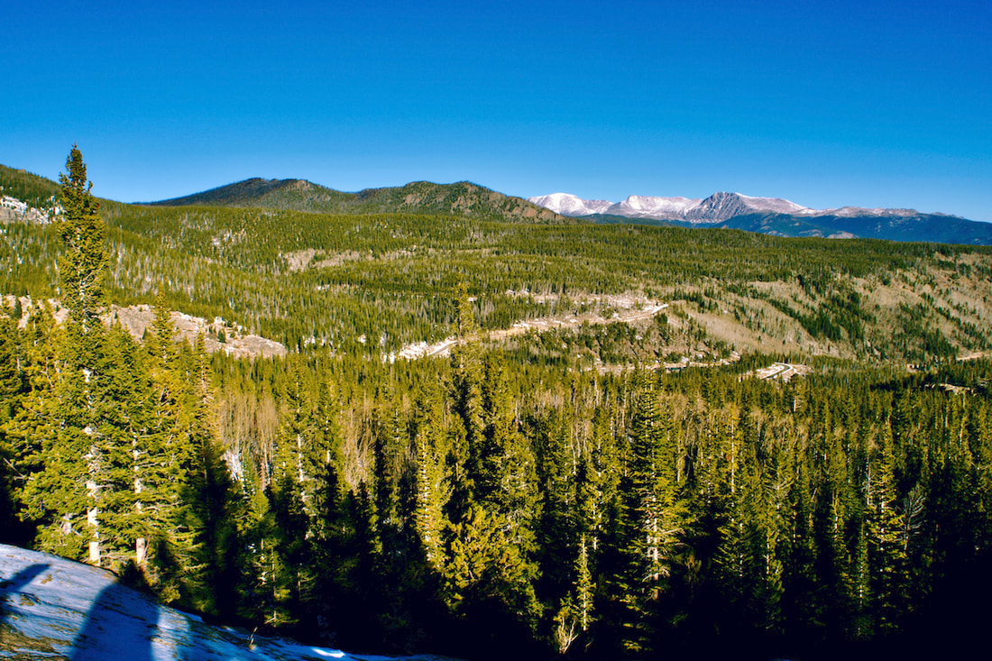
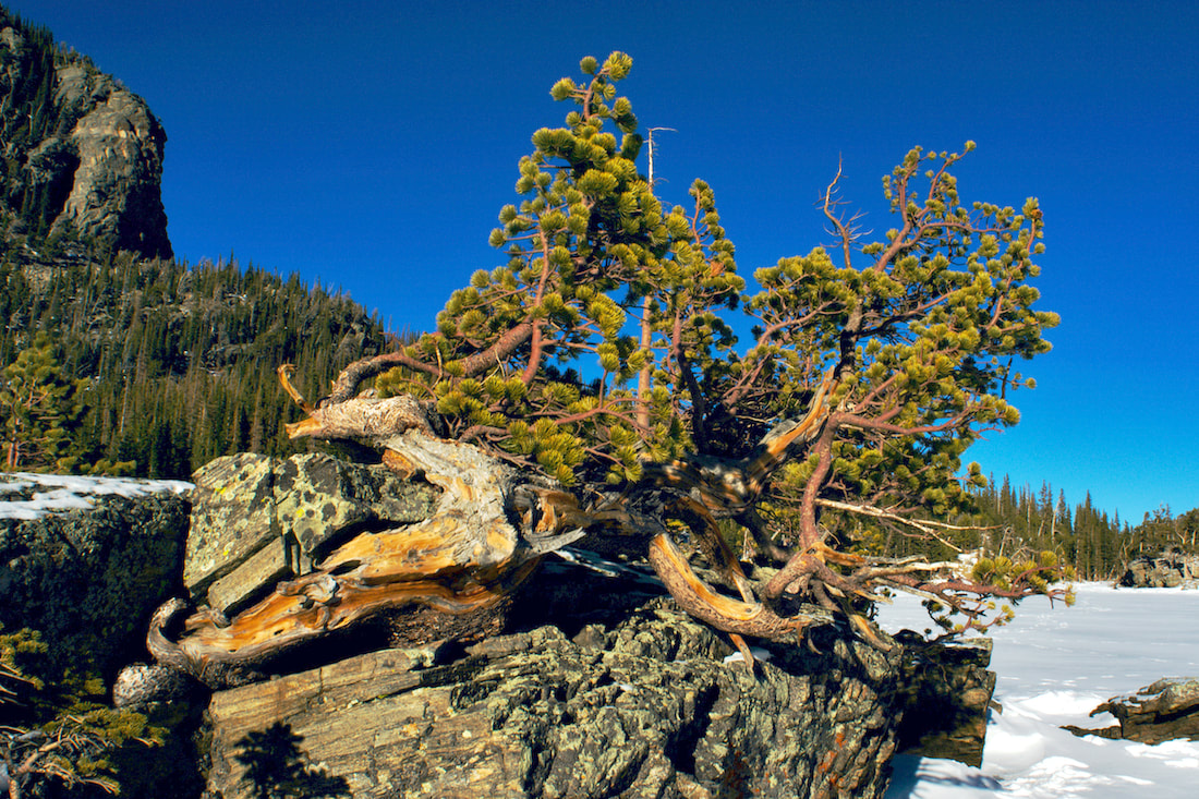
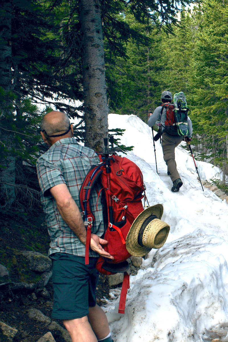
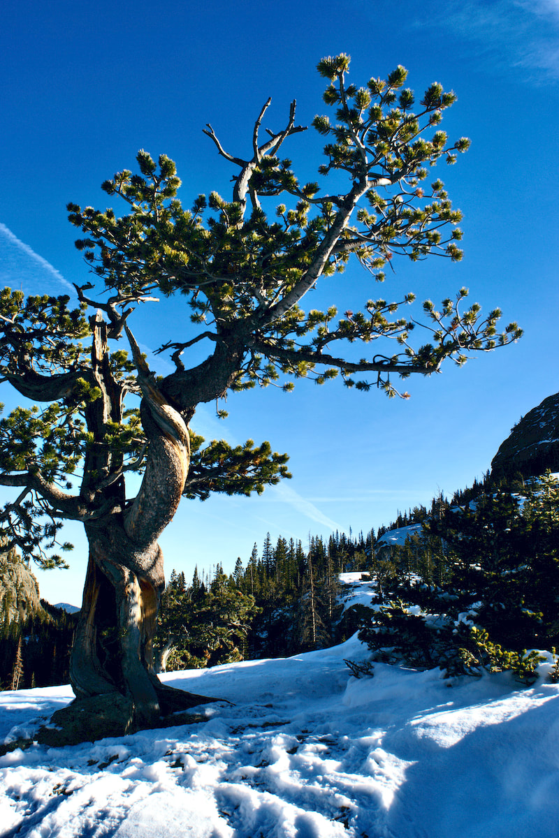
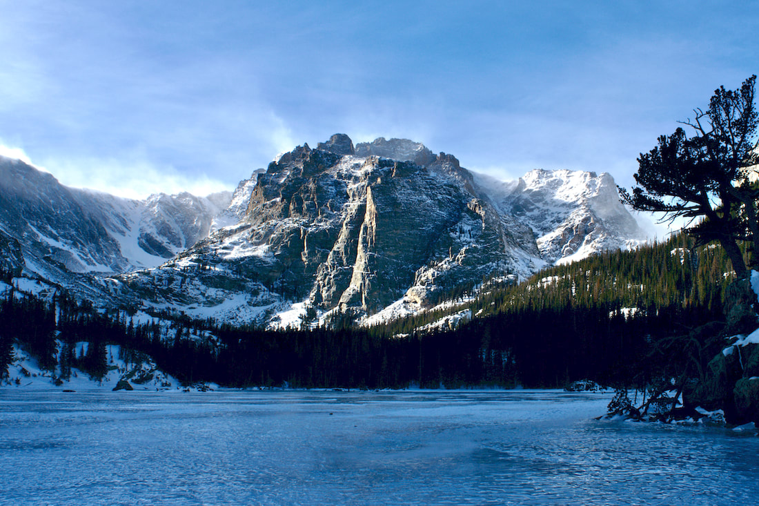
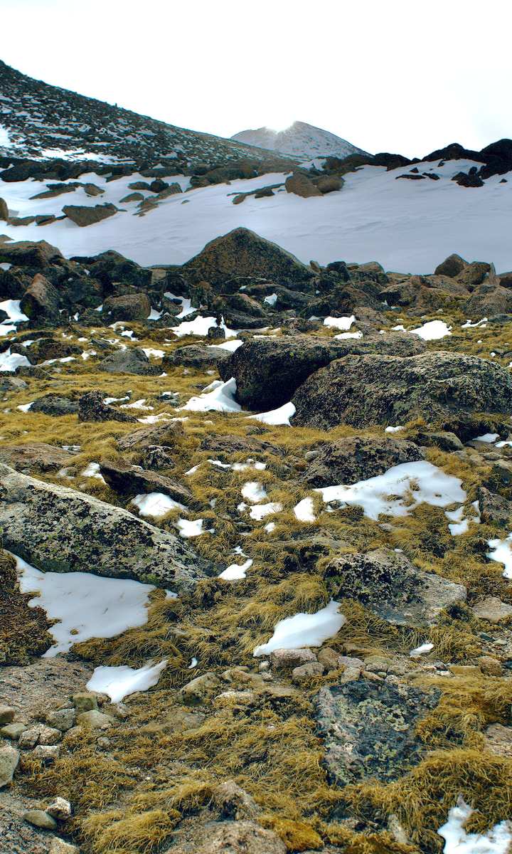 Photo: D. Rusk 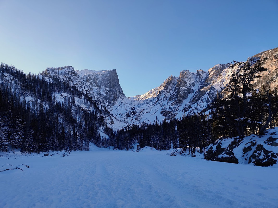 Dream Lake on a windless, perfect day in mid-January. Photo by Barb Boyer Buck Story and photos by Barb Boyer Buck A hike to Emerald Lake, that was the intention. It had lightly snowed overnight and the sky was a cloudless, cobalt blue. Most importantly, there wasn’t any wind. If you don’t know about the wind in the eastern foothills of Colorado – most notably in the valleys– well, It’s brutal. When air is forced over the Continental Divide and combines with Chinook upslope winds, the result is a cacophony of directionless and fierce wind. It’s just as crazy-making as the sound of a symphony warming up. When I was the renewable energy manager for the Town of Estes Park, my team thought perhaps wind turbines would be able to harness this crazy wind, but no. The wind comes from too many directions, is too fast (70-90 mph is not uncommon) and is never consistent. It’s either windy or it’s not, at least from October through April. I was excited to take a hike in the fresh snow with no wind. But it was a late start – we probably didn’t reach the Emerald Lake Trailhead until close to 1 p.m. I brought my snowshoes just in case, but micro-spikes and poles worked just fine. From its trailhead, Emerald Lake is 1.8 miles, so we figured we’d get there around 3 and have plenty of time to get back down before dark. It was nearly a month after Winter Solstice and the days were getting a bit longer. 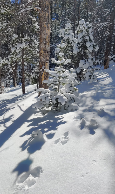 Beautiful lighting, fresh snow, and fresh bunny tracks! Beautiful lighting, fresh snow, and fresh bunny tracks! But we were stopped quite literally in our tracks with almost every step. Snow doesn’t usually stay on the tress very long in RMNP (again, the wind) but that day, it covered every branch like fluffy icing, it sparkled in the full sun. The views along the way were spectacular and even with my cell phone, I was able to capture amazingly clear photos with great detail. This was a function of the afternoon lighting as well, which became increasingly rich as the day wore on. The Emerald Lake Trailhead is by far the most popular one in Rocky Mountain National Park, any time of the year. This day, a Tuesday in mid-January, was no exception. There were a lot less people than in the summer months, but the route was still fairly crowded. 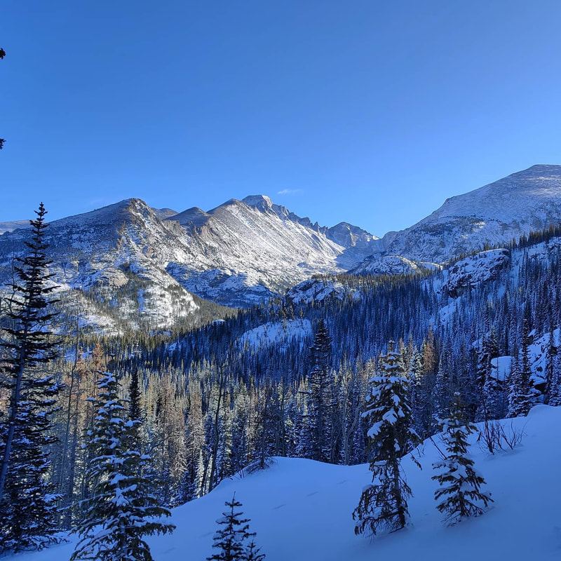 Longs Peak, Keyboard of the Winds, Pagoda Mountain, and Thatchtop from the Emerald Lake Trail. Here’s the etiquette for passing on the trail: those traveling up have the right-of-way. This is especially important when the trail is snow packed and/or icy. Further measures to take during these COVID times is to step aside, pull up your mask (if it’s down), and turn your back to the trail. Six feet of distance is just not possible on these popular trails. 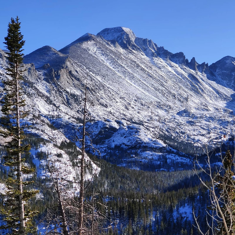 The Keyboard of the Winds and the top of Longs Peak were visible the entire way. Photo by Barb Boyer Buck But I found myself stopping many more times than I technically needed to because of the stunning sights, especially of the Keyboard of the Winds formation on the “back” side of Longs Peak. The wind I was talking about earlier can make some unearthly sounds as it passes through this jagged ridge. The trail to Emerald Lake is packed full of amazing views and destinations – if you count Bear Lake (which is just a few steps from the trailhead) you see four lakes, amazing views of Longs Peak, many other stunning peaks, and beautiful geologic formations. 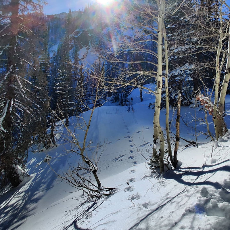 A bunny convention in the waning afternoon light. A bunny convention in the waning afternoon light. The first destination along the trail is Nymph Lake. In the winter, when the lakes are frozen over “winter trails” are established at each lake which cross over the frozen waters. Be very careful when you do this – sometimes the ice is thin in places you cannot see. Make sure that every lake is completely frozen on all edges before you try to walk across it. Views of Hallet Peak, first seen over Bear Lake, were now joined with the spires of Flattop Mountain. 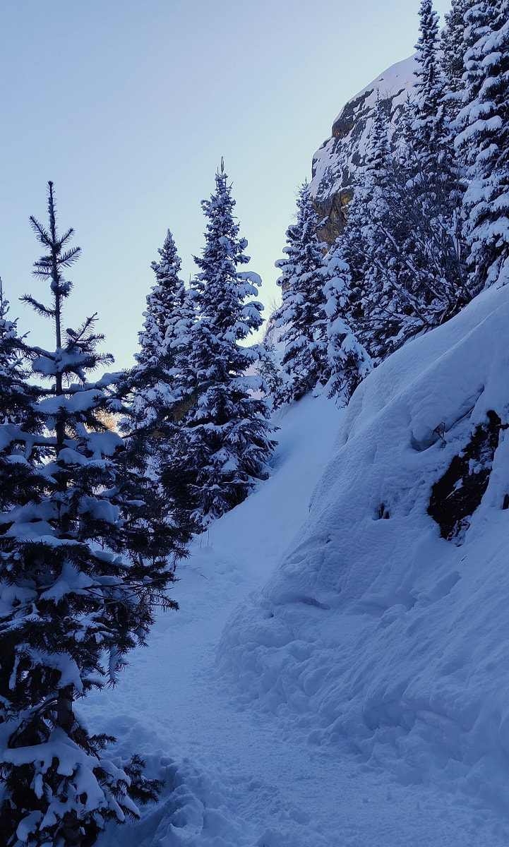 The trail to Dream Lake The trail to Dream Lake A bit further up, and you reach Dream Lake with more stunning views of these features. Other things we noticed at Dream Lake were the limber pines (colloquially, twisted pines). These trees are actually shaped by the wind as they grow, and they are some of the oldest living organisms on earth. Some limber pines in RMNP date back over 1,000 years, according to a report by several federal forestry agencies, “Limber Pine Conservation in Rocky Mountain National Park,” published in 2013. At this point on our hike, the sun was setting – as it sank over the peaks shading Dream Lake, a final alpenglow lit the scene in a spectacular way. 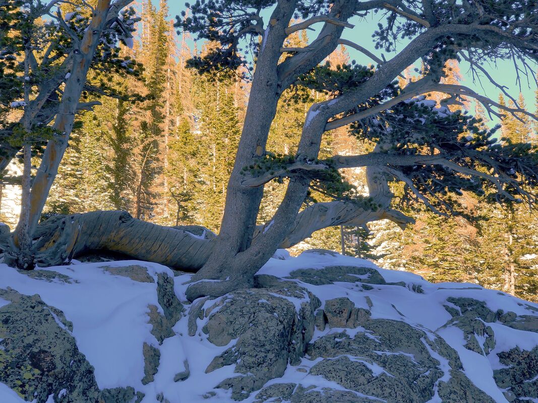 Limber pines are shaped by the fierce winds in exposed areas such as Dream Lake. These are the oldest living organisms in RMNP. Emerald Lake was not to be, not that day. But it’s days like that which make me glad to be alive. For me, rushing past the gifts of Nature, especially when they were laid out so beautifully for us to experience, is unforgivable. Emerald Lake isn’t going anywhere, and neither am I. 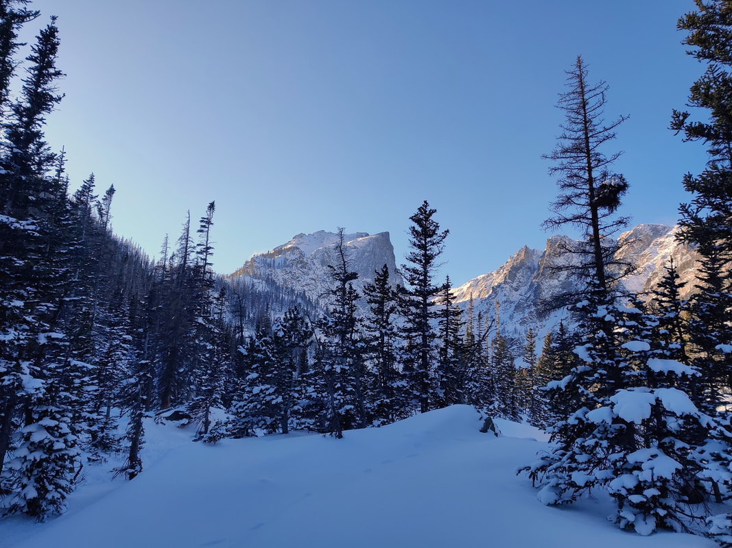 This Narnia-like scene was just before we reached Dream Lake. By Dave Rusk It was 20 days past the Winter Solstice last week when we ventured up into the Glacier Gorge area. Even though it was still 60 days until the Spring Equinox, the snowpack at the trailhead was very thin and it seemed like it wouldn't take much warmth to melt it away. But on this day, the trail was still snow covered, the skies were blue, and there was hardly a wiff of wind. The morning temperature was still cold.
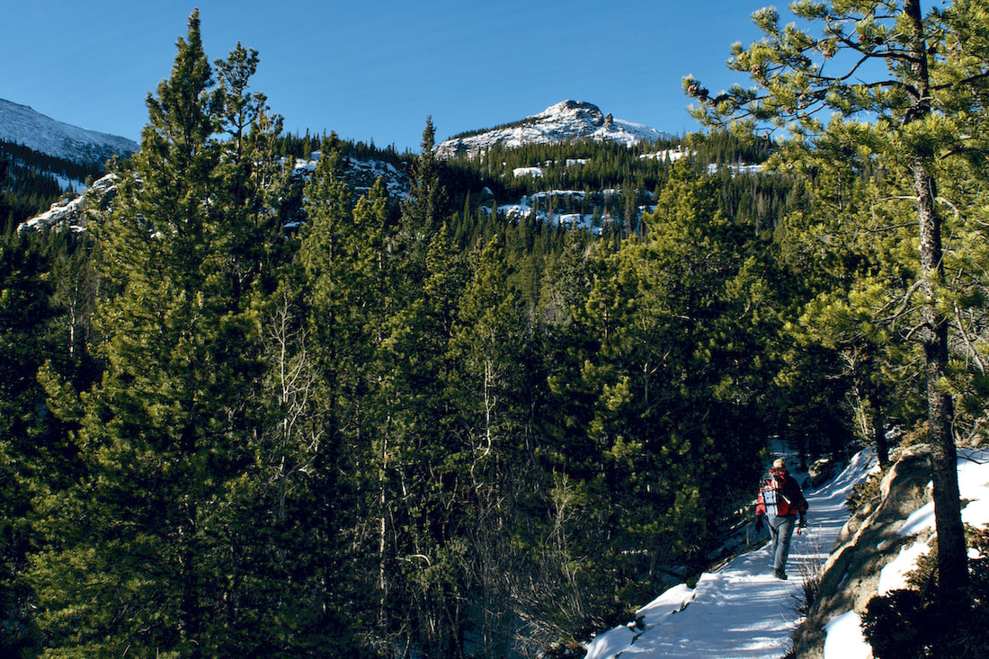
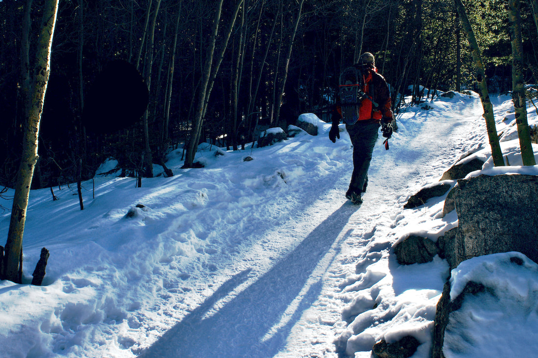
We quickly moved up the trail to where the mostly snowed over Icy Brook dropping out of the Loch Vale and joins with Glacier Creek. The snow was deeper here where it is sun and wind protected.
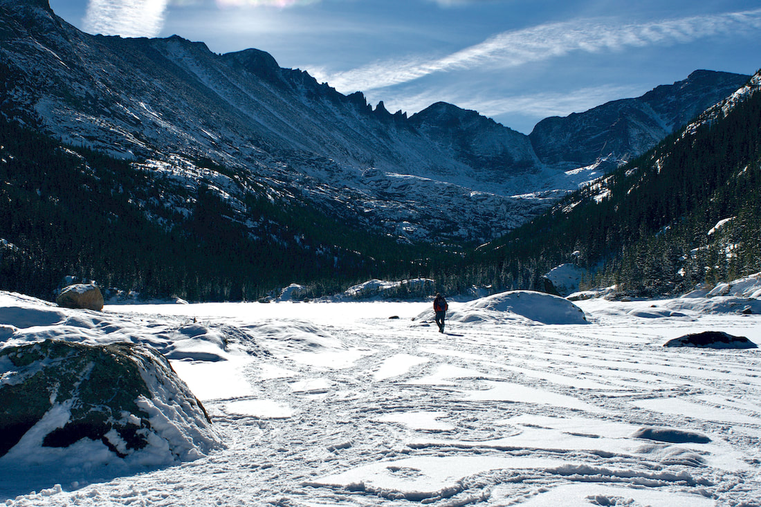
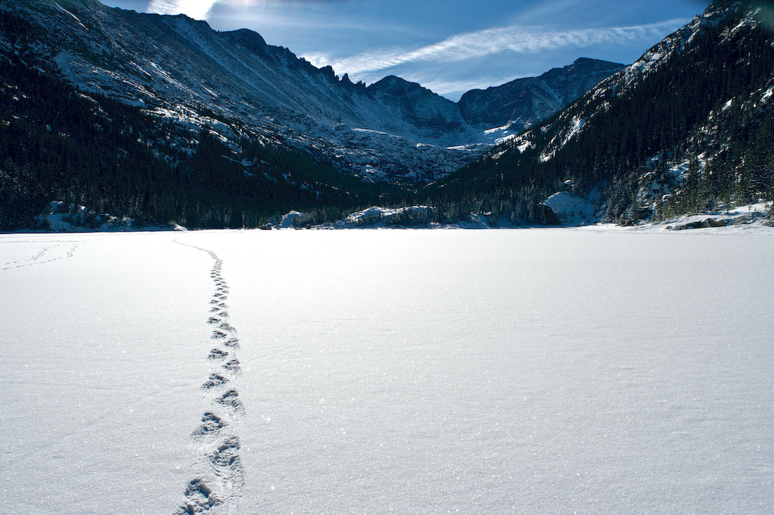
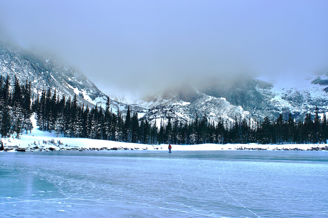
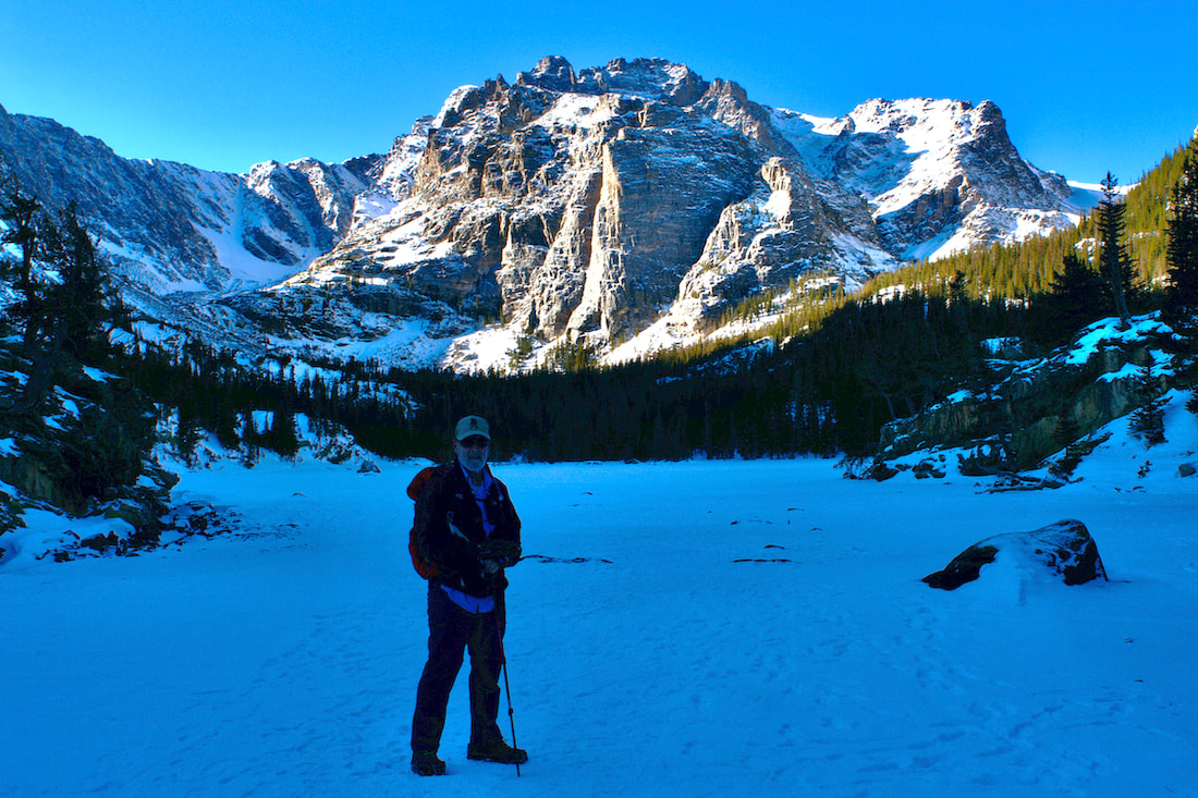
 We climbed up out of the drainage heading toward Mills Lake. The lake was frozen solid and there was still a couple of inches of snow on the lake that had fallen a few days before. We trudged across the middle of the lake to the far end.
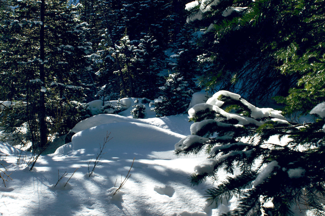
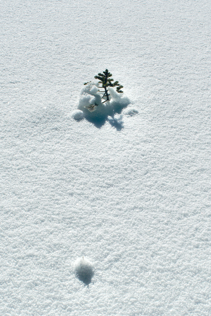
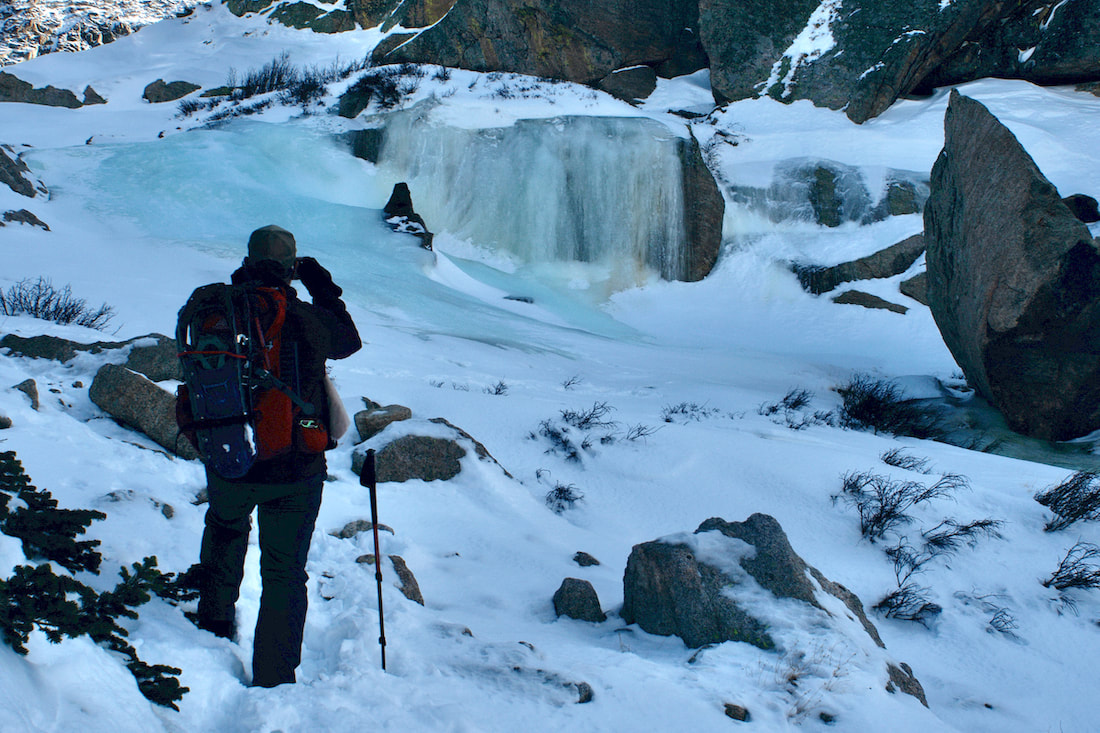
Once at the south end of Mills Lake, we followed the short drainage that connects Mills Lake to the small Jewell Lake and crossed it. At the south end of that lake, there was an area where Glacier Creek flows into Jewel Lake where the snow did not stick, like maybe the warmth of the water melted the snow, but left these odd puff balls of large flakes. It was kind of an odd phenomenon that was hard to explain. 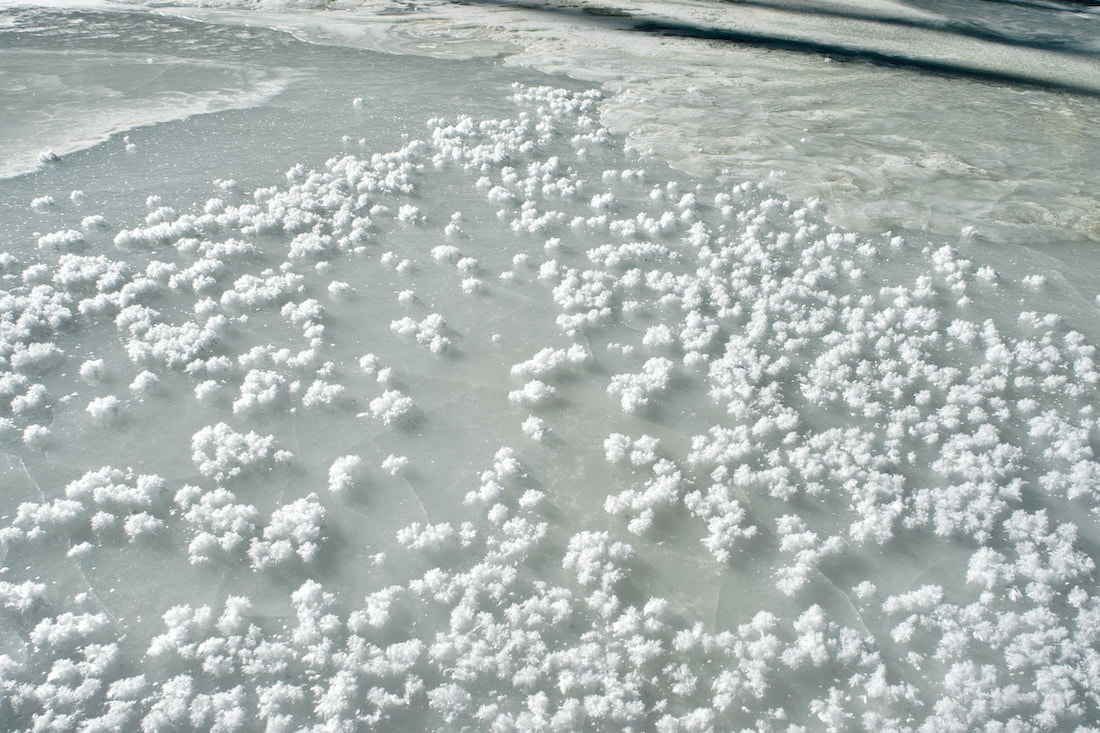
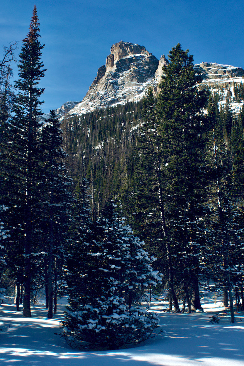
After Jewel Lake, we returned to the trail and worked through the blowdown area from a Nov 2011 wind event and started to move into the upper part of Glacier Basin with Arrowhead appearing to the west and then finally McHenry's Peak. 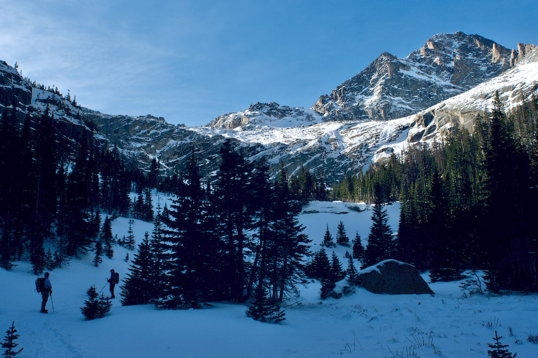
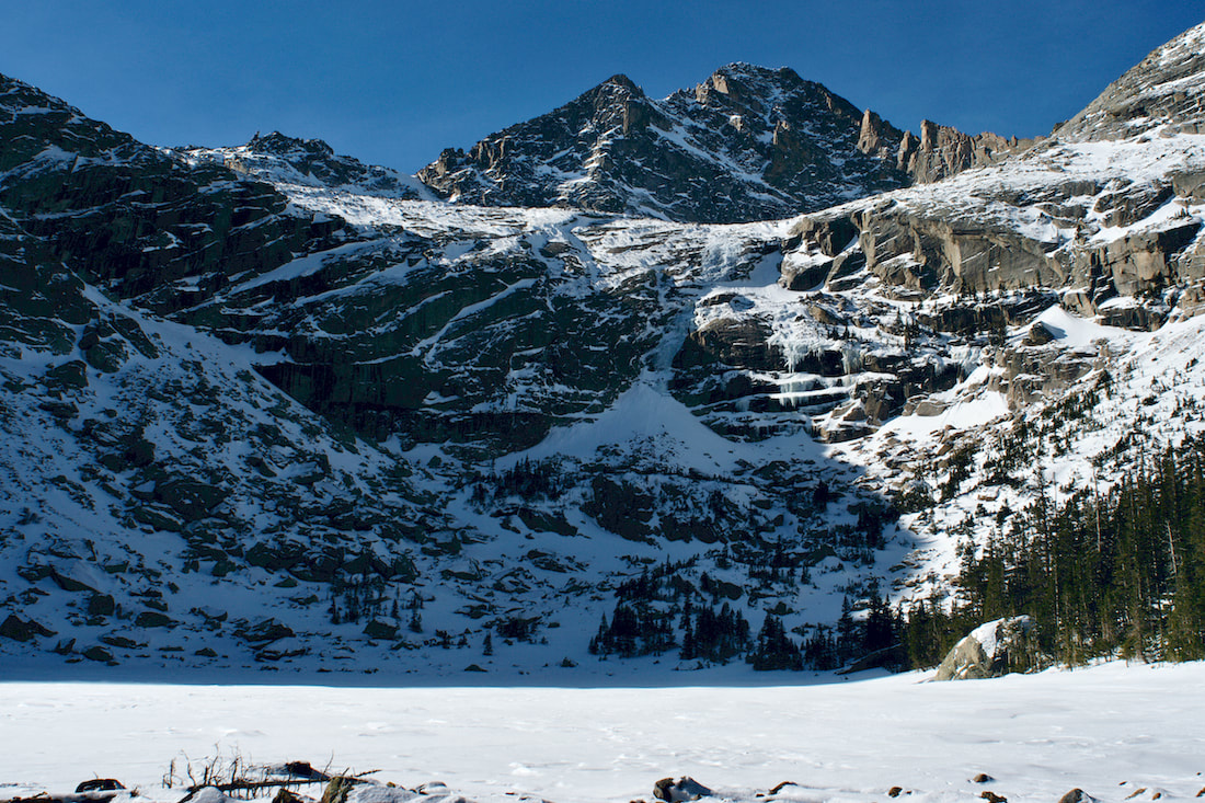
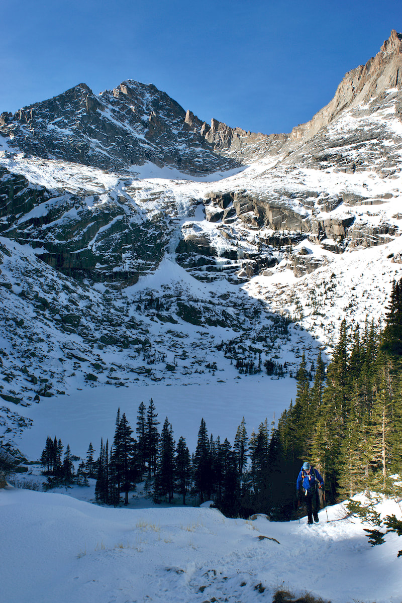
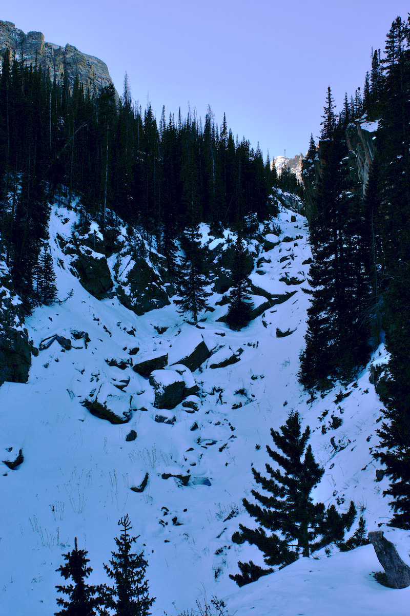
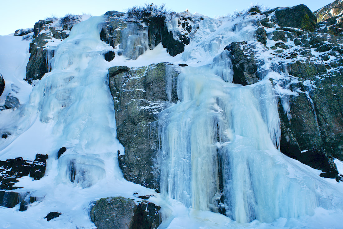
Once at Black Lake, also with a thin layer of of snow on it, we moved up the drainage that leads to the upper hanging valley. Part way up, now at about noon, with the sun at it's zenith for the day, we stopped for a bite to eat and take in the amazing view. The day had been warm and we were casual on our break. In the summer, there are lots of seeps, water that flows out of the cracks on down the rock face. These had turned into ice flows as the winter temperatures settled in.
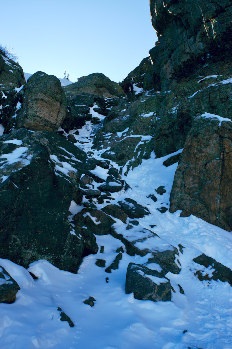
Up to this point, the trail to Black Lake was pretty well packed from snowshoers the previous day and shoe spikes was all that was needed for travel. But for moving into the upper basin, we decided to go with snowshoes. 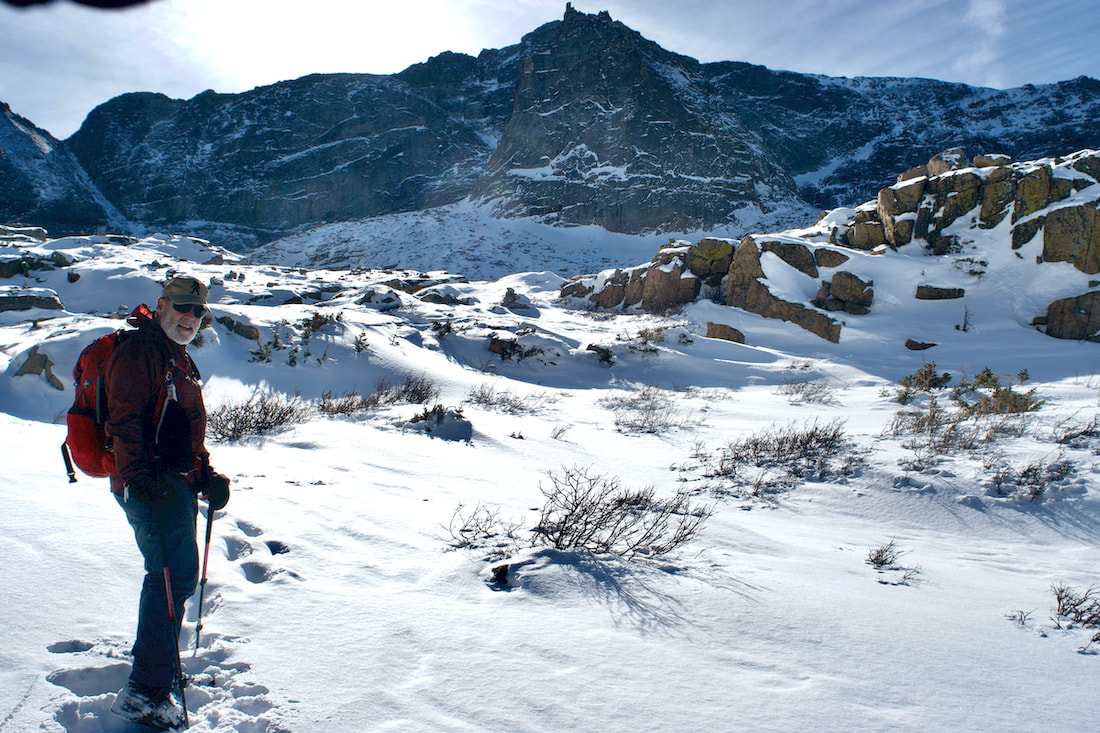 We climbed up into the Upper Basin that sits at the western base of Longs Peak. There was only one set of tracks and they were several days old, someone without snowshoes. Despite being mid day, the sun sat low on the horizon and I need to use my gloved hand to shade the camera lens.
From the upper basin, McHenrys Peak and Arrowhead rise dramatically to the west and turning behind us, we could see all the way across to the Mummy Range in the north. Jet contrails were the only things breaking up the blue sky. 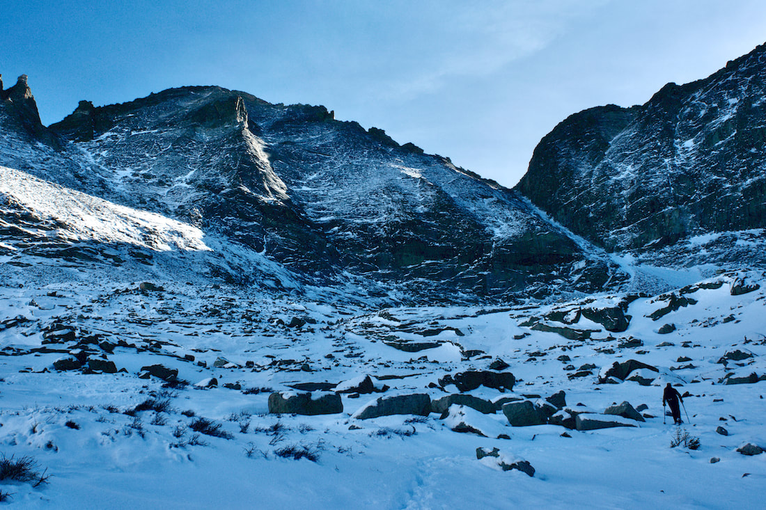 We navigated our way through the boulder fields heading for Green Lake. There was snow coverage over the krumholtz shrubs, but grass, willows and rock cairns were poking through the thin layer of snow.
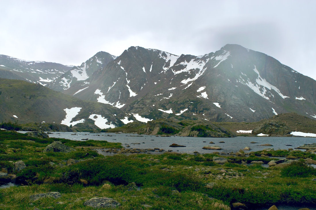
The sun had now dropped behind Chiefs Head Mtn and temperature started to drop and the downslope wind picked up. But the Key Board of the Winds rock formation continued to bask in the afternoon light. Finally at Green Lake at the base of Pagoda Mtn, we stopped for some more food and water before heading back down. We had caught a beautiful day in the Park.
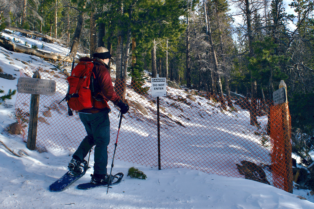
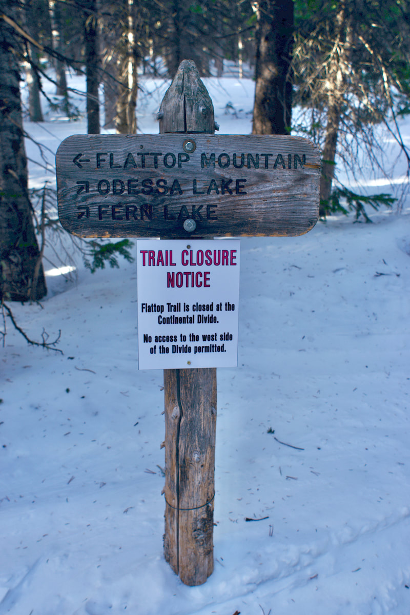
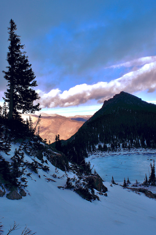
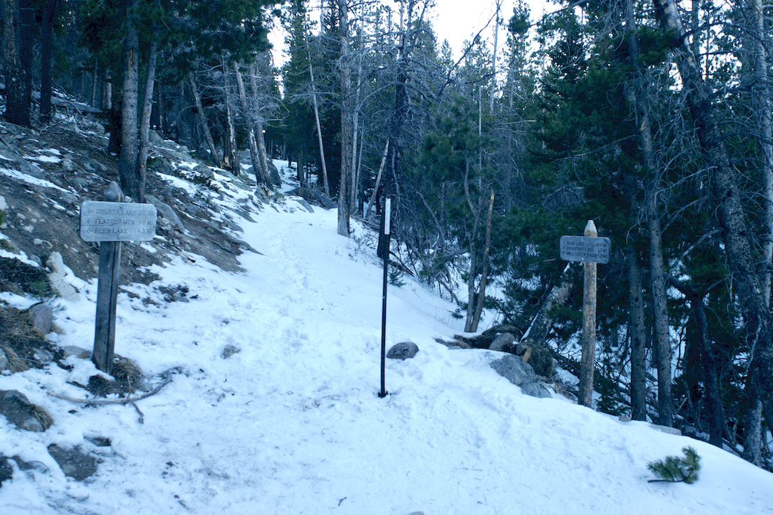
The weather prediction for Estes Park was for sun on this first day of winter, the shortest day of the year, but a blanket of clouds hung low on the mountain peaks as we began our trek up the Flattop Mtn trail from Bear Lake.
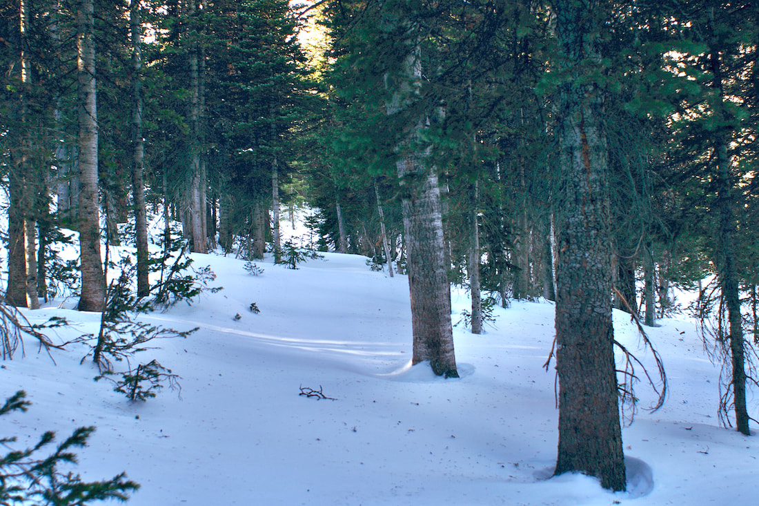
The trail was mostly packed, but there was enough soft snow that we decided to put the snowshoes on early, we knew we would eventually. Morning sun filtered through the trees and the temperature was moderate.
 Most of the trail along the lower eastern flank of Flattop Mtn was packed and as we looked east into the Estes Valley, we could see that it was sunny, and lacking snow. But where we were, at just over 10,000ft, there was about 1-3 ft of settled snow. A little further on and you can see the fire scar on Mt Wuh.
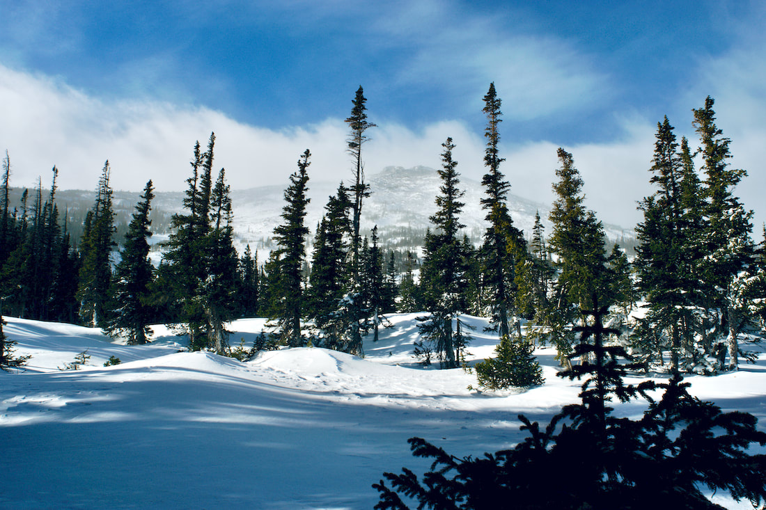
The trail travels through subalpine spruce and even though we were close to treeline at this point, there are some big spruce trees in this part. This is also a difficult section of trail to route fine as the trail often gets covered over with blown snow off Flattop Mtn in an area known in the winter as the Flattop Drift.  Keeping track of where to go can be difficult if no one has traveled through recently. It can also be a spot where you can follow the tracks of someone who doesn't know where the trail goes and you end up wandering around until you eventually happen upon the trail, or just make your own way.  Once around on the north side of Flattop Mtn, before the trail descends into the Odessa Gorge, there are two smallish ponds, Two Rivers Lake and Lake Helene, that most people pass by in the summertime on their way to Odessa Lake, but become the common destinations in the winter. On a clear day, Notchtop Mtn rises dramatically and there are fabulous views from these two lakes. But on this day, unless the clouds began to lift off, most of Notchtop Mtn remained hidden from view.
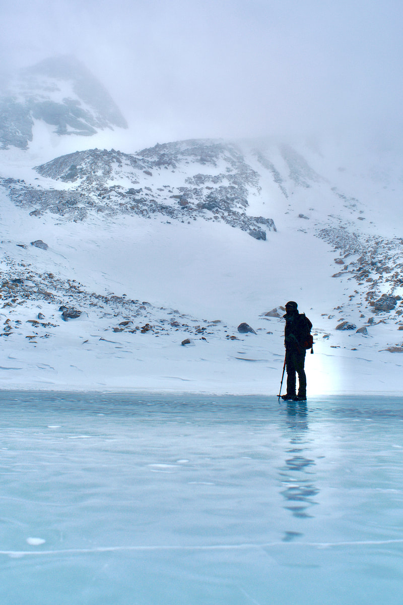
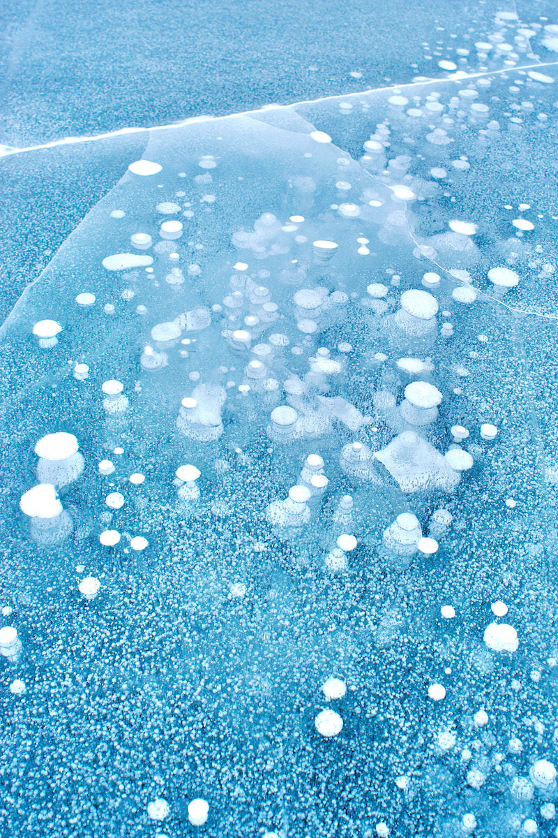
It was very windy at Lake Helene as is usually the case in the winter, and the lake was frozen over but free of snow. We braced ourselves against the wind and crossed over. We could tell we were right at the edge of the clouds, looking north Joe Mills Mtn kept appearing and then disappearing into the clouds. It would be like that all day. We continued past Lake Helene and started towards Ptarmigan Glacier and into the clouds.  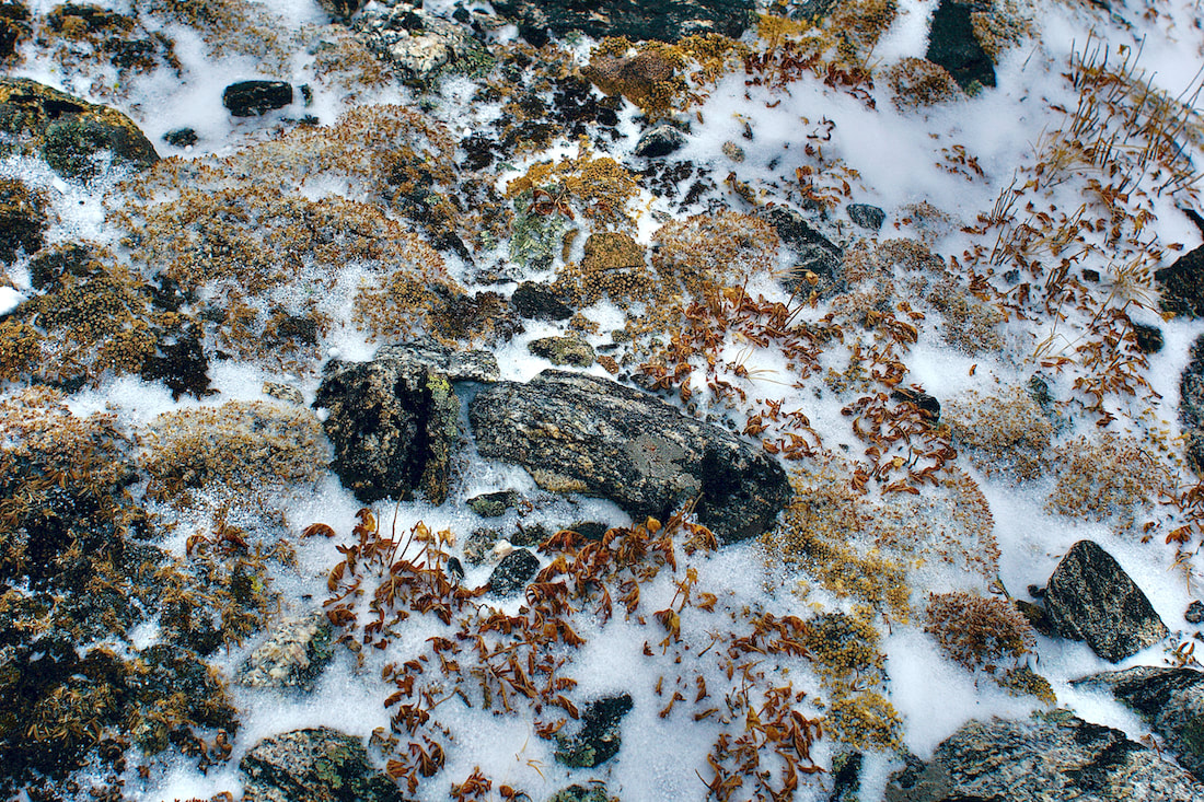 We really didn't have a specific destination at this point. It was a matter of how far could we safely go and leave enough time for the return before dark. Higher up, there is an unnamed tarn that sits roughly at the bottom of Ptarmigan Glacier. 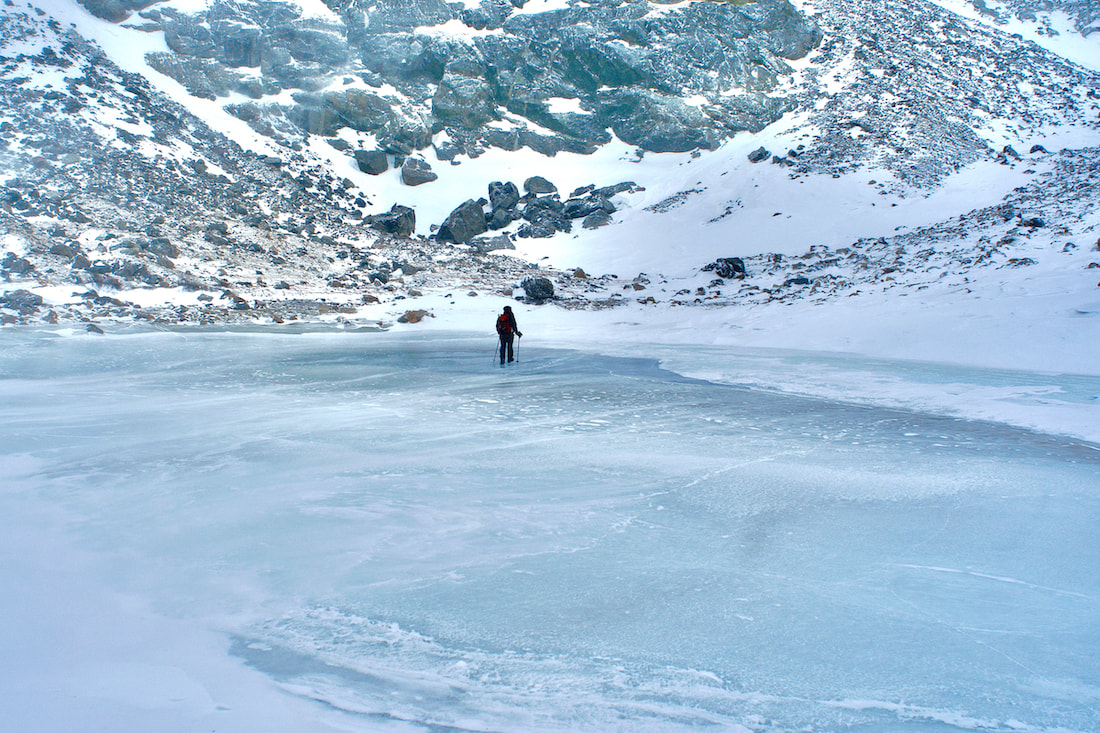 We crossed over and marveled at the designs of the frozen air bubbles.
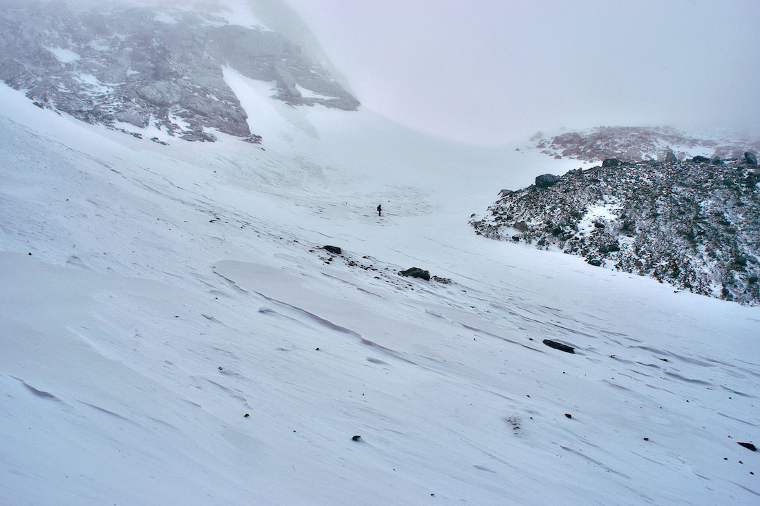
We had switched from snowshoes to spikes at this point and the travel up was slow, but it was easy to pick our way up the hillside. We were getting into some steeper terrain and in certain places there was a lot of debris on the snow that had come down from above. 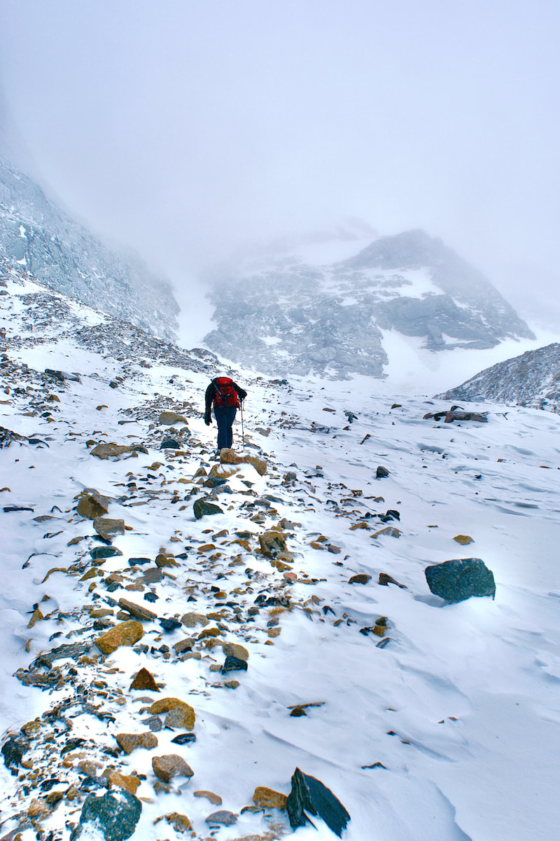 We crossed over a snowfield to a rock outcrop and decided we had reached our high point for the day.
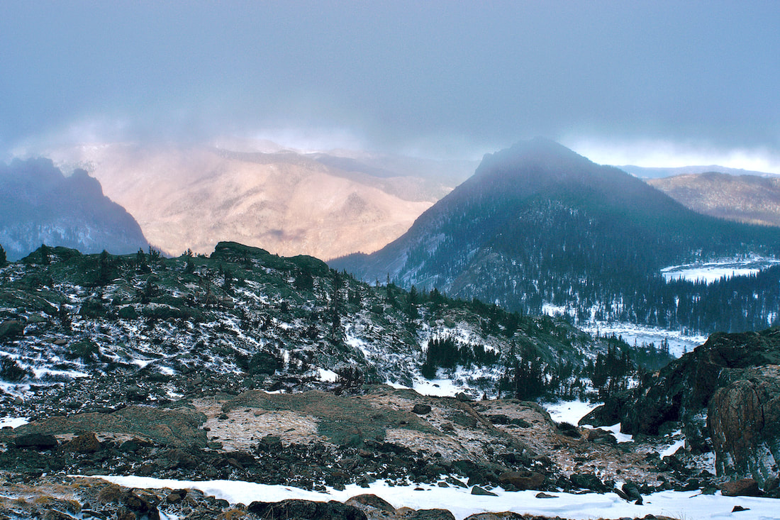
It had been our hope that as the day went on the clouds would begin to lift and give us that magical site of mountains emerging through the clouds. But the clouds just hung in there only giving us glimpses of the sunny day beyond. We made our way over to Two Rivers Lake before returning to the trail.
It had been a great first day of winter!
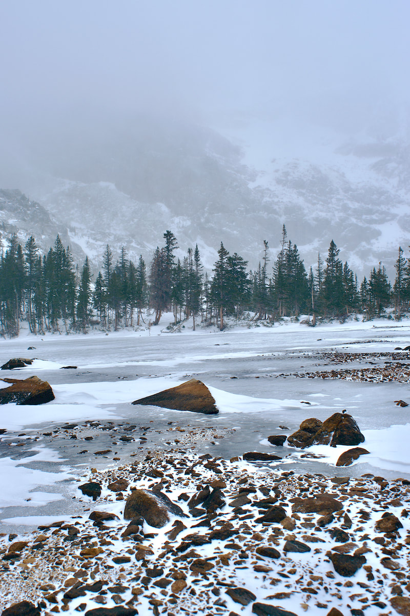
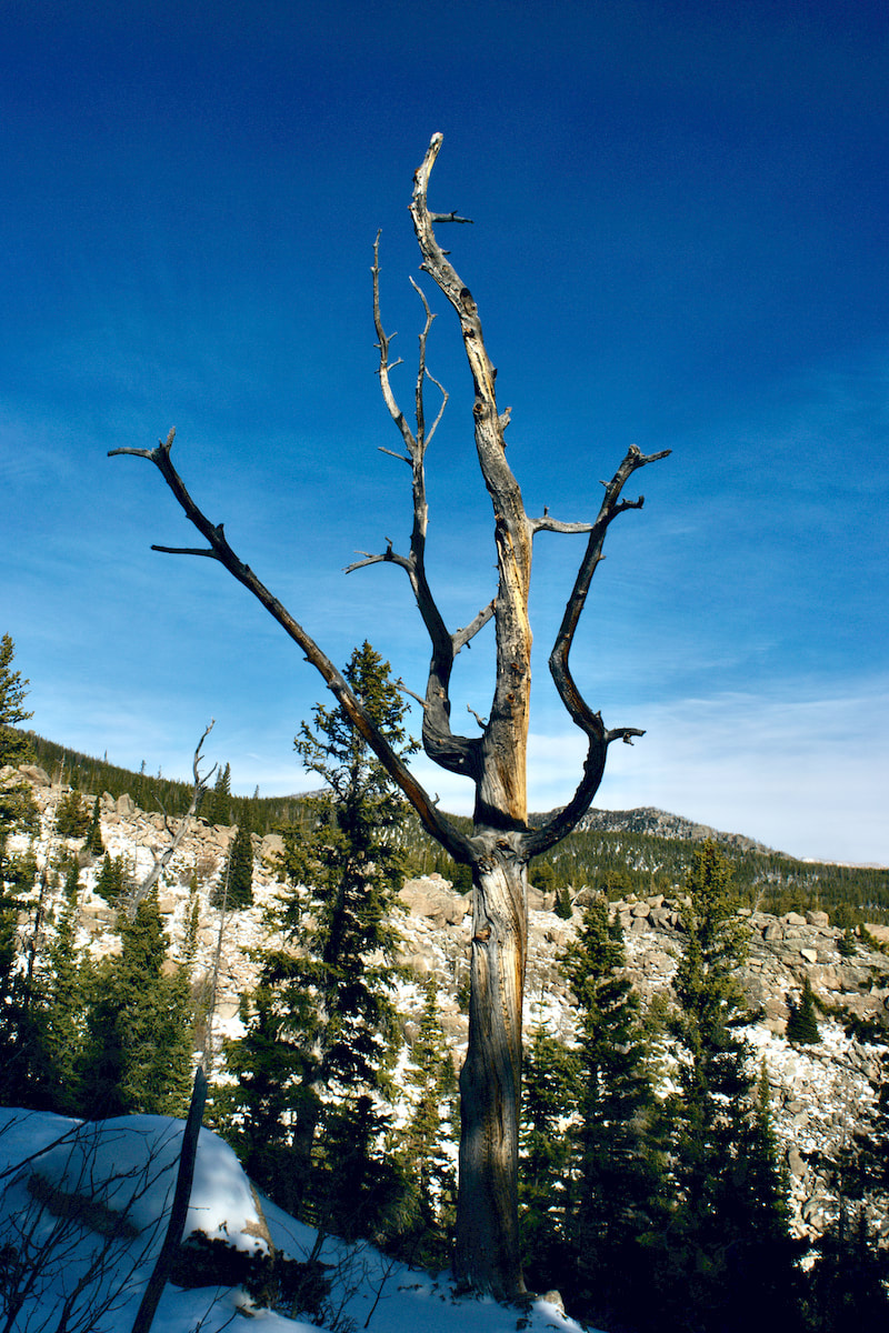
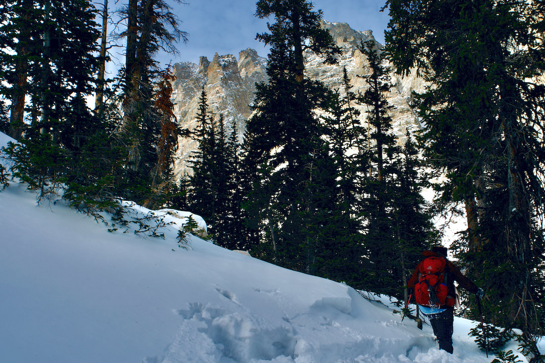
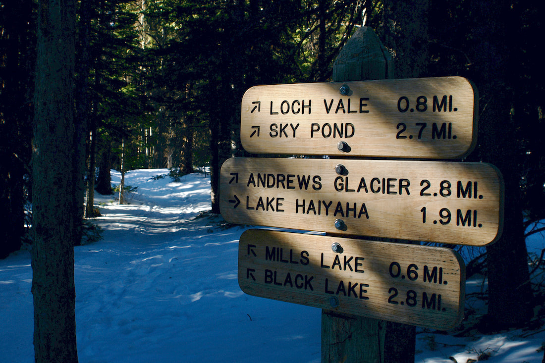
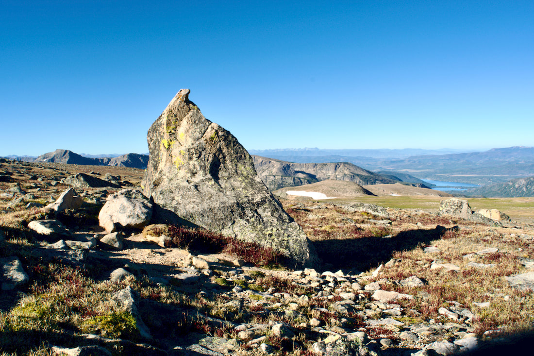
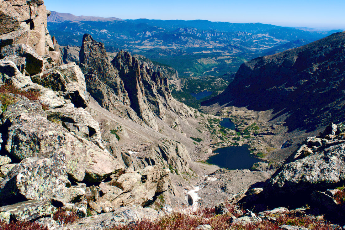
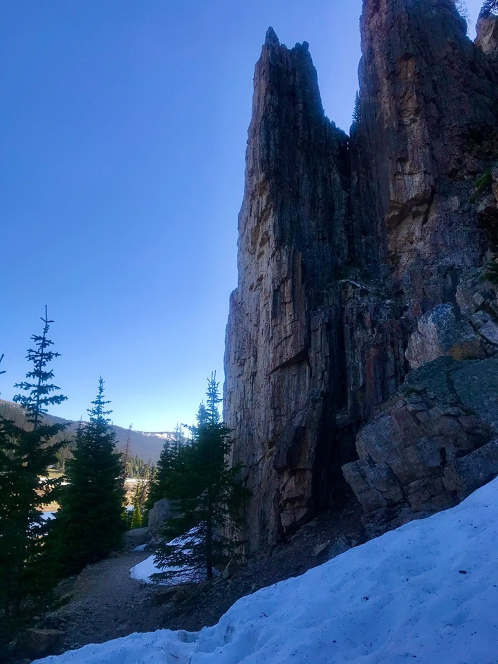
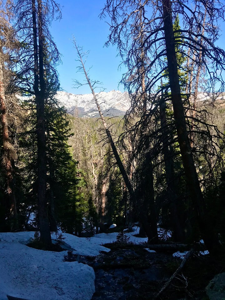
Yesterday was Winter Solstice. Over the last 48 hours or so, on the last day of Fall, we have been experiencing a winter wind storm with steady nonstop high winds and incredibly forceful gusts. The kind of wind that if you were a pica up in the tundra, you would want to be deep in your little cozy hole, far below the surface, surrounded by lots of dry flowers and grasses, curled up in a tight ball, fast sleep with visions of sugar-plums dancing in your head, while the wind ravaged those poor little tundra plants at the surface. It’s the kind of wind that sculptures bristlecone pine trees into marvelous twisted living art. The kind of wind that is so forceful it inspires awe. Having completed our shakedown trek to Sky Pond two weeks earlier, my brother and I felt ready to take on winter as it is on the east side of the Divide. So, late in the week last week we decided to head to Andrews Glacier, one of the eight named glaciers in Rocky Mountain National Park. Andrews Glacier sits between Taylor Peak to the south and Otis Peak to the north. Andrews Tarn is nestled at the base of the Andrews Glacier which, over the centuries, carved out a very high hanging valley that sits on the other side of The Sharkstooth Ridge from Sky Pond.
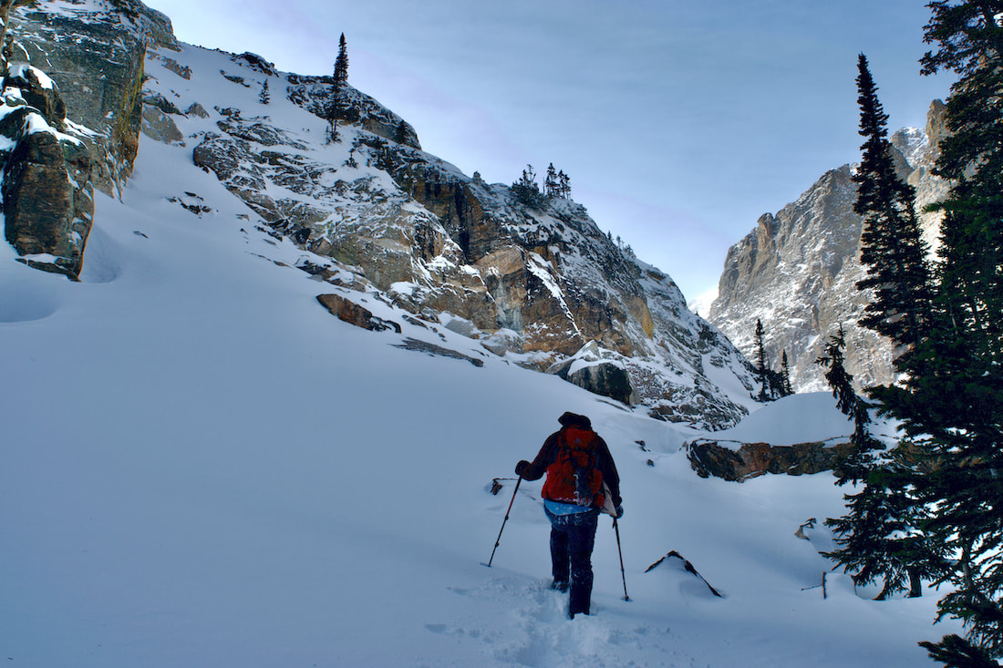
Still, it was warm enough that as we worked our way up, I would occasionally pull off my cap off my head to regulate my body temperature. Once I cooled down enough, the cap went back on. We continued up the Sky Pond trail until crossing on the footbridge that spans Andrews Creek, and then branched off the main trail and began heading into the Andrews Creek drainage.
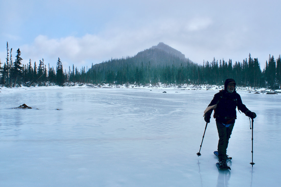
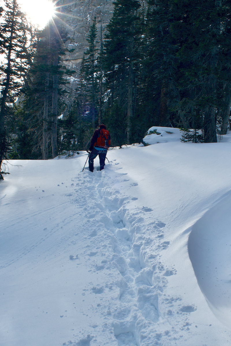
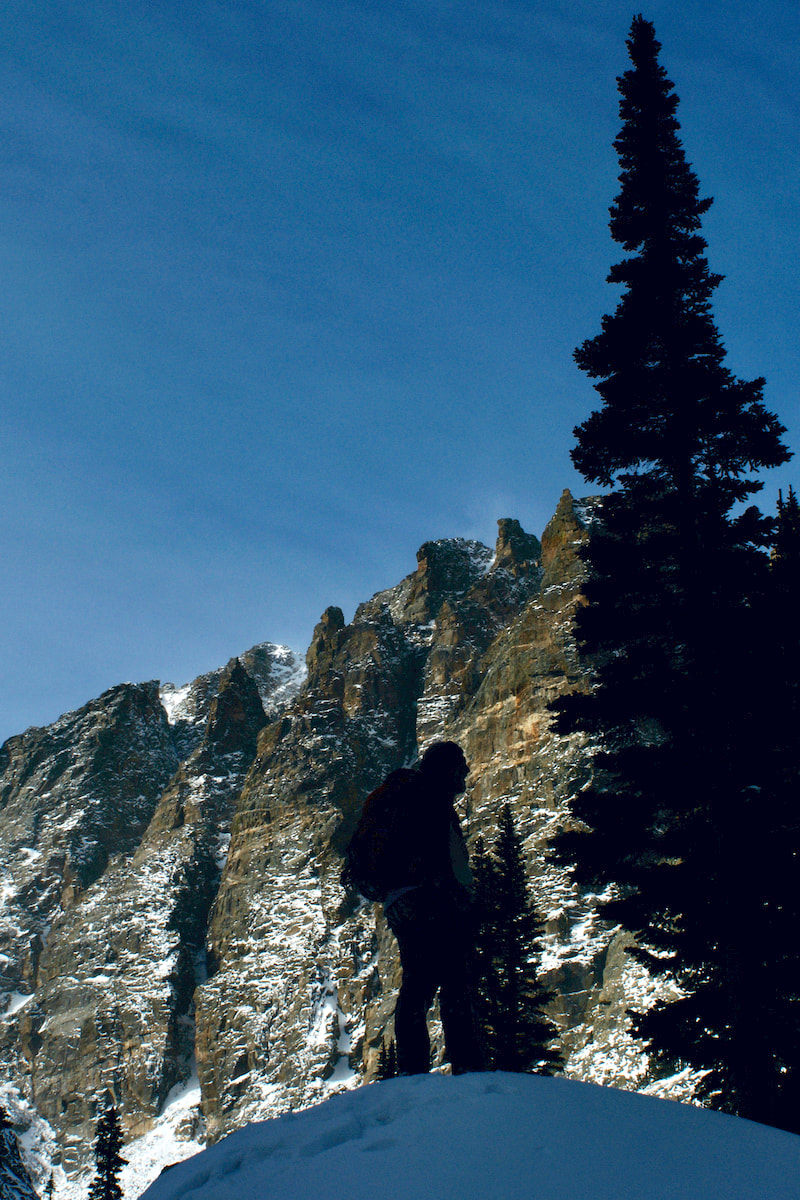
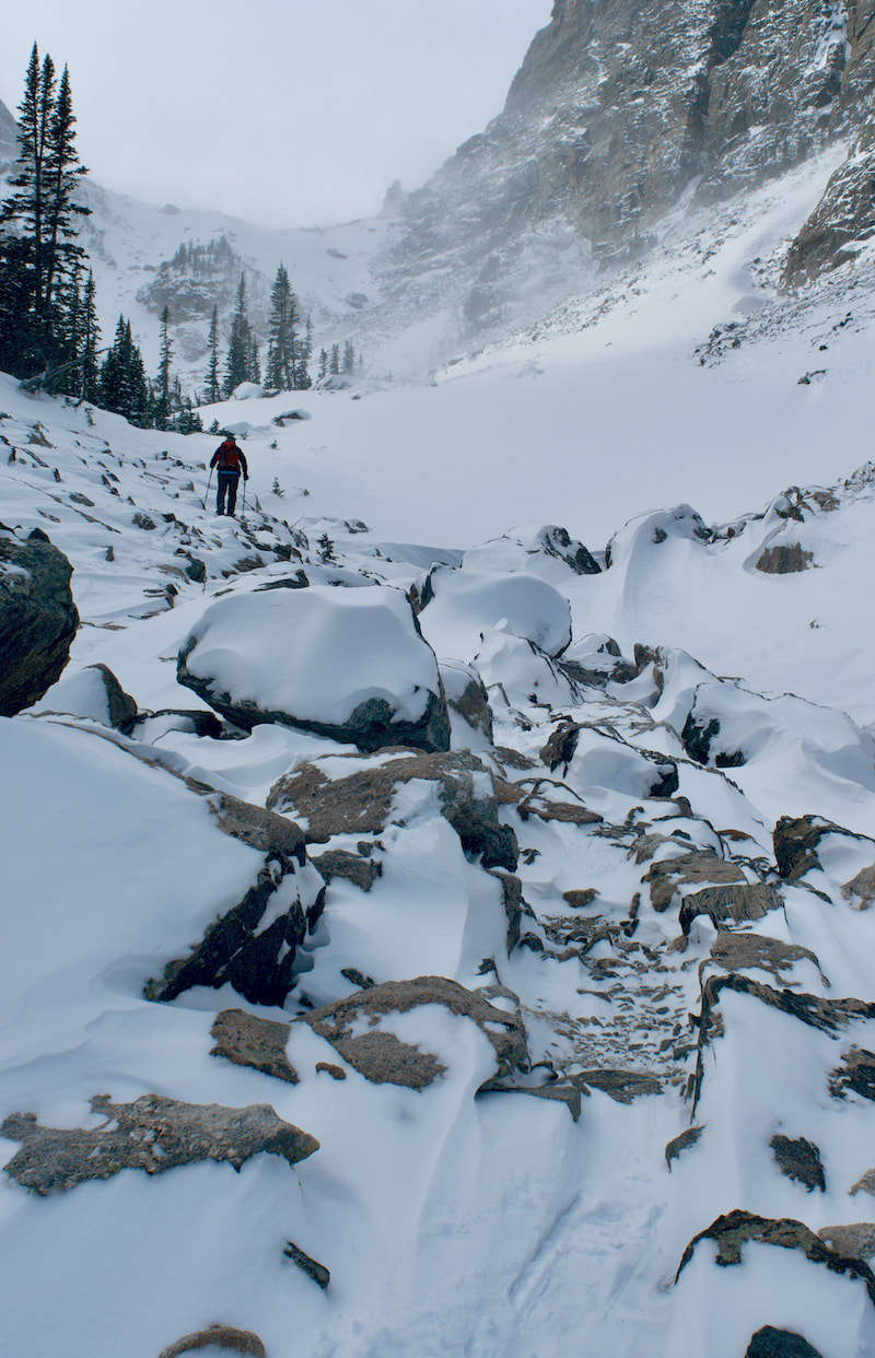
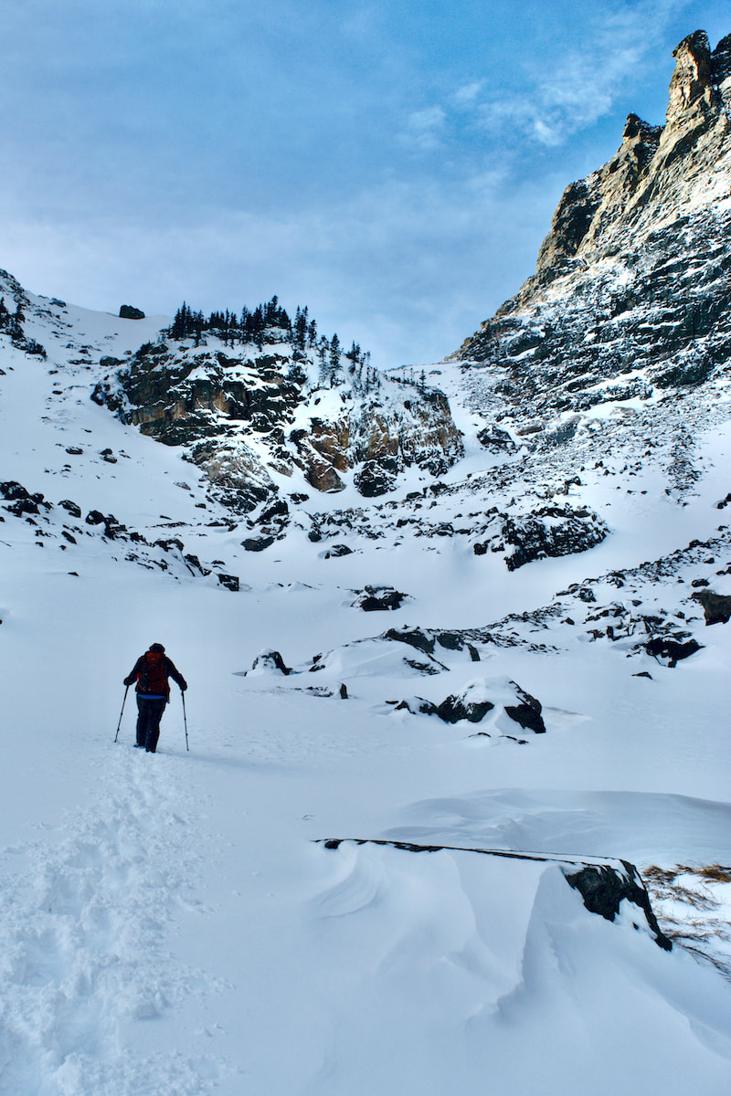
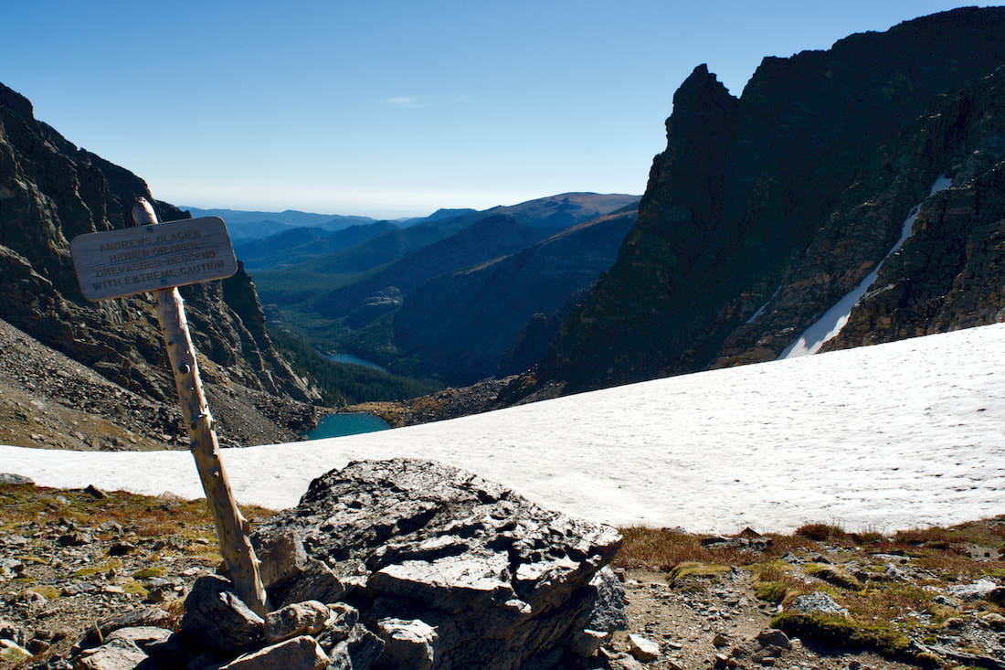
 The snow remained soft and we were aware that, in certain places, there was the potential for creating a small snow slide, so we stayed near the trees until we ascertained the small ridge that led up to the Tarn. That was the last stretch, and it proved to be a challenge. 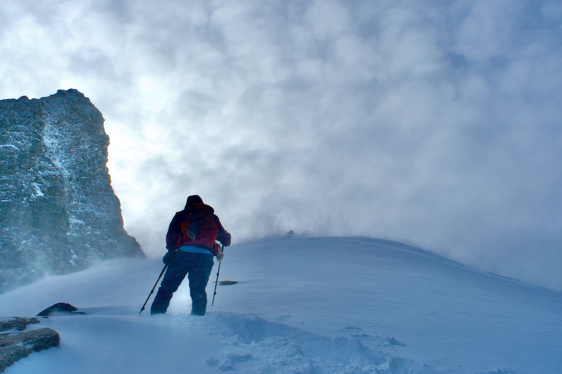 The wind was steady at this point and the snow, even on the crest of the ridge, was fairly deep and sugary. Every time Kip would attempt a big step up, the snow underneath slid and he would loose his footing. The day of breaking trail had taken a toll and making progress became frustrating. Having taken the easier task of following for most of the day, I offered to make an attempt to break the path up this final stretch. I jammed the toe of my snowshoes deep into the snow and pushed down trying to make a step, which worked most of the time. Slow progress with rests kept us moving up and we finally made it to The Tarn. Our hard efforts were rewarded with the strongest, most forceful winds of the day. The wind was ferocious. There would be no lingering for afternoon snacks here. I quickly moved into a position to snap a few photos that I hoped would turn out, then we carefully worked our way back down out of the blast. 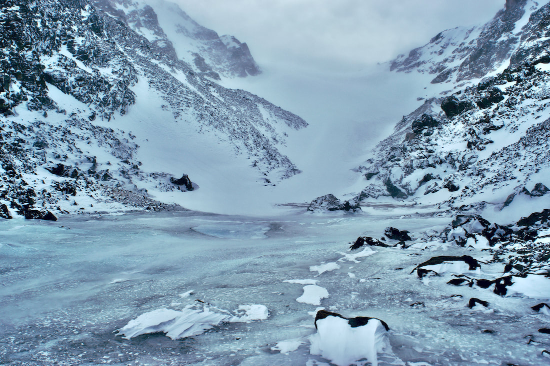 Once down into the treeline, we did not follow our tracks out, but choose instead to stay in the basin until we reached the Sky Pond trail, completing our loop. Our legs were tired, but we knew darkness was approaching quickly. We barely beat the darkness back to the parking lot and found that we were the last car in the lot. Cheers went up at what had turned into an adventurous day. It was 17 days before the Winter Solstice and the sun was getting low on the horizon. The temperature above 9,000ft had stayed below freezing, but on this day, the temperature hovered near the freezing mark and the sun felt warm, even spring like. 17 days after Winter Solstice would put us into early January and I would hope by then the temperature would feel considerably colder. (Click on the photos for a larger image)
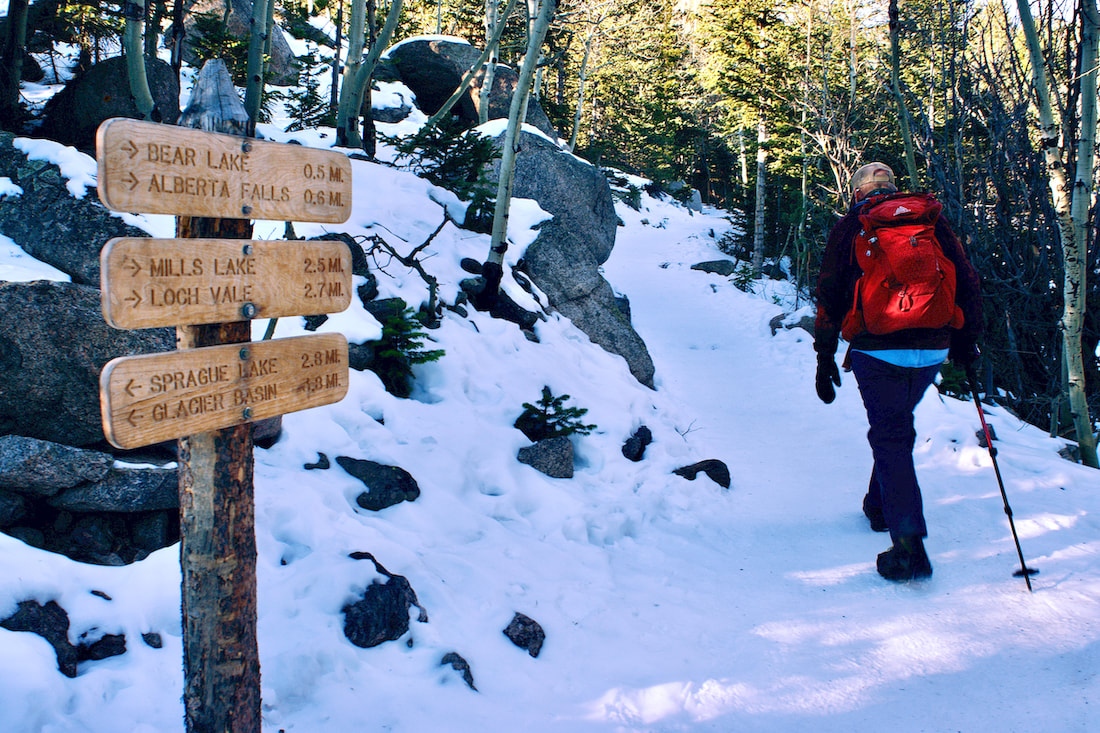
In other words, it was a pretty mild day, on top a string of mild days, for our first winter venture out for the season. My hiking partner and I were heading up the four and a half miles to Sky Pond. We found the trail covered with packed snow, but not icy, so we knew there had not been very many days above freezing, which would make the trail icy with the melting and freezing.
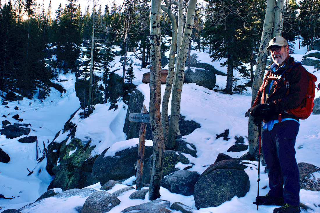
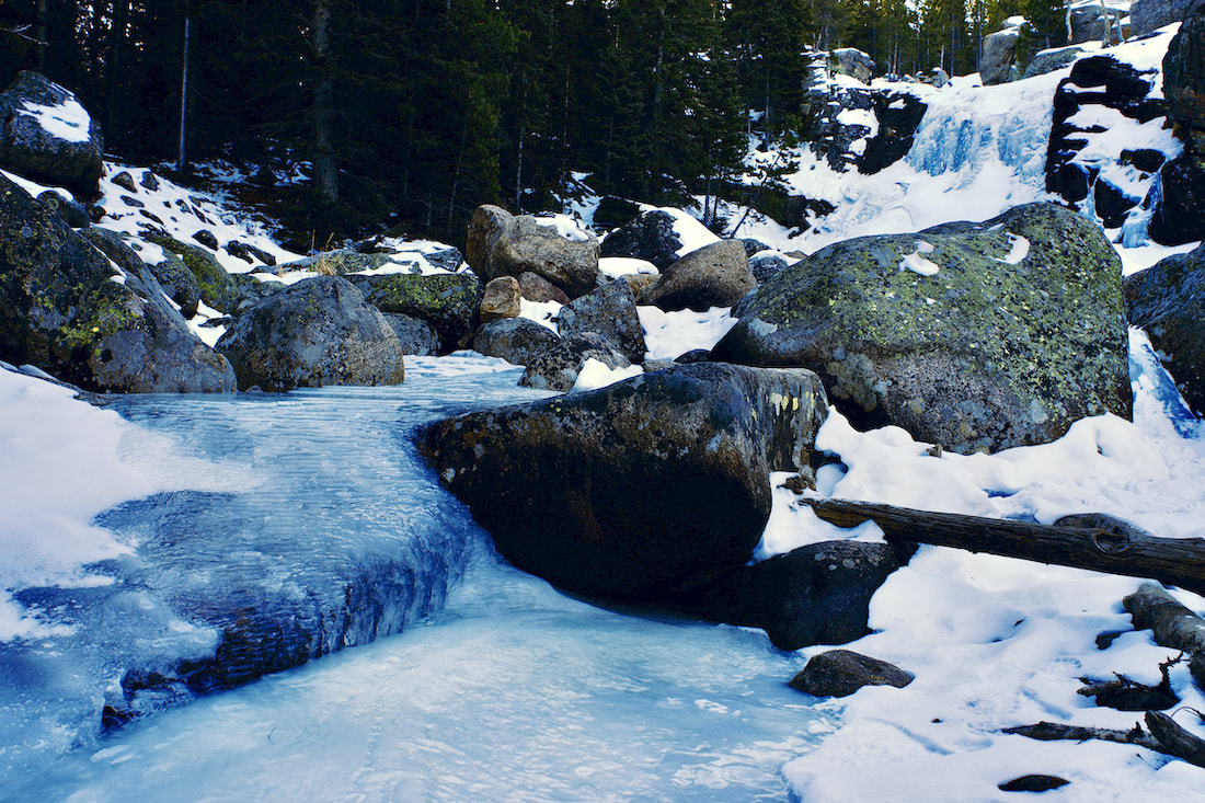
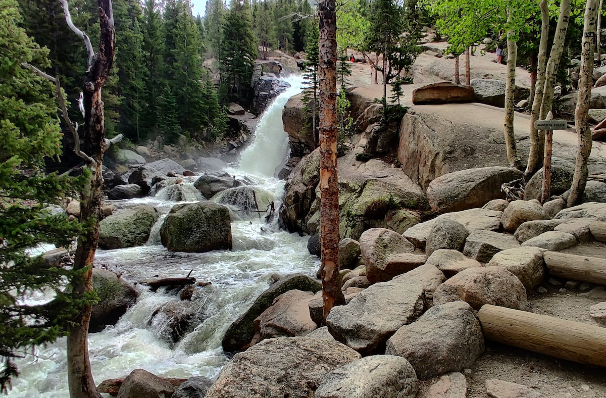
Alberta Falls was pretty well frozen over with thick ice for the winter, though we could hear the water flowing below the ice, but snow had not yet covered over the falls. It had been a while since there had been any significant snowfall.
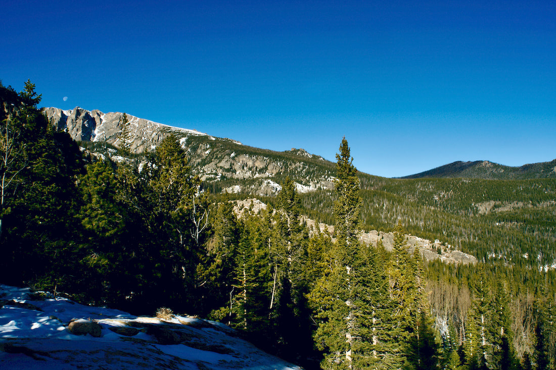
Not far past the falls and a short step off the trail there's an overlook that looks off to the north. To the left, the crags of Flattop Mtn above Emerald Lake are barely visible. In the foreground, the Bear Lake Road switchbacks up, and off in the distance were the snowy Mummy Range. Normally, those would be the notable features to point out at this spot. But this year, sitting in the middle of all of that is Mt Wuh and the burn scar visible on its' western slope from the recent Troublesome fire. That part of the Park is currently closed to hikers.
We continue on, following the windy trail around the east Glacier Knob until, finally around its east flank, the Loch Vale comes into spectacular view. Even though it was near mid-day, the low sun cast bands of sunlight across the scene. But in the far distance, the Taylor Peak massif basked in the midday sun.
It was quite a stellar day once we reach The Loch. The lake had completely frozen over and there were many tracks that headed across it, which we followed. There was about and inch of snow on top of the ice, which indicated that there had not been even a wiff of wind since whenever the last little bit of snow fell, very unusual. Timberline Falls was, of course, spectacularly frozen over and on the return, we watched as a couple of ice climbers make short work of a one pitch ascent of the right falls.
This was a shake down hike. We had gathered our winter gear and needed to figure out what we had forgotten for future trips. But we felt we scored a pretty good first winter day out with fantastic conditions.
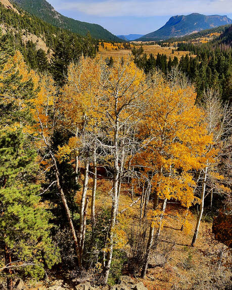
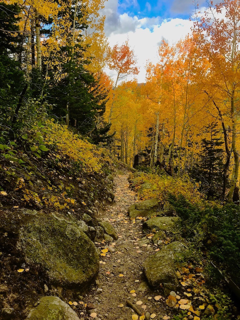
Now, bring on the snowstorms!! We're ready!! by Barb Boyer Buck “All I want for my 81st birthday is to see the leaves in Rocky Mountain National Park,” my mother told me in mid-September. The only problem was that her birthday is in the second week of October and traditionally, snow and wind pretty much takes out the leaves in RMNP by then. OK, I thought, I will make a reservation for her birthday and hope for the best. It turned out to be absolutely glorious weather and the leaves at the lower elevations of RMNP were spectacular. It also turned out to be the last weekend that Old Fall River Road was open for the season, and we took a ride up that way, too. The trip up to the Alpine Visitor Center via this road was very interesting; it was the latest date I had ever driven up and asset protection due to the Cameron Peak Fire was evident. Here is a photo essay to illustrate what I mean.
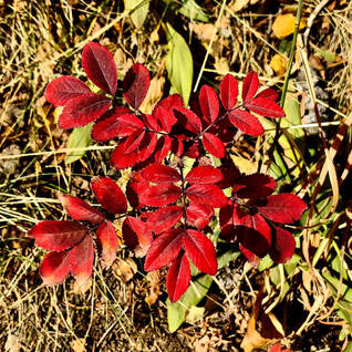
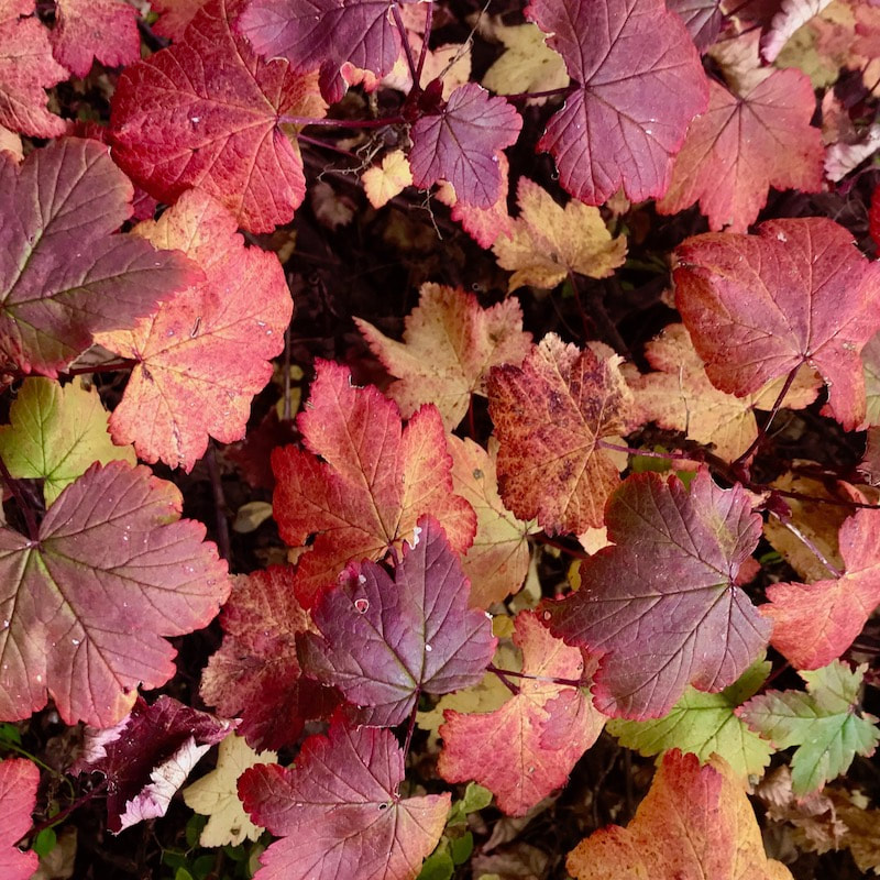
At mile 3, we stopped at Chasm Falls. At this point, the most notable fall color were much lower to the ground. The trees were starting to lose their leaves, but the ground cover was spectacular. Colors below and above Chasm Falls were the most vibrant.
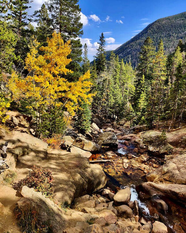 Below Chasm Falls 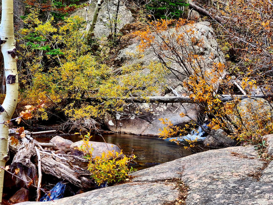 Above Chasm Falls
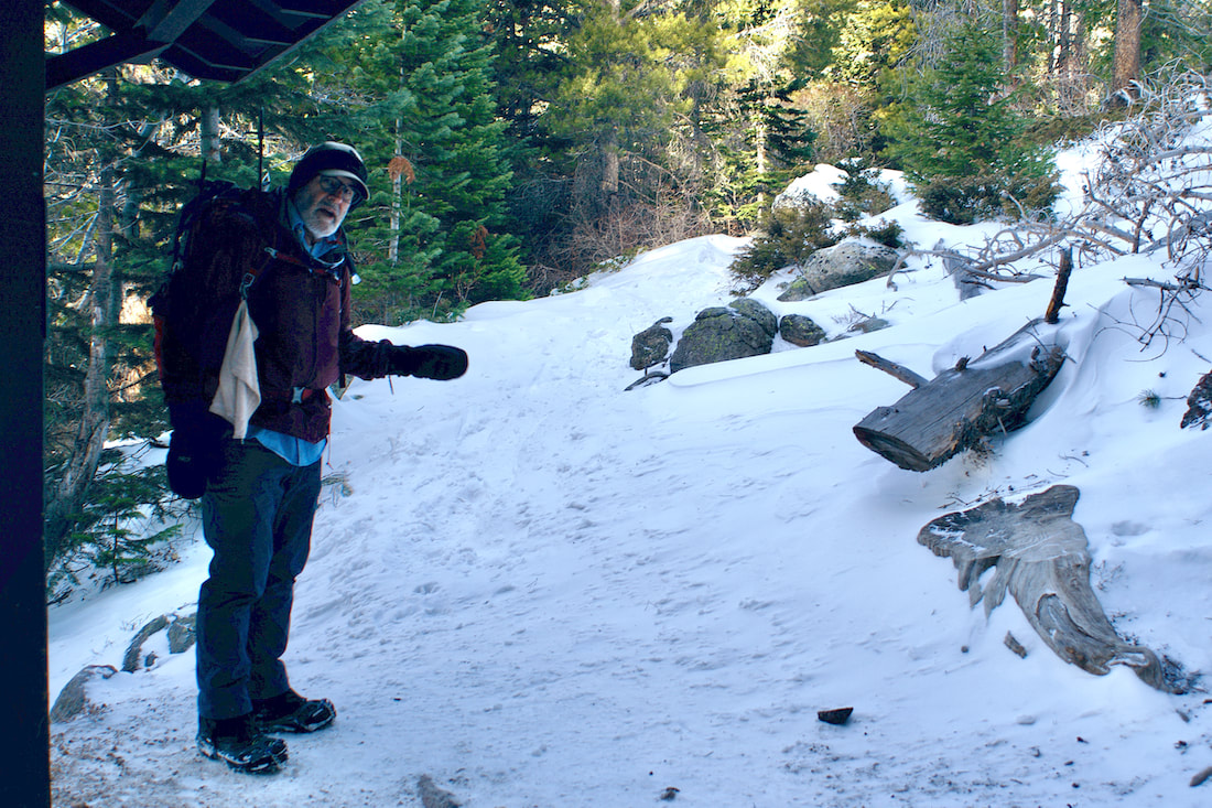
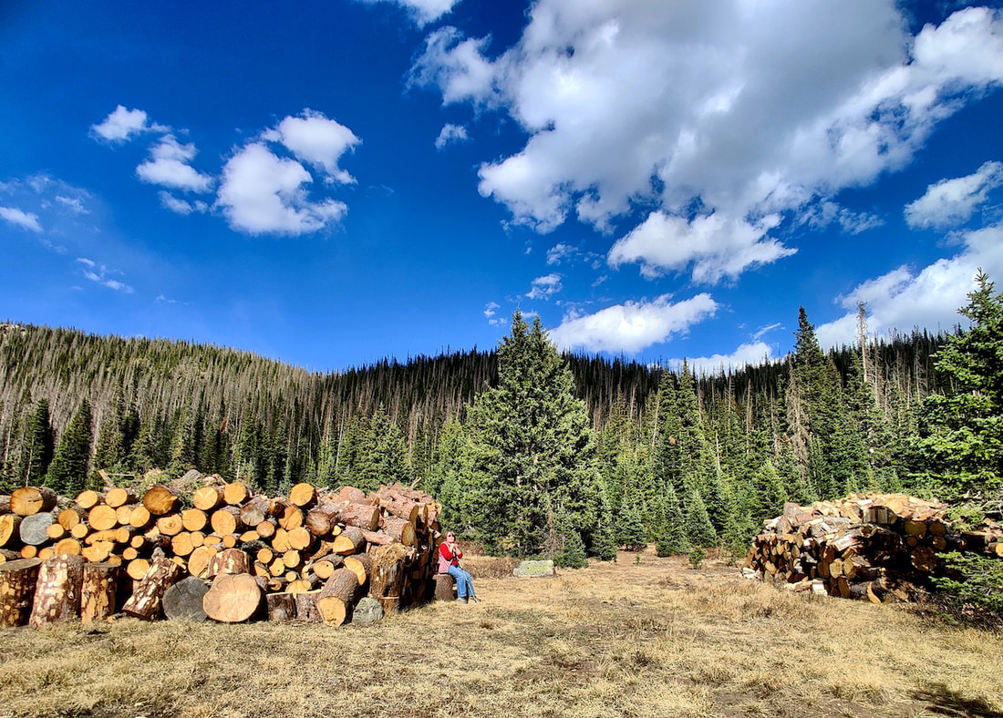 My mother sits by cleared & cut dead trees, part of the efforts to protect this area from the potential threat of the Cameron Peak Fire.
In Willow Park, young Engelman spruce and lodgepole pines thrive against the backdrop of the "grey ghosts," killed by pine beetle. The last pine beetle infestation was unprecedented. It began in 1996 and extended well into 2014, killing most of the established lodgepole forests in RMNP. "Hard winters with cold temperatures can kill beetle eggs and larvae wintering under a tree's outer bark. Related to general climate warming, average winter temperatures in the Rocky Mountains have been higher than normal over the past ten years. Trees have also been weakened by a prolonged period of low precipitation. The combination of milder temperatures and low precipitation has aided a vast outbreak of beetles." - NPS/ROMO
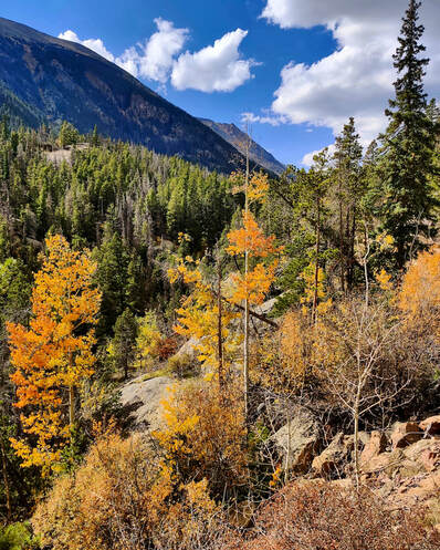
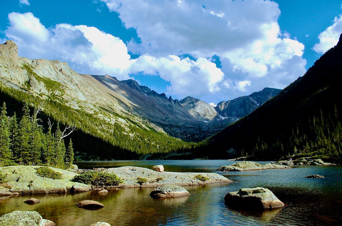
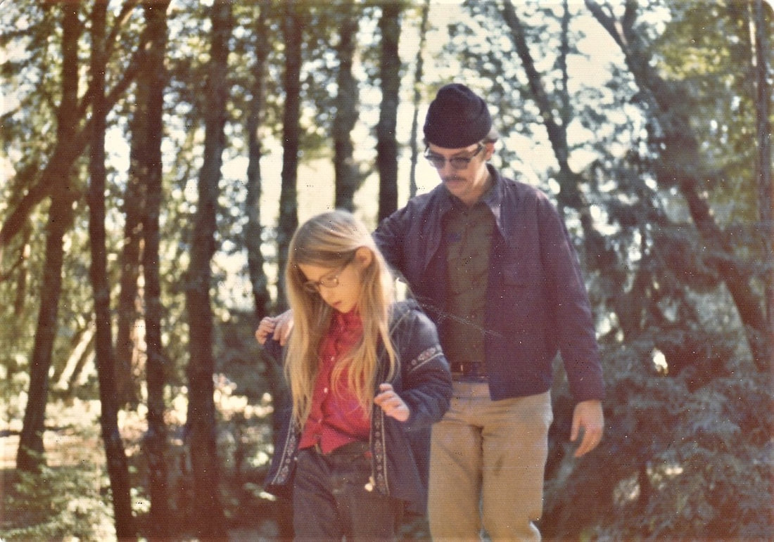
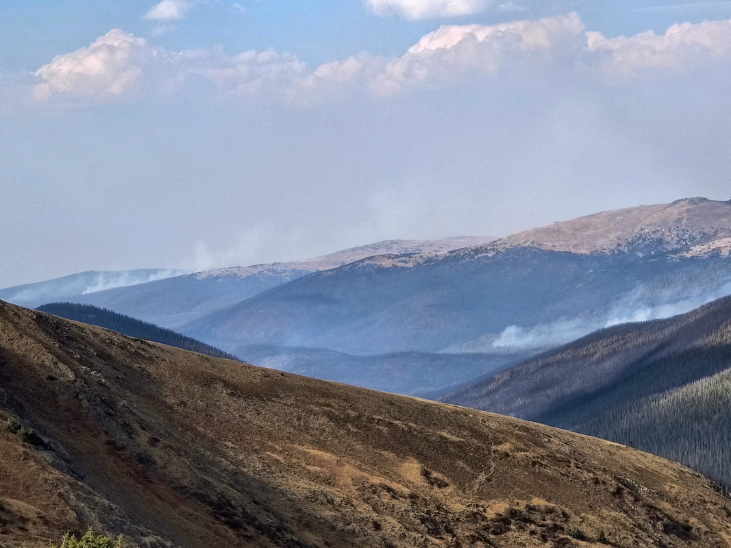 This photo was taken looking north from the parking lot at the Alpine Visitor's Center. Pockets of active fire were observed among the burned swatches of the Cameron Peak Fire, which extends into RMNP's northwest portion. 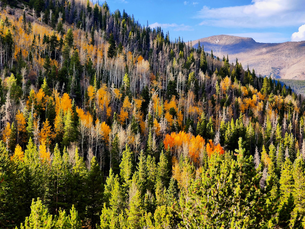 Traveling back down via Trail Ridge Road, fall color was past its peak near Hidden Valley 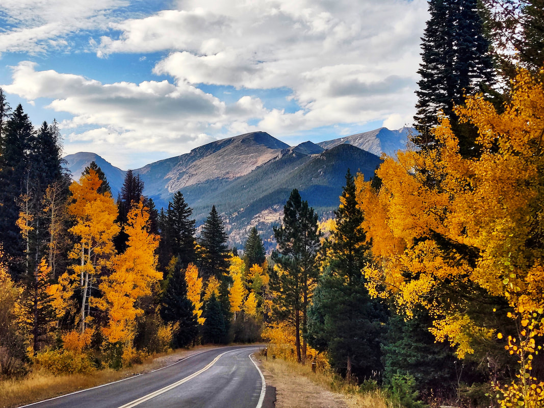 But just past the Deer Ridge Junction dropping down into West Horseshoe Park, the aspen were glorious. Mount Chapin, Chiquita and a bit of Ypsilon crowned the scene 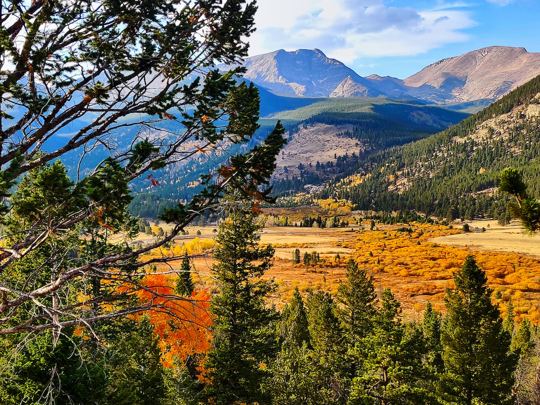 I took several photos from the West Horseshoe Park overlook, this one shows Mount Ypsilon and Mummy Mountain towering over the valley. 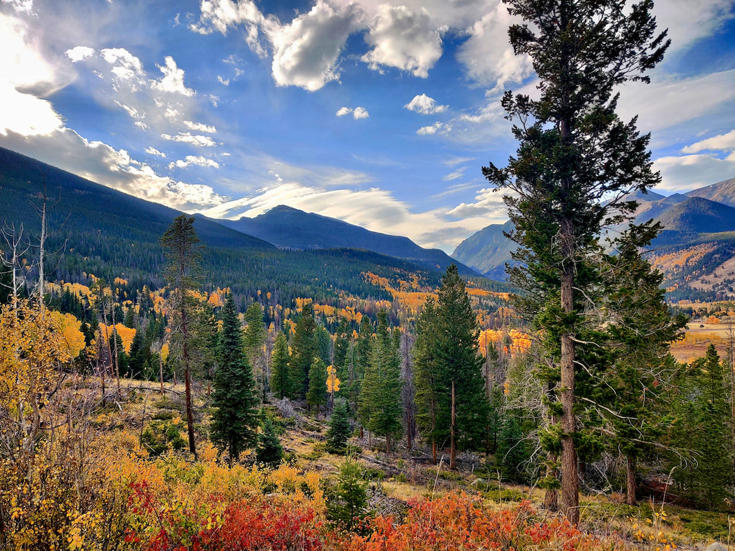 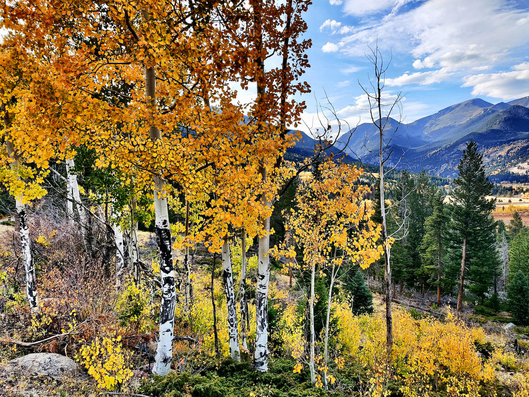 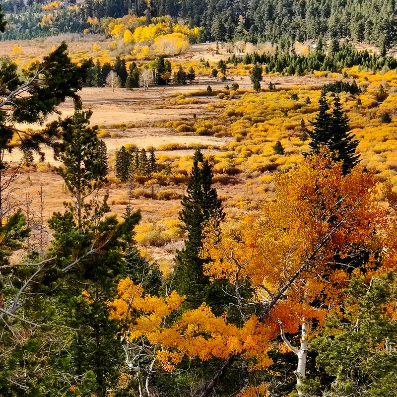 The rich colors of the willows in West Horseshoe Park warranted a close-up! 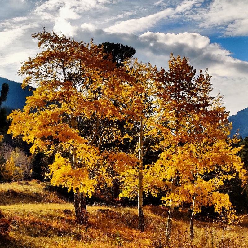 Nearing where we started from in Endovalley, I stopped to take a final picture of these glorious aspen, backlit by the setting sun. After the most recent snow on October 11, both Old Fall River Road and Trail Ridge Road closed. Trail Ridge reopened today, but it is unclear whether Old Fall River Road will again this season. Since 2016, Old Fall River Road has closed for the season on the first Monday in October (it used to be Labor Day) but it stayed opened this year five days after that, to give firefighters access to the remote areas in the Park. I am very grateful for this, because my mother got the birthday present she wished for.  By Barb Boyer Buck Ever since I was a kid, hiking with my family in the mountains of Northern California and later in Colorado's high country, I remember the refrain: "Hey, Pop! Are we there yet?" My brother, sister, and I echoed this sentiment on all long hikes, even if we were enjoying ourselves. It became a habit. My dad would bend down, circle one arm around my shoulder and point to where the trail rounded a bend, traveling out of sight. "Just around that ridge," he would say. Most of the time, there was another ridge beyond that one… and another ... and another. When we were tired this was frustrating, but these days I understand why my dad did that. We had to keep going forward to reach our goal and he was trying to keep our spirits up. 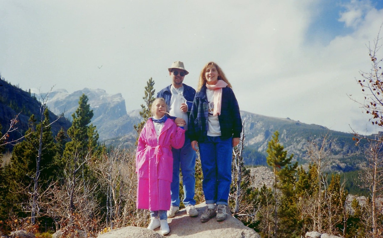 My little sister, my dad, and I hiking on the Glacier Gorge Trailhead above Alberta Falls on the way to Mills Lake in the mid 1980s.
Add to that the spotty and/or non-existent phone coverage in RMNP and the danger increases.
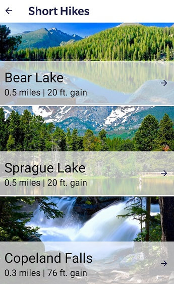
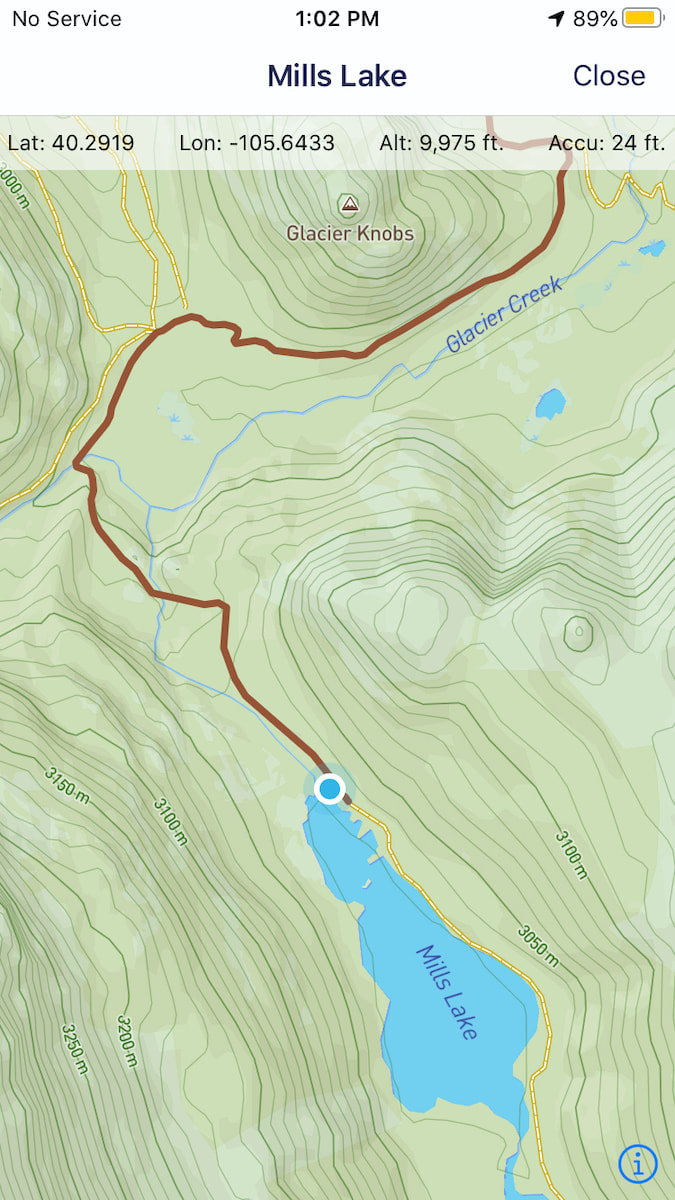
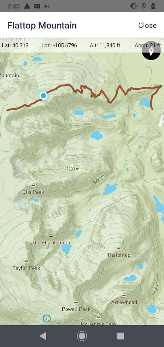
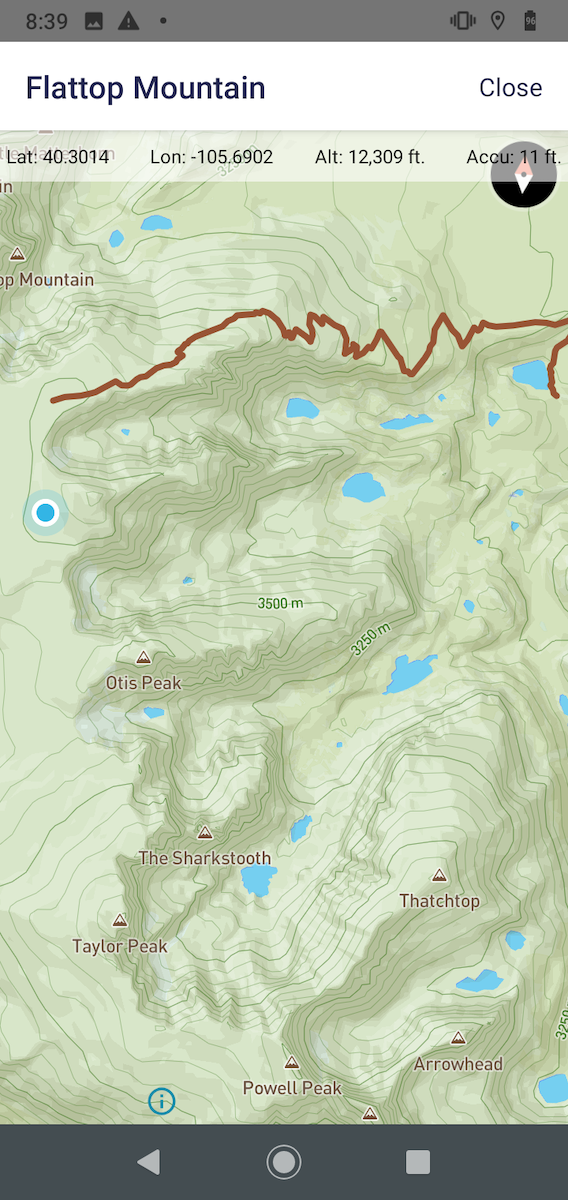
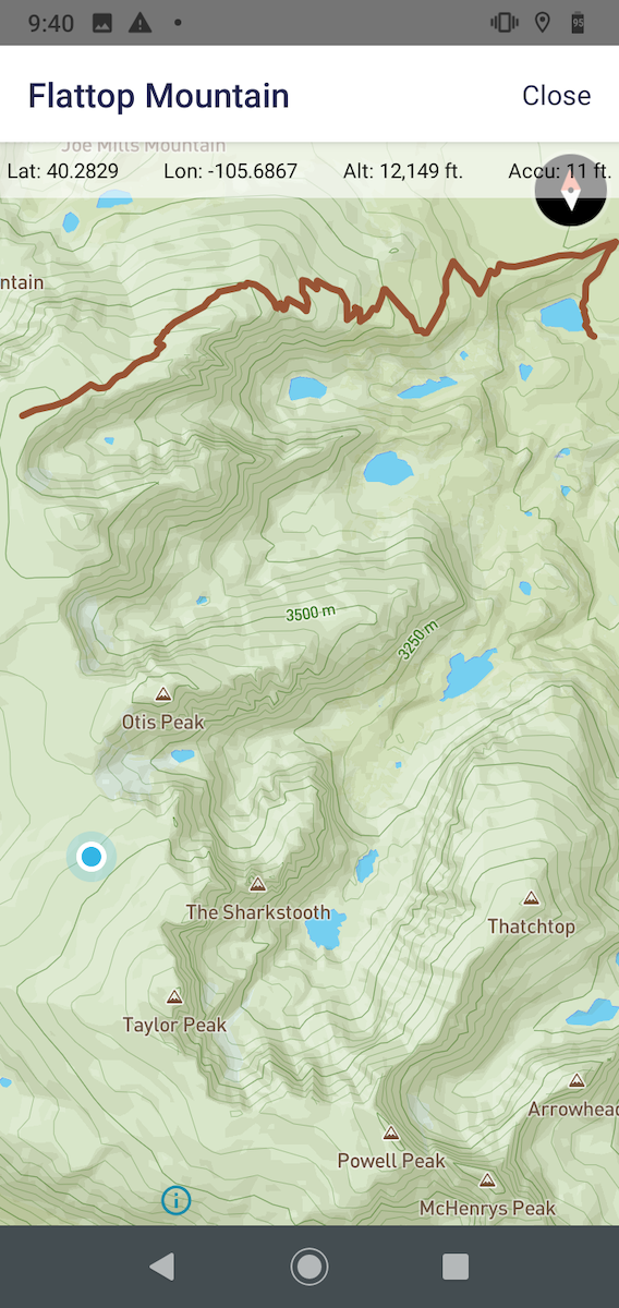
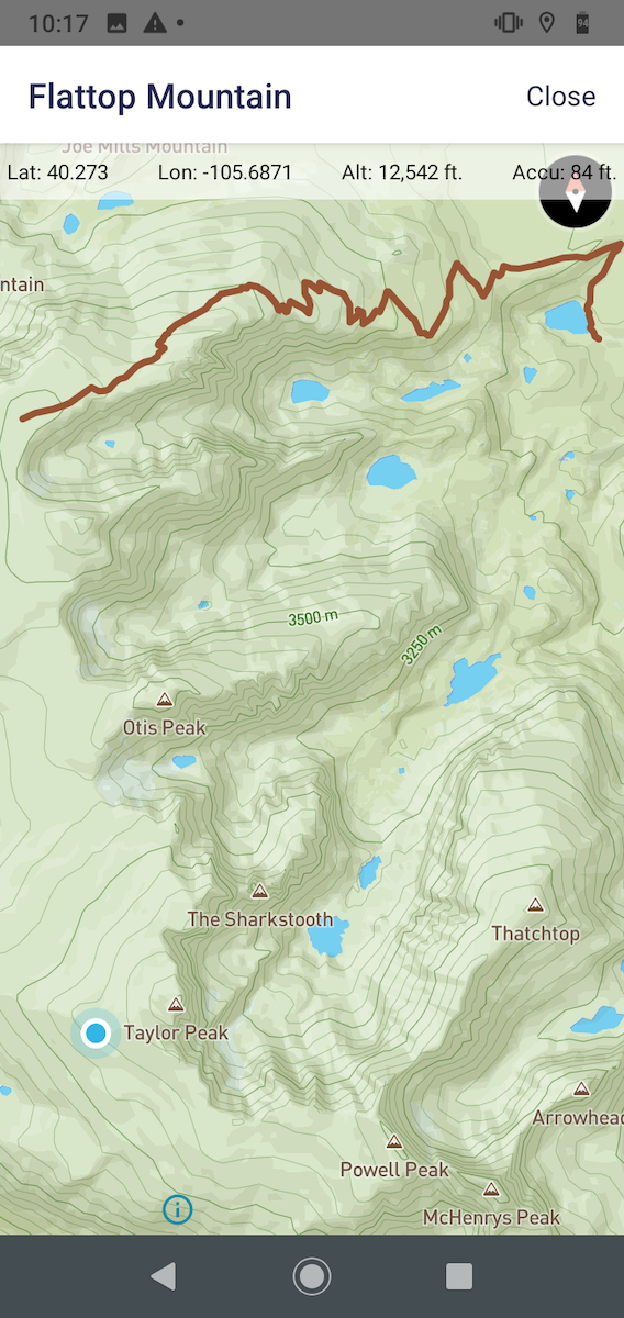
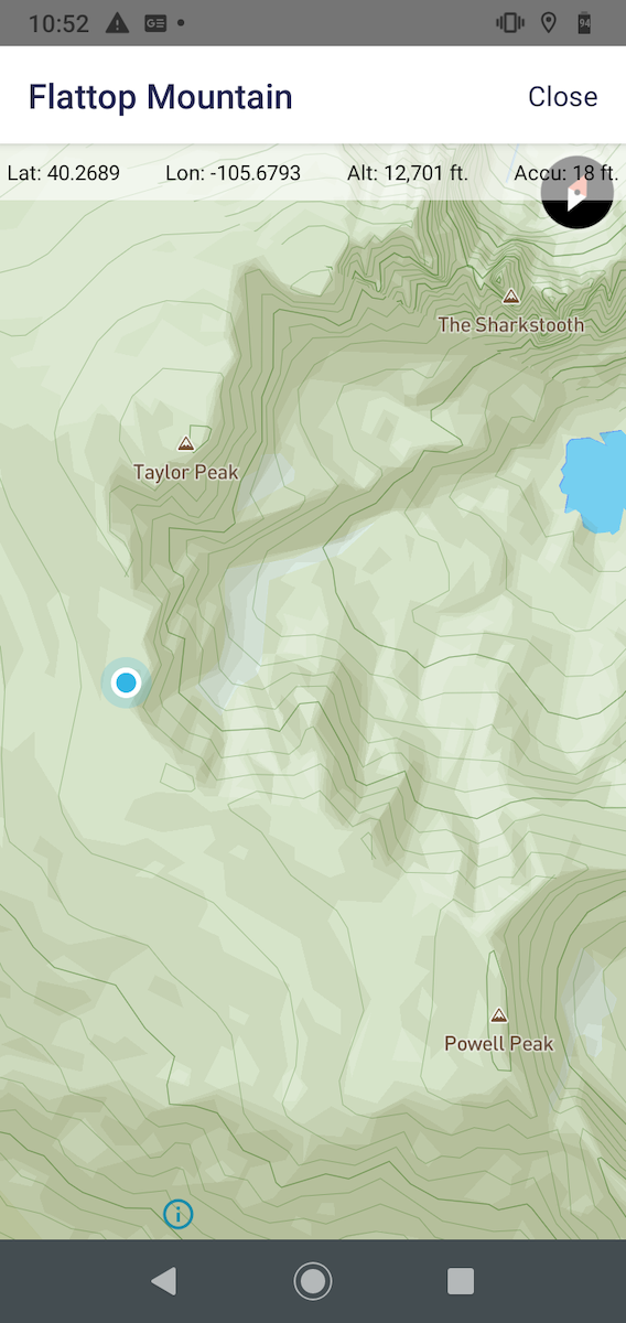
Rocky Mountain Day Hikes has developed a free app for smart phones (either Apple or Android) called GPSmyhike to help with these concerns.
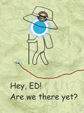
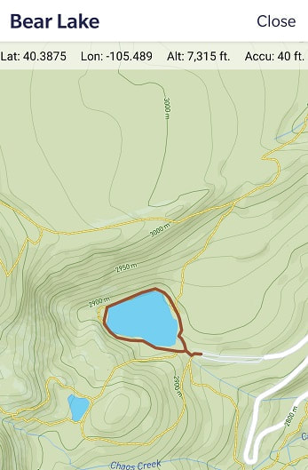
The downloaded topographic trail map indicates the trail with a red line and a moving blue dot (which we've named ED) tells you exactly where you are at any point along your hike.
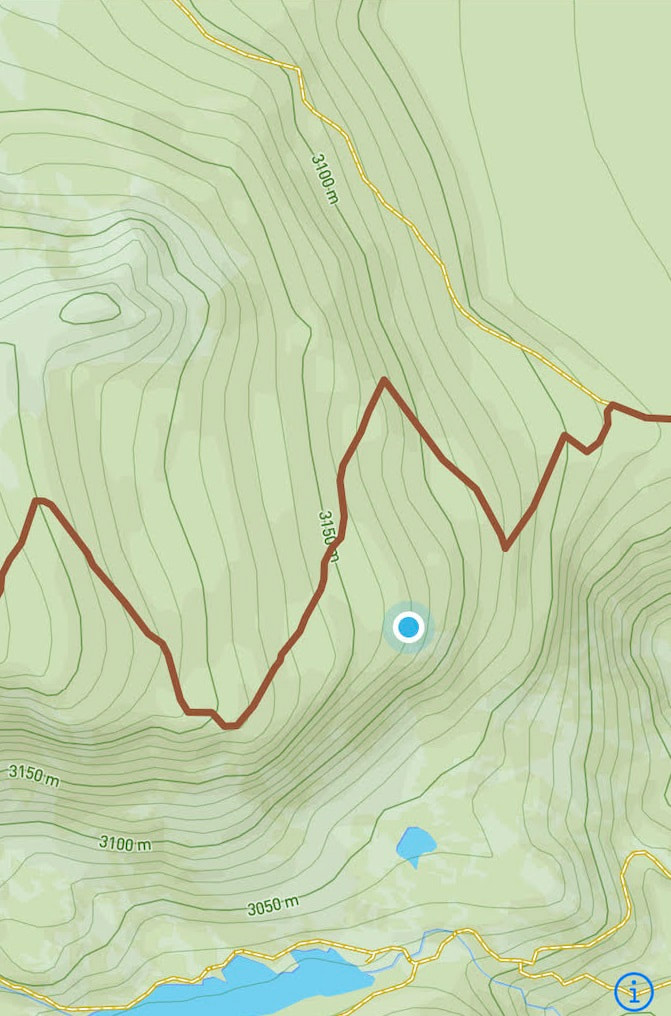
RMDH founder and app developer Dave Rusk had an opportunity to test the app's efficacy in early June, while hiking the Flattop Mountain Trail. Portions of the trail were covered in snow and it quickly became unclear where it went. "Even if there are tracks in the snow, it doesn't mean that it's the actual trail," Dave said. GPSmyhike helped him to find the trail which he & his hiking partner had wandered away from. Read his report of that hike here.
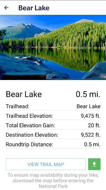
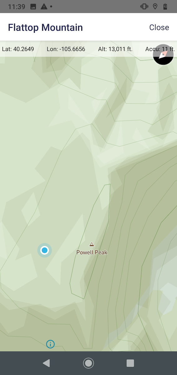
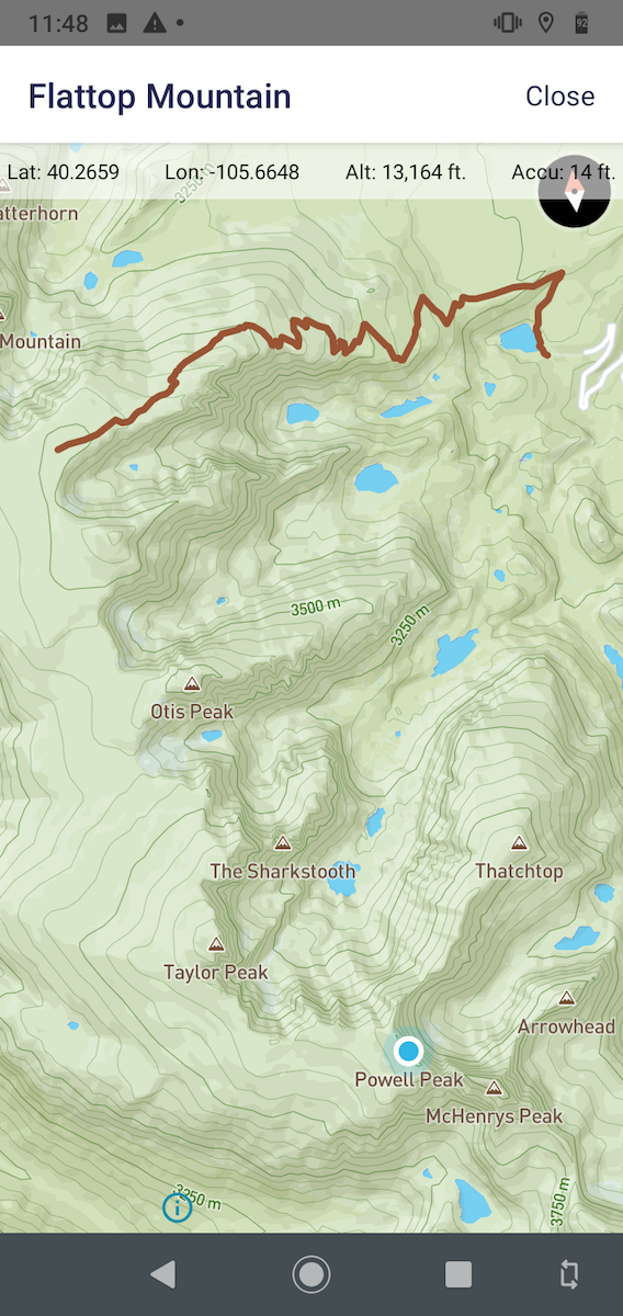
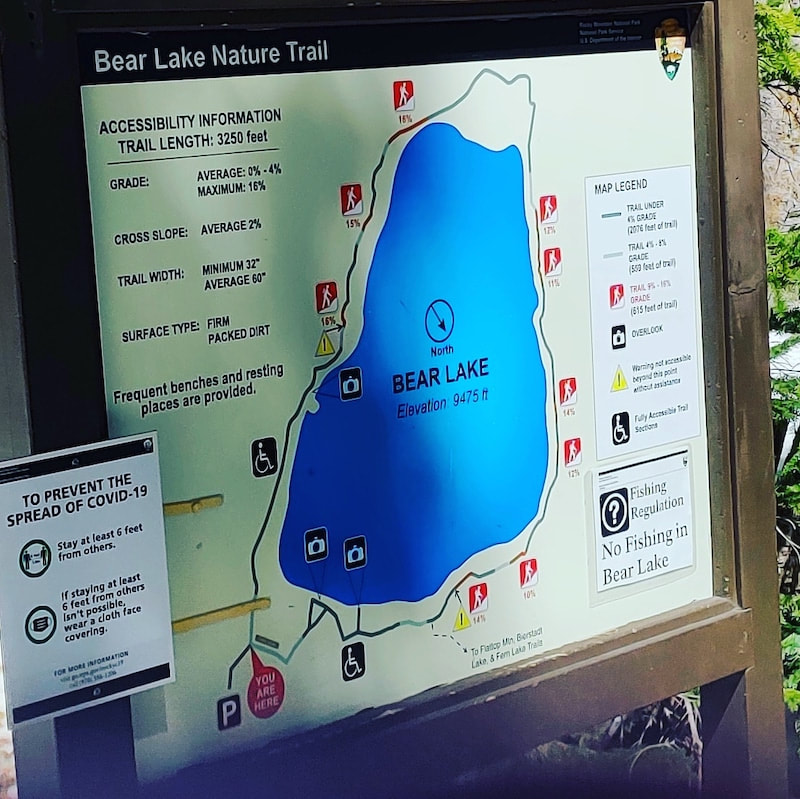
Once you've downloaded the map, ED will appear anywhere you are! Even if you are off the trail, even if you have downloaded a map for a different hike altogether. Zoom out on any trail map you've downloaded and ED will tell you exactly where you are! ED always answers the question "are we there yet?" Have you tried out the app? We would love to hear about your experiences and perhaps see some app screenshots paired with actual photos of the location ED indicated you were. Submit these photos to HikeRockyAtHome@gmail.com and we may use them in a future piece! Trailhead: Bear Lake Trailhead Elevation: 9,475' Destination Elevation: 13,208' Elevation Gain: 3,733' Roundtrip Miles: 16 This hike was done several weeks ago, on September 2. Before the area received several days of hot, dry winds that blew up the Cameron Peak fire and eventually closed Trail Ridge Road due to heavy smoke conditions. And before the dramatic change in the weather that dropped temperatures by nearly 50 degrees overnight and kept Trail Ridge Road closed for many more days with as much as 16" of snow. Conditions can change very quickly in the mountains. I left the Bear Lake parking in the dark with other hikers wearing headlamps to see their way on the trail. My destination on this day was Powell Peak via the Flattop Mtn trail and across the tundra, rounding the backside of the many peaks that make up The Front Range. Because of the extended amount of time cruising above treeline, it was important that there was a zero percent chance of thunderstorms in the forcast.
I started up the Flattop Mtn trail like a race horse out of the starting gate, but then settled into a steady pace as I rose in elevation with the sun.
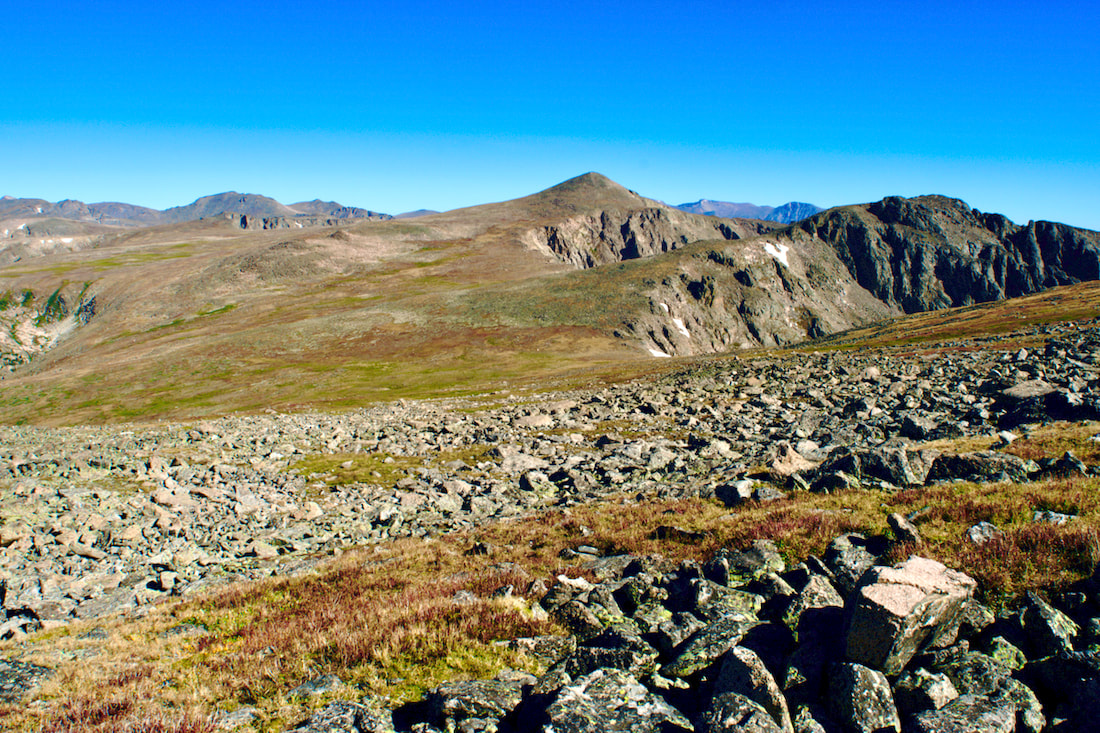
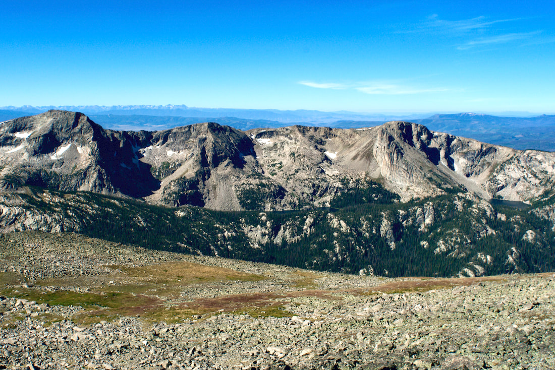
 Taylor Peak comes into view I worked my way around the western flank of Hallett Peak until I could see Longs Peak and Taylor Peak, two prominent landmarks. I needed to go around Taylor Peak to get to Powell Peak, so I headed for a low spot to the right of Taylor and kept that spot in my sights while I navigated the terrain. 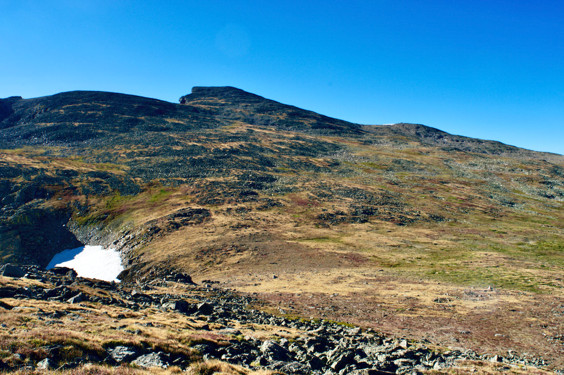 Andrews Glacier and Taylor Peak After passing Otis Peak, a visible trail appeared that led to the top of Andrews Glacier. I took a peek down to The Loch Vale before continuing on my tundra traverse.
Once I reached the high point on the shoulder of Taylor Peak, I found I was still not far enough around to see my direction to Powell Peak yet. But I was able to see across the valley to the southwest at the dramatic range, with Andrews Peak to the the left and Ptarmigan Mtn to the right, and I could also see the two lakes, Nakoni and Nanita, that sit below them.
 Taylor Peak and the Loch Vale
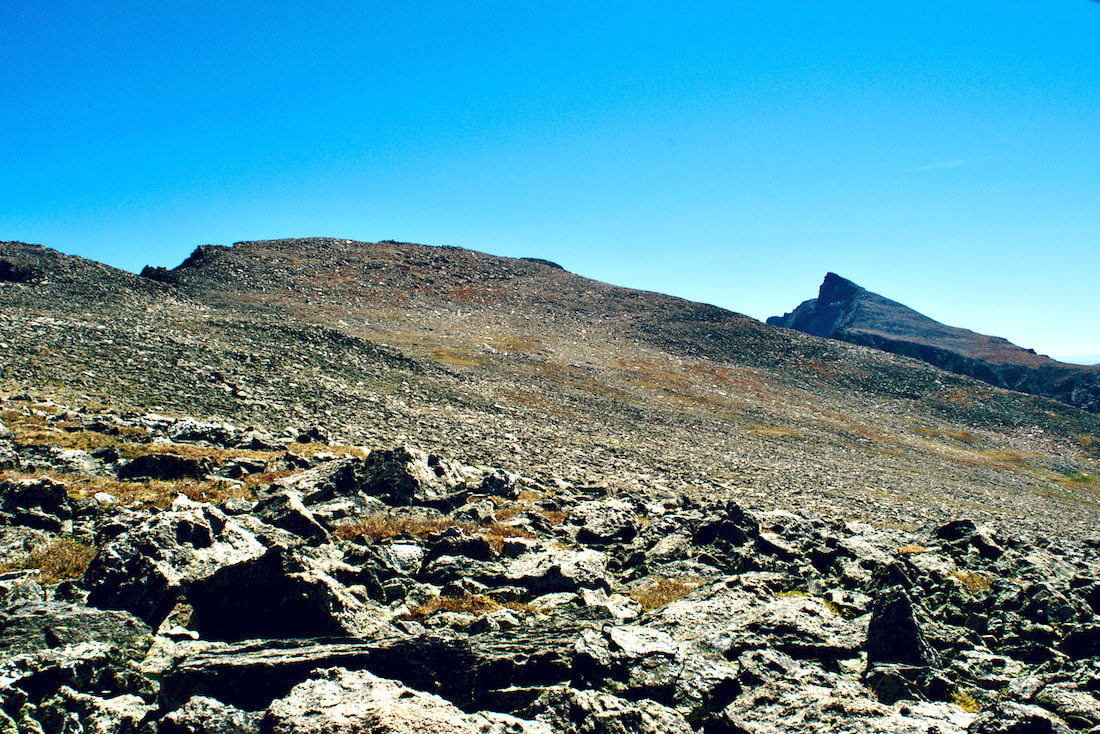
The actual summit of Powell Peak is hard to make out. It is not as prominent as many of the other surrounding peaks are, especially from the back side. And because of the rising elevations, some things are hidden. I kept an eye on a really prominent peak which at first I thought was neighboring McHenrys Peak. But later I realized that Powell Peak was hiding McHenrys Peak and what I was looking at all along was Chiefs Head Peak.
It wasn't until I was on the actual summit of Powell Peak that I realized my error. Right in front of me, sticking up like a sore thumb, was the backside of McHenrys Peak between Longs Peak and Chiefs Head Peak behind it. The topography can be confusing, and very dramatic when trekking across the tundra. 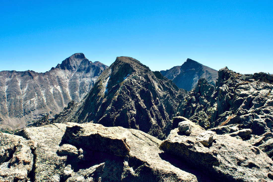 McHenry's Peak 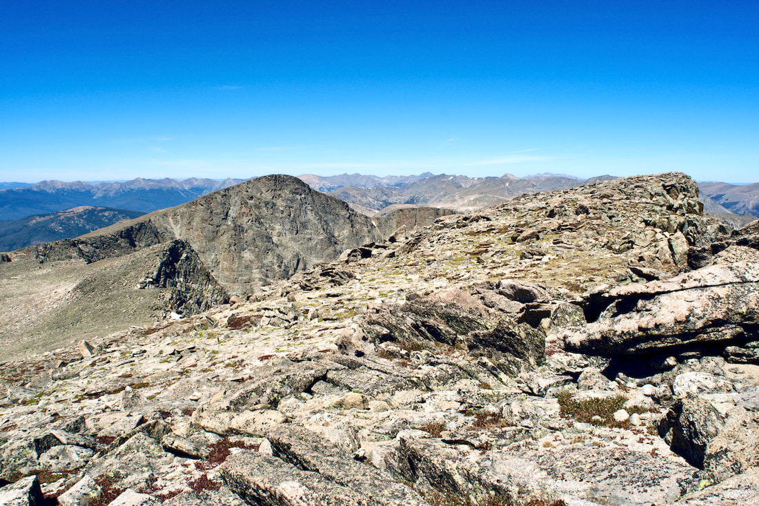 Taylor Peak from the Summit of Powell Peak At 13,208 ft, Powell Peak is slightly lower than McHenrys Peak by only 19ft, but higher than the more prominent Taylor Peak by 55ft. But the distance to get to Powell Peak is considerable, and I began to make my way back. It took me six hours to reach the summit of Powell Peak from the Bear Lake Parking lot, but only four and a half hours on the return.
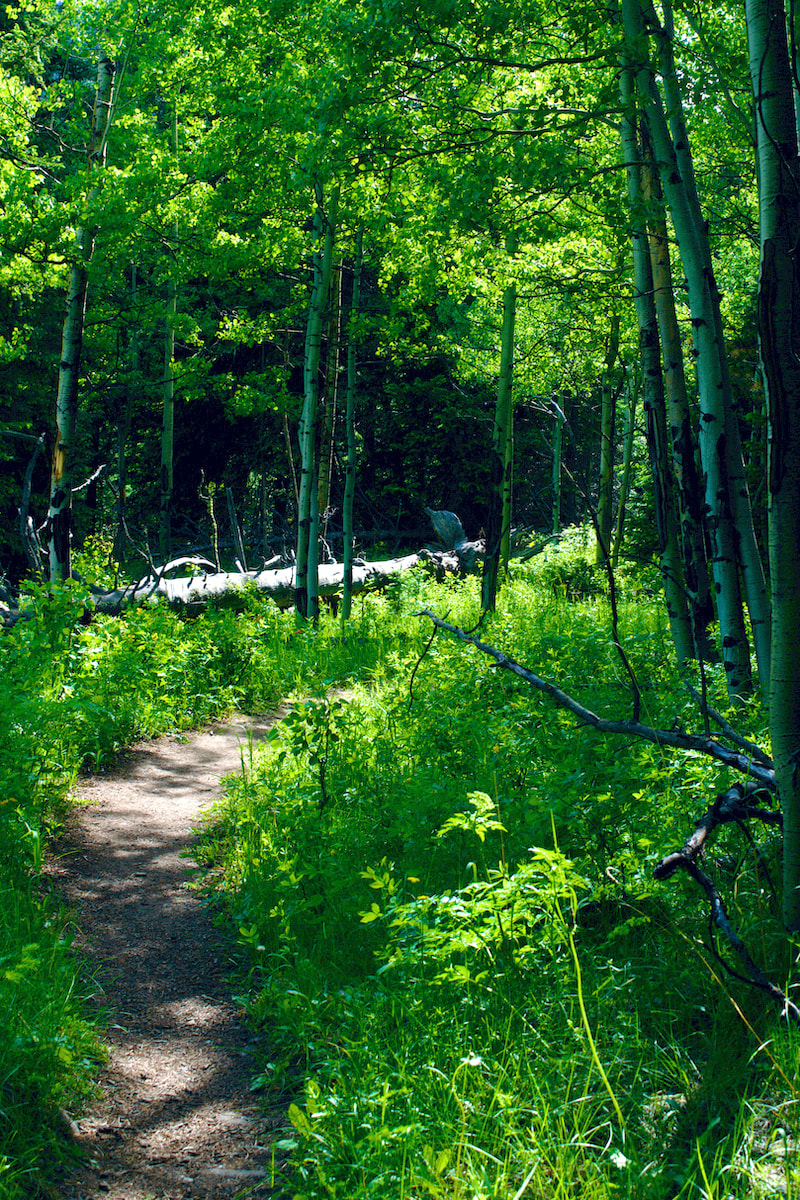
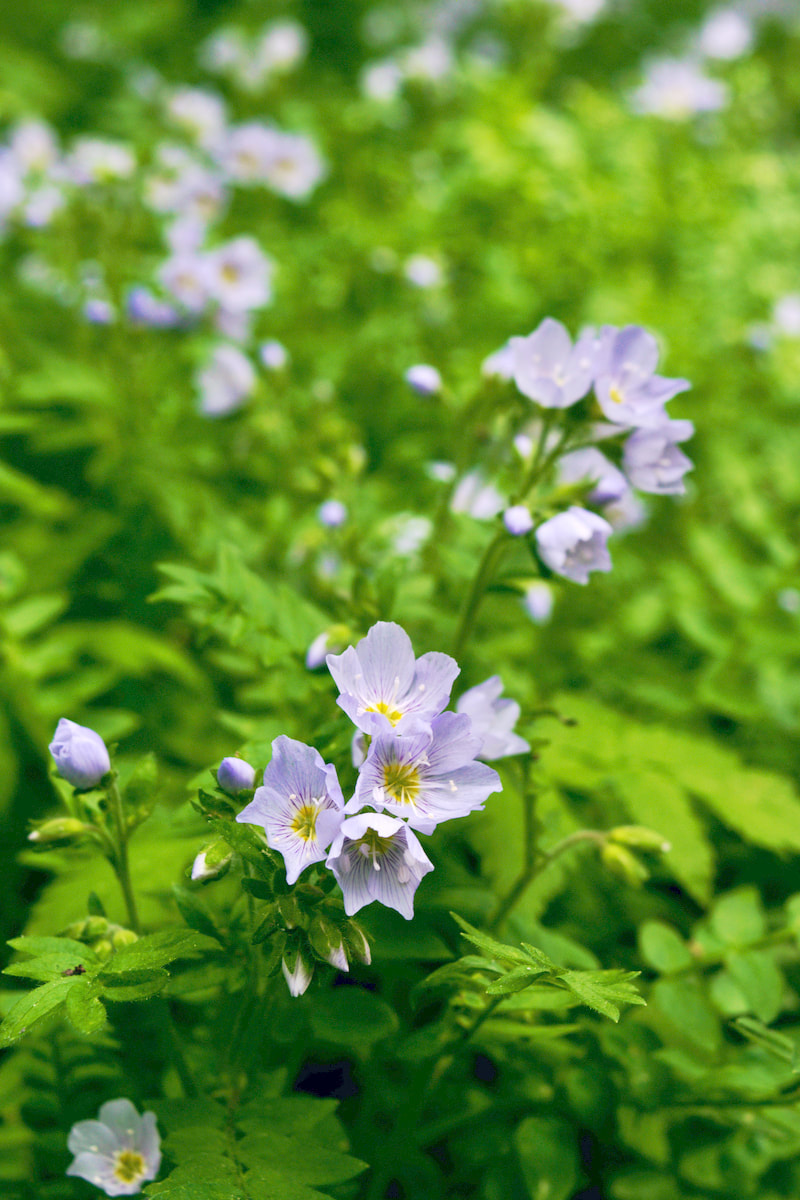
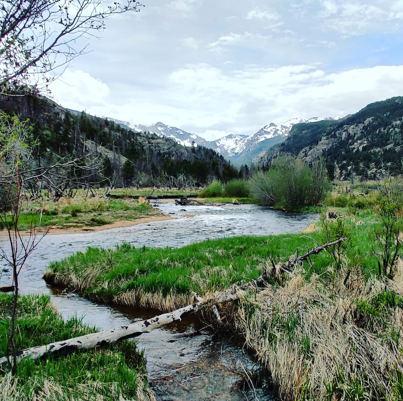
Story and photos by Barb Boyer Buck Every summer, I eagerly anticipate the reopening of Old Fall River Road in Rocky Mountain National Park. It usually happens around July 4, depending on weather. This dirt road travels one-way up to the top of the pass, emptying out at the back of the Alpine Visitor’s Center parking lot and Trail Ridge Road (that’s how you get back down). In places, the grade is as steep at 16% and switchbacks on the road can reach as tight as 20 degrees radii. It’s narrow and rocky, tends to become riddled with fairly deep potholes, and has very steep drop-offs (with no guardrails) on one side for most of the way. Yet, my little 2-door, front-wheel drive car can manage it easily. In fact, wider and heavier cars have a much more difficult time. For the time being with my knees in rehab, this is my favorite way to access the sub-alpine forest, which is at its most beautiful this month and next. 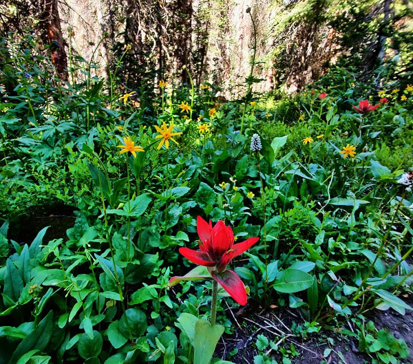 The subalpine forest is at its most colorful right now. Every week, the sights, smells, and sounds are different, making it a shame to limit yourself to just one trip. The road closes when the first snows start accumulating at that elevation, usually at the beginning of October. September is a beautiful month to drive it as well, with the aspen leaves in full color (not just gold, but often orange and red, too) and the tundra becomes a sea of rust-gold. Old Fall River Road travels from Endovalley (near the Alluvial Fan), where it passes through several ecosystems as you travel up. These include the montane, subalpine, and alpine. In some spots, rich riparian areas offer a rare east-side Rocky look at the sights and sounds of this ecosystem. You move from dense forests to tundra in only 11 miles. This will be one of the longest 11-mile drives you will take. But especially if you’re used to city traffic logjams, you couldn’t ask for a more pleasant delay. There are plenty of places to stop and I recommend stopping at all of them, if you can. 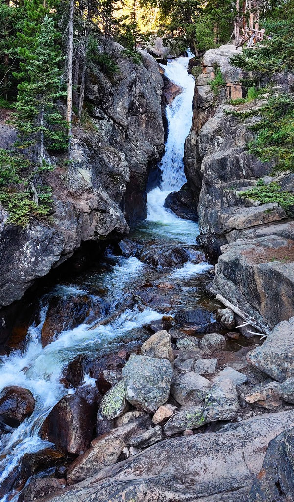 Chasm Falls is the first major attraction when you're traveling up Old Fall River Road. The first major attraction is Chasm Falls. This amazing water feature can be seen with a very short hike from the pullout, making it a rare experience for everyone. These types of waterfalls are common in the backcountry, especially just before you approach treeline, accessed by arduous hiking in most cases. There is a spectacular hike (as I remember, I hiked it long ago) that can be accessed from this road at Chapin Creek Trail. There is space for approximately 10 cars in the pullout for the trailhead, so it’s best to go up very early. This trail is 6.6 miles to Chapin Meadows (at the base of Mount Chapin), where it splits to the Mummy Range trail. Several spots to pullout include limited access (foot traffic only) to beautiful forests and the Fall River, which follows the road for most of the way up. 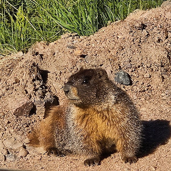 Wildlife, such as this marmot, is often encountered along Old Fall River Road. Glorious wildflowers, wildlife, lush forests and stunning views greet you the entire way. When its approximately three months of vehicle access is over, you can hike or bike this road (weather permitting). Of course, I love the sights and sounds I witness from my car & the short hikes I do when I stop at certain places. But just as enthralling to me is the rich history of this road. 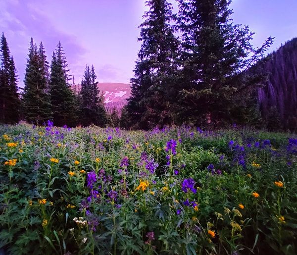 Driving up Old Fall River Road at night is not recommended, but dusk adds a little more magic to the experience. Construction of the road began in 1913 and lasted seven years, with a brief interruption caused by World War I in 1914. When it was finally finished, it connected Estes Park to Grand Lake. When Rocky Mountain National Park was dedicated in the Fall River Valley in 1915, attendees could observe men, using only hand tools, widening the path that Native Americans had weathered for 10s of thousands of years. This actually caused an issue for some of the more refined and prominent representatives at the RMNP dedication. Because at the time, Colorado State Penitentiary inmates, housed in nearby cabins, were the men building the road. (A construction company took over building the road before it was fully extended to Grand Lake.) Congressmen, Colorado’s governor, prominent local businessmen, and local women associations attended the dedication; seeing the convicts carving out the road was the not the proper aesthetic and the men could be dangerous, some thought. In my opinion, seeing slave labor at work was not very palatable for the higher-ups of the time.  As Old Fall River Road approaches the Alpine Visitors Center, sub-alpine forest changes to tundra, on which elk are often spotted. Another important part of the road’s history is its association to the end of Estes Park’s grand old hotels. Before Fall River Road was opened in 1920, people who came to Estes Park had reached the end of the road, so to speak. They couldn’t travel farther west than Rocky Mountain National Park’s east-facing mountains, unless they climbed over. Hotels on the east side of RMNP such as Elkhorn Lodge (built in 1874), Stanley Hotel (1909), the Crags Lodge (1914), the Baldpate Inn (1917) were designed to have everything a visitor could need. Lodging, food, entertainment, opportunities to relax, and starting points for hunting trips or wildflower gathering were provided by these lodges. (These days hunting and gathering of anything is illegal in Rocky Mountain National Park, it’s a federal crime.)  Stunning views await you on your next drive up Old Fall River Road! But after Fall River Road finally opened to create vehicle access from Estes Park to Grand Lake, the story changed a bit. Eventually, Estes Park was not the place to stay for weeks or months at a time; it was a place to stop for a few days on the way to points west. Grand Old Hotels gave way to roadside motels, especially in the 1950s and 60s when vehicle travel became America’s favorite pastime. Do yourself a favor and make Old Fall River Road part of this summer's adventure in Rocky Mountain National Park. Be sure your vehicle does well in high altitudes, has a full tank of gas, and my advice is not to drive large vehicles up it, it’s much more difficult that way. But above all, remember it’s only ONE WAY, going up – you will have to take Trail Ridge Road to go back down, either to Estes Park or Grand Lake.  Especially in the 1950s & 60s, traveling America in your vehicle was promoted. This caused Grand Old Hotels to give way to motels in Estes Park and Grand Lake. Story by Barb Boyer Buck Photos by Simon Vogt “The summit is the goal, but it’s not the reason.” For Simon Vogt, mountaineering in the high peaks of Colorado’s Rocky Mountains has become a metaphor for the new life he is developing for himself: one of sobriety and focus. Simon has attempted to climb Longs Peak twice – once in November of last year and then again in April of this year. The most recent trek to Longs ended at the intersection of trails leading to Chasm Lake and Boulder Field. “I knew that I was being very ambitious trying to climb Longs at that time,” he explained. “It was winter time, I was alone, and I hadn’t done anything that big in terms of altitude and class. 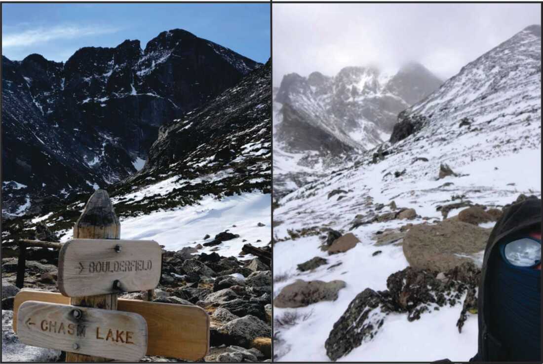 Simon Vogt attempted to reach the summit of Longs Peak twice - once in November of last year, and in April. Setbacks are not problems, he believes, they are opportunities to learn. “I set out, all prepared and with every intention to summit. I didn’t get very far, only 4-5 miles in, when I reevaluated the time it took me to get there, the time I still had ahead of me, the weather, and the time of day. I decided I’d gone far enough & turned around there.” This thoughtful attitude hasn’t been Simon’s strategy his entire life, however. He was born and lived in Germany for eight years after which his family moved to New York. He moved to Colorado for college in the early-1990s. 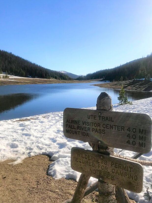 The trail to Mount Ida starts at the Ute Trailhead, near Poudre Lake. “Colorado is the first place I developed a real interaction with the outdoor world – climbing, hiking & mountain biking,” he said. But he also encountered tumultuous problems with the law, alcohol and drugs. His naturally impulsive and reckless nature got him into some real trouble while he was using and drinking. “I almost died many times,” he said citing a week-long coma from a heroin overdose in 1994 and daring mishaps while bouldering with friends. “I was also shot at several times and stabbed as a result of poor choices,” he said. “It was the world I was living in at the time.” Simon moved back to Colorado about four years ago and a couple of years after that, he almost died again. “I quit drinking after I went to the emergency room for pancreatitis. That felt very deathbed-like,” he said. This was a little more than 18 months ago, in September, 2018. “Being able to get up from that bed and walk out of the hospital was the beginning of a new start, and a miracle.” He faced an immediate test right after getting sober: his boss died, he got evicted from his apartment, and his girlfriend left him. He started living in his truck. In these uncertain days, Simon started taking walks at night because he couldn’t sleep. “I got back into hiking more and more after that,” he said. In the past year, Simon has climbed 17 of Colorado’s 14ers and many other slightly-lower summits. His favorite summit in Rocky Mountain National Park (so far) is Mount Ida, about a 9-mile roundtrip trek that begins at Milner Pass, off Trail Ridge Road. On June 7, he got to the trailhead about 7:30 a.m. and immediately encountered a snow-covered trail. “I put on my nanospikes but right away I got lost,” he said. “It probably took me about two hours to get to treeline, (twice the time it usually takes).” Once he got to the tundra, the trail runs along the Continental Divide. “It was a perfect day, sunny and sometimes partly cloudy. After treeline the trail is dry and well-tread, you can see the path stretch out for about a mile at a time. It’s really gentle and travels up to 12,000 feet,” he explained. 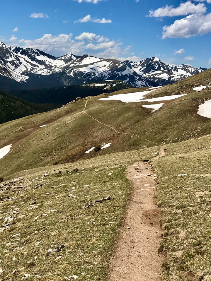 Mount Ida trail on June 7. After climbing out of the montane zone, the path travels along the Continental Divide. From this path, Simon could see features from both sides of the Divide including Rock Cut, Trail Ridge Road, the Alpine Visitor’s Center, the Never Summer Range, Lake Granby, and Longs Peak. I summited at noon and the first time I saw anyone else was on the way back down, about a mile from the summit. It’s nice to be alone, but running into someone is reassuring. It’s a secret link between you and them, a comradery of being with someone within a 10 miles radius. “ 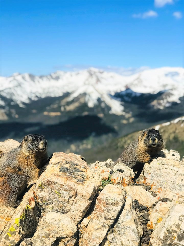 Marmots on the way to Mount Ida on June 7. Simon generally hikes alone, especially on his longer adventures. “Mountaineering is very peaceful, meditative, and an inner experience,” he said. “There’s a dichotomy between being deep inside of yourself, examining your consciousness from a little further back in your mind, juxtaposed with the physical challenges of the outside environment. “Emotionally it puts me very much at ease, I go out there for the feeling of solitude, to get more of an inner connection by having that outward experience. This is when I thrive and feel alive.” On these treks, Simon also finds he can communicate quite easily with what he understands as God; this has been one of his touchstones since achieving sobriety. “Turning your life over to a higher power, trusting that things are going to be OK, any way it turns out-- that is the key,” he said. “You have to let things go and not stress or be anxious about things you don’t have any control over, like trail conditions or the weather, or what you encounter at work.” “Once you see yourself as connected to a greater path in life it’s easier to enjoy the moment.” 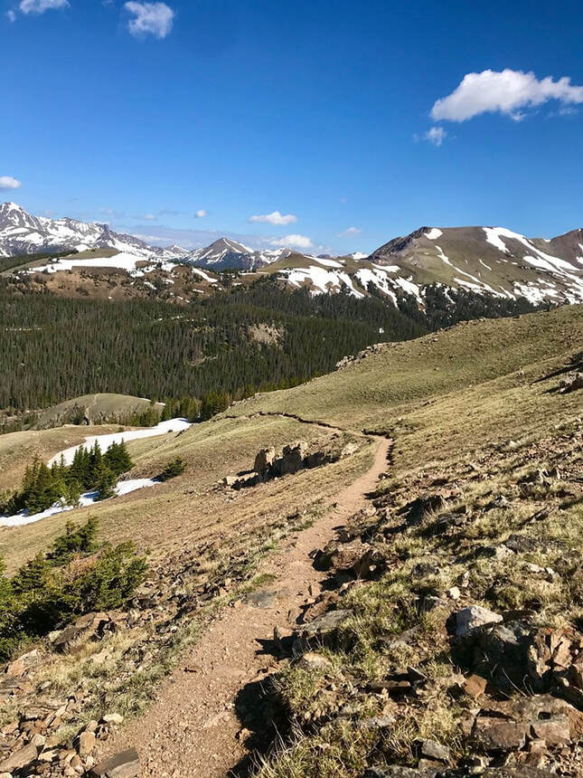 The gratitude he feels while on these trips reinforces this connection. Suddenly, he is no longer the outcast and trying to fit himself into a shape society asks him to fill. These days, Simon works as a freelance contractor and carves out considerable time for traveling and mountaineering. While standing on these mountaintops alone, he sees these moments as wonderful gifts– that are uniquely for him alone. “I experience a rush of endorphins, that weird chemical euphoria that I used to seek out artificially,” he explained. “I become grateful for being a human on this planet, for having legs to get me to the summit.” Simon is continuously honing his preparation for hiking, after every trip he has figured out a way to lighten his pack a bit more and reduce the amount of water he carries. His advice for hiking is similar to his advice for achieving and maintain sobriety. 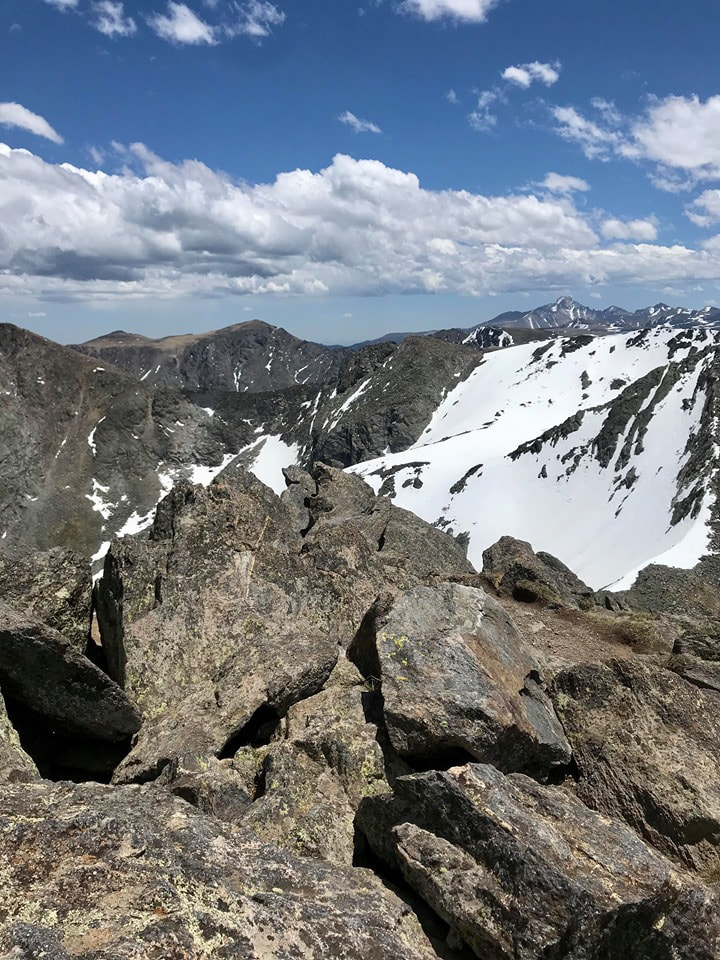 View of Longs Peak from the Mount Ida trail on June 7. “When climbing a mountain, you should only expend about ¾ of your energy climbing to the summit, you need to reserve about ¼ for the return,” he counseled. “You need to find your own path and whatever path that is, keep moving. Keep moving even if it’s not forward, sometimes you have to go sideways. As long as you keep going – take another step and then another and another. “I apply the same things in hiking that I apply in recovery; it’s not necessarily getting to the mountain top that’s the important thing. In life, you’re never like ‘I made it!’ You never truly reach that point. You’re never done, it’s never over. Once you get to the top you have to get back down.” Taking responsibility for his actions, along with expecting setbacks on the journey is essential to Simon’s new outlook on life. “If you can use those setbacks and disappointments not as a discouragement but as a motivator, you succeed,” he said. “They are learning experiences and that’s what it takes to improve. You have to expect to have problems and run into unforeseen things – in life and in hiking.” 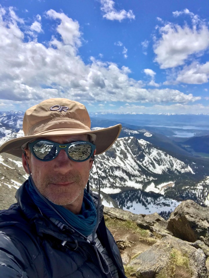 Simon Vogt on the summit of Mount Ida on June 7. For a brief moment, spring rises through our elevation on its way up to the alpine. The aspens leaf out with a spring green and and the meadows show a flush of new green growth. Golden banner and blue flag iris are among the early season flowers that let us know summer is near. The waterfalls flow heavy with snowmelt and we wait for the snow to clear off the trails so we can hike to the alpine lakes.
 The More Things Change, the More They Stay the SameBy Barb Boyer Buck “What’s on your butt and why are you going to Cleveland?” I looked over at my dad who was sitting next to me while I was driving. I had no idea what he was talking about.
“Barb! The speed limit is 45!” he said. Oops, I was going 50. I was excited about driving up above treeline on Trail Ridge Road and wasn’t paying close attention. Also, for the first time in decades, it was a beautiful, early June afternoon and the traffic was sparse. I was giddy about this – it had been more than 20 years since I’ve seen visitation this light in Rocky on a glorious summer day. I was driving his car, so I respected his wishes and slowed to 45 mph. Almost immediately, a large truck was tail-gaiting me. “See, now there’s a bozo on my butt since I’m going the speed limit!” I said, but Don heard differently. All three of us broke out in uproarious laughter when I explained to my dad that what he heard as Cleveland was “speed limit” and nothing was wrong with my butt. One of the things I love most about my parents is their senses of humor. When RMNP announced the timed-entry reservation system would start on June 4, I made a reservation for the first day. It is required to present your receipt (paper copy or downloaded onto your phone) at the entrance gate and that you enter during the time period you reserved. I told my parents my reservation was from 8-10 a.m. and asked they pick me up by 8.
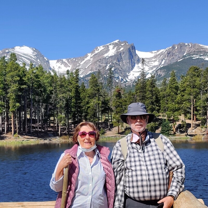
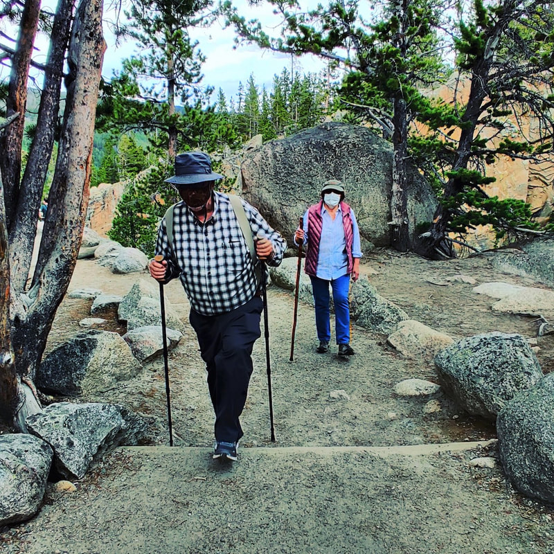
Note to self: next time, tell them to be someplace one hour before I really need them there. There were rangers standing on the road, right before we reached the Beaver Meadows entrance of RMNP at about 9 a.m. to make sure we had made a reservation and then at the gate we showed rangers our reservation confirmation. My dad had a heart attack three years ago; he turned 78 this year. Sprague Lake was the perfect spot, I thought, for a small hike. We took a slight detour to show them the handicapped accessible camping spot. There is virtually no elevation gain and it’s a half-mile jaunt around the perimeter of this lake, which was created by Abner Sprague when he was building is lodge there in 1914. To my surprise, my parents had never been there. Our family moved to Colorado Springs in 1979 and my parents owned a house in Longmont for 30 years before they downsized to a smaller place in Johnstown, just two years ago. I had hiked with my parents in Rocky many times before; I guess we were all younger then and did more strenuous hikes.
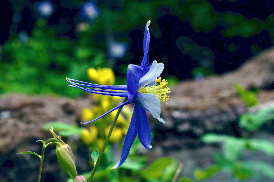
While preparing for this trip, I had suggested to my dad that he bring his pole & flies. “I don’t have a current fishing license,” he said. What? I had envisioned Mom & I hiking while my dad fished – that’s what we had always done in the past while us kids were growing up, on the South Platte River at Deckers, in southern Colorado. But that was 40 years ago, I reminded myself. My mother was having a wonderful time – she loved discovering the different wildflowers and encouraged me to take close-up shots of everything. “That one is called Frauenschue,” she said, pointing at a golden banner. My mother is German and grew up in a small town in Bavaria, exploring the woods and hills of Ober Franken. Frauenschue translates to “women’s slippers.” “Oh, I think that’s a wild hazelnut bush!” she exclaimed. “After the war (WWII), my mother sent us kids out to the woods to pick them. We ate a few (they were so sweet!), but kept most of them because she would grind them up to make flour and cookies.” Hermine pointed out wild strawberries and gooseberries as well. She stopped to marvel at the striated granite rocks and pieces of wood with interesting markings from insect infestation. I think I get my excitement at seeing beautiful nature from my mother, who notices every detail. She doesn’t hide her enthusiasm when she is pointing these things out, and it’s an absolute joy to be with her in nature (unless she starts talking too loud to my dad, which can scare off the wildlife.)
“How can I take pictures if I have those in both hands?” he said. I pointed out the loops attached the handles. “You just let go of your poles & take a picture,” I explained. He finally agreed and was soon out-pacing my mother and I, who stopped often to admire the flora and features around us.
So, we hiked up there. Again, my father was outpacing my mom and I who were discovering more plants and flowers. On the way down we got caught in a sudden rainstorm and were pelted, somewhat painfully, with hail.
Note to self: patience is the key when dealing with children and elderly parents. Our drive up to the top of Trail Ridge Road was everything I hoped it would be. On that day, it was very warm and the snow that had been recently plowed through to open the pass was melting quickly, rivulets of snowmelt were everywhere. But Mom & Pop were too tired to take the trip all the way down to Grand Lake, so we turned around and drove back down to Estes Park.
beach, or the redwood forests, or vacationing in Yosemite National Park. In Colorado, you guys were older but we still went fishing and hiking all day. “What I liked was we also saw a lot of young families with their small children, instilling in them the love of nature. We saw people our age still hiking, even if they needed polls or sticks.” My skeptical and stubborn dad had a great time, too. “I was reluctant to go, having been almost exclusively in my house for about 100 days, but the park has been a favorite destination since I moved to Northern Colorado in 1988,” said Don. “We go two to five times a year on average and every trip before was enjoyable.“This time, with the Covid-19 around, I was not sure I wanted to be around people that much and the park has always been full in the past with heavy car and foot traffic. But I went because, 1. There were reservations to minimize attendance, 2. This is the best time to see the park emerging from its delayed winter, and 3. My daughter is a very persistent person, and enjoyable company.” Note to self: remember everyone, no matter what their age, have irritating quirks and differences in approach to life, including me. Both of my parents agreed the air was cleaner, the visibility was greater. “The whole park looks refreshed, like the pandemic gave it a breather,” said my mom. “Trail Ridge Road was always a special place for me,” she said. “It always showed me how unimportant we as humans are, even if we think we are so important. In other words, the park put me back to reality.” “The problem with the timed arrivals is that there are no timed departures,” Don said. “We, like I imagine most other visitors, decided that once we arrived, we were going to stay as long as possible. The result is, of course, that the further in the day, the more crowded the park became. “The air was crystal clear, even though we were breathing it through masks, a practice that about half the visitors seem to employ. The clarity of the air allowed us to see and photo extremely detailed features on the far horizon,” he said. It was a wonderful day for many reasons. I enjoyed reconnecting with my parents and reminiscing about the times we hiked as a family over the years. My mother experienced the burgeoning wildflowers and plants that she enjoyed so much. And my grumpy old dad got a little less grumpy. “Returning home, we felt that peaceful defusing of nerves that had started on entering the park and continued well into the night,” he said. “I realized that I needed that trip. I have three months of tension to get rid of, and Rocky Mountain National Park had once again worked its wonders.” This land is my land – and yoursBy Barb Boyer Buck Yesterday, Rocky Mountain National Park opened for the first time since it was closed to the public on March 20 in consideration of the national COVID19 crisis. But right up until yesterday (and during the day), there were rapid changes in both RMNP and Town of Estes Park policies, which made things a bit confusing. 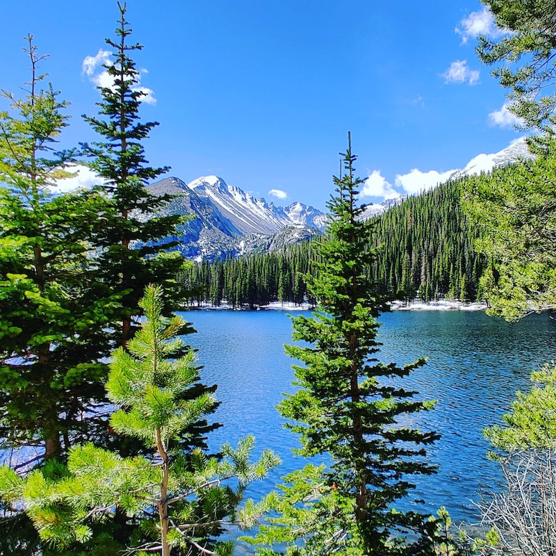 Bear Lake with Longs Peak For the past 25 years I’ve lived in Estes Park and generally accessed the Rocky via either the Fall River or Beaver Meadows entrances, both located just west of town. These entrances handle most of the vehicles entering the Park; in the winter months, it can be a factor of 30 times more vehicles entering the Park from this side of the Continental Divide. Just to illustrate this dichotomy: in July, 2019 (the Park’s highest visitation month that year) more than 210,500 vehicles entered Rocky from the vehicle entrances near Estes Park, compared to about 61,000 vehicles on the west entrance, at Grand Lake. 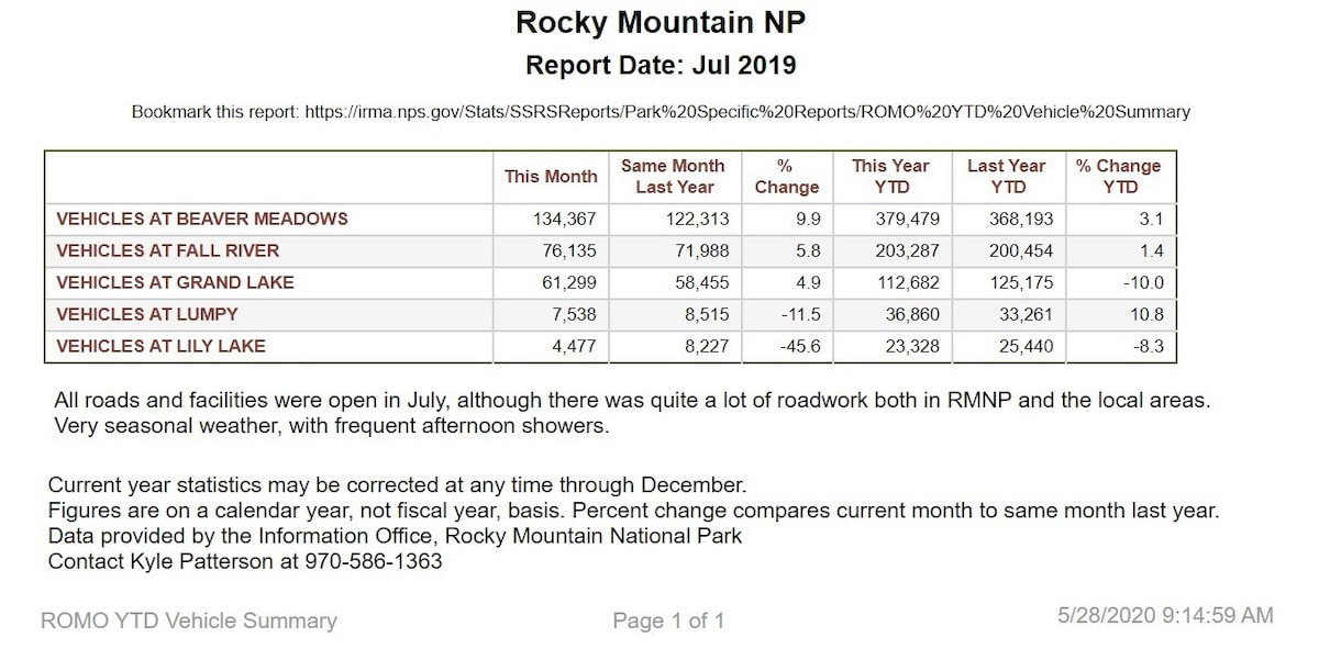 Click for a larger image As the dust begins to settle on changing regulations at both the local and federal level, it appears that as of June 4, 2020, Rocky will host only 4,800 vehicles per day from any entrance, or 148,800 vehicles for the entire month, a little more than half of the vehicles that cruised through the Park’s gates last year in July, the year’s highest visitation month. (For the purposes of this comparison, vehicle counts at access points that don’t require an entrance fee are being left out, ie, Lily Lake, Longs Peak, and Lumpy Ridge on the east side.) 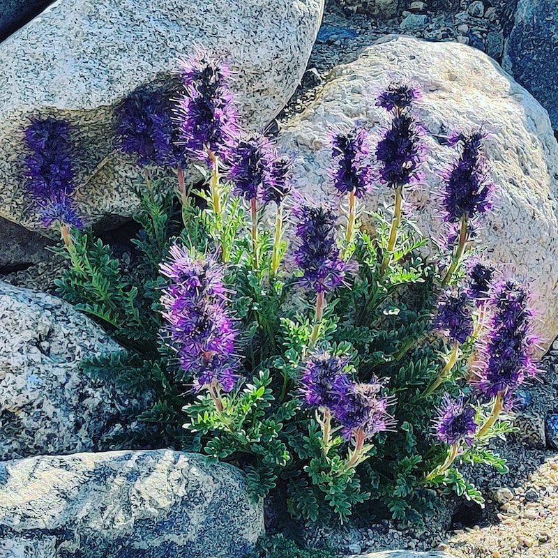 Purple Fringe wildflower Rocky Mountain National Park publishes vehicle counts on their website for all of these access points going back more than 20 years. 2020’s timed-entry for July will keep vehicles at 42,200 less than what was counted in 1996 for that month, according to RMNP. 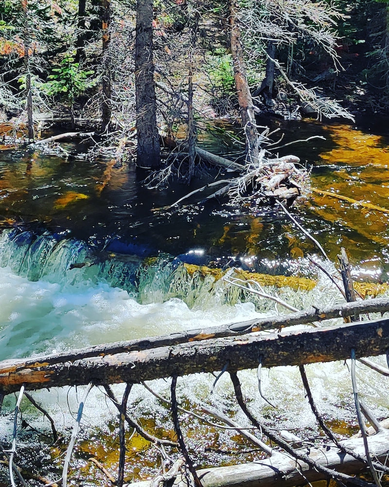 Upper Fall River Wow. I’ve lived in Estes Park since then and I am absolutely thrilled about this! But I also realize as a National Park, this land belongs to every citizen of this country and access needs to be granted to everyone on a fair basis. 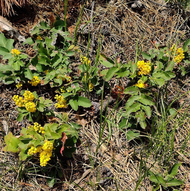 Flowering Oregon grape Park officials recognize this too; thus, the introduction of reservation system for entry into RMNP. At an Estes Park Town Board meeting on May 12, Rocky Mountain National Park officials presented the plan for a timed-entry system to be implemented with the opening of the Park to the public on May 27. Federal approval for the timed-entry plan did not come through until yesterday, but the Park opened anyway so I started my visit before 8 a.m., remembering how RMNP experiences so much congestion this time of year. 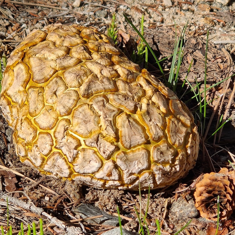 Puffball Mushrooms I took along a friend who is relatively new to the area and hadn’t seen much of Rocky previously. We ended up spending about eight hours in RMNP, touring all the areas we could access by car. We took a few short hikes, too – such as around the Bear Lake Nature Trail. Pro tip, especially if you have children: the Rocky Mountain Conservancy publishes a guide book to interpret the bear-paw trail markers around the lake: https://rmconservancy.org/product/bear-lake-nature-trail/. 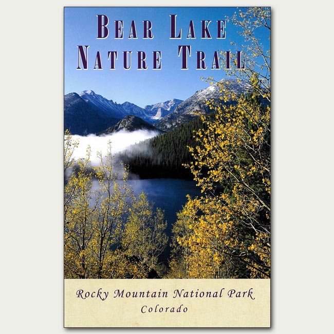 Joe and I entered RMNP from the Fall River entrance station. Only one gate was open, but the line to get in was relatively short. There were two rangers at the entrance, both wearing masks. They were friendly and encouraging, and thanked us for visiting. 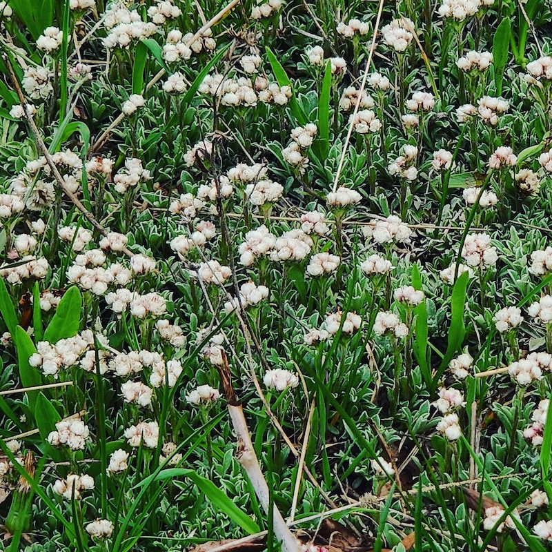 Pussytoes Currently, the Aspen Glen Campground (the first destination after entering the Park from that entrance) is closed; there are no plans yet to open this campground this summer. We continued to Sheep Lakes – a popular spot for Big Horn Sheep during the spring and early summer months. Unfortunately, we didn’t see any that early in the day. 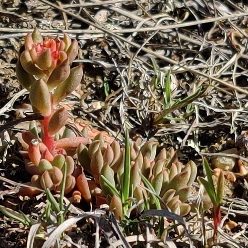 Stonecrop Next, was the entrance to Endovalley and the Alluvial Fan created by the Lawn Lake Flood of 1982. Prior to the area being established as a National Park, a group of farmers from Loveland dammed the small lake in the upper portions of the Roaring River Valley. This valley descends 2500 feet in just six miles and when the long-forgotten dam finally deteriorated enough to fail, it resulted in a spectacular fan of rock debris, creating what is today an amazing waterfall. There are several indications of that flood still remaining at the site. 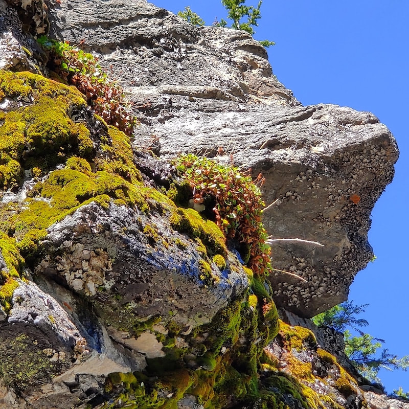 Mossy rock outcrop The road to Endovalley is closed to vehicles, but foot and bicycle traffic to the picnic grounds and Old Fall River Road is still allowed. I became a little anxious about this time; it was already after 10 a.m. and we hadn’t yet seen Bear Lake. As a local I have seen the Bear Lake Corridor become more and more crowded with every visit; parking at Bear Lake is usually completely full well before noon. Over the years, increasing visitation compelled Park officials to initiate several protocols: a sign before you head up telling you if the parking lot is full and several shuttle busses and shuttle-bus stops along the way. 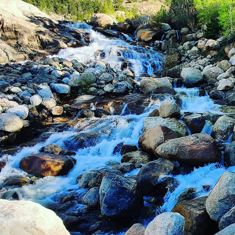 Horseshoe Falls at the Alluvial Fan The bottlenecking at this location is caused by Bear Lake Road itself - it dead ends at Bear Lake after traveling through Moraine Park. The traffic was relatively light on the road; the shuttle stops were empty (as were the shuttle busses driving by) and it was easy to get a parking spot right at Bear Lake. The lake is located at nearly 9,500 feet above sea level in the sub-alpine region with glorious views of the Continental Divide, including the back side of Longs Peak. Yesterday, even though visitation was a fraction of what it usually is this time of year, it was still hosting lots of families and groups and there was a considerable amount of screeching and yelling, making it sound more like an amusement park than a national park. Masks were required at this location if it became impossible to stay at least six feet away from others (and it was). Unfortunately, quite a few groups and individuals did not observe this rule.
On the way back from Bear Lake we stopped where we could along the road. The Glacier Gorge parking area (that leads to Alberta Falls) was completely full, so we didn’t stop there. We walked around Sprague Lake, which was also moderately populated with people; some with masks, most without. The Glacier Basin Campground and road are closed at this time. Hollowell Park was open and the trail looked great – we didn’t hike much there because it looked like a storm was moving in and the trailhead leads through lots of meadows.
We stopped at the Moraine Park Discovery Center (also currently still closed) and were greeted with amazing views across the moraine floor. The new leaves on the aspen trees were lime green and many elk were brooding – it’s almost calving season.
Then, it was on to Trail Ridge Road. This is also US Highway 34, making it the highest paved thoroughfare in the United States. Currently, Trail Ridge Road is open to Rainbow Curve, just below tree line which is a little more than 11,000 feet in elevation in Rocky. Above this line, trees cannot tolerate the temperatures and weather to survive. At or near this line, especially on Trail Ridge Road, you will encounter trees that are some of the oldest organisms in Colorado – more than 400 years old, in some cases. They are also the most curious trees you’ll see – stunted and short, some twisted from the wind, with limbs growing only on the leeward side of the trunk. The side that faces the harsh elements are polished nearly smooth, like driftwood.
On the way up, we stopped at Hidden Valley - a historical site that once hosted a small, fully-developed day skiing resort just below the Continental Divide. The ski lifts have been removed, and safety fencing was installed after the resort’s closure in 1991. But yesterday, we observed several skiers, hiking up to the Divide to ski down some of the slopes that still had snow.
All in all, it was a perfect day! But when we got back into town (and cell reception), we discovered the mask ordinance in downtown Estes Park, which supplements regulations still in place for Larimer County, was revoked. This emergency ordinance was enacted on May 1 through a special meeting and essentially stated that mask must be worn throughout the downtown Estes Park corridor (even outdoors).
This ordinance caused some backlash from the downtown business owners who were having a hard-enough time controlling mask use inside of their businesses (as per county order). Visitors who were accustomed to strolling around downtown, eating and drinking various foods and snacks, were not thrilled, either. Also, during our day in the Park, the timed-entry reservation system for Rocky was finally approved by the Secretary of the Interior and will be implemented starting June 4. This means that between the hours of 6 a.m. and 5 p.m., a reservation must be held to access the Park. The complete description of the timed-entry reservations system is linked to from our site, https://www.rockymountaindayhikes.com/index.html. The reservation system is up and running as of today at https://www.recreation.gov/ticket/facility/300013 This means reservations to visit Rocky Mountain National Park from June 4-July 31 can now be made on this site. Pro-tip: if you are an interagency pass holder (America the Beautiful pass, allowing you to access any federally-managed land; a RMNP annual pass holder, or a Golden Access (lifetime pass holder for those 62 or older), you still need to make a reservation. All reservations will include a $2 reservation fee, even if you possess a pre-paid access pass. For those who need to access Trail Ridge Road for work or other non-recreational purposes, the Park will be issuing a $25 pass. Information about this can also be found on the RMNP website. We are still awaiting clarification on several contingencies that may arise, but at this point, I am completely in support of the timed-entry reservation system. I am thrilled to be able to experience this beautiful place without the congestion and delays caused by the more than 4.5 million visitors who visit RMNP annually, now the third most-visited national park in the nation. But I am concerned the Town repealed its downtown corridor mask ordinance. Most of these millions of visitors come through Estes Park, and at this time, we only have 23 hospital beds. The average age in Estes Park is 59; but we are a popular retirement part-time residence, so this this age demographic is a bit misleading. Our community swells in the summer months, with the snowbirds (second-home owners who only live in the area during summer). Snowbirds are not counted in age or population demographics and tend to be elderly. Rocky Mountain National Park belongs to every citizen in this country and hosts millions of citizens from all over the world. One hundred years ago, the last time a worldwide pandemic affected us, this area was sparsely populated and hosted hundreds – not millions - of visitors. A large-scale reinfection in this area, which to date has had very few confirmed cases, may force our governor to request NPS to close Rocky again; or even close down all in-store shopping in Estes Park. I believe if those who visit this area do so after careful planning, everyone will experience a less hectic and more enriching experience than has been possible for more than 20 years. We will be pleased to help welcome you to your Rocky Mountain National Park, one of the most beautiful places in the world. Having Rocky Mountain National Park closed has pushed the rocky mountain day hiker further east into the Roosevelt National Forest. That’s actually just fine, because at this time of year hiking east of the National Park is preferable. Not only is this area further east, but it’s also lower elevation. That is to say, this is where springtime in the Rockies starts. Although I haven’t been in The Park recently, I am certain there is still lots of snow in there and most of the main trails are not yet cleared, although maybe some of the lower Montane trails are. If the boundaries of Rocky had been established more on an ecological lines, it’s likely that this area, known as the Foothills Life Zone, would have been included all the way east to the high plains. So we could say the trails in Roosevelt National Forest are part of the Rocky Mountain Ecological Park, if such a Park existed. And there are a number of good representative trails to hike in this region during the spring months.
hillside. It’s about a 1000’ ft elevation gain through south-facing forest terrain in the first mile. Pretty much just straight up. But, eventually the terrain levels out and at the same time the trees end. Now the terrain is like a low-elevation grassy, rolling tundra. The views are right into Rocky Mountain National Park and it becomes clear, there’s still plenty of snow to melt out of the Park! Most of it will melt over the next month. It appears fire has passed through this rounded ridge top where we are hiking and the hiking is superlative, especially if you navigate over the rocky spine of the ridge.
I highly recommend exploring the eastern portion of the Rocky Mountain Ecological area of Roosevelt National Forest during the remaining month of May. Then you can follow spring as it ascends into the National Park all the way to the Alpine Zone. 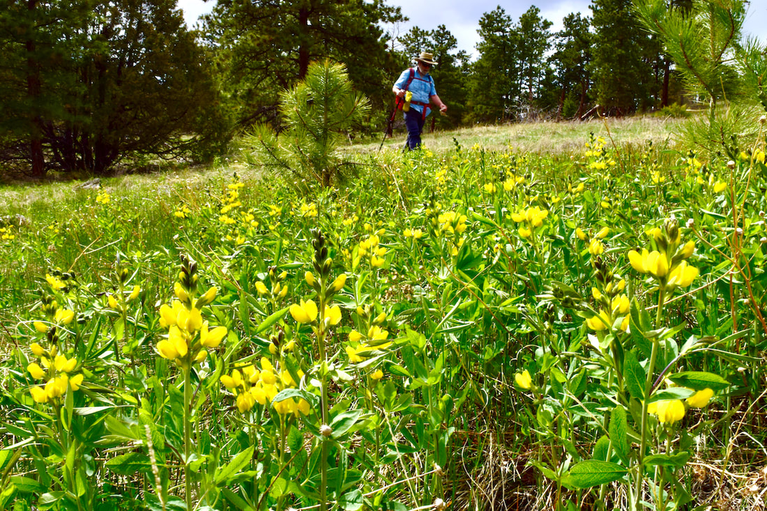 Golden Banner signals the start of hiking season
by Barb Boyer Buck A little more than a month ago on my 54th birthday, I took a stroll into Wild Basin. This was just a couple of days before Rocky Mountain National Park closed for pandemic mitigation. A group of four young people wearing sneakers and light jackets were standing at the Sandbeach Lake trailhead. They discussed whether or not they should hike up to the lake.
Yes, I had been. It was decades ago and I wore the same hiking boots I was now putting on my feet. “A long time ago,” I said. “It was a hard hike, very steep.” The teenagers mulled it over a few more minutes and then got back into their car and roared off. I watched them leave and considered taking the hike myself. I started up the trail, but then broke left to follow the Ouzel Falls trail signs. I chickened out. I had the right shoes, fortified against the icy snow patches with YakTraks, I had a real jacket, but I’m not the woman I used to be.
before until after 11 p.m. and didn’t get much sleep. “How can you do this hike after working so late?” Tim asked, and I felt strong and admired. That’s a great feeling. We were going to camp in Rocky Mountain National Park’s backcountry for the first time as a couple.
But Tim has lived here as long as the Rotary’s Duck Race has been around. When I met him, he was well-versed on hiking Rocky. He was the expert. I was just in love with the landscape, the flowers, the weather - I documented every sight with my camera. I grew up hiking and camping with my parents in northern California and southern Colorado, but every place Tim took me to was something new and beautiful. Rocky Mountain National Park is one of this country’s richest treasures.
Anyway, he was my geek one week, and after I developed the black and white picture I took of him, Tim illustrated it with his cartoon art before it went to press. So, I had my dream job in a dream location. I lived in a tiny efficiency cabin near the hospital and after Tim and I got together, we moved next door to a larger, 2-bedroom place owned by the same people. We had the best landlords.
you’re in shape. I’d like to think we made it in less time – I was in the best shape of my life since I was on the swim team in high school. I don’t remember and since this is my story, I suppose I can say whatever I like about it.
We were heavily laden – we liked our food and drink and were not going to scrimp just because we were in the wilderness. I distinctly remember a bag of apples and a bottle of wine, but we brought other food, too. We also carried camp and cooking gear, sleeping bags. We didn’t pack many clothes, except for layers. It gets cold at 10,000 feet.
When we reached the lake, it was what I had imagined. And more. I remember bits and pieces – I remember taking photographs, most of all. Tim had some
We hiked back down under cloudy skies. It was cool and dry; the hike was a piece of cake (these days, I shudder to think what my knees would do). We stopped again for a few pictures. I took two rolls of film in those pre-digital days and I’m glad I did, even though it cost me close to $10 to develop them. That evening, I went to work at the restaurant again.
recovered from several major surgeries. I learned, the hard way, about patience and gratitude.
right away, I keep trying until I master it. And in this time of quarantine, my patience is being tested again. It seems to be holding up pretty well, actually, and I wish the same for all of you. 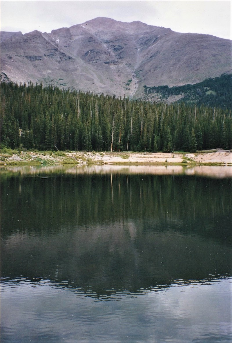 Under cloudy skies, Sandbeach Lake takes on a deep green color. by Sybil Barnes Sitting in my house wondering when this “social distancing” will end and there will be entertainment venues and gathering places open and restaurant or bar tables around which to gather, I remember when ... Won’t you return with me to “those thrilling days of yesteryear” as I look back on a simpler time when we wanted to mingle with other people?
In the evening, we usually went to a program at the Y camp. Sunday was the hymn sing. Other nights were movie screenings or talent shows or lectures about world events. And then there were dances at the Teen Barn or hanging out playing spades or ranking passers-by on the Ad Building steps or watching the local boys who came out to play basketball. At least once a week, we went downtown. My father loved to eat and talk to people. My brother and I went along for the ride. We usually drove to the Dark Horse parking lot. Our first stop was to visit the Kemple family at their arcade. They offered a shooting gallery and booths for tossing baseballs into milk bottles or bursting balloons with darts. We rarely played any of the games, just enjoyed talking with them. Our other entertainment there was watching who was coming in or out of the Dark Horse bar, Sometimes as a special treat, we went in and sat on the carousel horse barstools to enjoy a bowl of soup. My grandmother was a suffragist and a supporter of the Temperance Movements so my father’s drink of choice was water. Maybe that’s when I became a CocaCola addict. The Dark Horse and all of the Riverside entertainment complex were torn down before I was old enough to drink there. We went on our way across the bridge to the Wheel alley. There was another arcade where one of the Riverside Plaza fountains is now with pinball machines and other games. Sometimes my brother would peel off there to hang out with his friends. My father and I turned east on to Elkhorn for a refuelling stop - the Dog House. Hazel and Dale Stoner spent their winters travelling in the southwest to fairs and rodeos. In the summer they offered hamburgers, hot dogs and corn on the cob from their tiny storefront between Coulter’s Waffle Kitchen and the Macdonald Book Shop. The corn was on a stick - perfect for eating while walking - and kept in a pot of melted butter so we always needed a pile of napkins to wipe our greasy faces. The Dog House was a casualty of the 1982 Lawn Lake flood. Continuing east on Elkhorn, we passed Jerry’s Sandwich Shop and maybe stopped into the corner pharmacy - Alpine Drug - to look at the magazine rack. Further down the street we stared at the baron of beef lit up by heat lamps in the window of the Tender Steer. In the next block was Jax Snax, but not much was happening at that 3.2 bar until later in the evening. And Brodies Market was usually closed after 6 p.m. Our next stop was Casey’s little train, the Silver Streak Railroad, at Trout Haven. I felt way too sophisticated to go for a ride but I still loved to hear Phil Martin’s chant and always laughed when he would tilt up a car with a crowbar and call out “There’s a BEAR under there.” Past the train station, there was a gas station and the original Trout Haven pond. Small vending machines offered fish food for purchase Sometimes we picked up handfuls of gravel to throw in to see the fish rise to the surface. The small row of shops that signalled the end of the business district started with Andy Anderson’s liquor store and ended with Crowley’s Restaurant. In between was Gift Haven where Lois and Ted Matthews entertained us with stories of the customers they had that day or their adventures hiking in RMNP. I used to have a collection of porcelain animals that were purchased there. Then it was on to DieAlte Delicatessen for another food stop. They had wonderful sandwiches. My memory is creaky about whether it was owned by Peter Marsh’s family or some of the Crowleys. (maybe both at different times.) Munching on our sandwiches and chips, we crossed the street and turned west to walk by the football field, soon to be turned into a parking lot after the new school was built out by the fairgrounds. We got a drink of water from the fountain in front of the original library with its Hobbit House wooden door in Bond Park. Then we passed the Chamber of Commerce, the Town Hall/Police Department and the Coffee Bar before reaching one of our favorites - the Silver Spruce Pharmacy.
Refreshed and fortified, we continued up the street, maybe stopping to watch the airbrush artist painting sweatshirts next to Western Brands. In the next block we ducked into the Taffy Shop to say hello to Mr. Slack and get a small box of our favorites - mint, lemon and cinnamon. On past the Community Church and the Dinner Bell and across Fall River for more ice cream at the Dairy King. My choice there was a chocolate dipped soft-swirl cone The bathrooms at Tregent Park mark that location. Back across the street and turning east, we looked in the windows of Kings Casuals to see the latest women’s fashions and at the horse paintings and tiny carousel in the Haff Sisters studio before stopping at the Chevron to visit with Fred Bonelli when he wasn’t having to dash out to fill somebody’s gas tank or work on fixing a flat tire. If you’ve ever seen a brochure for Helen and Tom Justin’s original Lazy B Ranch/Chuckwagon on Dry Gulch Road, Fred is the cook in the cover photograph. More food was on display at Hart’s Cottage Inn Buffeteria and further down that block there was another window full of meat under heat lamps at the Continental.Besides a bar, that was a fine dining establishment in several different incarnations. Next door we stopped to visit Lois Schmidt at the Estes Park Times and Old Fashioned Candy Store. Usually my father picked up some horehound drops and I went for the butterscotch disks or cinnamon bears. One more stop - up Moraine to the original Tony’s in Gaslight Square where we picked up more sandwich fixings to enjoy at home or sometimes had a sloppy joe burger or smoked oyster pizza.to counteract the earlier inhalings of sugar. Stuffed to the gills, we might stop at the A&W (now the parking lot across from Snowy Peaks Winery) for a jug of root beer. And then it was home again to watch the stars, listen to the burble of the Big Thompson, and think about what to eat tomorrow. What do you remember about your early visits to Estes Park? They could be from half a century ago or last summer. Share them with us. This essay will appear in a slightly different form in the Estes Park Museum newsletter sometime in the coming year.
By Barb Boyer Buck There is a quality to the early spring air in the Colorado Rocky Mountains that makes me want to get outside. The weather changes quickly here, so I wear layers and bring snowshoes or spikes in case I’ll need them. Once I actually start walking in it, the fresh air entices me to rip off my hat and gloves and unzip my coat. It’s still chilly but if the wind isn’t blowing, it’s an amazing feeling on my skin – more invigorating than cold. The air is a call to come out of hibernation and embrace the wilderness again. This is weather made for humans: calm, with temps ranging from chilly to warm. Rocky Mountain wildlife thrives in many conditions but humans can bask in this pleasant weather, rediscovering hope in Spring.
the recent closure of Rocky Mountain National Park and all accommodations in town. Nor to the fact that no one is eating out anymore and pretty much staying in their homes. This year, with the threat of the dreaded COVID19 keeping everyone inside, the spring air is even more tempting. Truly, the air smells and feels so fresh it can’t help but draw me outside.
I imagine it smells like mustard because that’s what it looks like. It covers every surface, even creeping through all the cracks in your home to make deposits on your furniture. But right now, in early Spring in the Rockies, the air is nurturing and clean. When the temperature is mild, I open my windows to let the glorious breeze touch everything that has gotten dreary in my house over the winter. My plants perk up and start stretching even more toward the promise of Spring.
I went to the store on March 16, wearing medical exam gloves and a face mask (not the 95 kind, just the kind that I already had). I dragged my friend along with
Just two days later I took what turned out to be my last hike in Rocky Mountain National Park “until further notice.” I saw many groups of people, hugging and kissing each other for selfies. It seemed like summertime – almost as crowded and just as noisy. I began wondering if we should practice social distancing outside, too. On March 20, our mayor asked the Secretary of the Interior to close Rocky Mountain National Park; that evening, RMNP closed for an indeterminate period of time. And three days later, all hotels were ordered to stop operations by the Town of Estes Park. Why would a town that depends on tourism to survive discourage visitation of any kind? This situation is very serious, I realized.
For all of us who take solace in nature, we handle it by answering the call of the spring air.
Accept Nature’s invitation to shed the dreariness of Winter and be renewed by Spring. By Rebecca Detterline The fall colors were not quite popping on my recent trip to the Thunder Lake Cabin, so as I stumbled happily around Wild Basin, I began to take notice of all the wild flowers transitioning into their autumn expressions. As we await the peak of fall colors, we tend to forget the wildflowers, assuming they are ‘done’ for the season. What if the wildflowers are not done? What if they are just now taking their truest, most beautiful form? Maybe wildflowers are like humans in that they do not become their most genuine selves until they have weathered a few storms.
‘No spring or summer beauty hath such grace as I have seen in one autumnal face.’ -John Donne The Mountains Have Seen it All
By Sybil Barnes There’s a saying you might have heard - “The only thing constant is change.” Sometimes I wonder how true that is. When I look up at Longs Peak or Twin Owls or the thumb on Prospect, I can imagine that I’m Patsey Estes or Isabella Bird or Esther Burnell seeing them for the first time. There are many other places in Estes Park and Rocky Mountain National Park about which I can’t say the same. But aside from a radical change in population of both visitors and residents and the associated buildings, roads, and services that go along with that increase, what changes have truly happened here? Let’s start with some of the history we know. Perhaps as a way to escape from the turmoil of the approaching Civil War, Patsey Estes and her family chose to live a hardscrabble life of subsistence ranching in a place with no neighbors. She had followed her husband from a relatively comfortable life in Missouri to this place he had discovered on a hunting trip and thought was beautiful. As far as we know, none of her letters or other writings exist so it’s impossible to say if she shared that feeling. This open space offered sweeping views with no neighbors. Though there was an abundance of wild game and fish to eat, it was a lonely life. The Estes family only had each other and the rare visitor for entertainment. Joel and his sons made trips to Denver to sell meat and skins but Patsey was home with the other children and a million chores. They eventually moved on to New Mexico after selling their “improved” property with its panoramic views from Longs Peak to Eagle Rock. Isabella Bird shared a lot of her feelings when she arrived as one of the first tourists to enjoy the hospitality of Grif Evans and his family. Evans had only moved up the hill from Lyons to take over the Estes holdings and was one of the first to recognize the potential of entertaining visitors as a revenue source. Ms Bird had a horse and was interested in exploring the area both on horseback and on foot. As a visitor, she had few of the responsibilities of providing a home or entertainment. Her writings may have encouraged an Irish nobleman to explore this part of Colorado while he was on a hunting trip to Wyoming. Unfortunately, no known record exists of the guests at Lord Dunraven’s hotel on Fish Creek. There are a few photographs which show women “taking the air” in front of the hotel. And it is known that the Irish Earl was not accompanied by his wife or daughters on most of his American trips. He spent his days riding and hunting and his evenings with food and drink. His visits were mostly made in the summer or fall but he left a land manager here year round. By the beginning of the 20th century, there was a town forming in the open space that had been named Estes’ Park by the newspaper editor, William Byers. Ranchers like the MacGregors and the McCreerys and the James and Hondius families arrived in the later 1880s and had become used to the conveniences of a general store and weekly mail delivery. More and more dudes were discovering the delights of a summer spent in the cool mountains. Shops selling souvenir photographs were opening at the confluence of the Big Thompson and Fall River in the space between Elkhorn Lodge and the MacGregor holdings. Horses and hiking were the main means of transportation and a pleasant way to explore the area. Other families, including the Spragues and Chapmans had ventured further west and created another small community in what they called Willow Park. Private cabins were built on the eastern hillside with sweeping views of the meadow between the moraines. Fish were abundant in the Thompson River and Frank Bartholf grazed his cattle further to the south on what would become the Bear Lake Road. Flora Stanley first came to Estes Park with her husband in 1909. He saw the potential for growth and development as a summer tourist destination. He had the discretionary income to build a fine hotel and create an infrastructure of utilities for the town that had been platted by Abner Sprague and was being marketed by Loveland businessman C.H. Bond and others. The hotel needed electric lights and indoor plumbing, so Stanley funded a power plant and a sewage system which would serve the entire village. He donated some of his property for public use as a community park and gathering place. Flora had vision problems so she was unable to comment on the view. She was probably delighted that her husband’s respiratory problems were solved by spending summers in the mountains but possibly just as happy to return to Maine for nine months of the year. When Esther Burnell and her sister Elizabeth came west on a summer vacation they discovered another settlement in the Tahosa Valley at the base of Longs Peak. The young women were hired to be nature guides at Enos Mills’ lodge. After a summer spent climbing mountains and identifying wildflowers, Elizabeth went to California to continue her education and Esther stayed to homestead property on the Fall River Road. She married Enos and became the mother of Enda Mills Kiley. After Enos’ untimely death, Esther and Enda carried on his legacy by running the Longs Peak Inn and making sure that his nature writings stayed in print and his ecological philosophy was brought forward through the 20th century. Growth of the town of Estes Park has always been limited by the topography of the area. Many people wanted to visit in the summer but not that many wanted to spend a windy and cold winter here. That changed with the construction of the Adams Tunnel to bring water from the wetter west side to the plains of eastern Colorado. When Bertha Ramey’s family moved from Lyons to start providing insurance and related services to the businesses and homeowners, the land where the Estes family had settled was still a meadow with the Big Thompson River meandering through it. By 1950, that property had been flooded by a reservoir called Lake Estes. Now when visitors make the last turn down Park Hill, they see water reflecting the mountain ranges beyond. Also by the 1950s, a few hundred people had decided to spend the winter months in Estes Park. Many of them worked for the National Park Service. Others spent the slower months getting their tourist accommodations ready for the next season. By the 1970s, young business people were seeing the potential for attracting visitors all year round. Though the main business district of the town was still only three blocks long, development had reached across all the flat spaces and was beginning to creep up the sides of the surrounding mountains. Geologic time outlasts any kind of human time. And the mountains can withstand climate change more easily than any animal or plant life form. In a hundred years or a thousand years, the approaches to Estes Park and Rocky Mountain National Park will still be up from the lower elevations with a last drop to a valley surrounded by mountains. Whether your view is of Twin Sisters or Lumpy Ridge or Ypsilon or our favorite fourteener, Longs Peak, and your family has been here for four generations or you are one of the four million who visited during the last year, remember these words from a song by Cowboy Brad, who we also know as Longs Peak Ranger Brad Fitch, “We live in Paradise.” (This article appeared in a slightly different form in the Rocky Mountain Conservancy newsletter. Are you a member of the Conservancy?) ‘If I fall asleep right now, I can get four full hours of sleep before my hike across the divide tomorrow. Unfortunately, I’m still at work!’ It’s that time of year when those of us who are lucky enough to live, work and recreate in the Estes Valley are stumbling around like a bunch exhausted zombies living on a diet of coffee, craft beer, beef jerky and gummy worms.
It is the season of back-to-back 4 am wake-up calls followed by showers at the Rec Center and eight hours of slinging beers at The Rock Inn. I can’t remember the last time I sat down for a meal with my boyfriend. I think we maybe shared some bleary-eyed sips of early morning coffee earlier this week. I love the busyness of it all, especially knowing that it is the final push before we transition into fall. I’ve heard folks say that if you’re lucky enough to live in the mountains, you are lucky enough. That is certainly true and I am so grateful for my good fortune! On top of that, I have been blessed with a strong body, a (relatively) sound mind, and a job and coworkers (and customers!) who make work fun. I get to play outside almost every day. Sometimes I am not sure what I did to deserve all this and I even feel a little guilty about it. The best way I know how to thank the universe for all I’ve been given is to practice gratitude every single day and share experiences and knowledge with others. Lately I’ve noticed people declining my invitations to get outside because they feel intimidated. To me, this is hilarious and these concerns are completely unfounded. I have never considered myself an athlete. Being able to walk a long way in the mountains carrying a heavy pack does not make a person an athlete. It does make one a good candidate for manual labor, though. My late husband was a classic sandbagger, forever lowering me down ice climbs that were grades above my ability level or taking me on adventures that lasted twice as long as he remembered, causing me to show up to more than one shift at work unshowered and wearing ski pants. While I wouldn’t change a single one of those zany experiences, I am very careful to respect other people’s tolerances for risk and suffering. For me, getting out into the mountains with someone is about the time spent with that person. Whether we are going across the continental divide, up Longs Peak or walking to Mills Lake, time in the mountains is for sharing laughter, stories and sometimes tears. It is certainly not about getting to some destination I have likely visited many times before that will still be there next week or even next year. All that being said, I am so grateful for the amazing adventure partners who have helped me expand my comfort zone. I, too, love seeing people push themselves beyond what they believed they could do. Let’s all continue to encourage one another to reach new heights while respecting boundaries, limitations and fears. Cheers to the end of another great season and to the memories made and friendships strengthened as we continue to navigate the peaks and valleys of this beautiful life. |
"The wild requires that we learn the terrain, nod to all the plants and animals and birds, ford the streams and cross the ridges, and tell a good story when we get back home." ~ Gary Snyder
Categories
All
“Hiking -I don’t like either the word or the thing. People ought to saunter in the mountains - not hike! Do you know the origin of the word ‘saunter?’ It’s a beautiful word. Away back in the Middle Ages people used to go on pilgrimages to the Holy Land, and when people in the villages through which they passed asked where they were going, they would reply, A la sainte terre,’ ‘To the Holy Land.’ And so they became known as sainte-terre-ers or saunterers. Now these mountains are our Holy Land, and we ought to saunter through them reverently, not ‘hike’ through them.” ~ John Muir |