The Continental
|
|
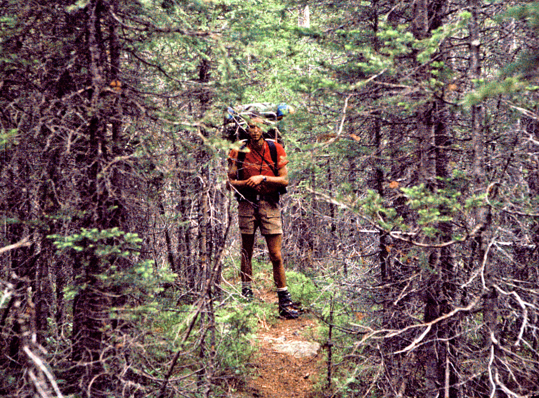
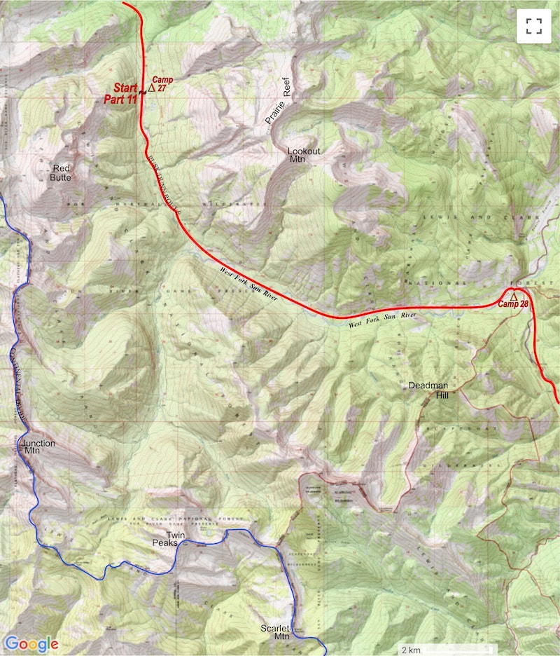
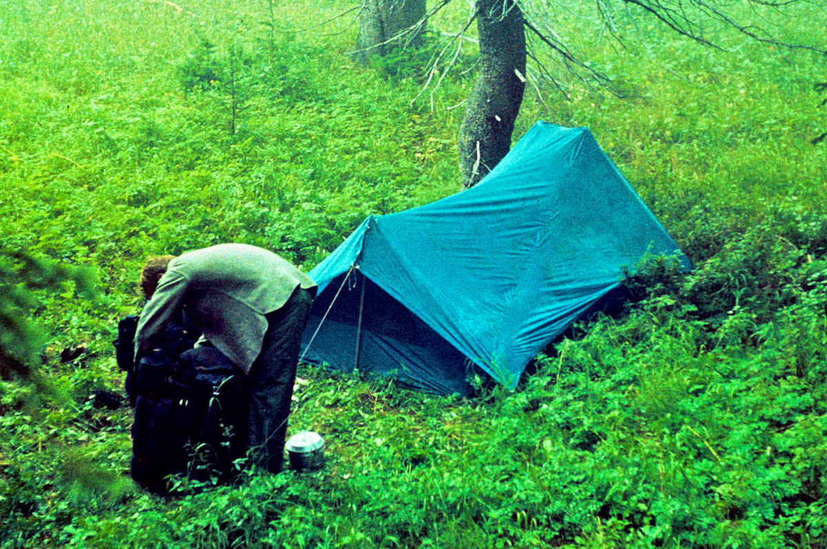
June 8 - 10 Bob Marshall Wilderness, Montana (Go to Pt 1) The rain persisted throughout the night but had let up to a light drizzle by morning. Getting dressed was miserable, everything was wet and I actually had to wring water out of my socks before putting them on. My u-trou, shorts and t-shirt were wet, cold, dirty, smelly and ripe for mold. And then there were my boots, which must’ve weighed-in at least eight pounds apiece as waterlogged as they were. I slowly laced my boots while Craig fiddled with his pack, we were both in a glum, listless state of mind; a real ‘Eeyore’ kind of morning.
thickets of half-dead, stunted trees infested with viperous deadfall. The miles were easy when the trail favored our side of the river but made for torturous progress when it did not.
The next morning I was anxious to get over the pass and push another high-mileage day but now that we were closer to the headwaters of Straight Creek, the steep, switching-back-and-forth nature of the trail got intertwined with the
I was unbelieving of what I was seeing. A fracture line, maybe forty yards across by two or three feet deep, had opened up just above and, in slow motion, all the embedded rocks, alpine flowers and tundra started to flow down the hill like molten lava. Amazingly, the embedded rocks stayed temporarily set in the tundra, even as they flowed, and to make this whole incongruous scene even more unbelievable - Craig actually jumped across on three more of those moving rocks to solid ground just before the whole thing broke apart into a small scale landslide. This was another one of those WTF moments. Craig was now fifty yards down the slope from where he had been a moment ago and I was still standing, utterly gob-smacked, at the edge of a completely destroyed, roiling swath of mud, water and rock. Out of this swath gushed a whole new stream of water, carrying with it rocks and mud and earthen debris down and across the slope. And the topper was, Craig had just rock-surfed an actual landslide!
stomach and as for a dietary staple, continued consumption was not going to be sustainable. Tolerable for a week’s outing, maybe, but after almost a month of eating Mountain House freeze dried meals, just the sight of the package was getting offensive. We both agreed over dinner that this had to change the next time we resupplied but, until then, we were okay with finishing off the last scrapings of our freeze dried meal out of the burnt bottom of the pan.
I thrashed around for my rain slick then ran out into the pouring rain to pull down our packs. It was useless trying to cover them, it was raining too hard, so I threw the luggage into the already crowded tent where Craig wrestled the wet packs around to make room for me to get in out of the rain. By the time I finally got back to sleep it was time to get up.
0 Comments
June 11 Bob Marshall Wilderness, Montana (Go to Pt 1) I thrashed around for my rain slick then ran out into the pouring rain to pull down our packs. It was useless trying to cover them, it was raining too hard, so I threw the luggage into the already crowded tent where Craig wrestled the wet packs around to make room for me to get in out of the rain. By the time I finally got back to sleep it was time to get up.
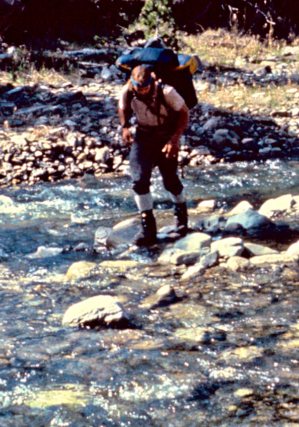
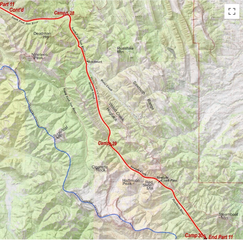
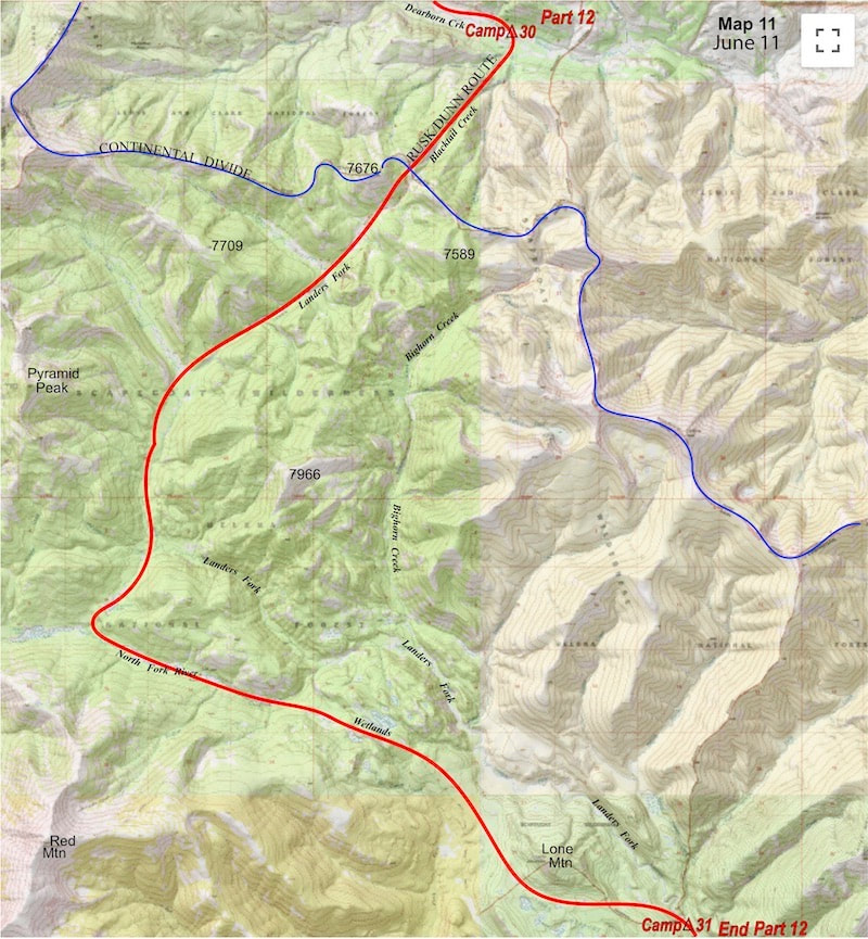
been on, looking for Craig’s boots had they been swept away down river.) From Dearborn Creek we climbed up a faint trail in a gathering mist to the ridge of the Divide.
We consulted the map and took a guess as to our exact location on the ridge as best we could, given the foggy, thicket of trees where we now stood. We were aiming to traverse into the Bighorn Creek valley and felt lucky when we happened across a snatch of pine-needled trail, which started us in the right direction but in the end only served to twist our (my) bearings into thinking we were descending to Bighorn Creek when, in fact, we were not. We were well down the drainage when things just didn’t look right, so we decided to check our progress on the map. Thinking we were in the Bighorn Creek valley, we examined the visible terrain around us against the map and couldn’t make heads or tails out of what we were seeing. So we pulled out the compass and the bearing it showed was somewhat close to the way we should be going but didn’t make any sense against the terrain - until we started to it piece together. “Huh, we must be in Landers Fork.” Craig finally stated mater of factly, after we had examined the map, compass, altimeter and terrain. Sure enough, wrong valley. “Well, shit. Shit!” was about all I could say to this revelation. We didn’t have any maps that showed where Landers Fork went and I had been the guy out front and it was the lead guy’s job not to lead us into the wrong valley; I’d just walked us down into ‘shit’ creek. We had no idea how much of a detour following Landers Fork would take us on but one thing was for sure, we had scant appetite for backtracking up the valley, re-climbing the ridge and traversing back over into the Bighorn Creek basin. So, despite the fact that we would be flying blind, we just went ahead and walked right off our map. We followed Landers Fork downriver all afternoon, looking hard to re-join something familiar to our maps but just couldn’t see enough terrain from within the towering forest to positively identify anything and we were starting to run up against the end of the day. About the time I was thinking we should start scoping out a campsite, the trail imperceptibly contoured out of the creek bed up onto a marshed-out plateau where it abruptly vanished. This was not welcome and certainly not this late in the day.
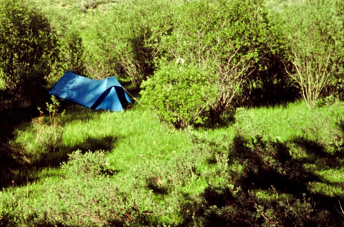
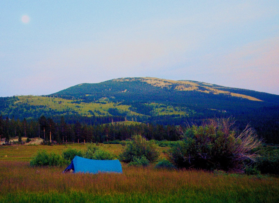
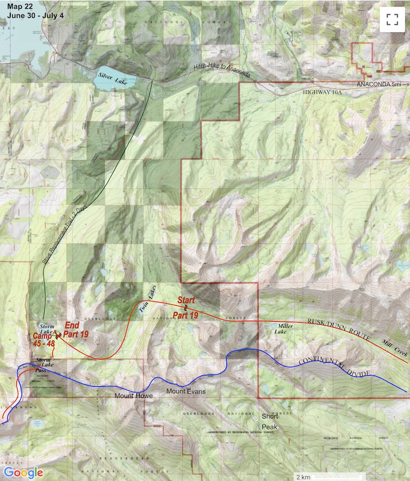
length of the plateau and neither the path nor the terrain allowed us to drop down to the river for another four miles. By the time we were finally able to drag ourselves down to the river to camp, it was after 8:30 p.m. and I was toast. The one upside was that the campsite we found was nestled into one of the most idyllic spots I’d seen yet. Set at the edge of an open and tidy forest, not 30 yards from the riverbank, was a huge Spruce tree whose lower limbs were a high reach off the ground and fanned out to umbrella a large area of clean, thick pine needles, more than enough room for our tent and a small but spacious front yard for cooking. We pitched the tent and made a half-assed attempt at cooking dinner but settled for overheated, undercooked, glop because we were just too tired and hungry to wait. I dozed off while eating this crud, that’s how tasty the food was and how ready I was to call it quits on the day.
June 12 - 14 Bob Marshall Wilderness, Montana (Go to Pt 1) Set at the edge of an open and tidy forest, not 30 yards from the riverbank, was a huge Spruce tree whose lower limbs were a high reach off the ground and fanned out to umbrella a large area of clean, thick pine needles, more than enough room for our tent and a small but spacious front yard for cooking. We pitched the tent and made a half-assed attempt at cooking dinner but settled for overheated, undercooked, glop because we were just too tired and hungry to wait. I dozed off while eating this crud, that’s how tasty the food was and how ready I was to call it quits on the day. The next morning I was so sore and stiff it was all I could do just to get out of the tent and take a leak. The sun was out and it was another sparkling day, so we sprawled out in our enchanting, little front yard to make the usual, workday oatmeal for breakfast. After the oatmeal was finished we decided to fix some pancakes because Craig had found extra pancake mix in his food bag and nobody wanted to see that to go to waste.
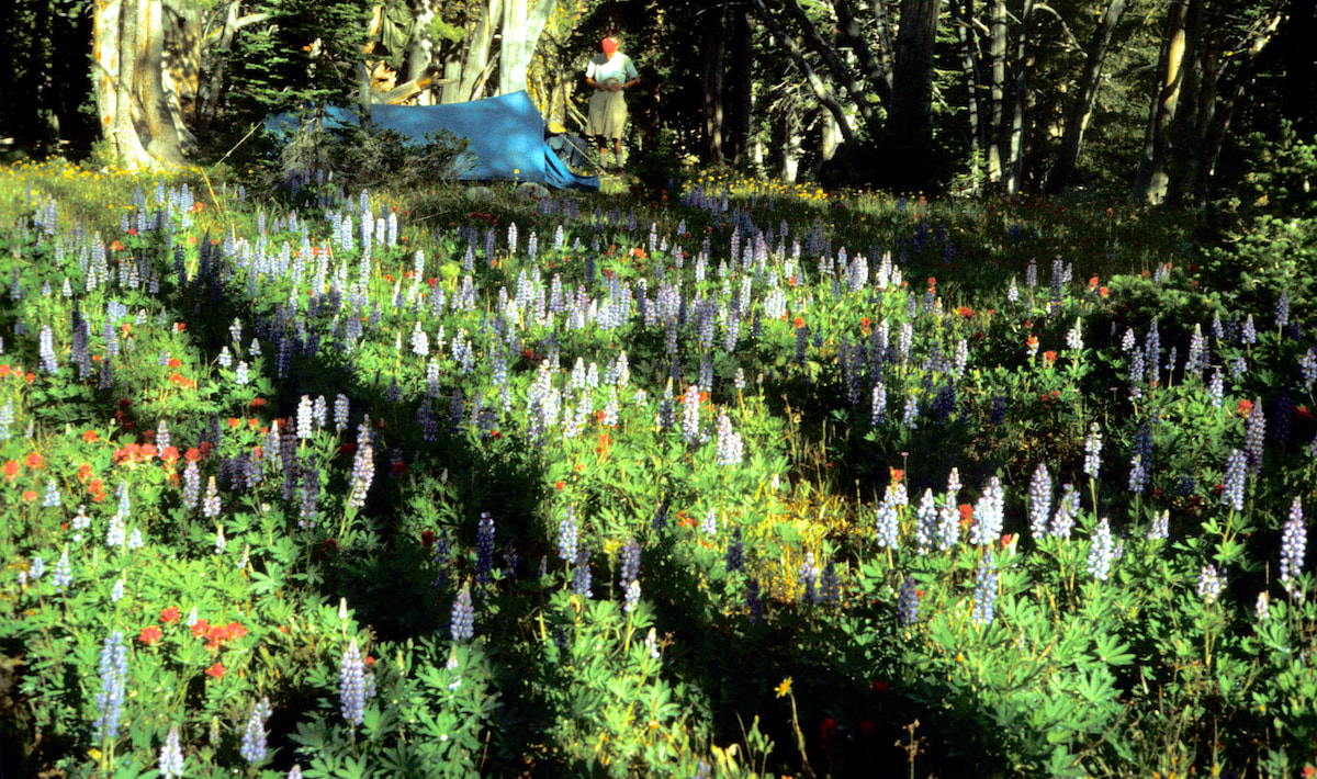
The glen where we camped was bursting with wildflowers and all along the cobbled riverbank Columbine, vibrant Paintbrush and Wild Iris thrived in dense clusters and Beargrass fuzz intermingled with Fireweed to carpet the open meadow bordering up to the forest. From riverbank to forest, the Edenesque gardens created a stunning kaleidoscope of color and texture, shimmering as they reflected the sunlight and swaying in the slightest hint of breeze. The river ran full, not raucously so but coursed with a powerful, low-rumbling current that included the occasional, muffled sound of rocks, rolling along the river bottom. Sun filtered down through the overhead boughs and sparkled across the water to spotlight flowers and landscape arrangements of every design. As I was taking all this in from the ease of my packrest, I started to look at a short, thick stick, lying on the ground at the edge of our camp and began to see the head of a bird, an eagle’s beak, actually, in the way the broken end had splintered apart. So I went over, picked it up, sat back down, pulled out my trusty, twelve-tool Swiss Army knife and started to whittle. While Craig was in the thick of reading James Cavell’s ‘Shogun’, I happily whittled away the afternoon, hewing my branch into a bird, and by sundown I had a pretty decent carving which I later sent to my brother, Dave, for his birthday. The next morning dawned just as clear and serene as the previous one had and the desire to just blow-off another day was tempting; camping in such idyllic spots was not just one of the highlights of being on the Divide, it was part and parcel of why we were even out here, which invariably made packing-up slow and leaving an attitude gear-grinder getting back into hiking mode.
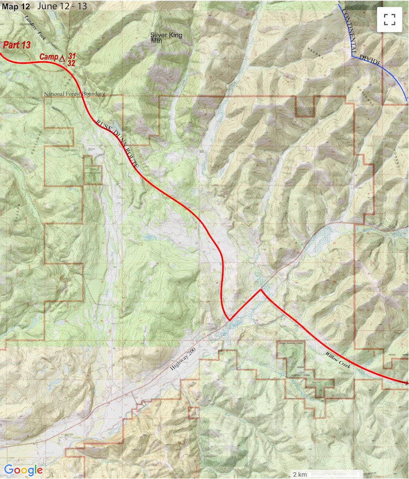
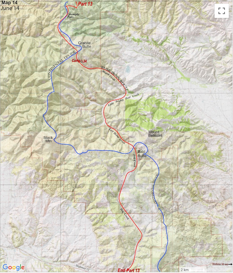
disappointed. The trail had become a 4W track and then dirt, unimproved road with all the impending signs of civilization. The road finally turned to gravel where it emptied out into an expansive, arid valley and by early afternoon we found ourselves standing along the pavement of route 200, considerably west of the Divide. That much we’d figured out.
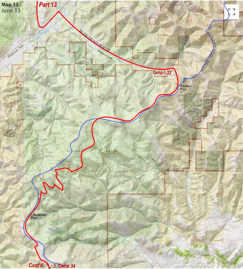
area, so this would put us back on route. Unfortunately, this also meant finishing out the day with six, mind-numbing miles of road-warrior walking to reach camp along Willow Creek at the base of Flesher Pass.
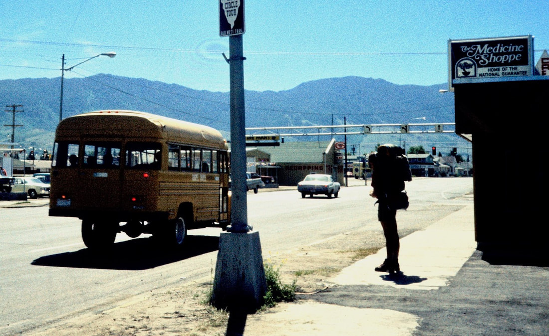
June 15 - 19 Helena, MT/Helena NF (Go to Pt 1) We checked into a ‘rustic’, motel on the west side of town right around dusk and stood under a hot shower for the first time in three weeks. After that revival, we wandered down to the nearby steakhouse to feed our insatiable appetites with a ‘game-on’ feast that included Montana sized steaks with all the fixings and cherry pie a-la-mode.
We had next to nothing in the way of clothes, beyond what we were wearing, so we loitered about the laundromat in our long-johns while the rest of our stuff went through the cycle. The final stop on our walk-about was the grocery store where we were going to have to address the failed, freeze dried dinner experiment. In the end, there was no way around going without heavy, canned foods as the only other viable option. Once back at the motel, we reorganized our stuff and packed the bags with a week’s worth of provisions for the next stretch to Butte.
bloodsuckers swarmed in large, bug-clouds and I was suddenly as desperate to get the tent up as if I were standing butt-naked in a howling snowstorm. The peckers were so bad that I finally had to pull out my rain coat for some protection while we hustled to get the tent’s pegs secured and us out of the scrum
the ridge, or so we figured. Shorts and t-shirts had offered scant protection against the forest’s claws and we were both a scratched up mess with blood smeared gouges mixed with sweat and dirt slashed across our lower legs and forearms.
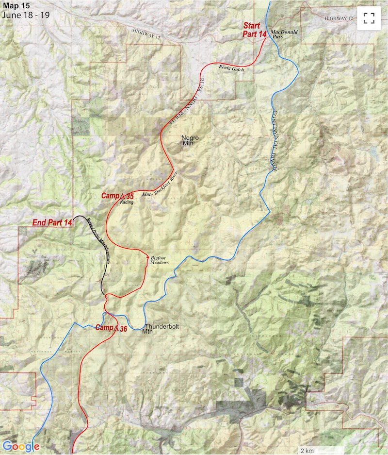
We were standing in a small, gap-like pass and as I looked around I started to notice the faint traces of a trail bearing to the west. We had to get out of this forest to where we could get a view of the terrain and maybe this ghost trail would get us there, so we started tracking the trail through the woods. The terrain sprawled and undulated in imperceptible ways and the dry, scraggily, pine woods effectively obscured navigational views. There were unmarked, unused trails that wandered intermittently through the forest but the pine-needled path we were following maintained the ridge so we stuck with it. I was out front and we were moving across this terrain pretty fast, so I leaned on my not-yet-seasoned ‘gut-feeling’ as to whether this path was taking us the right direction or not and at this particular moment my gut-feeling was quite comfortable with following the trail, heading along the Continental Divide, or so I had it convincingly pictured in my head. The path improved as we progressed along the ridgeline and we were hell-on-fire, burning up the first several miles effortlessly. Compared to the previous six weeks, our packs were light as day sacks, our legs were now in powerful shape and this terrain was easy. As such, we were in full-throttle mode when two hours later the forest thinned out, the trail ended and the ridge suddenly dropped away into a vast, arid valley and situated several miles out in the valley was a town, a fairly good sized town. And in no way should we be seeing any vast valleys and definitely no towns. So, WTF now?!
June 19 - 22 Helena NF (Go to Pt 1) Two hours later the forest thinned out and the ridge suddenly dropped away into a vast, arid valley and situated several miles out in the valley was a town, a fairly good sized town, and in no way should we be seeing any vast valleys and definitely no towns. So, WTF now!?
in my south-forward orientation, could we possibly be heading north. Finally, I stated “The compass is wrong; it’s got to be wrong.” Craig was just now getting a compass bearing on the town out beyond and stopped to look at me. “How is the compass ‘wrong’?” he asked
During the past six weeks Craig and I had swapped over the lead innumerable times and it was pretty much the lead guy’s job to keep track of where we were going. When I was following Craig I was there for consultation if there was a question but I really didn’t pay that much attention to the details of his route finding as it was much easier to get lost in your own hiking thoughts and let the lead guy raise a question if there was one. This afternoon, Craig had been following my lead because earlier in the day I had been the guy who had practically bellowed “Tallyho! A trail! Follow me!” and now I was the guy staring numbly at the map; the guy who had just led us six miles north or, more precisely, twelve miles out of our way. At this point, I handed the map back to Craig and we began the painful retreat of the six, unnecessary miles we’d just come.
Craig was pissed and worn out; hell, we were both pissed and worn out. And even though Craig was the kind of guy who would never begrudge anyone for an honest mistake, his low key nature could be pressed with a repeat of the same mistake, especially when tired, hungry and being eaten by mosquitoes. This wrong-way-turn fiasco today was one thing but I had also been the guy asleep at the wheel when I led us down into Landers Fork a couple of weeks prior and that memory was still very fresh in everybody’s mind. That evening I kind of acted nonchalant, as if nothing all that bad had happened while Craig was generous enough to pretend like the day hadn’t been a complete waste.
private property. You know, one of those properties where the No Trespassing signs also read ‘Trespassers will be shot on sight. Survivors will be Prosecuted’ complete with bullet holes - and we believed them!
We had gotten into town early enough to get settled with our gear at a motel, stop by the Forest Service Office for a couple of maps and hang out at the laundromat where we changed clothes straight from the dryer. We should have gotten started back out on the trail by mid-afternoon the following day, we had all of our supplies restocked and the bags were packed sitting by the door but it was the damned café that hooked us. We made our excuses about it being too late in the day to get started but the real reason we stayed over another night in Butte was so we could eat more food; more Montana Burgers, Idaho fries, frosty milkshakes and cherry pie. We ate three more times before leaving town the next morning.
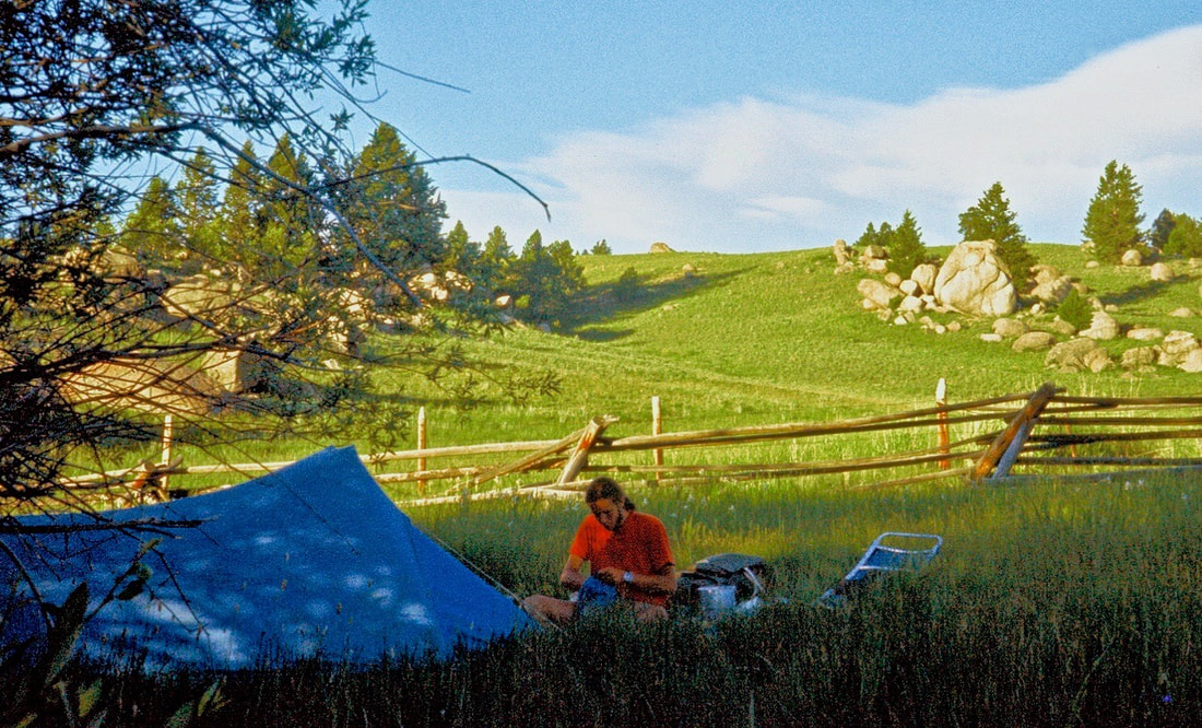
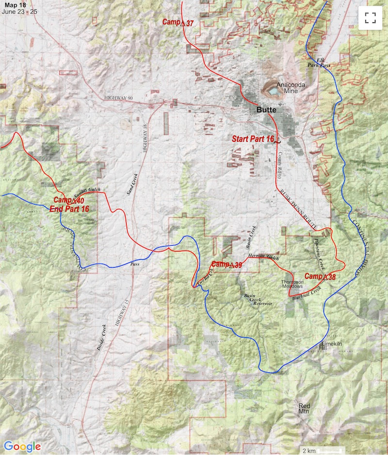
June 23 - 25 South of Butte, MT (Go to Pt 1) We headed south out of Butte carrying 17 days’ worth of provisions and now that canned meats had replaced the majority of our freeze dried meals, the loads were uncomfortably heavy again.
wandering even a mile or so astray of the Continental Divide’s ridge could, and did, put us off our detailed, topo maps. The inevitability of this happening had come up during the planning stages so, as back-up, we had supplemented the 24,000 scale maps with small scale, 250,000 series topo maps that offered us a big-picture view of the overall terrain but little, if any, detail. Then, if all else failed, we also carried Forest Service maps which showed Forest Service roads and trails but did not show topography or relevant elevations and were pretty much being carried along as our preferred choice of fire starter material and emergency tp. Well, we weren’t even seven miles south of Butte before we had to rely on a 250,000 series map for directions only to discover our orienteering skills wholly inadequate to navigate cross-country bushwhacking with a 250,000 series topo map. To compound the problem, we had become disorientated in an area where the terrain features were indistinct, each blending with every other nondescript gully, gulch, meadow and crest of high ground that spider-webbed around the landscape. We wandered around all afternoon and finally just took a westerly bearing and held to it, knowing that, eventually, we’d hit a road. By late afternoon we had crossed over the gravel roadway of Route 2 and were camped in an open meadow along the meandering Blacktail Creek. We had a long way to go to reach Idaho and, straight-up, we didn’t have enough supplies, ergo time, to spend on further wandering and gambling with our feeble orienteering skills through these nondescript woods, electing the following day to bail-out down a road to Herman Gulch, ending the afternoon with our camp a short ways up the Two-Bit Creek valley.
I had started the morning with one quart of water and as we took a break at the top of the valley it dawned on me that we weren’t going to see water for another twelve miles. I glanced up at the blazing sun and then down at my half empty water bottle, which exhibited no illusion of being ‘half full’. We climbed out of the valley then descended the four miles down from the ridge into the hot, bone-dust dry, Divide Creek valley, hitting this baked out basin with near-empty canteens. The seven mile crossing was an endless, withering affair under a sun which, by the forth mile, had become crushingly intense. The green woods of the western foothills appeared as a mirage, shimmering through the heat waves that rose up from the kiln baked earth. Our progress toward that mirage inched closer so slowly that it seemed as if we must be walking in slow motion with the salvation of shade and water at the western edge of the basin refusing to come any closer. It should probably be mentioned here that we had run into another, unexpected challenge while hiking south from Butte, range cattle. Huge tracks of Forest Service land become summer grazing grounds for sheep and cattle and south of Butte in 1977, it was cattle country. I’d seen cattle country before, from behind a car windshield, but I’d never tried to walk through the middle of a ranging herd of cows before. Craig and I knew nothing about the nature of these roaming bovines other than what we observed on our first encounter, which was that they got real skittish, real fast which instantly created the tendency for us to get all skittish in panicked response. The first time we broke out of the woods into a pasture of cattle, we figured we’d just mosey our way through the herd at a casual pace but were quickly met by an agitated and visibly disturbed, mob of cows. As we ventured further out into the herd, they suddenly seemed on the verge of being provoked into a fulminating stampede, at least that’s what it looked like to us, so we backed-off to reassess. Again at the edge of the woods, we decided the only prudent thing to do, now that these evil beasts had thoroughly scared the shit out of us, was to skirt around the herd, turning a ten minute walk across the meadow into a circuitous, roundabout forty five minutes. I’m sure a Montana cowboy would have laughed his ass off watching us cower our way around that pasture. So it was, that after crossing the parched Divide Creek valley in hopes of a quick path to water, we found instead a huge, fenced-in pasture of bulls standing between us and the creek. As we watched the bulls grazing out in the meadow, I also took notice of an old, leeward listing barn with no barn doors, standing out in the middle of the pasture. Then I looked up and down the fence line and saw that the fence trailed off, far into the distance in both directions. Well, at this juncture I really had no patience left for looking at possible ways around the pasture, I was thirsty enough to risk ‘running with the bulls’ but Craig, sporting his flaming-red t-shirt, wasn’t so sure about it, so we took another moment to reassess the situation. The pasture was huge and we only counted 7 or 8 bulls scattered about in various spots and none of them were really all that close so, finally, with water singing a deafening siren-song in my head, I said “fuck-it” and climbed over the fence, immediately turning my focus on that solitary barn out in the middle of the pasture. Craig would have preferred we at least check the map for an alternative before carelessly poking this hornet’s nest but I was over the fence before he could wrest the map from my grasp. Reluctantly following suit, Craig climbed over the fence but waited to leave some space between the two of us with his strategy being, if I was far enough ahead I would become the bulls’ first target of interest when they inevitably got wise to our trespassing on their turf. An admirable strategy considering once we climbed into that bull-pen it was undeniably every man for himself. As expected, we went unnoticed the first bit out into the pasture but at the point where we were completely exposed, halfway between the fence and the barn, the bulls became aware of strangers in their midst. Most of them were a ways off and just stood and watched as we methodically worked our way across the meadow but one big bull, not far from the barn, turned and, very slowly, started walking in our direction. We both saw this dangerous behavior immediately and picked up the pace with the swift realization that we needed to reach that barn before that bull decided to go berserk. If the bull did came after us, I was convinced we’d find protection inside the barn. I kept glancing over at the bull as he continued to walk towards us and then, sure as shit, just before we got to the barn that giant, badass bull decided to charge. The second I saw the bull make a break for us I got hit by a jolt of adrenaline that shot me twenty yards or so through the open end of the barn where my hopes of finding safety inside were instantly dashed as there was absolutely nothing in the barn; no loft, no rope hanging from the ceiling, no crates or machinery to hide behind, no hay bales, nothing - the building was stone-cold empty and I could hear the bull’s hooves pounding toward me just beyond the door. The other end of the barn was also open so, without missing a step, I bolted pell-mell through to the other end and dove behind the outside wall. I could hear commotion inside the barn then Craig flew around the corner to the other side of the door. We could hear the bull stomping around inside the barn then, slowly, the hoof stomping went quiet. Apparently satisfied the intruders had been driven off, the bull turned and walked out the same way he’d stormed in. Craig peeked around the corner and saw that the bull was still milling about on the other side of the barn, then he looked over at me, shrugging ‘what now?’ From the barn, the creek was still several hundred yards off, through open pasture, and that bull continued to loiter about not more than 200 feet away. Craig kept peering around the side of the barn, waiting for the beast to back-off until, finally, the bull went back to grazing and we, in a very calm manner, using the barn as a screen between us and the bull, made double-time for the Cottonwoods and Willows bordering the creek.
What we did have for ‘water purification’ were these disgusting iodine tablets that turned your mouth orange and made everything that followed them taste terrible. However, we both agreed that this cow sewage was beyond iodine treatment and started to wander up valley in search of at least treatable water if not decent water. We continued up stream for another forty minutes or so on this pocked-out, splat covered, dirty, smelly, fly-infested, cattle road to near the ‘headwaters’ of this miserable, dribbling flow and then were reduced to collecting water in a cup from the cleanest dribble we could find, knowing full well it was still too filthy to drink but unable to refrain from filling a water bottle anyway, just to see what it looked like. Not surprisingly, It looked like shit. And, of course, we knew to boil the water first before drinking it but, at this point, I was just too thirsty to give a cow-shit, leaving Craig to grimace in disgust as he watched me drop two iodine tablets and a package of orange drink into the bottle of septic water, give the concoction a vigorous shake, and guzzle down a half quart of murky, lukewarm, floater-filled, iodine-flavored, orange drink and when I didn’t immediately projectile-vomit orange slime and die, Craig decided to give the koolaid a try.
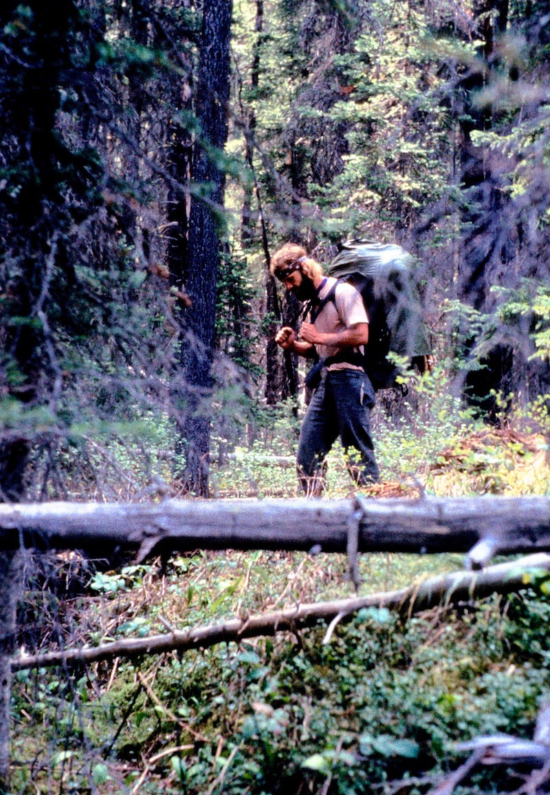
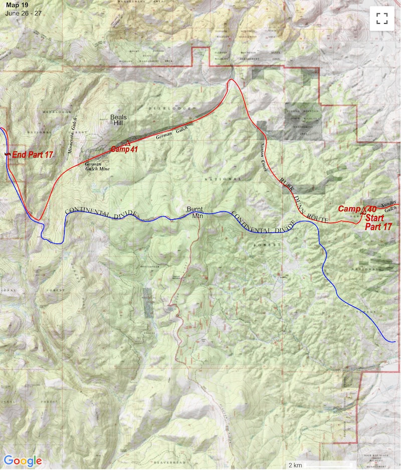
June 25 – June 27 Deerlodge NF, MT (Go to Pt 1) We camped that night in a thinly wooded pasture tucked high up in Sunday Gulch. The next morning we hiked cross-county out of Sunday Gulch up onto a sparsely forested, ambling plateau. We trekked across the open terrain for about a mile or so before descending to Norton Creek which we followed down to German Gulch.
A dilapidated but welcoming veranda wrapped around two sides of the house so we dropped our packs, pulled the lunch bag, and stepped up onto the porch. The deck’s wood planks were grey and curled with age but the thick, rough sawn lumber was still stout under foot. We went through the doorless entry into a moderate, yet spacious living area that was much brighter inside than I’d expected. All the doors and windows had long since been removed along with any and all fixtures and hardware, leaving only the wood shell with light streaming through the doors and numerous window frames. We got comfortable on the wood floor in the main room and ate lunch, gazing out the large openings at the roaming yard of wildflowers. “How old do you think this place is?” I pondered out loud. “I don’t know,” Craig replied “turn of the century, maybe. It kind of reminds me of the Cartwright house on Bonanza.” The wood’s weathering had probably been accelerated by the harsh, mountain environment but the house did look to be maybe 100 years old. My mind wandered to imagine what life might have been like living in these Montana mountains during the 19th century; how isolated and remote it would have been and the level of self-sufficiency, ingenuity and sheer toughness it would have required to survive. That thought kind of made what Craig and I were doing seem rather pedestrian, if I started to make any comparisons.
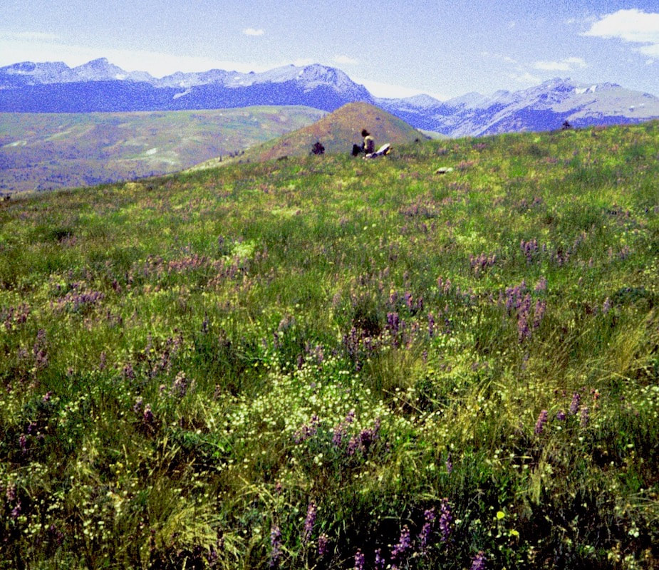
brook straight out of wonderland, complete with toadstool stones crowned by large, flowering, columbine bells. Facing a hot, sweaty climb up out of the gulch to finish our day on the other side, we opted instead for an early camp and a dip. The water was nipple-biting cold but it sure felt great to rinse off four days of sweat-encrusted, trail dirt. The following day we climbed out of German Gulch, hiking past the German Gulch Mine and I was like “whoa cowboy, take a look at that!” This was late 1900’s, industrially-altered landscape on such a large scale and so incongruent to the remote mountains we were in that it really was an astounding sight . A colossal, mining operation had completely disemboweled a vast section of mountainside and, according to a sign posted at the top, the mine had produced $13 million dollars’ worth of gold (for whom it did not say) around the turn of the century. To be sure, the titanic mess they left behind was indeed impressive, in a man-made-disaster kind of way. From the mine we did a quick valley descent into Minnesota Gulch then climbed back out the west side to reconnect with the Divide’s ridgeline. The top of the ridge was open, just above tree line, and the entire rolling, sprawling crest was a boundless meadow of alpine wildflowers. 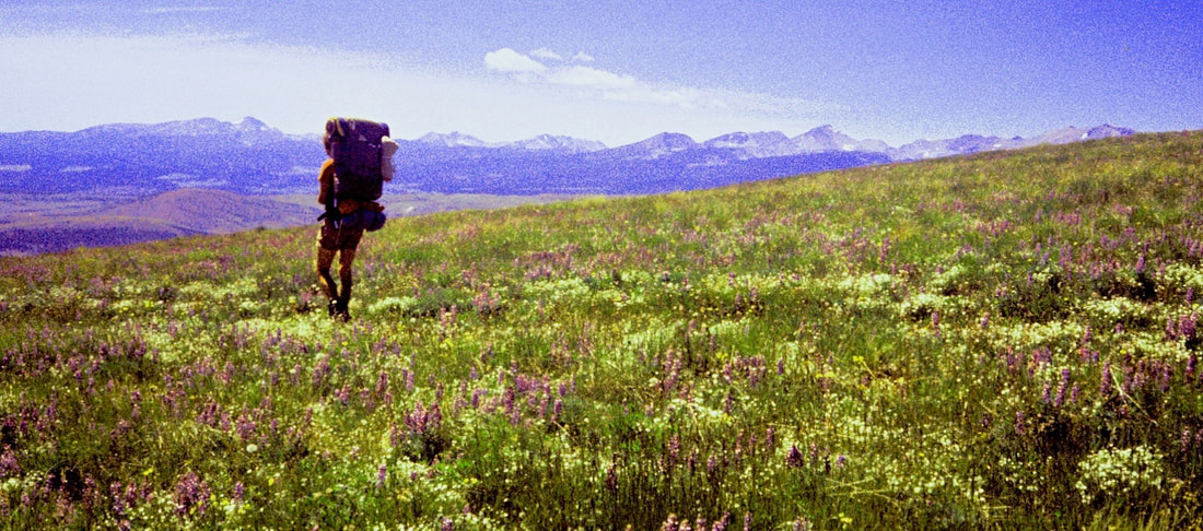 A duvet of vibrant reds, greens, purples, whites and yellows lay out across the lazy ridge for over a mile and it was as if we had just crossed over into the Land of Oz. We were literally walking knee deep in wildflowers and I never would have imagined that ambient air could be so enticingly sweet or wildflowers so utterly stunning!
The sun was warm and, after topping off my lunch with some of Craig’s ‘extras’, I settled back to absorb the whole fantastical scene. An hour and a half later I woke up.
June 27 - June 30 Deerlodge NF, MT (Go to Pt 1) We dropped the packs, pulled off our boots and sat back in the midst of this splendid, botanical display to eat lunch. Craig had been off-pace all morning and wasn’t much interested in eating; saying he was feeling some kind of funk he lounged back against his pack and dozed-off.
I rousted Craig, who started to cause me a little concern with how sluggishly he lumbered back up onto his feet, only to then stand and stare at his pack "Hey, Craig, common man, let's go" I prodded, turning back out along the ridge. Near the base of Sugarloaf Mountain we found a spring of cold, clear water gurgling out of a thicket of Columbine that looked like the perfect place to stop and make camp. Craig was feeling a little better by suppertime and ate most of his ration but was happy to pass on the leftovers. In the morning, Craig felt better but now I was feeling the funk, weak and lethargic as we pulled out of camp.
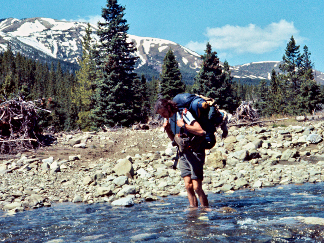
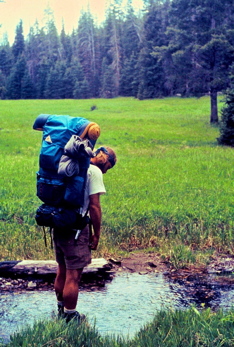
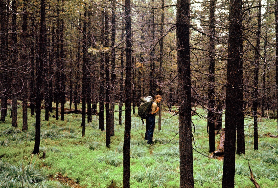
Naturally, we got sucked into a gully that progressively got steeper and the real bugger was that the gully was lined with all this slick, wettish grass that proceeded to take us right to the edge of what was possible to get down without the use of ropes (which we didn’t have, anyways). The mad-gravity made down-stepping a vicious, one-legged, deep-knee bend, leaving the downhill foot little time to plant before gravity would take over. The grade finally got so steep that it was getting hard to simply even stand without slipping and we were spending more time arresting slides down the slick grass than we were navigating on our feet. I felt on the verge of a rag-doll descent the whole way and it was like ‘Shit! Even the damn grass out here wants a piece of me.’ We eventually got down the gully’s final slide but were a little beat-up by the time we made it to Mill Creek, stopping at the river to nurse varying degrees of grass-rash before approaching the next obstacle, crossing the river. The shallowest part of Mill Creek was also the widest part of the river but we pieced together enough rock-hops to get started and, with a few kangaroo jumps mid-stream, we managed to get to the other side dry. We stopped for lunch on a cobbled beach along the riverbank and passed the lunch sack back and forth. I ate but was still feeling washed-out with some pain in my gut and it started me wondering about some of the dank water we had been drinking. After lunch we started up the Mill Creek trail, although to call what we were following a ‘trail’ would be to define the word as 'someplace in the woods' since we were continually climbing over deadfall, studying the pine-needled ground for trail traces and mostly just following our noses through the forest. About an hour after leaving the cobbled beach I really started to feel like crap; lightheaded and weak-kneed with jousting pains flashing around in my gut.
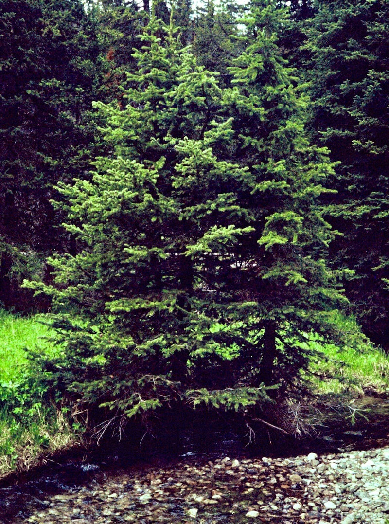
I did not sleep well at all during the night and in the morning I still felt wrecked with little interest in the breakfast granola. Craig was no better off but we packed our stuff anyway and carried on up Mill Creek. Our pace through terrain like this would have normally been around 3mph but as we labored on through the forest our forward progress dwindled to barely a mile and a half per miserable hour. We were both sick, from what we did not know, and by mid-day we just didn’t have the strength to keep pack-muling our way up the valley, calling it quits short of Miller Lake. We ate nothing the rest of the afternoon and only had a cup of soup with rice for dinner. We both slept better that night and felt somewhat recovered in the morning, so we carried on up Mill Creek. It took a long, steep climb to get out of the valley, eventually winding up to the top of a narrow ridge that strung itself between two, towering, unnamed peaks. Our intention was to drop into the Twin Lakes valley on the opposite side of this ridge, so we walked across the narrow crest and took a look down the other side. “Holyshit!” I blurted out right as Craig was exclaiming the exact same thing. Looking down the west side of the ridge was like looking down a church steeple; it wasn’t vertical but it definitely qualified as ‘holyshit’ steep. The wind was ripping over the ridge so we dashed behind a boulder to talk over what our options might be. We pulled the map and studied the various ways to get down off the ridge but found nothing that was going to end us up where we needed to be, except the west side which we had just looked at. We left our packs behind the boulder and went back out to have another look. The mountain was in an active stage of decay and the entire west side was falling apart with loose scree, rocks and talus precariously stacked ata steepness that seemed impossible to hold rocks. Craig and I would have to take different lines of descent, well apart from one another, because we were going to cut loose a lot of rocks descending this face. 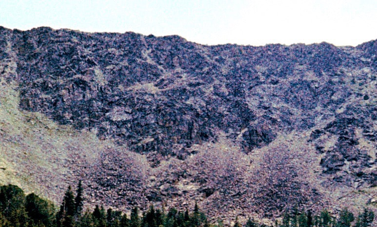 Ridge descent We gathered up our gear and started down. Just to the south of Craig’s line of descent, I keyed-in on a large fin of solid rock rising out from the debris where I hoped to find good handholds. The holds were there and I was thankful to have them the first fifty feet or so as loose rocks shot out from under my feet, careening at ballistic speeds down the face. After several hundred feet, the rock fin that I was using for stabilization ended abruptly and from this point forward it was going to be 500 feet of pulse-pounding descent where every downward movement had to be precisely controlled. The dislodged rocks that bounced and cartwheeled off into oblivion provided a graphic visual of what could happen if either one of us lost it and, to be sure, I wasn’t just freaking out about my ability to control the descent; there were two of us that had to get down this thing unbloodied. We both made it down the rocky, horror show unscathed but rattled to be sure. We took a break in the tundra alongside a splashing stream to regroup and let the adrenaline washout.
June 30 - July 5 Beaverhead Deerlodge NF, MT (Go to Pt 1) We both made it down the last stretch of the rocky, horror show on legs that were trembling from both fatigue and stress by the time we reached the bottom. We took a break in the tundra alongside a splashing stream to regroup and let the adrenaline washout.
Once we were on good trail I was able to step into a comfortable pace and switch over to auto-hike mode. When I reached the river below Twin Lakes, I stopped to look around for a crossing point which is when I noticed there was nobody behind me, namely Craig. There was a decent log to get across the river so I crossed over, dropped my pack and sat down to wait for him.
When I got to the river fork I followed it back to where there was a double-log bridge crossing at what was the trail’s actual crossing point. I looked down at the approach to the log and sure enough, there were fresh Galibier boot prints in the mud, Craig’s boot prints. It was pretty clear what was going on now. I had crossed the river too soon and while I had dilly-dallied on what was actually a fisherman’s trail Craig had walked right by me on the opposite side of the river and crossed the bridge further up, like everybody else. I had left my pack back at the fisherman’s path but took off up the trail after Craig. This was quite the pickle; Craig was now in front of me thinking he was still behind and doing double-time trying to catch-up to me while, in reality, I was the one that was behind doing triple-time trying to catch-up to him. Up ahead, Craig ran into some hikers coming down the opposite direction from the lakes and asked if they’d passed me, nope. Now he’s wondering… ‘Could I have possibly passed him somewhere?’ Which made no sense at all but he figured if hikers coming down the trail hadn’t passed me then it must have happened somehow, so he dropped his pack and doubled back to look for me. Well, we finally got our act together, I had to go back and get my stuff then we went down by the river to eat lunch.
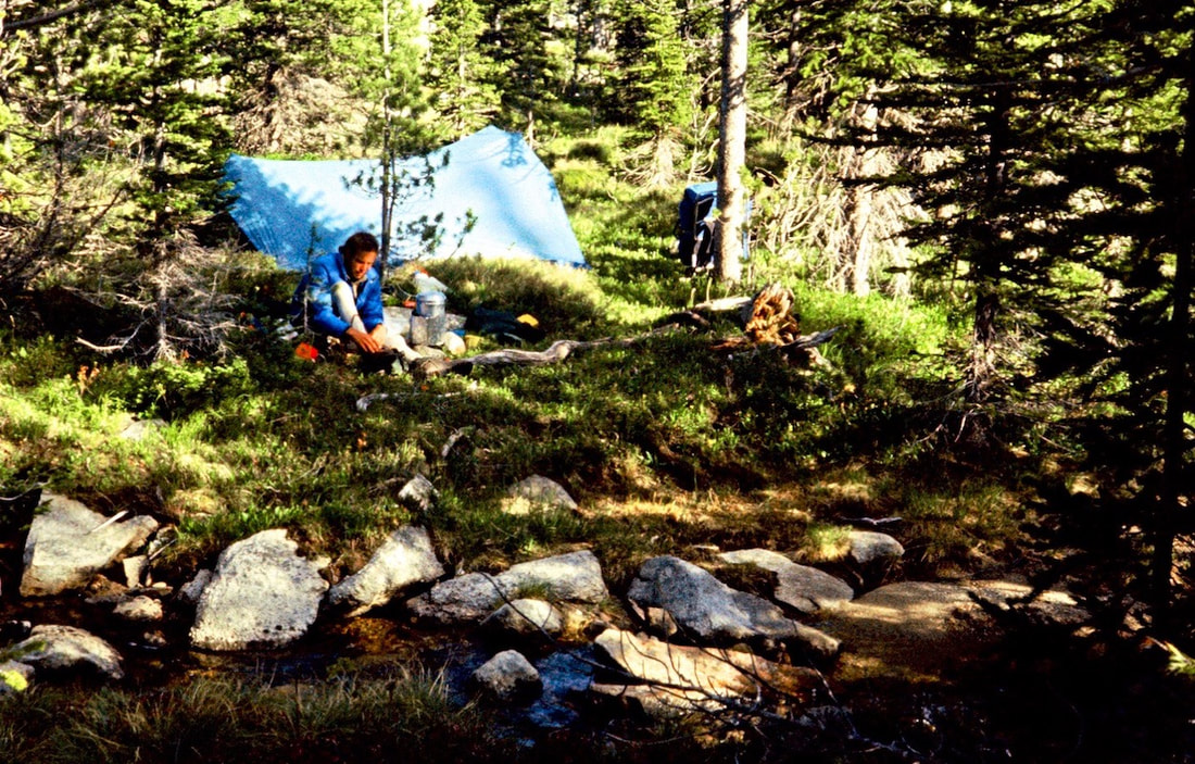
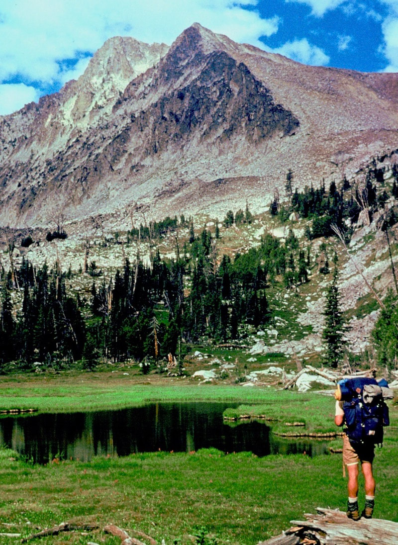
For two hours we fiddled with the stove, disassembling, cleaning and reassembling all the parts we could but to no avail. The stove was broken. We had built a fire earlier to get the tea water going but this resorting to campfires for cooking was not going to work; we had to have a functioning stove. The busted stove was a grim stroke of bad luck but at the same time not all bad luck because we were in a place where getting out of the mountains to a town was actually a viable option. We were camped at Storm Lake, two short miles from a Forest Service trailhead which was nine miles from the highway and the town of Anaconda was only ten more miles down the road. This being the 4th of July weekend there were people up in the mountains so our chances of getting a ride into town the following day seemed pretty fair. Anaconda wasn’t much of a town but hopefully we could find a camp stove there. After sleeping until almost 10 a.m., we got up the next morning feeling better and with an appetite, so we rekindled the fire and cooked up some killer good, campfire pancakes. The clouds had been building over the ridgeline all morning and not long after our pancake breakfast it started to rain. The whole idea of getting down out of the mountains and hitch-hiking to Anaconda for a new stove got washed away as soon as it started to rain and we spent the next 5 hours listening to the steady drum of rain on our tent fly. Craig was still ploughing his way through ‘Shogun’ while I spent time flipping the pages of ‘Still Life with Woodpecker’. Sometime around mid-afternoon we decided to eat and pulled out the lunch sack. Later, after we had eaten, I started feeling those now familiar, stabbing gut pains that I’d suffered from for almost a week and then Craig started complaining of the same thing. Finally, Craig declared “It’s the cheese.” I hadn’t considered the cheese because it tasted fine and there was no mold on it, which happened occasionally and we’d just pare off the moldy piece. “Really? Do you think that’s it?” I queried. “It’s got to be” Craig replied. “I was feeling a lot better before we ate and the cheese is the only thing I ate that could be bad. Now I feel like crap again.” I thought about the hot, greasy cheese in the lunch bag and then it dawned on me that I always felt worse in the afternoon.
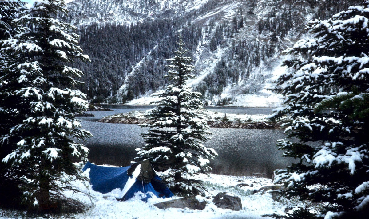
The next morning was the 4th of July and it was cold, cloudy and windy. We packed up our camp, hung the packs from a high limb and started the walk out to the trailhead. The trail was a muddy mess from yesterday’s rain and the skies looked to be threatening with more. When we got to the trailhead there were no cars parked in the lot so we started pounding down the road. We ran into a couple of fishermen further on but nobody heading out of the mountains until we had hiked most of the nine miles to the highway. Finally, a couple heading to town gave us a ride in the back of their pick-up. Long story short, the hardware store that had the camping gear was closed on the 4th so we stayed over in Anaconda and bought a new, Bluet cartridge stove the next morning. We stopped into the local drug store on our way out of town for a fist full of candy bars, each, and then spent the better part of the day getting back up to our camp at Storm Lake. The new stove worked great but we were guessing at how many cartridges we would need, so I was hoping the two we’d bought would get us to Salmon, Idaho. The weather had been cold and threatening all day but during the night it didn’t rain; it snowed, bringing with it a dim, grey morning with thick, stone-cold clouds oozing over the ridge. I poked my head out of the tent to a fresh blanket of snow covering the cirque and it was cold.
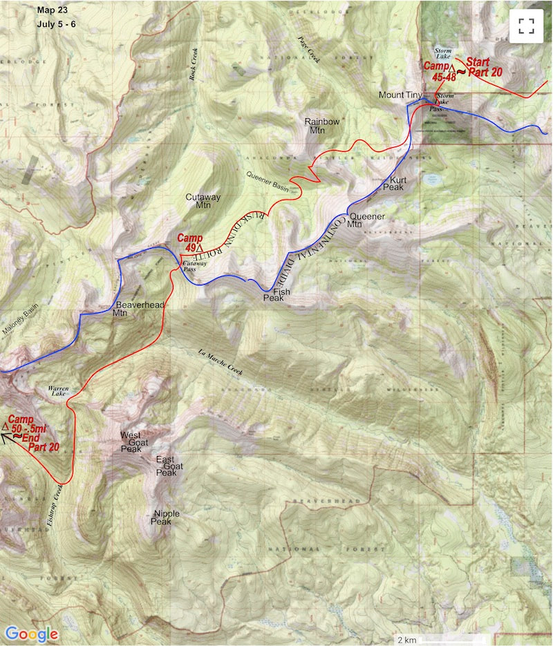
July 5 - 6 The Anaconda-Pintler Wilderness, MT (Go to Pt 1) The weather had been cold and threatening all day but during the night it didn’t rain, it snowed; unfolding a dim, grey morning with thick, stone-cold clouds
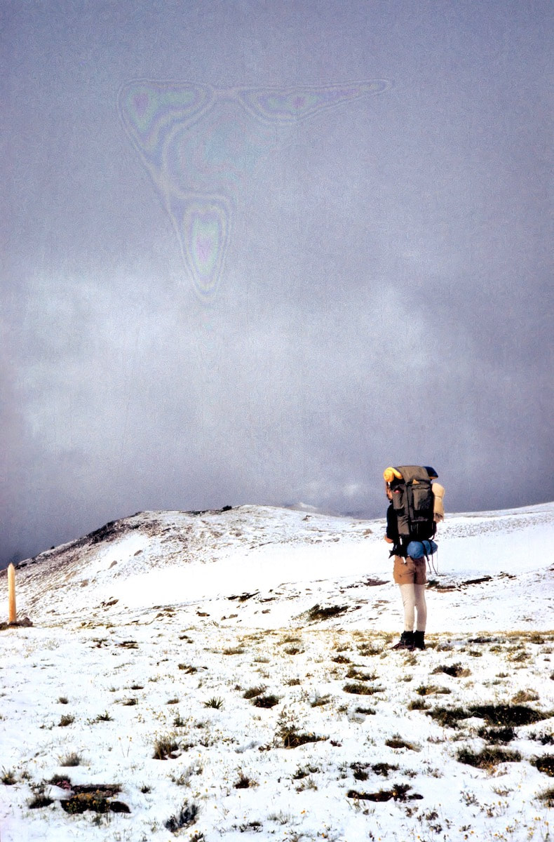
From Storm Lake we headed up toward Storm Lake Pass and as we started up the hill it did occur to me that maybe a cold, wet, snowy morning was precisely why I was carrying the gloves in the first place but, oh well, at least they were still warm and dry if I ever needed them again. As we climbed toward the ridge, the misty edge of the clouds hung just overhead but appeared to lift as we gained elevation. When we topped over the pass, clouds had already begun to tear away from the summit of Mount Tiny and adjacent crags as salient views of the peaks and valleys began to emerge. 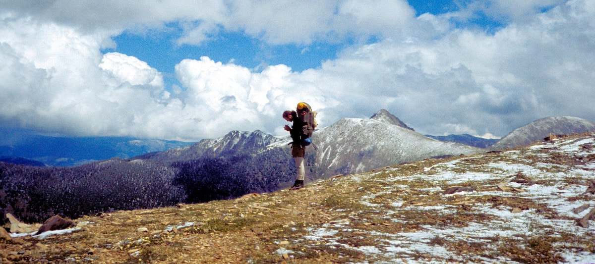 Snow-freshed Anaconda Pintlers By the time we were crossing Goat Flat Mountain, the cloud cover had completely broken apart and the sun shone down across the snow-freshed Anaconda Range stretching out to the southwest. The trail continued across open tundra and the hiking was brisk. We took a break on top of the ridge below Rainbow Mountain and by now the clouds had puffed back into cotton balls, floating harmlessly across the sky. As the snow melted, the alpine wildflowers stood out in colorful contrast against the dissipating white, with the ridge ambling away to converge with the vast and changing landscapes that lay out across the thousands of visible square miles on either side of the Divide. 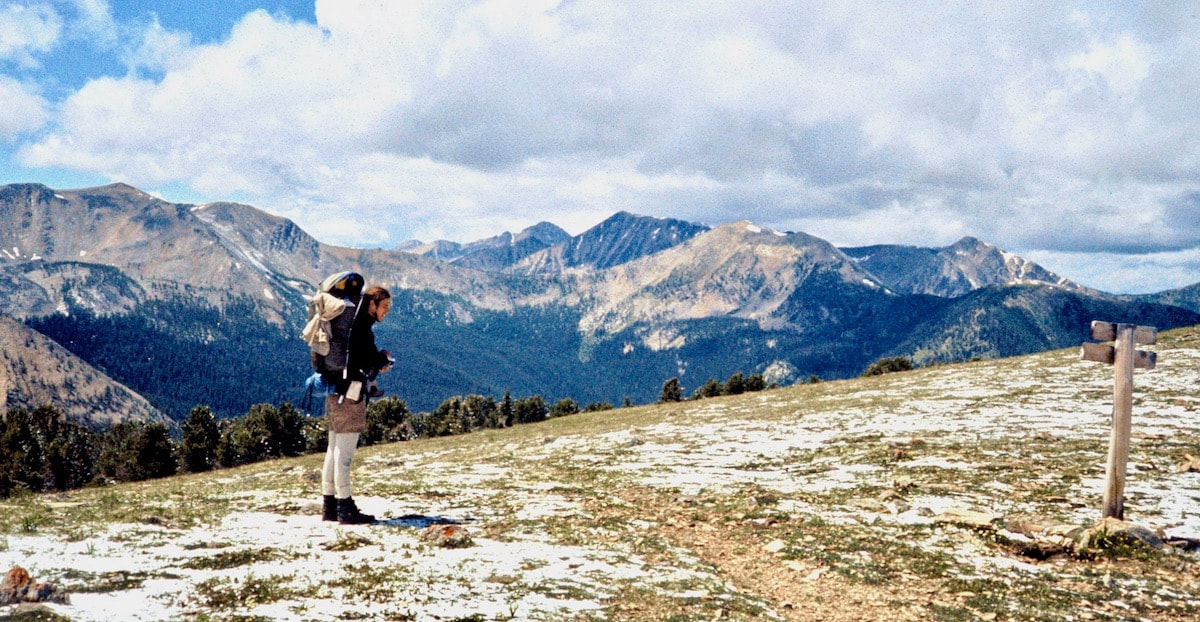 Goat Flat Mtn It should be noted that Montana is famously known as ‘Big Sky Country’ and during our travels through the Montana mountains we had been witness to the true meaning of the term ‘Big Sky’ on numerous occasions. We had watched fantastical electrical storms erupt from massive, anvil thunderheads over a hundred miles distant and dust devils flung up in western Idaho. In fact, from the top of the Divide, looking both east and west, one could watch several distinctly different weather patterns develop from western Idaho to northern Wyoming to eastern Montana. The curvature of the earth was detectable from these airy ridges and looking out to the roads and dwellings far in the distance from the top of the Divide was similar to the view one gets from a plane window seat. And from our perch on the ridge, this was certainly turning out to be another humongous, big-sky kind of day. 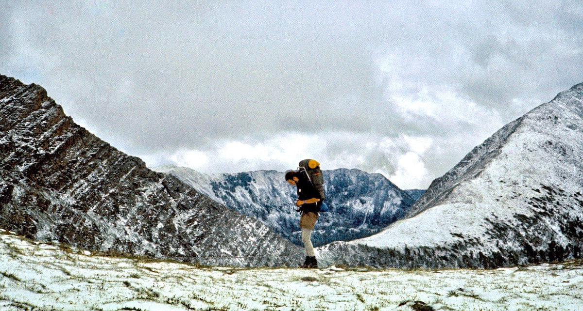 Snow on the Divide We camped that night just short of Cutaway Pass in a patch of alpine meadow alongside a lapping stream of sweet, ice-cold water. During the day it had never gotten all that warm and once the sun dipped behind the ridge the temperature dropped like a stone, lacing the stream’s edges with ice by morning. The sunrise skies were clear but with temps below freezing, we packed-up camp anxiously awaiting the sun to clear the eastern ridge. We dispensed with Cutaway Pass in short order then descended 1,600 feet to La Marche Creek then climbed another 1,000 feet up to a splendid, little hanging valley, cradling the shimmering waters of Warren Lake, backed and flanked by the steep, rocky walls of unnamed peaks.
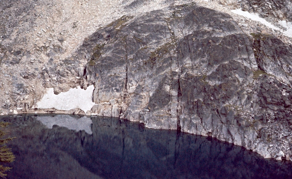
We skirted Rainbow Lake and climbed an additional 800 feet of steep elevation to attain the ridge of the Divide. Again, the views demanded a break on the ridge with Martin Lake sparkling 700 feet below, nestled in a hanging valley whose stream plummeted another 700 feet into the deep, aqua-turquoise of Johnson Lake in the valley far below.
|
Kip Rusk, 1977
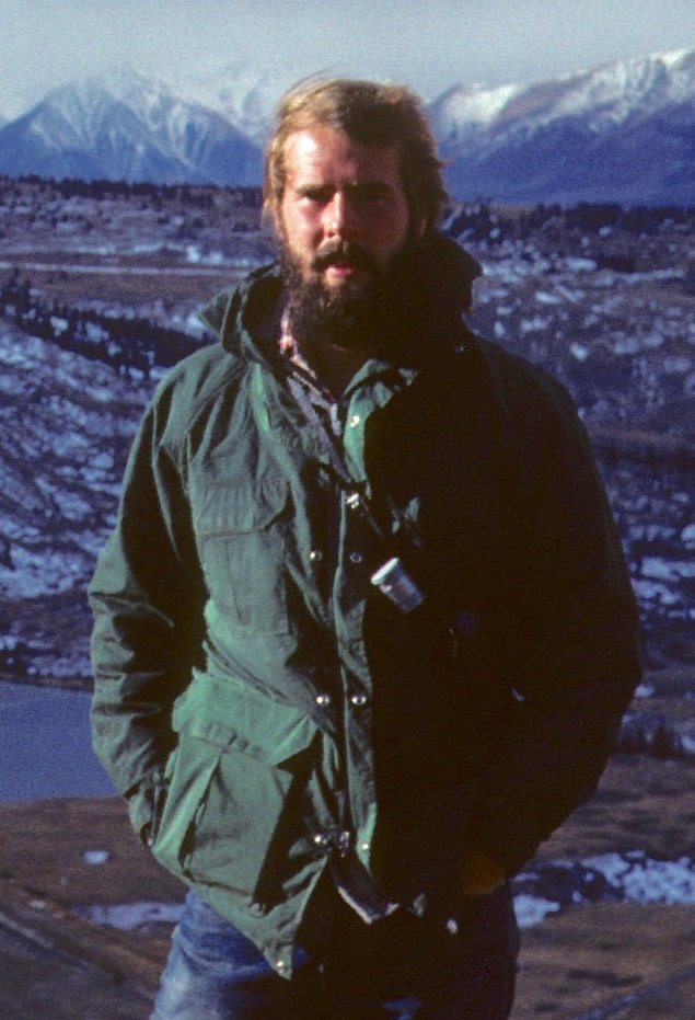
Kip RuskIn 1977, Kip Rusk walked a route along the Continental Divide from Canada to Mexico. His nine month journey is one of the first, documented traverses of the US Continental Divide. 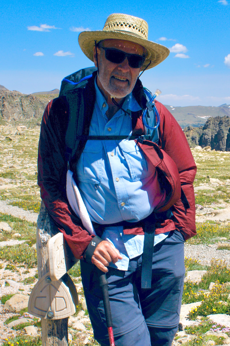
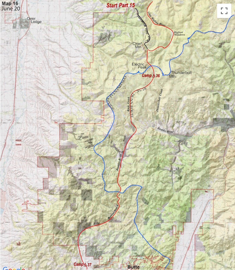
Montana Part 1 - Glacier Ntl Pk Part 2 - May 11 Part 3 - May 15 Part 4 - May 19 Part 5 - May 21 Part 6 - May 24 Part 7 - May 26 Part 8 - June 2 Part 9 - June 5 Part 10 - June 7 Part 11 - June 8 Part 12 - June 11 Part 13 - June 12 Part 14 - June 15 Part 15 - June 19 Part 16 - June 23 Part 17 - June 25 Part 18 - June 27 Part 19 - June 30 Part 20 - July 5-6 Part 21 - July 7-8 Part 22 - July 9-10 Part 23 - July 11-15 Part 24 - July 17-18 Part 25 - July 18-19 Part 26 - July 19 Part 27 - July 20-21 Part 28 - July 22-23 Part 29 - July 24-26 Part 30 - July 26-30 Part 31 - July 31-Aug 1 Part 32 - Aug 1-4 Part 33 - Aug 4-6 Part 34 - Aug 6 Part 35 - Aug 7-9 Part 36 - Aug 9-10 Part 37 - Aug 10-13 Wyoming Part 38 - Aug 14 Part 39 - Aug 15-16 Part 40 - Aug 16-18 Part 41 - Aug 19-21 Part 42 - Aug 20-22 Part 43 - Aug 23-25 Part 44 - Aug 26-28 Part 45 - Aug 28-29 Part 46 - Aug 29-31 Part 47 - Sept 1-3 Part 48 - Sept 4-5 Part 49 - Sept 5-6 Part 50 - Sept 6-7 Part 51 - Sept 8-10 Part 52 - Sept 11-13 Part 53 - Sept 13-16 Part 54 - Sept 17-19 Part 55 --Sept 19-21 Part 56 Sept 21-23 Part 57 - Sept 23-25 Part 58 - Sept 26-26 Colorado Part 59 - Sept 26 Part 60 - Sept 30-Oct 3 Part 61 - Oct 3 Part 62 - Oct 4-6 Part 63 - Oct 6-7 Part 64 - Oct 8-10 Part 65 - Oct 10-12 Part 66 - Oct 11-13 Part 67 - Oct 13-15 Part 68 - Oct 15-19 Part 69 - Oct 21-23 Part 70 - Oct 23-28 Part 71 - Oct 27-Nov 3 Part 72 - Nov 3-5 Part 73 - Nov 6-8 Part 74 - Nov 9-17 Part 75 - Nov 19-20 Part 76 - Nov 21-26 Part 77 - Nov 26-30 Part 78 - Dec 1-3 New Mexico Part 79 - Dec 3-7 Part 80 - Dec 8-11 Part 81 - Dec 12-14 Part 82 - Dec 14-22 Part 83 - Dec 23-28 Part 84 - Dec 28-31 Part 85 - Dec 31-Jan2 Part 86 - Jan 2-6 Part 87 - Jan 6-12 Part 88 - Jan 12-13 Part 89 - Jan 13-16 Part 90 - Jan 16-17 Part 91 - Jan 17 End |