Support Our Local Partners
Click the Link
Click the Link

The Original Taffy Shop
|
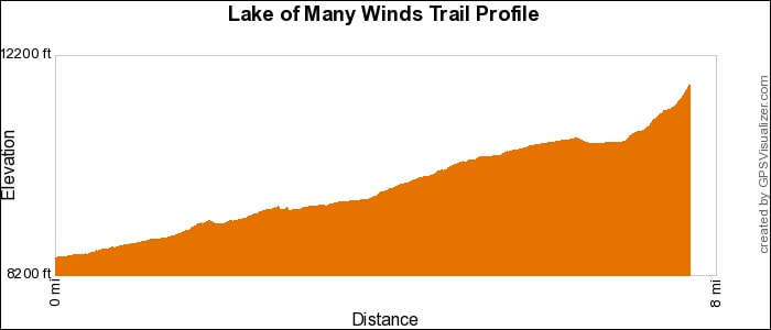
Trail Type: Lake Hike
Trailhead: Wild Basin Beginning Elevation: 8,500' Destination Elevation: 11,620' Total Elevation Gain: 3,120' Total Roundtrip Miles: 15 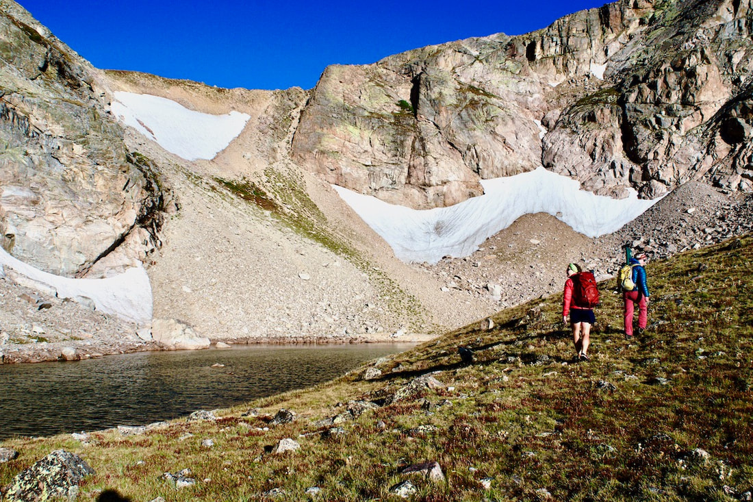
Lake of Many Winds with the Boulder-Grand Pass
|
Trail Description
The destination for this hike is off the main trail and requires some backcountry navigation skills including map reading skills and an awareness of the lay of the land. These are sensitive areas, please travel carefully. Follow the Thunder Lake trail to the lake and the path along the north shoreline. Cross the inlet stream and follow the narrow path that ascends above treeline. The lake sits at the base of the Boulder/Grand Pass. How to Get There
Drive south of Estes Park on Hwy 7 13.5 miles, toward the town of Allenspark. Turn right at the Wild Basin Ranger Station sign and follow the dirt road for 2 miles to the trailhead at the end. |
|
Trail Profile
See an Index of Trail Profiles here
|
Weather Information
|

Brownfield's
|

Images of RMNP
|

Backbone Adventures
|

New Roots Real Estate
|

Poppy's Pizza & Grill
|

Mama Rose's
|
Visit Estes Park
|

Estes Park Health
|

The Original Taffy Shop
|

The Spice Rack
|

Raven's Roast Coffee Lounge
|

MacDonald Book Shop
|

Windcliff Vacation Rentals
|

Affinity Massage & Wellness
|

Mountain Home Cafe
|

Spur Liquor
|

Estes Park Mountain Shop
|

Rocky Mountain Adventures
|
Aspen Winds
|

The Barrel
|

Rams Horn Village Resort
|
Backpacking Light
|

Plum Creek Shoe Station
|